Broomfield

Civil Parish in Essex Chelmsford

England

Broomfield

Roundabout on Chelmer Valley Road, Chelmsford
Roundabout on Chelmer Valley Road, Chelmsford Credit: David Howard

Broomfield is a civil parish located in the county of Essex, England. It is situated just south of Chelmsford, the county town, and covers an area of approximately 7.7 square kilometers. The parish is home to a population of around 2,500 residents.

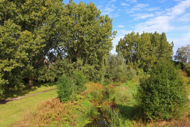
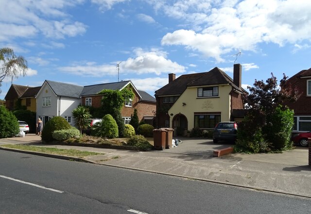
Broomfield is primarily a residential area, characterized by its picturesque countryside setting and quaint village atmosphere. The parish is surrounded by beautiful green fields and farmland, offering residents a peaceful and rural lifestyle. Despite its rural nature, Broomfield benefits from its close proximity to Chelmsford, which provides easy access to a range of amenities and services.

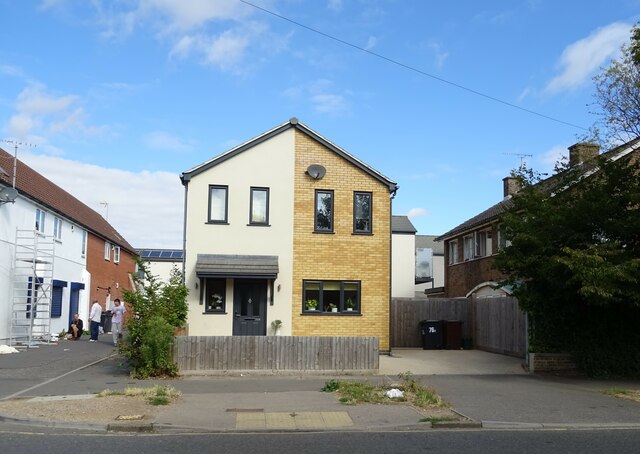
The village itself is small, with a charming traditional layout and a handful of local businesses, including a village shop and post office. Broomfield also boasts a primary school, providing education for the local children. The St. Mary's Church, a historic and architecturally significant building, is a notable landmark in the area.

Broomfield is well-connected in terms of transportation, with good road links to Chelmsford and surrounding areas. The A130 road runs through the parish, connecting it to major routes such as the A12 and A127. Additionally, Chelmsford railway station is within easy reach, providing regular train services to London and other destinations.

Overall, Broomfield offers a tranquil and idyllic setting for those seeking a rural lifestyle within easy reach of urban amenities. Its picturesque countryside, small village atmosphere, and convenient location make it an attractive place to live for residents of all ages.

If you have any feedback on the listing, please let us know in the comments section below.

Broomfield Images

Images are sourced within 2km of 51.756405/0.450022 or Grid Reference TL6909. Thanks to Geograph Open Source API. All images are credited.

Roundabout on Chelmer Valley Road, Chelmsford
Chelmer Valley Road, Chelmsford
The Compasses Public House in Chelmsford.
The Compasses
Public House in Chelmsford.
River Chelmer View from Valley Bridge, Chelmsford.
River Chelmer
View from Valley Bridge, Chelmsford.
Aubrey Close Residential road near Chelmsford.
Aubrey Close
Residential road near Chelmsford.
George VI postbox on Kings Road, Chelmsford Postbox No. CM1 267.
See <a href="https://www.geograph.org.uk/photo/7267006">TL7008 : Kings Convenience Store on Kings Road, Chelmsford</a> for context.
George VI postbox on Kings Road, Chelmsford
Postbox No. CM1 267. See TL7008 : Kings Convenience Store on Kings Road, Chelmsford for context.
Kings Convenience Store on Kings Road, Chelmsford Showing position of Postbox No. CM1 267.
See <a href="https://www.geograph.org.uk/photo/7267005">TL7008 : George VI postbox on Kings Road, Chelmsford</a> for postbox.
Kings Convenience Store on Kings Road, Chelmsford
Showing position of Postbox No. CM1 267. See TL7008 : George VI postbox on Kings Road, Chelmsford for postbox.
House on Kings Road, Chelmsford
Kings Road, Chelmsford
Houses on Patching Hall Lane, Chelmsford
Patching Hall Lane, Chelmsford
School Lane Towards Parsonage Green.
School Lane
Towards Parsonage Green.
Flats on School Lane
Broomfield Library On Main Road.
Broomfield Library
On Main Road.
Main Road (B1008), Broomfield
The Kings Arms, Broomfield On Main Road.
See <a href="https://www.geograph.org.uk/photo/7267108">TL7010 : Sign for the Kings Arms, Broomfield</a> for sign.
The Kings Arms, Broomfield
On Main Road. See TL7010 : Sign for the Kings Arms, Broomfield for sign.
Sign for the Kings Arms, Broomfield See <a href="https://www.geograph.org.uk/photo/7267106">TL7010 : The Kings Arms, Broomfield</a> for context.
Sign for the Kings Arms, Broomfield
War Memorial on Church Green, Broomfield
Show me another place!

Broomfield is located at Grid Ref: TL6909 (Lat: 51.756405, Lng: 0.450022)

Administrative County: Essex

District: Chelmsford

Police Authority: Essex

What 3 Words

///fled.thighs.viewer. Near Chelmsford, Essex

Related Wikis

Chelmsford City F.C.

Chelmsford City Football Club is a semi-professional football club based in Chelmsford, Essex, England. Currently members of the National League South...

West Chelmsford (UK Parliament constituency)

West Chelmsford was a parliamentary constituency represented in the House of Commons of the Parliament of the United Kingdom. From 1997 to 2010 it elected...

London Basin

The London Basin is an elongated, roughly triangular sedimentary basin approximately 250 kilometres (160 mi) long which underlies London and a large area...

St John Payne Catholic School

Saint John Payne Catholic School is a Roman Catholic voluntary aided school in Chelmsford, Essex. Established in 1959, the school serves the mid Essex...

St Peter's College, Chelmsford

St. Peters College was a Church of England Voluntary Aided School in Chelmsford, Essex. The school was a specialist arts college. == History == The school...

Broomfield, Essex

Broomfield is a village and residential suburb in the City of Chelmsford district, immediately north of the city itself. It is the site of a major Accident...

Chelmsford County High School for Girls

Chelmsford County High School for Girls or "CCHS", is a selective grammar school for girls aged 11–18 located in Chelmsford, Essex, England. Entrance to...

Chelmer Valley High School

Chelmer Valley High School (CVHS) is an academy based on a large site on the outskirts of Chelmsford, Essex, England. It has specialisms in engineering...

Nearby Amenities

Located within 500m of 51.756405,0.450022
Crossing
Crossing: unmarked
Crossing Markings: no
Lat/Long: 51.7555936/0.446087
Bus Stop
Micawber Way
Bus: yes
Naptan AtcoCode: 15003400702
Naptan Bearing: W
Naptan CommonName: Jeffreys Stop
Naptan Crossing: Micawber Way
Naptan Indicator: W-bound
Naptan Landmark: Jeffreys Stop
Naptan NaptanCode: esxdpgtd
Naptan PlusbusZoneRef: CHLMSFD
Naptan Street: Copperfield Road
Naptan Verified: no
Public Transport: platform
Source: naptan_import
Lat/Long: 51.7552007/0.4434221
Bus Stop
North Melbourne Shops
Bench: yes
Bus: yes
Naptan AtcoCode: 15003400704
Naptan Bearing: E
Naptan CommonName: North Melbourne Shops
Naptan Crossing: Dickens Place
Naptan Indicator: Opp
Naptan Landmark: North Melbourne Shops
Naptan NaptanCode: esxdpgtj
Naptan PlusbusZoneRef: CHLMSFD
Naptan Street: Copperfield Road
Naptan Verified: no
Public Transport: platform
Shelter: yes
Source: naptan_import
Tactile Paving: yes
Lat/Long: 51.755718/0.4463961
Bus Stop
Havisham Way
Bus: yes
Naptan AtcoCode: 15003400705
Naptan Bearing: SE
Naptan CommonName: Havisham Way
Naptan Crossing: Havisham Way
Naptan Indicator: Adj
Naptan Landmark: Havisham Way
Naptan NaptanCode: esxdpgtm
Naptan PlusbusZoneRef: CHLMSFD
Naptan Street: Copperfield Road
Naptan Verified: no
Public Transport: platform
Source: naptan_import
Lat/Long: 51.7560065/0.4488757
Bus Stop
Weller Grove
Bench: no
Bus: yes
Naptan AtcoCode: 15003400706
Naptan Bearing: W
Naptan CommonName: Nickleby Road
Naptan Crossing: Nickleby Road
Naptan Indicator: Adj
Naptan Landmark: Nickleby Road
Naptan NaptanCode: esxdpgtp
Naptan PlusbusZoneRef: CHLMSFD
Naptan Street: Copperfield Road
Naptan Verified: no
Public Transport: platform
Shelter: no
Source: naptan_import
Tactile Paving: yes
Lat/Long: 51.7549968/0.4508469
Bus Stop
Weller Grove
Bench: yes
Bus: yes
Naptan AtcoCode: 15003400707
Naptan Bearing: SE
Naptan CommonName: Weller Grove
Naptan Crossing: Weller Grove
Naptan Indicator: Adj
Naptan Landmark: Weller Grove
Naptan NaptanCode: esxdpgtw
Naptan PlusbusZoneRef: CHLMSFD
Naptan Street: Copperfield Road
Naptan Verified: no
Public Transport: platform
Shelter: yes
Source: naptan_import
Tactile Paving: yes
Lat/Long: 51.7549879/0.4530185
Bus Stop
North Melbourne Shops
Bus: yes
Naptan AtcoCode: 150034007Y4
Naptan Bearing: W
Naptan BusStopType: CUS
Naptan CommonName: North Melbourne Shops
Naptan Crossing: Dickens Place
Naptan Indicator: o/s
Naptan Landmark: North Melbourne Shops
Naptan NaptanCode: esxgwmam
Naptan PlusbusZoneRef: CHLMSFD
Naptan Street: Copperfield Road
Naptan Verified: no
Public Transport: platform
Source: naptan_import
Lat/Long: 51.7557389/0.4469354
Bus Stop
Madeline Place
Bus: yes
Naptan AtcoCode: 15003400801
Naptan Bearing: SW
Naptan CommonName: Madeline Place
Naptan Crossing: Madeline Place
Naptan Indicator: Adj
Naptan Landmark: Madeline Place
Naptan NaptanCode: esxdpgwa
Naptan PlusbusZoneRef: CHLMSFD
Naptan Street: Nickleby Road
Naptan Verified: no
Public Transport: platform
Source: naptan_import
Lat/Long: 51.7540841/0.4477999
Bus Stop
Wickfield Ash
Bus: yes
Naptan AtcoCode: 15003400802
Naptan Bearing: N
Naptan CommonName: Wickfield Ash
Naptan Crossing: Wickfield Ash
Naptan Indicator: Adj
Naptan Landmark: Wickfield Ash
Naptan NaptanCode: esxdwdgt
Naptan PlusbusZoneRef: CHLMSFD
Naptan Street: Nickleby Road
Naptan Verified: no
Public Transport: platform
Source: naptan_import
Lat/Long: 51.7542934/0.4441617
Bus Stop
Peggotty Close
Bus: yes
Naptan AtcoCode: 1500IM2320
Naptan Bearing: N
Naptan CommonName: Peggotty Close
Naptan Crossing: Peggotty Close
Naptan Indicator: Opp
Naptan Landmark: Peggotty Close
Naptan NaptanCode: esxdtpgp
Naptan PlusbusZoneRef: CHLMSFD
Naptan Street: Oliver Way
Naptan Verified: no
Public Transport: platform
Source: naptan_import
Lat/Long: 51.7532205/0.4541305
Bus Stop
Quilp Drive
Bench: yes
Bin: no
Bus: yes
Naptan AtcoCode: 1500IM2340
Naptan Bearing: W
Naptan CommonName: Quilp Drive
Naptan Crossing: Quilp Drive
Naptan Indicator: Opp
Naptan Landmark: Quilp Drive
Naptan NaptanCode: esxdpgwd
Naptan PlusbusZoneRef: CHLMSFD
Naptan Street: Oliver Way
Naptan Verified: no
Public Transport: platform
Shelter: yes
Source: naptan_import
Tactile Paving: yes
Lat/Long: 51.7548502/0.4557563
Turning Circle
Lat/Long: 51.7531035/0.4537095
Turning Circle
Lat/Long: 51.754268/0.4559705
Turning Circle
Lat/Long: 51.7565225/0.4551449
Turning Circle
Lat/Long: 51.7567143/0.4457702
Turning Circle
Lat/Long: 51.7525335/0.4464428
Turning Circle
Lat/Long: 51.755708/0.4438411
Turning Circle
Lat/Long: 51.7529977/0.4463174
Crossing
Crossing: marked
Crossing Island: no
Crossing Markings: zebra
Crossing Ref: zebra
Surface: asphalt
Tactile Paving: yes
Traffic Calming: table
Lat/Long: 51.7549106/0.445786
Turning Circle
Lat/Long: 51.7563339/0.4457153
Turning Circle
Lat/Long: 51.7560345/0.4456919
Turning Circle
Lat/Long: 51.7529686/0.4472818
Library
North Melbourne Library
Addr City: Chelmsford
Addr Postcode: CM1 4UU
Addr Street: Dickens Place
Internet Access: yes
Internet Access Fee: no
Opening Hours: Mo, We, Th, Su off; Tu 09:00-17:30; Fr 09:00-19:00; Sa 09:00-17:00
Operator: Essex County Council
Operator Type: government
Operator Wikidata: Q5399679
Phone: +44 345 603 7628
Website: https://libraries.essex.gov.uk/library-locations-and-opening-times/north-melbourne-library/
Wikidata: Q53672796
Lat/Long: 51.7546542/0.4455917
Barrier: cycle_barrier
Lat/Long: 51.7538157/0.4465243
Barrier: cycle_barrier
Lat/Long: 51.7536748/0.4465411
Barrier: cycle_barrier
Lat/Long: 51.7542911/0.4461818
Pharmacy
Morrisons Pharmacy
Addr City: Chelmsford
Addr Postcode: CM1 4UX
Addr Street: Copperfield Road
Dispensing: yes
Drive Through: no
Healthcare: pharmacy
Opening Hours: Mo-Fr 08:00-20:00; Sa 08:00-19:00; Su 10:00-16:00
Phone: +44 1245 443317
Lat/Long: 51.7548779/0.4463195
Barrier: cycle_barrier
Lat/Long: 51.7556377/0.4525055
Crossing
Crossing: marked
Crossing Island: no
Crossing Markings: zebra
Tactile Paving: yes
Lat/Long: 51.7544411/0.4463596
Newlands Spring
Is In: Chelmsford;Essex;UK
Place: neighbourhood
Lat/Long: 51.7549253/0.4504966
Entrance: yes
Lat/Long: 51.7523542/0.447122
Bicycle Parking
Lat/Long: 51.7524471/0.4503221
Height: 36
Man Made: tower
Tower Type: lighting
Lat/Long: 51.7535206/0.4507395
Height: 36
Man Made: tower
Tower Type: lighting
Lat/Long: 51.7534406/0.4523623
Height: 36
Man Made: tower
Tower Type: lighting
Lat/Long: 51.7529113/0.450676
Height: 30
Man Made: tower
Tower Type: lighting
Lat/Long: 51.7525302/0.4507377
Height: 10
Man Made: tower
Tower Type: lighting
Lat/Long: 51.7524497/0.4509429
Height: 30
Man Made: tower
Tower Type: lighting
Lat/Long: 51.7523268/0.4513895
Height: 36
Man Made: tower
Tower Type: lighting
Lat/Long: 51.7528117/0.4523215
Height: 30
Man Made: tower
Tower Type: lighting
Lat/Long: 51.7524622/0.4520935
Height: 30
Man Made: tower
Tower Type: lighting
Lat/Long: 51.7539748/0.4507833
Height: 30
Man Made: tower
Tower Type: lighting
Lat/Long: 51.7537988/0.4522062
Crossing
Crossing: marked
Crossing Island: no
Crossing Markings: zebra
Crossing Ref: zebra
Tactile Paving: yes
Lat/Long: 51.754103/0.444429
Barrier: lift_gate
Lat/Long: 51.7544534/0.4459407
Turning Circle
Lat/Long: 51.7544023/0.4461945
Entrance: main
Lat/Long: 51.7549678/0.4461675
Crossing
Crossing: marked
Crossing Island: no
Crossing Markings: zebra
Crossing Ref: zebra
Tactile Paving: yes
Lat/Long: 51.7554678/0.4451391
Barrier: bollard
Bicycle: yes
Foot: yes
Lat/Long: 51.7578703/0.4454087
Post Box
Brand: Royal Mail
Brand Wikidata: Q638098
Brand Wikipedia: en:Royal Mail
Collection Times: Mo-Fr 16:30; Sa 12:00
Colour: red
Drive Through: no
Operator: Royal Mail
Operator Wikidata: Q638098
Ref: CM1 470
Lat/Long: 51.7549322/0.4558524
Direction: both
Surface: asphalt
Traffic Calming: table
Lat/Long: 51.7546815/0.4459494
Direction: both
Surface: asphalt
Traffic Calming: table
Lat/Long: 51.7552446/0.4456369
Entrance: yes
Lat/Long: 51.7553867/0.445934
Post Box
Brand: Royal Mail
Brand Wikidata: Q638098
Brand Wikipedia: en:Royal Mail
Collection Times: Mo-Fr 16:30; Sa 12:00
Colour: red
Drive Through: no
Operator: Royal Mail
Operator Wikidata: Q638098
Ref: CM1 471
Lat/Long: 51.7554496/0.4446773
Colour: green
Man Made: street_cabinet
Operator: Openreach
Operator Wikidata: Q7096543
Ref: BIH-D
Street Cabinet: telecom
Utility: telecom
Lat/Long: 51.7554508/0.4446221
Colour: green
Man Made: street_cabinet
Operator: Openreach
Operator Wikidata: Q7096543
Ref: BIH-D
Street Cabinet: telecom
Utility: telecom
Lat/Long: 51.7554494/0.4446041
Bicycle Parking
Access: customers
Bicycle Parking: wall_loops
Covered: no
Fee: no
Lat/Long: 51.7549515/0.4459423
Charging Station
Access: customers
Capacity: 2
Charge: 0.42 GBP/kW
Fee: yes
Operator: GeniePoint
Operator Wikidata: Q111363966
Ref: GP11078
Socket Chademo: 1
Socket Chademo Output: 50 kW
Socket Type1 Combo: 1
Socket Type1 Combo Output: 50 kW
Socket Type2: 1
Socket Type2 Output: 43 kW
Lat/Long: 51.7548298/0.4472768
Recycling
The Salvation Army
Brand: The Salvation Army
Brand Wikidata: Q188307
Brand Wikipedia: en:The Salvation Army
Operator: Salvation Army
Recycling Clothes: yes
Recycling Type: container
Lat/Long: 51.7548113/0.4469408
Recycling
Recycling Clothes: yes
Recycling Type: container
Lat/Long: 51.754799/0.4469518
Turning Circle
Lat/Long: 51.7584747/0.448561
Turning Circle
Lat/Long: 51.7587656/0.4486129
Trolley Bay
Lat/Long: 51.7546522/0.4471852
Trolley Bay
Lat/Long: 51.7545167/0.447353
Generator Method: photovoltaic
Generator Output Electricity: yes
Generator Source: solar
Generator Type: solar_photovoltaic_panel
Location: roof
Power: generator
Lat/Long: 51.7533709/0.4447022
Generator Source: solar
Generator Type: solar_photovoltaic_panel
Location: roof
Power: generator
Lat/Long: 51.7550138/0.4438037
Generator Source: solar
Generator Type: solar_photovoltaic_panel
Location: roof
Power: generator
Lat/Long: 51.7550022/0.4437393
Generator Source: solar
Generator Type: solar_photovoltaic_panel
Location: roof
Power: generator
Lat/Long: 51.7545896/0.4436186
Generator Source: solar
Generator Type: solar_photovoltaic_panel
Location: roof
Power: generator
Lat/Long: 51.7545722/0.4435462
Addr City: Chelmsford
Addr Housenumber: 10
Addr Postcode: CM1 4UN
Addr Street: Pickwick Avenue
Lat/Long: 51.7549677/0.4431358
Addr City: Chelmsford
Addr Housenumber: 8
Addr Postcode: CM1 4UN
Addr Street: Pickwick Avenue
Lat/Long: 51.7549659/0.443225
Addr City: Chelmsford
Addr Housenumber: 6
Addr Postcode: CM1 4UN
Addr Street: Pickwick Avenue
Lat/Long: 51.7549503/0.4433748
Addr City: Chelmsford
Addr Housenumber: 4
Addr Postcode: CM1 4UN
Addr Street: Pickwick Avenue
Lat/Long: 51.7549482/0.4434617
Post Box
Operator: Royal Mail
Operator Wikidata: Q638098
Lat/Long: 51.75373/0.4466625
Generator Method: photovoltaic
Generator Output Electricity: yes
Generator Source: solar
Generator Type: solar_photovoltaic_panel
Location: roof
Power: generator
Lat/Long: 51.7570889/0.447529
Generator Method: photovoltaic
Generator Output Electricity: yes
Generator Source: solar
Generator Type: solar_photovoltaic_panel
Location: roof
Power: generator
Lat/Long: 51.7566522/0.4481883
Generator Method: photovoltaic
Generator Output Electricity: yes
Generator Source: solar
Generator Type: solar_photovoltaic_panel
Location: roof
Power: generator
Lat/Long: 51.7568944/0.4473226
Generator Method: photovoltaic
Generator Output Electricity: yes
Generator Source: solar
Generator Type: solar_photovoltaic_panel
Location: roof
Power: generator
Lat/Long: 51.7567457/0.4443467
Generator Method: photovoltaic
Generator Output Electricity: yes
Generator Source: solar
Generator Type: solar_photovoltaic_panel
Location: roof
Power: generator
Lat/Long: 51.7576894/0.4496949
Generator Method: photovoltaic
Generator Output Electricity: yes
Generator Source: solar
Generator Type: solar_photovoltaic_panel
Location: roof
Power: generator
Lat/Long: 51.7575709/0.4496949
Generator Method: photovoltaic
Generator Output Electricity: yes
Generator Source: solar
Generator Type: solar_photovoltaic_panel
Location: roof
Power: generator
Lat/Long: 51.757607/0.4498093
Generator Method: photovoltaic
Generator Output Electricity: yes
Generator Source: solar
Generator Type: solar_photovoltaic_panel
Location: roof
Power: generator
Lat/Long: 51.7574394/0.4498864
Generator Method: photovoltaic
Generator Output Electricity: yes
Generator Source: solar
Generator Type: solar_photovoltaic_panel
Location: roof
Power: generator
Lat/Long: 51.7573714/0.4499774
Generator Method: photovoltaic
Generator Output Electricity: yes
Generator Source: solar
Generator Type: solar_photovoltaic_panel
Location: roof
Power: generator
Lat/Long: 51.7572919/0.4500988
Generator Method: photovoltaic
Generator Output Electricity: yes
Generator Source: solar
Generator Type: solar_photovoltaic_panel
Location: roof
Power: generator
Lat/Long: 51.7573946/0.449835
Generator Method: photovoltaic
Generator Output Electricity: yes
Generator Source: solar
Generator Type: solar_photovoltaic_panel
Location: roof
Power: generator
Lat/Long: 51.7572977/0.4484293
Generator Method: photovoltaic
Generator Output Electricity: yes
Generator Source: solar
Generator Type: solar_photovoltaic_panel
Location: roof
Power: generator
Lat/Long: 51.7572413/0.4484503
Generator Method: photovoltaic
Generator Output Electricity: yes
Generator Source: solar
Generator Type: solar_photovoltaic_panel
Location: roof
Power: generator
Lat/Long: 51.7570115/0.4484854
Generator Method: photovoltaic
Generator Output Electricity: yes
Generator Source: solar
Generator Type: solar_photovoltaic_panel
Location: roof
Power: generator
Lat/Long: 51.7569653/0.4485181
Generator Method: photovoltaic
Generator Output Electricity: yes
Generator Source: solar
Generator Type: solar_photovoltaic_panel
Location: roof
Power: generator
Lat/Long: 51.7535404/0.4505828
Generator Method: photovoltaic
Generator Output Electricity: yes
Generator Source: solar
Generator Type: solar_photovoltaic_panel
Location: roof
Power: generator
Lat/Long: 51.753547/0.4504514
Generator Method: photovoltaic
Generator Output Electricity: yes
Generator Source: solar
Generator Type: solar_photovoltaic_panel
Location: roof
Power: generator
Lat/Long: 51.7536056/0.4483306
Generator Method: photovoltaic
Generator Output Electricity: yes
Generator Source: solar
Generator Type: solar_photovoltaic_panel
Location: roof
Power: generator
Lat/Long: 51.7562016/0.4498203
Generator Method: photovoltaic
Generator Output Electricity: yes
Generator Source: solar
Generator Type: solar_photovoltaic_panel
Location: roof
Power: generator
Lat/Long: 51.7578334/0.4530497
Generator Method: photovoltaic
Generator Output Electricity: yes
Generator Source: solar
Generator Type: solar_photovoltaic_panel
Location: roof
Power: generator
Lat/Long: 51.7577814/0.453024
Generator Method: photovoltaic
Generator Output Electricity: yes
Generator Source: solar
Generator Type: solar_photovoltaic_panel
Location: roof
Power: generator
Lat/Long: 51.7577944/0.4533555
Generator Method: photovoltaic
Generator Output Electricity: yes
Generator Source: solar
Generator Type: solar_photovoltaic_panel
Location: roof
Power: generator
Lat/Long: 51.7577467/0.4533439
The data included in this document is from www.openstreetmap.org. The data is made available under ODbL.

Have you been to Broomfield?

Leave your review of Broomfield below (or comments, questions and feedback).