Broom Wood

Wood, Forest in Essex Chelmsford

England

Broom Wood

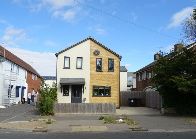
Aubrey Close Residential road near Chelmsford.
Aubrey Close Credit: Wayland Smith

Broom Wood is a charming woodland located in Essex, England. Situated near the village of Broomfield, this forested area is known for its natural beauty and serene atmosphere. Covering an area of approximately 100 acres, Broom Wood is a popular destination for nature enthusiasts, walkers, and wildlife lovers.

The wood is predominantly made up of oak and hornbeam trees, which create a dense canopy, allowing only dappled sunlight to filter through. This creates a tranquil and picturesque environment, perfect for relaxing strolls or peaceful picnics. The forest floor is covered in a lush carpet of ferns, bluebells, and wildflowers, adding to the woodland's enchanting ambience.

Broom Wood is home to a diverse range of wildlife, including deer, foxes, badgers, and a variety of bird species. Birdwatchers can spot woodpeckers, owls, and other woodland birds throughout the year. The wood's diverse ecosystem provides food and shelter for these animals, making it an important habitat for local wildlife.

The woodland is crisscrossed by a network of well-maintained trails, allowing visitors to explore its beauty at their own pace. There are also designated areas for nature study and educational activities, making Broom Wood a popular spot for school outings and nature clubs.

Broom Wood is easily accessible, with ample parking facilities available nearby. The wood is open to the public throughout the year, and there are no admission fees. It offers a peaceful retreat from the hustle and bustle of everyday life, providing a haven for those seeking solace in nature's embrace.

If you have any feedback on the listing, please let us know in the comments section below.

Broom Wood Images

Images are sourced within 2km of 51.760238/0.44751302 or Grid Reference TL6909. Thanks to Geograph Open Source API. All images are credited.

Aubrey Close Residential road near Chelmsford.
Aubrey Close
Residential road near Chelmsford.
George VI postbox on Kings Road, Chelmsford Postbox No. CM1 267.
See <a href="https://www.geograph.org.uk/photo/7267006">TL7008 : Kings Convenience Store on Kings Road, Chelmsford</a> for context.
George VI postbox on Kings Road, Chelmsford
Postbox No. CM1 267. See TL7008 : Kings Convenience Store on Kings Road, Chelmsford for context.
Kings Convenience Store on Kings Road, Chelmsford Showing position of Postbox No. CM1 267.
See <a href="https://www.geograph.org.uk/photo/7267005">TL7008 : George VI postbox on Kings Road, Chelmsford</a> for postbox.
Kings Convenience Store on Kings Road, Chelmsford
Showing position of Postbox No. CM1 267. See TL7008 : George VI postbox on Kings Road, Chelmsford for postbox.
House on Kings Road, Chelmsford
Kings Road, Chelmsford
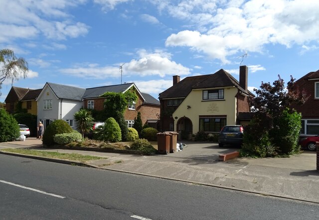
Houses on Patching Hall Lane, Chelmsford
Patching Hall Lane, Chelmsford
School Lane Towards Parsonage Green.
School Lane
Towards Parsonage Green.
Flats on School Lane
Broomfield Library On Main Road.
Broomfield Library
On Main Road.
Main Road (B1008), Broomfield
The Kings Arms, Broomfield On Main Road.
See <a href="https://www.geograph.org.uk/photo/7267108">TL7010 : Sign for the Kings Arms, Broomfield</a> for sign.
The Kings Arms, Broomfield
On Main Road. See TL7010 : Sign for the Kings Arms, Broomfield for sign.
Sign for the Kings Arms, Broomfield See <a href="https://www.geograph.org.uk/photo/7267106">TL7010 : The Kings Arms, Broomfield</a> for context.
Sign for the Kings Arms, Broomfield
War Memorial on Church Green, Broomfield
Postbox at Chelmsford CM1 399. Royal Mail list this box as 'CM1 399D Woodhall Road'.
Postbox at Chelmsford
CM1 399. Royal Mail list this box as 'CM1 399D Woodhall Road'.
The Pig and Whistle, Chignall Smeally
Walkers skirt the old gravel pit, 1982 On the way from Great Waltham and back via the White Horse at Pleshey. The tower crane on the horizon towards the right was a help in locating this shot, as it could only have been engaged on extensions to Broomfield Hospital.
Walkers skirt the old gravel pit, 1982
On the way from Great Waltham and back via the White Horse at Pleshey. The tower crane on the horizon towards the right was a help in locating this shot, as it could only have been engaged on extensions to Broomfield Hospital.
Woodhall Hill, Chignall Smealy The outskirts of Chignall Smealy, a diffuse settlement whose 'centre' is little different to this part, in terms of population density.
Woodhall Hill, Chignall Smealy
The outskirts of Chignall Smealy, a diffuse settlement whose 'centre' is little different to this part, in terms of population density.
Show me another place!

Broom Wood is located at Grid Ref: TL6909 (Lat: 51.760238, Lng: 0.44751302)

Administrative County: Essex

District: Chelmsford

Police Authority: Essex

What 3 Words

///deduced.scribbled.pans. Near Chelmsford, Essex

Related Wikis

London Basin

The London Basin is an elongated, roughly triangular sedimentary basin approximately 250 kilometres (160 mi) long which underlies London and a large area...

West Chelmsford (UK Parliament constituency)

West Chelmsford was a parliamentary constituency represented in the House of Commons of the Parliament of the United Kingdom. From 1997 to 2010 it elected...

Chelmsford City F.C.

Chelmsford City Football Club is a semi-professional football club based in Chelmsford, Essex, England. Currently members of the National League South...

St John Payne Catholic School

Saint John Payne Catholic School is a Roman Catholic voluntary aided school in Chelmsford, Essex. Established in 1959, the school serves the mid Essex...

Broomfield, Essex

Broomfield is a village and residential suburb in the City of Chelmsford district, immediately north of the city itself. It is the site of a major Accident...

St Peter's College, Chelmsford

St. Peters College was a Church of England Voluntary Aided School in Chelmsford, Essex. The school was a specialist arts college. == History == The school...

Chignall

Chignall is a civil parish in the City of Chelmsford in Essex, England. The civil parish has 311 inhabitants (2011). The villages were recorded in the...

Chelmer Valley High School

Chelmer Valley High School (CVHS) is an academy based on a large site on the outskirts of Chelmsford, Essex, England. It has specialisms in engineering...

Nearby Amenities

Located within 500m of 51.760238,0.44751302
Crossing
Crossing: unmarked
Crossing Island: no
Crossing Markings: no
Tactile Paving: yes
Lat/Long: 51.7577783/0.4422065
Barrier: bollard
Bicycle: yes
Foot: yes
Lat/Long: 51.757854/0.442148
Bus Stop
Havisham Way
Bus: yes
Naptan AtcoCode: 15003400705
Naptan Bearing: SE
Naptan CommonName: Havisham Way
Naptan Crossing: Havisham Way
Naptan Indicator: Adj
Naptan Landmark: Havisham Way
Naptan NaptanCode: esxdpgtm
Naptan PlusbusZoneRef: CHLMSFD
Naptan Street: Copperfield Road
Naptan Verified: no
Public Transport: platform
Source: naptan_import
Lat/Long: 51.7560065/0.4488757
Turning Circle
Lat/Long: 51.7567143/0.4457702
Turning Circle
Lat/Long: 51.7563339/0.4457153
Turning Circle
Lat/Long: 51.7560345/0.4456919
Barrier: stile
Lat/Long: 51.7612881/0.4412141
Barrier: stile
Lat/Long: 51.7611437/0.4403916
Turning Circle
Lat/Long: 51.7603869/0.4448119
Barrier: bollard
Bicycle: yes
Foot: yes
Lat/Long: 51.7578703/0.4454087
Barrier: bollard
Bicycle: yes
Foot: yes
Lat/Long: 51.7577879/0.4424522
Turning Circle
Lat/Long: 51.7584747/0.448561
Turning Circle
Lat/Long: 51.7587656/0.4486129
Generator Method: photovoltaic
Generator Output Electricity: yes
Generator Source: solar
Generator Type: solar_photovoltaic_panel
Location: roof
Power: generator
Lat/Long: 51.7570889/0.447529
Generator Method: photovoltaic
Generator Output Electricity: yes
Generator Source: solar
Generator Type: solar_photovoltaic_panel
Location: roof
Power: generator
Lat/Long: 51.7566522/0.4481883
Generator Method: photovoltaic
Generator Output Electricity: yes
Generator Source: solar
Generator Type: solar_photovoltaic_panel
Location: roof
Power: generator
Lat/Long: 51.7568944/0.4473226
Generator Method: photovoltaic
Generator Output Electricity: yes
Generator Source: solar
Generator Type: solar_photovoltaic_panel
Location: roof
Power: generator
Lat/Long: 51.7567457/0.4443467
Generator Method: photovoltaic
Generator Output Electricity: yes
Generator Source: solar
Generator Type: solar_photovoltaic_panel
Location: roof
Power: generator
Lat/Long: 51.7576894/0.4496949
Generator Method: photovoltaic
Generator Output Electricity: yes
Generator Source: solar
Generator Type: solar_photovoltaic_panel
Location: roof
Power: generator
Lat/Long: 51.7575709/0.4496949
Generator Method: photovoltaic
Generator Output Electricity: yes
Generator Source: solar
Generator Type: solar_photovoltaic_panel
Location: roof
Power: generator
Lat/Long: 51.757607/0.4498093
Generator Method: photovoltaic
Generator Output Electricity: yes
Generator Source: solar
Generator Type: solar_photovoltaic_panel
Location: roof
Power: generator
Lat/Long: 51.7574394/0.4498864
Generator Method: photovoltaic
Generator Output Electricity: yes
Generator Source: solar
Generator Type: solar_photovoltaic_panel
Location: roof
Power: generator
Lat/Long: 51.7573714/0.4499774
Generator Method: photovoltaic
Generator Output Electricity: yes
Generator Source: solar
Generator Type: solar_photovoltaic_panel
Location: roof
Power: generator
Lat/Long: 51.7572919/0.4500988
Generator Method: photovoltaic
Generator Output Electricity: yes
Generator Source: solar
Generator Type: solar_photovoltaic_panel
Location: roof
Power: generator
Lat/Long: 51.7573946/0.449835
Generator Method: photovoltaic
Generator Output Electricity: yes
Generator Source: solar
Generator Type: solar_photovoltaic_panel
Location: roof
Power: generator
Lat/Long: 51.7572977/0.4484293
Generator Method: photovoltaic
Generator Output Electricity: yes
Generator Source: solar
Generator Type: solar_photovoltaic_panel
Location: roof
Power: generator
Lat/Long: 51.7572413/0.4484503
Generator Method: photovoltaic
Generator Output Electricity: yes
Generator Source: solar
Generator Type: solar_photovoltaic_panel
Location: roof
Power: generator
Lat/Long: 51.7570115/0.4484854
Generator Method: photovoltaic
Generator Output Electricity: yes
Generator Source: solar
Generator Type: solar_photovoltaic_panel
Location: roof
Power: generator
Lat/Long: 51.7569653/0.4485181
Generator Method: photovoltaic
Generator Output Electricity: yes
Generator Source: solar
Generator Type: solar_photovoltaic_panel
Location: roof
Power: generator
Lat/Long: 51.7562016/0.4498203
Generator Method: photovoltaic
Generator Output Electricity: yes
Generator Source: solar
Generator Type: solar_photovoltaic_panel
Location: roof
Power: generator
Lat/Long: 51.7578334/0.4530497
Generator Method: photovoltaic
Generator Output Electricity: yes
Generator Source: solar
Generator Type: solar_photovoltaic_panel
Location: roof
Power: generator
Lat/Long: 51.7577814/0.453024
Generator Method: photovoltaic
Generator Output Electricity: yes
Generator Source: solar
Generator Type: solar_photovoltaic_panel
Location: roof
Power: generator
Lat/Long: 51.7577944/0.4533555
Generator Method: photovoltaic
Generator Output Electricity: yes
Generator Source: solar
Generator Type: solar_photovoltaic_panel
Location: roof
Power: generator
Lat/Long: 51.7577467/0.4533439
The data included in this document is from www.openstreetmap.org. The data is made available under ODbL.

Have you been to Broom Wood?

Leave your review of Broom Wood below (or comments, questions and feedback).