Bramhope

Civil Parish in Yorkshire Leeds

England

Bramhope

Old Rushes Farm Old Rushes Farm seen from the Leeds Country Way
Old Rushes Farm Credit: Mick Melvin

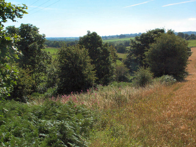
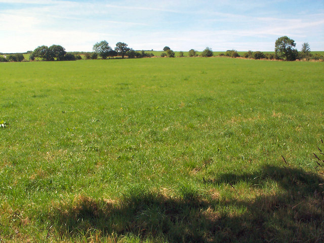
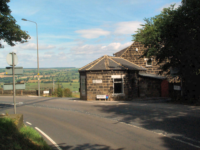
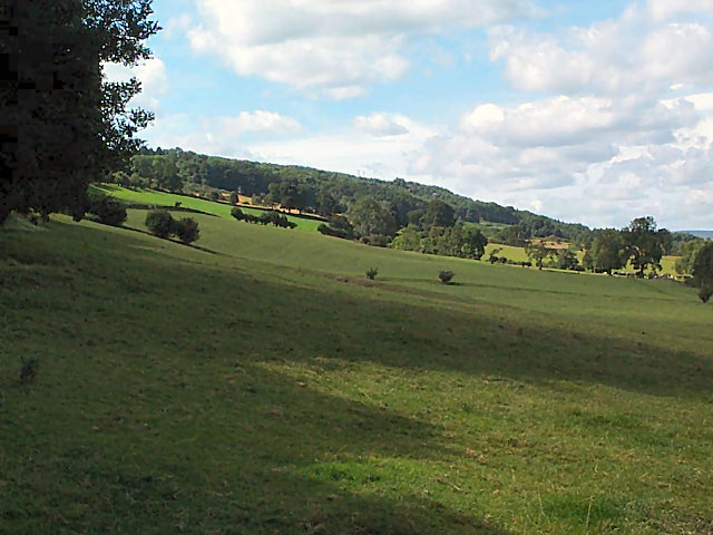
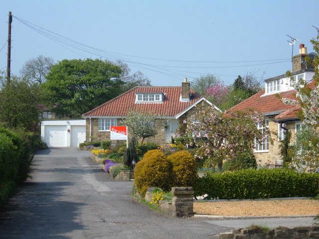
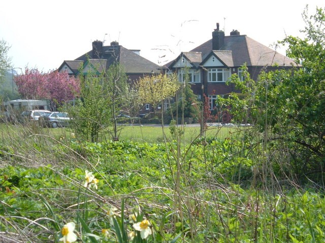
Bramhope is a civil parish located in the metropolitan borough of Leeds, West Yorkshire, in England. Situated approximately 9 miles north of Leeds city centre, it is nestled within the picturesque countryside of Lower Wharfedale. The village is surrounded by rolling hills and open green spaces, making it an ideal location for those seeking a peaceful and rural setting.

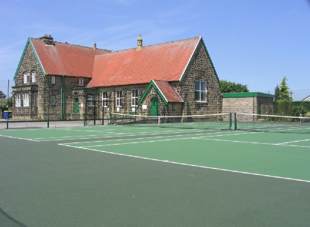
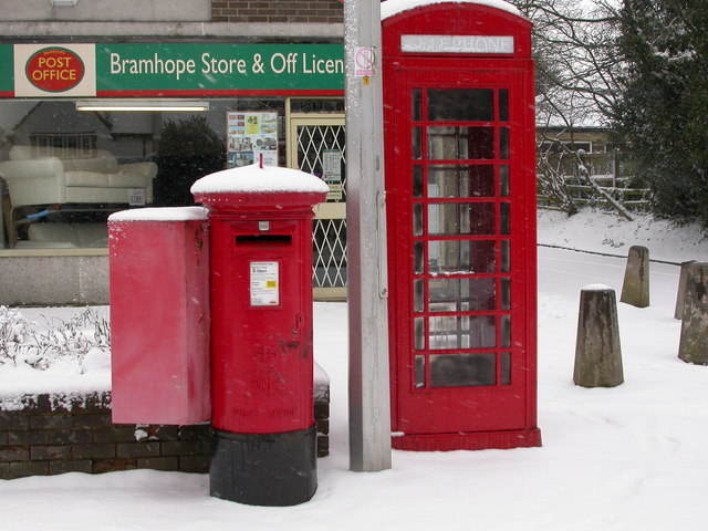
Bramhope is known for its charming character and close-knit community. The village centre features a range of amenities, including a local pub, a post office, a convenience store, and a primary school. There are also several churches, providing a place of worship for residents.

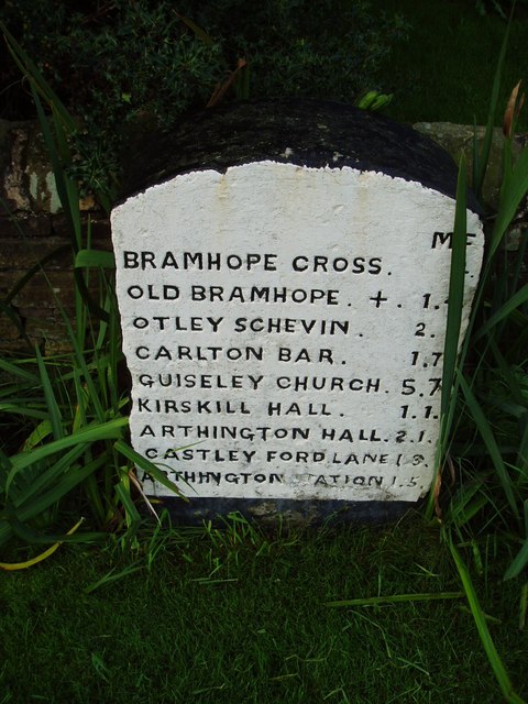
The area is well-connected, with good transport links. The A660 road runs through Bramhope, connecting it to Leeds and the nearby towns of Otley and Ilkley. Regular bus services provide easy access to these surrounding areas, as well as to Leeds city centre.

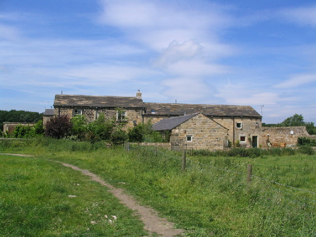
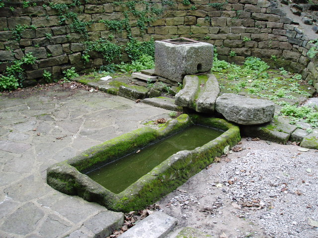
Bramhope boasts a rich history, with evidence of human habitation dating back to the Bronze Age. The village is home to several listed buildings, including a 17th-century manor house and a medieval church, which add to its historical charm.

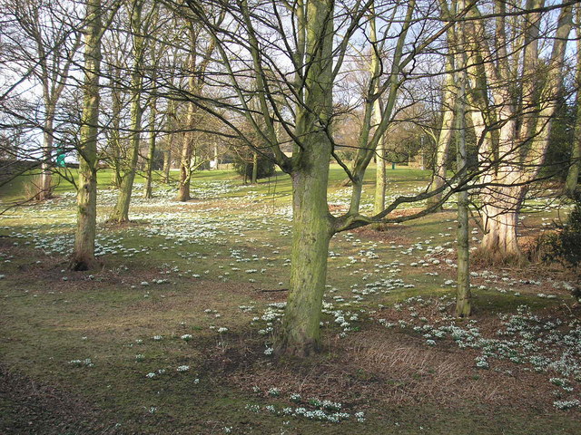
For outdoor enthusiasts, Bramhope offers plenty of opportunities to explore the beautiful countryside. The nearby Chevin Forest Park is a popular destination for walking and hiking, offering stunning views of the surrounding area.

Overall, Bramhope is a tranquil and idyllic village, offering a perfect blend of rural living and convenient access to nearby urban amenities.

If you have any feedback on the listing, please let us know in the comments section below.
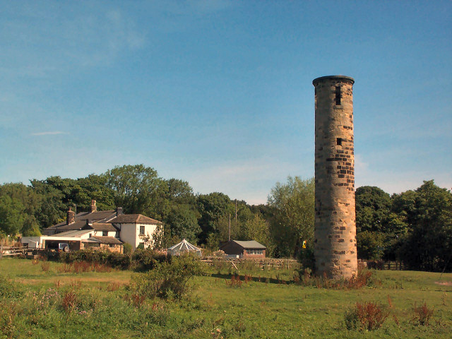
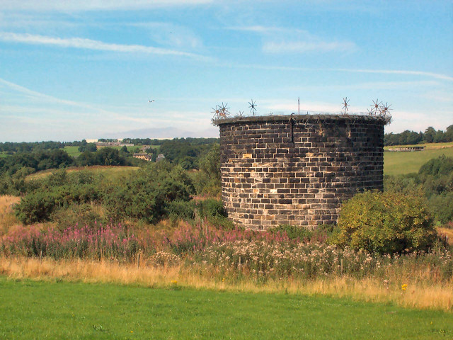
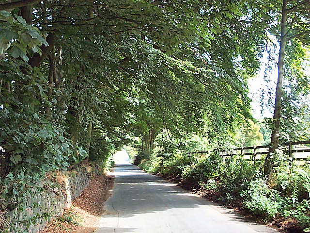
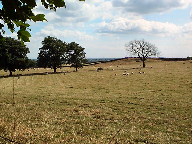
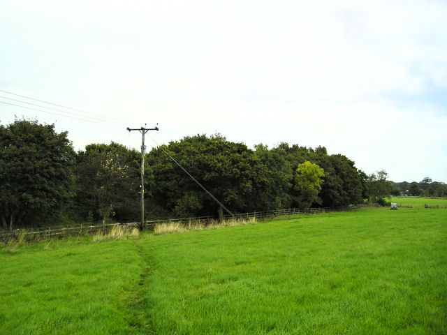
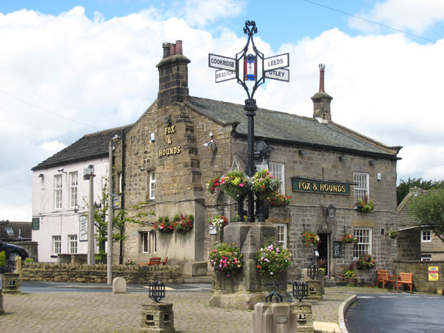
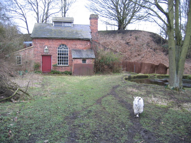
Bramhope Images

Images are sourced within 2km of 53.88267/-1.625717 or Grid Reference SE2443. Thanks to Geograph Open Source API. All images are credited.

Old Rushes Farm Old Rushes Farm seen from the Leeds Country Way
Old Rushes Farm
Old Rushes Farm seen from the Leeds Country Way
Robert Craven Memorial Hall Built in 1896, this is the village hall for the village of Bramhope. Built using a legacy of a local farmer, Robert Craven.
Robert Craven Memorial Hall
Built in 1896, this is the village hall for the village of Bramhope. Built using a legacy of a local farmer, Robert Craven.
Valley of Bramhope Beck View southeast towards None-go-bye's Hill.
Valley of Bramhope Beck
View southeast towards None-go-bye's Hill.
Crag Hill, Bramhope Moor Pasture land viewed southwards from Old Road.
Crag Hill, Bramhope Moor
Pasture land viewed southwards from Old Road.
Sighting tower south of Bramhope This is a sighting tower, built so that the engineers could keep a true line during construction of the Bramhope Tunnel on the Leeds to Harrogate railway line, directly underneath this point. This field was also used as a navvie camp during construction.  See <span class="nowrap"><a title="http://www.bramhope.org/brtunnel.htm" rel="nofollow ugc noopener" href="http://www.bramhope.org/brtunnel.htm">Link</a><img style="margin-left:2px;" alt="External link" title="External link - shift click to open in new window" src="https://s1.geograph.org.uk/img/external.png" width="10" height="10"/></span>
Sighting tower south of Bramhope
This is a sighting tower, built so that the engineers could keep a true line during construction of the Bramhope Tunnel on the Leeds to Harrogate railway line, directly underneath this point. This field was also used as a navvie camp during construction. See LinkExternal link
Air shaft, Bramhope Tunnel Bramhope Tunnel is on the Leeds to Harrogate railway line. The tunnel is over two miles long and was constructed from 1845 to 1849 at a cost of 24 lives. There are four of these shafts, and also a sighting tower survives (SE2442).  See the excellent description at <span class="nowrap"><a title="http://www.bramhope.org/brtunnel.htm" rel="nofollow ugc noopener" href="http://www.bramhope.org/brtunnel.htm">Link</a><img style="margin-left:2px;" alt="External link" title="External link - shift click to open in new window" src="https://s1.geograph.org.uk/img/external.png" width="10" height="10"/></span>
Air shaft, Bramhope Tunnel
Bramhope Tunnel is on the Leeds to Harrogate railway line. The tunnel is over two miles long and was constructed from 1845 to 1849 at a cost of 24 lives. There are four of these shafts, and also a sighting tower survives (SE2442). See the excellent description at LinkExternal link
Old Pool Bank The original course of what is now the A658 was down this steep, narrow lane. This is right at the top, looking downwards (northwards).
Old Pool Bank
The original course of what is now the A658 was down this steep, narrow lane. This is right at the top, looking downwards (northwards).
Trees at the top of Pool Bank It's dead Jim. (The one on the right.)
Trees at the top of Pool Bank
It's dead Jim. (The one on the right.)
The Bar House, near Pool Halfway down the old Pool Bank, where it crosses the current A660 from Otley (left) to Leeds (right). Old Pool Bank disappears down to the left of The Bar House.
The Bar House, near Pool
Halfway down the old Pool Bank, where it crosses the current A660 from Otley (left) to Leeds (right). Old Pool Bank disappears down to the left of The Bar House.
Western end of Pool Bank The fields of the western end of Pool Bank.  Taken from Old Pool Bank near the dismantled railway line, looking westwards.
Western end of Pool Bank
The fields of the western end of Pool Bank. Taken from Old Pool Bank near the dismantled railway line, looking westwards.
Bramhope Post Office Diversify to prosper!
Bramhope Post Office
Diversify to prosper!
Sycamore Close, Bramhope, LS16 Cul-de-sac at the southernmost edge of the village of Bramhope. Shown as undeveloped on the 1940s map.
Sycamore Close, Bramhope, LS16
Cul-de-sac at the southernmost edge of the village of Bramhope. Shown as undeveloped on the 1940s map.
Kings Drive, Bramhope, LS16 Situated just off the A660, Otley road. View from "Private Land", not someone's front garden.
Kings Drive, Bramhope, LS16
Situated just off the A660, Otley road. View from "Private Land", not someone's front garden.
Old Milestone in Bramhope This is one of several milestones along the road between Leeds and Otley giving distances in miles and furlongs.
Old Milestone in Bramhope
This is one of several milestones along the road between Leeds and Otley giving distances in miles and furlongs.
Old pump and well complex,  Bramhope A nearby plaque states:" Old Bramhope Township. Well and Pump Complex, origins unknown. Exposed 1992, landscaped 1994. A forgotten past is lost forever."
Old pump and well complex, Bramhope
A nearby plaque states:" Old Bramhope Township. Well and Pump Complex, origins unknown. Exposed 1992, landscaped 1994. A forgotten past is lost forever."
Snowdrops in Bramhope A fine display of snowdrops in what appear to be the grounds of a nearby hotel.
Snowdrops in Bramhope
A fine display of snowdrops in what appear to be the grounds of a nearby hotel.
Wood on mound This clump of trees has grown on the mound of soil and rocks that were dumped here during the construction of the railway tunnel that runs under it.
Wood on mound
This clump of trees has grown on the mound of soil and rocks that were dumped here during the construction of the railway tunnel that runs under it.
Fox & Hounds, Bramhope The Cross in the middle of the crossroads was erected in about 1876
Fox & Hounds, Bramhope
The Cross in the middle of the crossroads was erected in about 1876
Show me another place!

Bramhope is located at Grid Ref: SE2443 (Lat: 53.88267, Lng: -1.625717)

Division: West Riding

Administrative County: West Yorkshire

District: Leeds

Police Authority: West Yorkshire

What 3 Words

///fermented.chipper.rooms. Near Bramhope, West Yorkshire

Nearby Locations

Bramhope Bramhope

Related Wikis

Bramhope

Bramhope is a village and civil parish in the City of Leeds metropolitan borough, West Yorkshire, England, north of Holt Park and north east of Cookridge...

Bramhope Tunnel

Bramhope Tunnel is on the Harrogate Line between Horsforth station and the Arthington Viaduct in West Yorkshire, England. Services through the railway...

A660 road

The A660 is a major road in the Leeds and Bradford districts of West Yorkshire, England that runs from Leeds city centre to Burley-in-Wharfedale where...

Arthington railway station

Arthington railway station served the village of Arthington in the English county of West Yorkshire, near the North Yorkshire town of Harrogate. ��2...

Pool-in-Wharfedale railway station

Pool-in-Wharfedale railway station was a railway station serving the village of Pool-in-Wharfedale in West Yorkshire, England. It was opened by the North...

Creskeld Hall

Creskeld Hall is a grade II listed Country House located in Arthington, near Otley, West Yorkshire, England. == Etymology == The place-name is first attested...

Pool-in-Wharfedale

Pool-in-Wharfedale or Pool in Wharfedale, usually abbreviated to Pool, is a village and civil parish in Lower Wharfedale, West Yorkshire, England, 10 miles...

Breary Marsh

Breary Marsh is a Local Nature Reserve and Site of Special Scientific Interest situated adjacent to Golden Acre Park in Leeds, West Yorkshire, England...

Nearby Amenities

Located within 500m of 53.88267,-1.625717
Bramhope
Is In: UK, England, West Yorkshire, Wharfedale
Is In County: West Yorkshire
Is In Historic County: Yorkshire
Is In Municipality: Leeds
Is In Valley: Wharfedale
Place: village
Population: 3400
Wikidata: Q4956178
Wikipedia: en:Bramhope
Lat/Long: 53.885516/-1.6202619
Building: air_shaft
Source: OS 1:25k
Lat/Long: 53.8804492/-1.622486
Bus Stop
Leeds Road St Giles Garth
Bench: yes
Bin: yes
Bus: yes
Local Ref: 45010491
Naptan AtcoCode: 450010491
Naptan Bearing: NW
Naptan CommonName: Leeds Road St Giles Garth
Naptan Crossing: St Giles Garth
Naptan Indicator: Stop 45010491
Naptan PlusbusZoneRef: LEEDS
Naptan ShortCommonName: St. Giles Garth
Naptan Street: Leeds Road
Naptan Verified: no
Public Transport: platform
Shelter: yes
Source: naptan_import
Lat/Long: 53.886493/-1.6218944
Bus Stop
Moor Road
Bus: yes
Local Ref: 45025433
Naptan AtcoCode: 450025433
Naptan Bearing: SW
Naptan BusStopType: CUS
Naptan CommonName: Moor Road
Naptan Crossing: Manor Close
Naptan Indicator: Stop 45025433
Naptan PlusbusZoneRef: LEEDS
Naptan ShortCommonName: Manor Close
Naptan Street: Moor Road
Naptan Verified: no
Public Transport: platform
Source: naptan_import
Lat/Long: 53.8849798/-1.6237489
Turning Circle
Lat/Long: 53.8838715/-1.6195497
Turning Circle
Lat/Long: 53.8848412/-1.6244704
Post Box
Operator: Royal Mail
Post Box Type: lamp
Ref: LS16 710
Lat/Long: 53.87921/-1.6247471
Post Box
Operator: Royal Mail
Post Box Type: pillar
Ref: LS16 709
Royal Cypher: EIIR
Royal Cypher Wikidata: Q33102113
Lat/Long: 53.8844614/-1.6189229
Post Box
Operator: Royal Mail
Operator Type: private
Operator Wikidata: Q638098
Post Box Type: pillar
Ref: LS16 91
Lat/Long: 53.8851263/-1.6239214
Building: air_shaft
Source: OS 1:25k
Lat/Long: 53.8804744/-1.62254
Turning Loop
Lat/Long: 53.8838616/-1.625206
La Boutique
Phone: +44 113 284 2607
Shop: hairdresser
Lat/Long: 53.8850599/-1.622798
Fast Food
Le Raj
Addr City: Leeds
Addr Housenumber: 11
Addr Postcode: LS16 9AX
Addr Street: The Cross
Addr Suburb: Bramhope
Cuisine: indian
Fhrs Id: 1671510
Lat/Long: 53.885288/-1.6232325
The Cross
Ele: 180
Information: guidepost
Tourism: information
Lat/Long: 53.8851752/-1.6234182
Cafe
The Loft
Lat/Long: 53.885476/-1.623796
The Village Bakery
Addr City: Leeds
Addr Housenumber: 9-10
Addr Postcode: LS16 9AX
Addr Street: The Cross
Addr Suburb: Bramhope
Fhrs Id: 1073649
Shop: bakery
Source Addr: FHRS Open Data
Lat/Long: 53.8852463/-1.623217
The Village Newsagents
Addr City: Leeds
Addr Housenumber: 7
Addr Postcode: LS16 9AX
Addr Street: The Cross
Fhrs Id: 805425
Shop: convenience
Wheelchair: no
Lat/Long: 53.8852116/-1.6230117
Fast Food
Popsies Fish And Chips
Addr City: Leeds
Addr Housenumber: 12
Addr Postcode: LS16 9AX
Addr Street: The Cross
Addr Suburb: Bramhope
Cuisine: fish_and_chips
Fhrs Id: 859237
Lat/Long: 53.8853335/-1.6232362
Moor Road
Bus: yes
Public Transport: stop_position
Lat/Long: 53.8849961/-1.6238098
Parking Entrance
Lat/Long: 53.8851376/-1.624653
Turning Circle
Lat/Long: 53.8858954/-1.6254177
Public Bookcase
Book Exchange
Booth: K6
Colour: red
Covered: booth
Disused Amenity: telephone
Man Made: telephone_box
Public Bookcase Type: phone_box
Lat/Long: 53.8844691/-1.6189561
Bench
Lat/Long: 53.8844279/-1.6187456
Pharmacy
Stancliffe Pharmacy
Addr City: Leeds
Addr Housenumber: 4
Addr Postcode: LS16 9AF
Addr Street: The Parade
Addr Suburb: Bramhope
Fhrs Id: 467300
Healthcare: pharmacy
Lat/Long: 53.8842936/-1.6187265
Cafe
St Giles Church Hall Luncheon Club
Addr City: Leeds
Addr Housenumber: 9
Addr Postcode: LS16 9BA
Addr Street: Church Hill
Addr Suburb: Bramhope
Fhrs Id: 320684
Lat/Long: 53.8863265/-1.6226962
Waste Basket
Collection Times: Tu; Th
Condition: GOOD
Ref UK Leedscc Bin: 6843
Waste Basket Model: METAL SQUARE
Lat/Long: 53.885392/-1.625884
Waste Basket
Collection Times: Tu; Th
Condition: GOOD
Ref UK Leedscc Bin: 6842
Waste Basket Model: METAL SQUARE
Lat/Long: 53.885534/-1.62581
Waste Basket
Collection Times: Tu; Th
Condition: POOR
Ref UK Leedscc Bin: 637
Waste Basket Model: PLASTIC ROUND OPEN TOP
Lat/Long: 53.885604/-1.623189
Waste Basket
Collection Times: Tu; Th
Condition: GOOD
Ref UK Leedscc Bin: 977
Waste Basket Model: METAL SQUARE
Lat/Long: 53.885209/-1.622573
Waste Basket
Collection Times: Tu; Th
Condition: POOR
Ref UK Leedscc Bin: 390
Waste Basket Model: PLASTIC ROUND OPEN TOP
Lat/Long: 53.884919/-1.620947
Waste Basket
Collection Times: Tu; Th
Condition: POOR
Ref UK Leedscc Bin: 391
Waste Basket Model: METAL SQUARE OPEN TOP
Lat/Long: 53.88481/-1.620695
Waste Basket
Collection Times: Tu; Th
Condition: FAIR
Ref UK Leedscc Bin: 1749
Waste Basket Model: METAL SQUARE OPEN TOP
Lat/Long: 53.886405/-1.621833
Barrier: stile
Lat/Long: 53.8786316/-1.624661
Barrier: stile
Lat/Long: 53.8784853/-1.6247102
Barrier: stile
Source: survey
Lat/Long: 53.8791081/-1.6240403
Addr City: Bramhope
Addr Housenumber: 4
Addr Street: St Giles Garth
Source: survey
Lat/Long: 53.8858764/-1.6208199
Addr City: Bramhope
Addr Housenumber: 5
Addr Street: St Giles Garth
Source: survey
Lat/Long: 53.8857895/-1.6205061
Place Of Worship
St Giles
Denomination: anglican
Religion: christian
Lat/Long: 53.8864093/-1.6226921
Addr City: Bramhope
Addr Housenumber: 6
Addr Street: St Giles Garth
Source: survey
Lat/Long: 53.8857184/-1.6201681
Addr City: Bramhope
Addr Housenumber: 3
Addr Street: St Giles Garth
Source: survey
Lat/Long: 53.8859634/-1.6210801
Addr City: Bramhope
Addr Housenumber: 3
Addr Street: St Giles Garth
Source: survey
Lat/Long: 53.8860914/-1.6213269
Addr City: Bramhope
Addr Housenumber: 19
Addr Street: Eastgate Close
Source: survey
Lat/Long: 53.885612/-1.6214241
Dacre, Son & Hartley
Office: estate_agent
Source: survey
Website: https://www.dacres.co.uk/
Lat/Long: 53.8851504/-1.6219874
Addr City: Bramhope
Addr Housenumber: 17
Addr Street: Eastgate Close
Source: survey
Lat/Long: 53.8857416/-1.6218852
Barrier: kissing_gate
Source: survey
Lat/Long: 53.8865742/-1.6221795
Addr City: Bramhope
Addr Housenumber: 17A
Addr Street: Eastgate Close
Source: survey
Lat/Long: 53.8857511/-1.6216816
Power: pole
Lat/Long: 53.8851968/-1.6316765
Power: pole
Lat/Long: 53.8843462/-1.6316318
Power: pole
Lat/Long: 53.883819/-1.6310017
Power: pole
Lat/Long: 53.8832894/-1.6303573
Power: pole
Lat/Long: 53.8827826/-1.6296682
Power: pole
Lat/Long: 53.8827557/-1.6283266
Power: pole
Lat/Long: 53.8827022/-1.627003
Line Management: termination
Location Transition: yes
Power: tower
Lat/Long: 53.8826693/-1.6257301
Leeds Road St Giles Garth
Bus: yes
Public Transport: stop_position
Lat/Long: 53.8865372/-1.6218674
Bus Stop
Moor Road
Bus: yes
Naptan AtcoCode: 450026234
Naptan NaptanCode: 45026234
Public Transport: platform
Lat/Long: 53.8849625/-1.623934
Moor Road
Bus: yes
Public Transport: stop_position
Lat/Long: 53.8849477/-1.6238536
Generator Method: photovoltaic
Generator Output Electricity: yes
Generator Source: solar
Generator Type: solar_photovoltaic_panel
Power: generator
Lat/Long: 53.8841765/-1.6249223
Bus Stop
Bramhope Moor Road
Bus: yes
Public Transport: platform
Lat/Long: 53.8786489/-1.624662
Bramhope Moor Road
Bus: yes
Public Transport: stop_position
Lat/Long: 53.8786448/-1.6246996
Booth: K6
Covered: booth
Disused Amenity: telephone
Man Made: telephone_box
Lat/Long: 53.8787274/-1.6246385
The data included in this document is from www.openstreetmap.org. The data is made available under ODbL.

Have you been to Bramhope?

Leave your review of Bramhope below (or comments, questions and feedback).