Bradfield

Civil Parish in Essex Tendring

England

Bradfield

The Bradfield Memorial Stone Recently installed (Aug 2021). Dedicated to the memory of the fallen in all wars and the 75th anniversary (2020) of VE and VJ Days. Erected by the Bradfield Community at the edge of the village playing field.
The Bradfield Memorial Stone Credit: Tony Peacock

Bradfield is a civil parish located in the county of Essex, England. Situated in the Tendring district, it covers an area of approximately 9.5 square kilometers and is home to a small population of around 1,200 residents. The parish is surrounded by picturesque countryside, offering a peaceful and charming setting for its inhabitants.

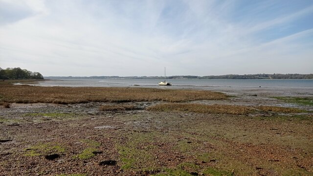
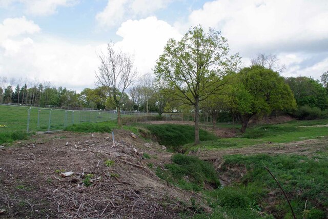
Bradfield is primarily a rural area, characterized by its open fields, farmland, and scattered dwellings. The landscape is predominantly flat, with some gentle undulations, and is intersected by a few small streams and brooks. The parish is known for its agricultural activities, with farming playing a significant role in the local economy.

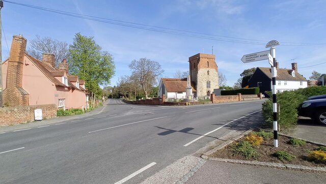
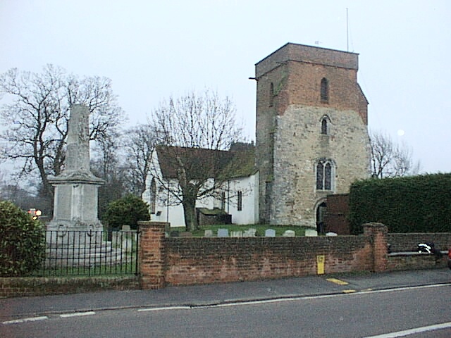
The heart of Bradfield is the village itself, which is centered around the historic parish church of St. Lawrence. This beautiful medieval church dates back to the 12th century and is a well-known landmark within the area. Other notable features of the village include a primary school, a village hall, and a pub, which serves as a social hub for residents.

Bradfield offers a range of amenities and services to its residents, including local shops, post office facilities, and public transportation links. The parish is also within a short distance of larger towns and cities, such as Manningtree and Colchester, providing access to a wider range of amenities and employment opportunities.

Overall, Bradfield is a peaceful and idyllic rural parish, offering a close-knit community and a tranquil lifestyle for its residents.

If you have any feedback on the listing, please let us know in the comments section below.

Bradfield Images

Images are sourced within 2km of 51.930886/1.112031 or Grid Reference TM1430. Thanks to Geograph Open Source API. All images are credited.

The Bradfield Memorial Stone Recently installed (Aug 2021). Dedicated to the memory of the fallen in all wars and the 75th anniversary (2020) of VE and VJ Days. Erected by the Bradfield Community at the edge of the village playing field.
The Bradfield Memorial Stone
Recently installed (Aug 2021). Dedicated to the memory of the fallen in all wars and the 75th anniversary (2020) of VE and VJ Days. Erected by the Bradfield Community at the edge of the village playing field.
Bradfield Parish Church, Essex Bradfield Church (Saint Lawrence), taken from the car park of the Stranger's Home Inn.
Bradfield Parish Church, Essex
Bradfield Church (Saint Lawrence), taken from the car park of the Stranger's Home Inn.
Boat on the River Stour A sailboat on the River Stour at low tide.
Boat on the River Stour
A sailboat on the River Stour at low tide.
Stream in New Mistley The stream ends up in the Landooze Rill in the Stour. I suspect the land behind the fence will soon be re-developed.
Stream in New Mistley
The stream ends up in the Landooze Rill in the Stour. I suspect the land behind the fence will soon be re-developed.
House in Bradfield Heath, Essex This attractive house stands at the end of Dairyhouse Lane, where it meets the main road through Bradfield Heath.
House in Bradfield Heath, Essex
This attractive house stands at the end of Dairyhouse Lane, where it meets the main road through Bradfield Heath.
Road to Bluehouse Farm
Farmhouse at Goldenferry Farm
Post Office and village store at Bradfield Heath, Essex
Field of sugar beet and small wood south of Bradfield Heath In the foreground, a maturing crop of sugar beet; in the middle distance a small wood beyond which is a public footpath; in the distance is the water tower located in <a href="https://www.geograph.org.uk/gridref/TM1227">TM1227</a> at Horsley Cross.
Field of sugar beet and small wood south of Bradfield Heath
In the foreground, a maturing crop of sugar beet; in the middle distance a small wood beyond which is a public footpath; in the distance is the water tower located in TM1227 at Horsley Cross.
Sugar beet under autumn skies No signs of an Indian summer yet with threatening skies in early September 2007. Within a month or maybe two, the sugar beet will be harvested and sent for processing into sugar. The TV mast in <a href="https://www.geograph.org.uk/gridref/TM1229">TM1229</a> is visible in the distance.
Sugar beet under autumn skies
No signs of an Indian summer yet with threatening skies in early September 2007. Within a month or maybe two, the sugar beet will be harvested and sent for processing into sugar. The TV mast in TM1229 is visible in the distance.
More useful information from LEAF As well as explaining ways of <a href="https://www.geograph.org.uk/photo/544437">TM1428 : Using water wisely</a>, here LEAF explains about oil seed rape and linseed and ways of feeding farmland birds. <span class="nowrap"><a title="www.leafuk.org" rel="nofollow ugc noopener" href="http://www.leafuk.org">Link</a><img style="margin-left:2px;" alt="External link" title="External link - shift click to open in new window" src="https://s1.geograph.org.uk/img/external.png" width="10" height="10"/></span>
More useful information from LEAF
As well as explaining ways of TM1428 : Using water wisely, here LEAF explains about oil seed rape and linseed and ways of feeding farmland birds. LinkExternal link
Manningtree Radio Mast
Small bridge on road from Bradfield to Wix A minor stream (not named on OS map) runs under this bridge to join the Stour near Wrabness
Small bridge on road from Bradfield to Wix
A minor stream (not named on OS map) runs under this bridge to join the Stour near Wrabness
Footpath Sign And Track Footpath and track off Bradfield Road Wix, Essex leading to Dairy House.
Footpath Sign And Track
Footpath and track off Bradfield Road Wix, Essex leading to Dairy House.
Wix Road Wix Road near to Bradfield, Essex.
Wix Road
Wix Road near to Bradfield, Essex.
Steam Mill Road, Bradfield Heath Steam Mill Road in the village of Bradfield Heath.
Steam Mill Road, Bradfield Heath
Steam Mill Road in the village of Bradfield Heath.
Windmill Road, Bradfield Heath Windmill Road in the village of Bradfield Heath, in north Essex.
Windmill Road, Bradfield Heath
Windmill Road in the village of Bradfield Heath, in north Essex.
Bradfield Heath Post Office The village post office in Bradfield Heath, in north Essex.
Bradfield Heath Post Office
The village post office in Bradfield Heath, in north Essex.
Show me another place!

Bradfield is located at Grid Ref: TM1430 (Lat: 51.930886, Lng: 1.112031)

Administrative County: Essex

District: Tendring

Police Authority: Essex

What 3 Words

///verges.fantastic.culminate. Near Mistley, Essex

Related Wikis

Bradfield, Essex

Bradfield is a village and civil parish in Essex, England. It is located about 3 miles (5 km) east of Manningtree and is 31 miles (50 km) northeast from...

Bradfield railway station

Bradfield railway station served the village of Bradfield in Essex. It was on the Manningtree to Harwich branch line, which is today known as The Mayflower...

Wrabness Nature Reserve

Wrabness Nature Reserve is a 27 hectare Local Nature Reserve on the south bank of the River Stour, west of Wrabness in Essex. It is managed by the Essex...

Horsleycross Street

Horsleycross Street is a hamlet in the English county of Essex. Horsleycross Street lies on the B1035 road about a mile to the north of the main A120 that...

Mistley

Mistley is a village and civil parish in the Tendring district of northeast Essex, England. It is around 11 miles northeast of Colchester and is east of...

Mistley railway station

Mistley railway station is on the Mayflower Line, a branch of the Great Eastern Main Line in the East of England, serving the village of Mistley, Essex...

St Mary's Church, Wix

St Mary's Church is a Grade II listed Anglican parish church in the village of Wix, Essex, England. Formerly associated with a priory from the Middle Ages...

Wix Priory

Wix Priory was a Benedictine nunnery in Wix, Essex, England, founded in around 1125–1135 and dissolved in 1525. The buildings have not survived except...

Nearby Amenities

Located within 500m of 51.930886,1.112031
Post Box
Postal Code: CO11 2UZ
Ref: CO11 49
Lat/Long: 51.9284026/1.1144669
Bus Stop
The Street
Kerb: raised
Layby: yes
Naptan AtcoCode: 150029007003
Naptan Bearing: SW
Naptan CommonName: The Street
Naptan Crossing: Heath Road
Naptan Indicator: SW-bound
Naptan Landmark: The Street
Naptan NaptanCode: esxgdptp
Naptan Street: The Street
Public Transport: platform
Source: naptan_import
Timetable Case: yes
Lat/Long: 51.9302601/1.115977
Bus Stop
The Street
Kerb: raised
Naptan AtcoCode: 150029007004
Naptan Bearing: NE
Naptan CommonName: The Street
Naptan Crossing: Heath Road
Naptan Indicator: NE-bound
Naptan Landmark: The Street
Naptan NaptanCode: esxgdptm
Naptan Street: The Street
Public Transport: platform
Source: naptan_import
Lat/Long: 51.9303103/1.1158186
Bus Stop
The Village Maid
Naptan AtcoCode: 1500IM62
Naptan Bearing: S
Naptan CommonName: The Village Maid
Naptan Crossing: Wix Road
Naptan Indicator: o/s
Naptan Landmark: The Village Maid
Naptan NaptanCode: esxadadt
Naptan Street: Heath Road
Public Transport: platform
Shelter: yes
Source: naptan_import
Lat/Long: 51.9284881/1.1143378
Bus Stop
The Village Maid
Kerb: raised
Naptan AtcoCode: 1500IM62AA
Naptan Bearing: N
Naptan BusStopType: CUS
Naptan CommonName: The Village Maid
Naptan Crossing: Wix Road
Naptan Indicator: Opp
Naptan Landmark: The Village Maid
Naptan NaptanCode: esxjagwm
Naptan Street: Heath Road
Public Transport: platform
Source: naptan_import
Lat/Long: 51.9288976/1.1144306
Barrier: stile
Lat/Long: 51.9286303/1.1084332
Barrier: kissing_gate
Lat/Long: 51.9270208/1.1102628
Location Transition: yes
Power: pole
Source: bing
Lat/Long: 51.9319578/1.117267
Location Transition: yes
Power: pole
Lat/Long: 51.9324873/1.1166559
Power: pole
Lat/Long: 51.9326714/1.1115139
Power: pole
Source: bing
Lat/Long: 51.9318018/1.115214
Power: pole
Lat/Long: 51.9327169/1.1102749
Power: pole
Source: bing
Lat/Long: 51.931033/1.1150492
Power: pole
Lat/Long: 51.9327643/1.1087746
Power: pole
Lat/Long: 51.9328211/1.1072927
Power: pole
Source: bing
Lat/Long: 51.9325362/1.1153646
Power: pole
Lat/Long: 51.9328685/1.1057894
Power: pole
Lat/Long: 51.9325861/1.1140933
Power: pole
Lat/Long: 51.9326278/1.1127191
Bradfield
Place: village
Population: 1000
Wikidata: Q4954520
Wikipedia: en:Bradfield, Essex
Lat/Long: 51.9328203/1.1183188
Flatman Irrigation
Landuse: commercial
Lat/Long: 51.9316923/1.1154769
Power: pole
Lat/Long: 51.9334673/1.1063172
Power: pole
Lat/Long: 51.9320752/1.1053247
Location Transition: yes
Power: pole
Lat/Long: 51.9314646/1.1049606
Leisure: playground
Lat/Long: 51.9321545/1.1173023
The data included in this document is from www.openstreetmap.org. The data is made available under ODbL.

Have you been to Bradfield?

Leave your review of Bradfield below (or comments, questions and feedback).