Bradfield

Settlement in Essex Tendring

England

Bradfield

The Bradfield Memorial Stone Recently installed (Aug 2021). Dedicated to the memory of the fallen in all wars and the 75th anniversary (2020) of VE and VJ Days. Erected by the Bradfield Community at the edge of the village playing field.
The Bradfield Memorial Stone Credit: Tony Peacock

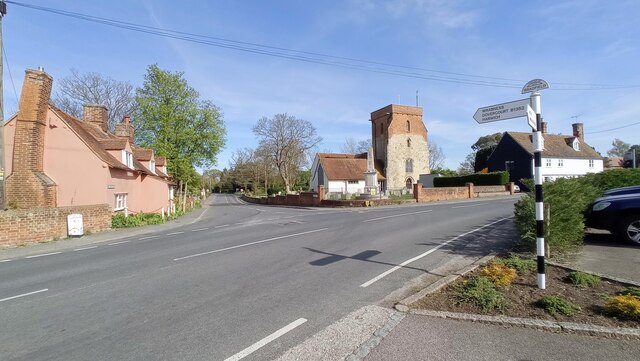
Bradfield is a small village located in the Tendring district of Essex, England. Situated about 10 miles northeast of the county town of Colchester, it is a rural area with a population of around 600 residents. The village is nestled amidst picturesque countryside, providing a tranquil setting for its inhabitants.

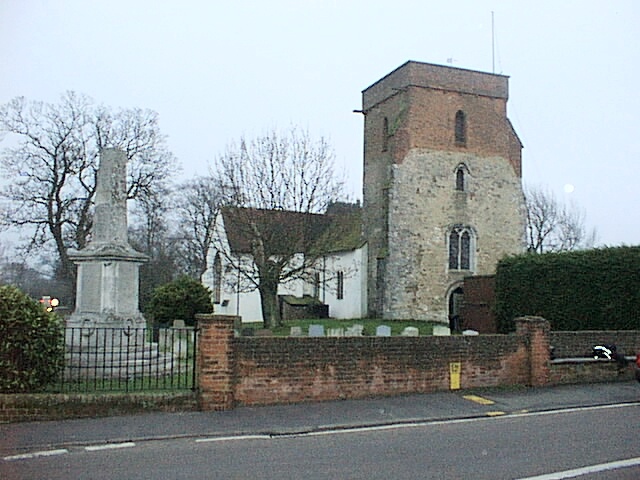
With its origins dating back to the Saxon period, Bradfield boasts a rich history. The village features a beautiful 12th-century church, St Lawrence's, which is renowned for its stunning architecture and intricate stained glass windows. The church serves as a focal point for the community and holds regular worship services.

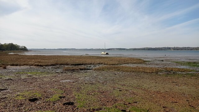
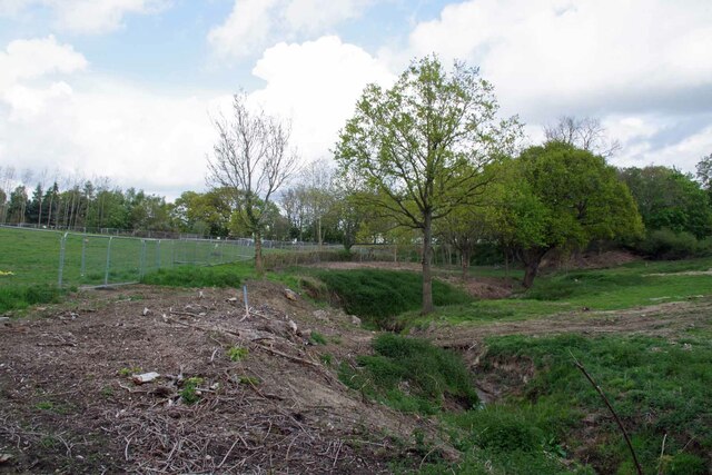
Bradfield is surrounded by idyllic farmland, offering panoramic views of the Essex countryside. The area is popular among nature enthusiasts and hikers, who can explore the numerous walking trails that wind through the village and its surroundings. The nearby Bradfield Woods, a nature reserve managed by the Suffolk Wildlife Trust, is a haven for wildlife and a designated Area of Outstanding Natural Beauty.

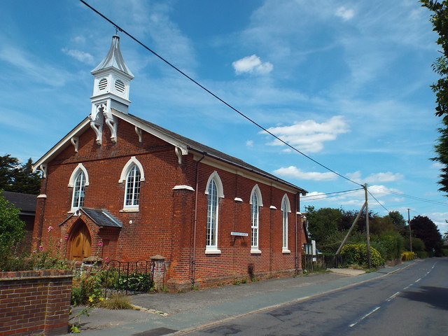
Despite its small size, Bradfield is not lacking in amenities. The village boasts a local pub, The Swan Inn, which serves as a social hub for both residents and visitors alike. Additionally, there is a village hall that hosts various community events, including fairs, meetings, and social gatherings.

Overall, Bradfield exudes a charming, rural character and offers a peaceful lifestyle for its inhabitants. Its rich history, natural beauty, and close-knit community make it an attractive place to live and visit in Essex.

If you have any feedback on the listing, please let us know in the comments section below.

Bradfield Images

Images are sourced within 2km of 51.934311/1.1179362 or Grid Reference TM1430. Thanks to Geograph Open Source API. All images are credited.

The Bradfield Memorial Stone Recently installed (Aug 2021). Dedicated to the memory of the fallen in all wars and the 75th anniversary (2020) of VE and VJ Days. Erected by the Bradfield Community at the edge of the village playing field.
The Bradfield Memorial Stone
Recently installed (Aug 2021). Dedicated to the memory of the fallen in all wars and the 75th anniversary (2020) of VE and VJ Days. Erected by the Bradfield Community at the edge of the village playing field.
Bradfield Parish Church, Essex Bradfield Church (Saint Lawrence), taken from the car park of the Stranger's Home Inn.
Bradfield Parish Church, Essex
Bradfield Church (Saint Lawrence), taken from the car park of the Stranger's Home Inn.
Boat on the River Stour A sailboat on the River Stour at low tide.
Boat on the River Stour
A sailboat on the River Stour at low tide.
Stream in New Mistley The stream ends up in the Landooze Rill in the Stour. I suspect the land behind the fence will soon be re-developed.
Stream in New Mistley
The stream ends up in the Landooze Rill in the Stour. I suspect the land behind the fence will soon be re-developed.
House in Bradfield Heath, Essex This attractive house stands at the end of Dairyhouse Lane, where it meets the main road through Bradfield Heath.
House in Bradfield Heath, Essex
This attractive house stands at the end of Dairyhouse Lane, where it meets the main road through Bradfield Heath.
Road to Bluehouse Farm
Post Office and village store at Bradfield Heath, Essex
Small bridge on road from Bradfield to Wix A minor stream (not named on OS map) runs under this bridge to join the Stour near Wrabness
Small bridge on road from Bradfield to Wix
A minor stream (not named on OS map) runs under this bridge to join the Stour near Wrabness
Footpath Sign And Track Footpath and track off Bradfield Road Wix, Essex leading to Dairy House.
Footpath Sign And Track
Footpath and track off Bradfield Road Wix, Essex leading to Dairy House.
Wix Road Wix Road near to Bradfield, Essex.
Wix Road
Wix Road near to Bradfield, Essex.
Steam Mill Road, Bradfield Heath Steam Mill Road in the village of Bradfield Heath.
Steam Mill Road, Bradfield Heath
Steam Mill Road in the village of Bradfield Heath.
Windmill Road, Bradfield Heath Windmill Road in the village of Bradfield Heath, in north Essex.
Windmill Road, Bradfield Heath
Windmill Road in the village of Bradfield Heath, in north Essex.
Bradfield Heath Post Office The village post office in Bradfield Heath, in north Essex.
Bradfield Heath Post Office
The village post office in Bradfield Heath, in north Essex.
Dairyhouse Lane, Bradfield Heath The square blue sign indicates that Dairyhouse Lane is a no through road.
Dairyhouse Lane, Bradfield Heath
The square blue sign indicates that Dairyhouse Lane is a no through road.
Dairyhouse Lane, Bradfield Heath Dairyhouse Lane, leading out of Bradfield Heath in North Essex.
Dairyhouse Lane, Bradfield Heath
Dairyhouse Lane, leading out of Bradfield Heath in North Essex.
Dairyhouse Lane, Bradfield Heath
Bradfield Methodist Church Bradfield Methodist Church is located between the villages of Bradfield and Bradfield Heath.
Bradfield Methodist Church
Bradfield Methodist Church is located between the villages of Bradfield and Bradfield Heath.
Bradfield Road, near Bradfield Bradfield Road is a country lane leading from Bradfield to Wix, in north Essex.
Bradfield Road, near Bradfield
Bradfield Road is a country lane leading from Bradfield to Wix, in north Essex.
Show me another place!

Bradfield is located at Grid Ref: TM1430 (Lat: 51.934311, Lng: 1.1179362)

Administrative County: Essex

District: Tendring

Police Authority: Essex

What 3 Words

///wisdom.stars.scariest. Near Mistley, Essex

Related Wikis

Bradfield, Essex

Bradfield is a village and civil parish in Essex, England. It is located about 3 miles (5 km) east of Manningtree and is 31 miles (50 km) northeast from...

Bradfield railway station

Bradfield railway station served the village of Bradfield in Essex. It was on the Manningtree to Harwich branch line, which is today known as The Mayflower...

Wrabness Nature Reserve

Wrabness Nature Reserve is a 27 hectare Local Nature Reserve on the south bank of the River Stour, west of Wrabness in Essex. It is managed by the Essex...

Priory Halt railway station

Priory Halt railway station served the district of Tendring, Essex, England, from 1920 to 1965 on the Mayflower Line. == History == The station opened...

Oakfield Wood

Oakfield Wood is a 2.8-hectare (6.9-acre) nature reserve west of Wrabness in Essex. It is managed by the Essex Wildlife Trust.This is former farmland which...

St Mary's Church, Wix

St Mary's Church is a Grade II listed Anglican parish church in the village of Wix, Essex, England. Formerly associated with a priory from the Middle Ages...

Wix Priory

Wix Priory was a Benedictine nunnery in Wix, Essex, England, founded in around 1125–1135 and dissolved in 1525. The buildings have not survived except...

Mistley

Mistley is a village and civil parish in the Tendring district of northeast Essex, England. It is around 11 miles northeast of Colchester and is east of...

Related Videos

Ep12 To Wrabness

In Ep12 To Wrabness we travel 28 hours from Grimsby to Wrabness. The weather through the night was not the best with a steep ...

Norfolk - The Essex Way

Beautiful countryside of Norfolk #norfolk #essex #norfolkcounty #country.

河邊濕地觀鳥 / 帶小朋友搭火車郊遊 / Essex Wrabness - Mistly / 輕鬆郊遊遊路線 / 倫敦近郊 / 英國行山

郊遊路線: Wrabness - Stour Estuary - Wrabness Nature Reserve - Bradfield - Mistley 全長13.5 公里總攀升154 米所需時間大概4 ...

Nearby Amenities

Located within 500m of 51.934311,1.1179362
Barrier: kissing_gate
Lat/Long: 51.9352465/1.1219038
Post Box
Post Box Mounting: brick_pillar
Post Box Type: wall
Postal Code: CO11 2US
Ref: CO11 74
Royal Cypher: GR
Royal Cypher Wikidata: Q33102273
Lat/Long: 51.9341356/1.1172523
Public Bookcase
Bradfield Book Exchange
Booth: K6
Colour: red
Disused Amenity: telephone
Listed Status: Grade II
Man Made: telephone_box
Old Phone: +44 1255 870216
Public Bookcase Type: phone_box
Lat/Long: 51.934205/1.1172501
Historic: memorial
Memorial: war_memorial
Lat/Long: 51.9343937/1.1174694
Bus Stop
Strangers Home Inn
Kerb: raised
Naptan AtcoCode: 150029007001
Naptan Bearing: N
Naptan CommonName: Strangers Home Inn
Naptan Indicator: o/s
Naptan Landmark: Strangers Home Inn
Naptan NaptanCode: esxgdptg
Naptan Street: The Street
Public Transport: platform
Source: naptan_import;survey
Lat/Long: 51.9342971/1.1172426
Bus Stop
Strangers Home Inn
Kerb: raised
Naptan AtcoCode: 150029007002
Naptan Bearing: S
Naptan CommonName: Strangers Home Inn
Naptan Indicator: Opp
Naptan Landmark: Strangers Home Inn
Naptan NaptanCode: esxgdptj
Naptan Street: The Street
Public Transport: platform
Source: naptan_import
Lat/Long: 51.9340332/1.1174213
Bus Stop
The Street
Kerb: raised
Layby: yes
Naptan AtcoCode: 150029007003
Naptan Bearing: SW
Naptan CommonName: The Street
Naptan Crossing: Heath Road
Naptan Indicator: SW-bound
Naptan Landmark: The Street
Naptan NaptanCode: esxgdptp
Naptan Street: The Street
Public Transport: platform
Source: naptan_import
Timetable Case: yes
Lat/Long: 51.9302601/1.115977
Bus Stop
The Street
Kerb: raised
Naptan AtcoCode: 150029007004
Naptan Bearing: NE
Naptan CommonName: The Street
Naptan Crossing: Heath Road
Naptan Indicator: NE-bound
Naptan Landmark: The Street
Naptan NaptanCode: esxgdptm
Naptan Street: The Street
Public Transport: platform
Source: naptan_import
Lat/Long: 51.9303103/1.1158186
Location Transition: yes
Power: pole
Source: bing
Lat/Long: 51.9319578/1.117267
Power: pole
Source: bing
Lat/Long: 51.9315982/1.1230182
Location Transition: yes
Power: pole
Lat/Long: 51.9324873/1.1166559
Power: pole
Lat/Long: 51.9326714/1.1115139
Power: pole
Source: bing
Lat/Long: 51.9318018/1.115214
Power: pole
Source: bing
Lat/Long: 51.931033/1.1150492
Power: pole
Source: bing
Lat/Long: 51.932142/1.119274
Power: pole
Source: bing
Lat/Long: 51.9325362/1.1153646
Power: pole
Source: bing
Lat/Long: 51.9319412/1.1206279
Power: pole
Lat/Long: 51.9325861/1.1140933
Power: pole
Source: bing
Lat/Long: 51.9317875/1.1217427
Power: pole
Lat/Long: 51.9326278/1.1127191
Man Made: survey_point
Ref: OS BM 10911
Source: bing
Source Ref: survey
Tpuk Ref: 7117
Lat/Long: 51.935698/1.1163826
Bradfield
Place: village
Population: 1000
Wikidata: Q4954520
Wikipedia: en:Bradfield, Essex
Lat/Long: 51.9328203/1.1183188
Flatman Irrigation
Landuse: commercial
Lat/Long: 51.9316923/1.1154769
Bus Stop
Caravan Park Hail & Ride
Naptan AtcoCode: 1500HNR608A
Naptan BusStopType: HAR
Naptan NaptanCode: esxjmdga
Naptan Status: ina
Naptan Verified: no
Public Transport: platform
Lat/Long: 51.9344978/1.1197825
Bus Stop
Caravan Park Hail & Ride
Naptan AtcoCode: 1500HNR608
Naptan BusStopType: HAR
Naptan NaptanCode: esxjmdaw
Naptan Status: ina
Naptan Verified: no
Public Transport: platform
Lat/Long: 51.9344513/1.1198375
Power: pole
Transformer: distribution
Lat/Long: 51.9376635/1.1134628
Leisure: playground
Lat/Long: 51.9321545/1.1173023
Defibrillator
Defibrillator Location: At north end of exterior of west wall (the one facing the road)
Emergency: defibrillator
Ref GB The Circuit: 2429812B-476A-4C4D-92C3-AD520107089D
Lat/Long: 51.9331237/1.1180599
The data included in this document is from www.openstreetmap.org. The data is made available under ODbL.

Have you been to Bradfield?

Leave your review of Bradfield below (or comments, questions and feedback).