Bradfield Combust

Settlement in Suffolk West Suffolk

England

Bradfield Combust

Church Farmhouse, Stanningfield Seventeenth century house <span class="nowrap"><a title="https://historicengland.org.uk/listing/the-list/list-entry/1278921" rel="nofollow ugc noopener" href="https://historicengland.org.uk/listing/the-list/list-entry/1278921">Link</a><img style="margin-left:2px;" alt="External link" title="External link - shift click to open in new window" src="https://s1.geograph.org.uk/img/external.png" width="10" height="10"/></span>
Church Farmhouse, Stanningfield Credit: Jonathan Thacker

Bradfield Combust is a village located in the county of Suffolk, England. Situated about 10 miles east of Bury St Edmunds, it is part of the Mid Suffolk district. The village has a population of approximately 800 inhabitants.

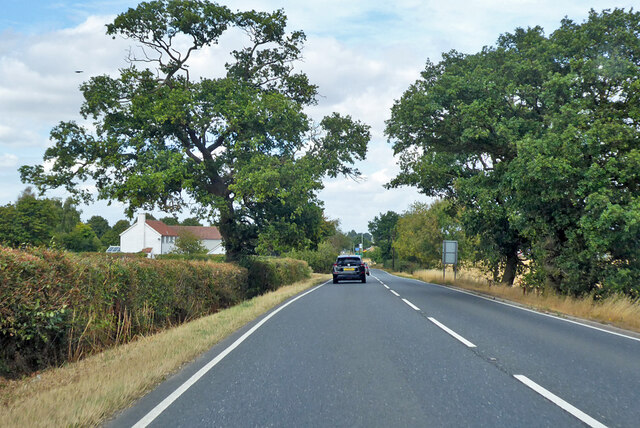
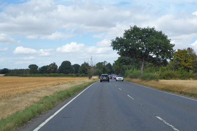
This rural settlement is known for its picturesque and idyllic surroundings. It is surrounded by beautiful countryside, with rolling hills, fields, and patches of woodland. The village is characterized by its charming thatched cottages, historic buildings, and well-maintained gardens, which add to its traditional and timeless appeal.

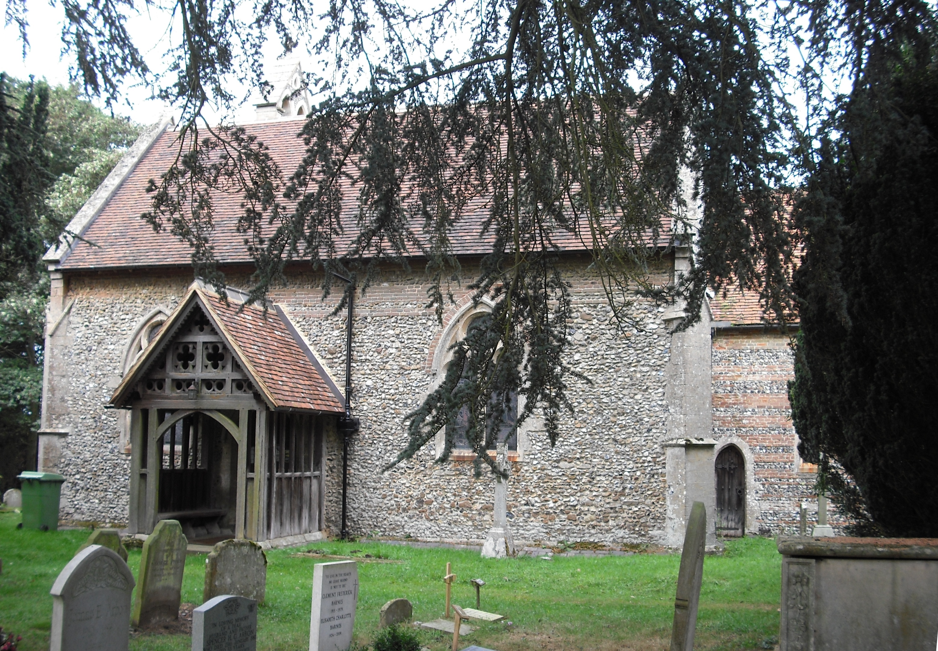
One of the notable landmarks in Bradfield Combust is the St. Mary's Church, a Grade II listed building dating back to the 14th century. This ancient church features stunning architecture and serves as a reminder of the village's rich history.

Despite its small size, Bradfield Combust has a vibrant community spirit. The village hosts various events throughout the year, including a summer fĂȘte and a Christmas fair, which bring residents together and foster a sense of belonging.

In terms of amenities, the village has a primary school, a village hall, and a local pub, which serves as a social hub for both residents and visitors. For more extensive facilities and services, the nearby towns of Bury St Edmunds and Stowmarket are easily accessible.

Bradfield Combust offers a tranquil and peaceful living environment, away from the hustle and bustle of urban life. Its natural beauty, community spirit, and rich history make it an attractive place for those seeking a rural lifestyle in the Suffolk countryside.

If you have any feedback on the listing, please let us know in the comments section below.

Bradfield Combust Images

Images are sourced within 2km of 52.183087/0.76709621 or Grid Reference TL8957. Thanks to Geograph Open Source API. All images are credited.

Church Farmhouse, Stanningfield Seventeenth century house <span class="nowrap"><a title="https://historicengland.org.uk/listing/the-list/list-entry/1278921" rel="nofollow ugc noopener" href="https://historicengland.org.uk/listing/the-list/list-entry/1278921">Link</a><img style="margin-left:2px;" alt="External link" title="External link - shift click to open in new window" src="https://s1.geograph.org.uk/img/external.png" width="10" height="10"/></span>
Church Farmhouse, Stanningfield
Seventeenth century house LinkExternal link
The Green at Hoggard's Green
A134 looking north A route from Colchester to King's Lynn, next major place, Bury St Edmunds. Parts of its route are on a Roman alignment, as here.
A134 looking north
A route from Colchester to King's Lynn, next major place, Bury St Edmunds. Parts of its route are on a Roman alignment, as here.
A134 looking north A route from Colchester to King's Lynn, next major place, Bury St Edmunds. Parts of its route are on a Roman alignment, as here.
A134 looking north
A route from Colchester to King's Lynn, next major place, Bury St Edmunds. Parts of its route are on a Roman alignment, as here.
A134 looking north, Bradfield Combust A route from Colchester to King's Lynn, next major place, Bury St Edmunds. Parts of its route are on a Roman alignment, as here, although the A134 pulls off the Roman line just ahead.
A134 looking north, Bradfield Combust
A route from Colchester to King's Lynn, next major place, Bury St Edmunds. Parts of its route are on a Roman alignment, as here, although the A134 pulls off the Roman line just ahead.
A134 looking north A route from Colchester to King's Lynn, next major place, Bury St Edmunds.
A134 looking north
A route from Colchester to King's Lynn, next major place, Bury St Edmunds.
Bend and junction on A134 The A134 heads for Bury St Edmunds, Water Lane goes right for Little Whelnetham.
Bend and junction on A134
The A134 heads for Bury St Edmunds, Water Lane goes right for Little Whelnetham.
Lodge, Bradfield Combust Dated 1865. Surprisingly by William Eden Nesfield. Grade II listed.
On the other side of the entrance to Bradfield Hall stands a K6 phone box. Grade II listed.
Lodge, Bradfield Combust
Dated 1865. Surprisingly by William Eden Nesfield. Grade II listed. On the other side of the entrance to Bradfield Hall stands a K6 phone box. Grade II listed.
St. Nicholas: the parish church of Stanningfield This church once had a much taller 14th century tower but the top was removed as it was classed as dangerous. Inside the church is an early 19th century photograph that shows the original tower.
St. Nicholas: the parish church of Stanningfield
This church once had a much taller 14th century tower but the top was removed as it was classed as dangerous. Inside the church is an early 19th century photograph that shows the original tower.
Thatch on the Green, Cockfield
Cross Green Cross Green near to Cockfield, Suffolk.
Cross Green
Cross Green near to Cockfield, Suffolk.
After The Event Writing on the road at Cross Green near to Cockfield, Suffolk after a cycle event.
After The Event
Writing on the road at Cross Green near to Cockfield, Suffolk after a cycle event.
Near The Junction The road junction of the A.134 and A.1141 near to Stanningfield, Suffolk.
Near The Junction
The road junction of the A.134 and A.1141 near to Stanningfield, Suffolk.
Chapel Road Chapel Road just off the A.143 near to Stanningfield, Suffolk.
Chapel Road
Chapel Road just off the A.143 near to Stanningfield, Suffolk.
Methodist Church Methodist church near to Stanningfield, Suffolk.
Methodist Church
Methodist church near to Stanningfield, Suffolk.
Finger Post Finger post at Stanningfield, Suffolk.
Finger Post
Finger post at Stanningfield, Suffolk.
War Memorial War memorial at Stanningfield, Suffolk.
War Memorial
War memorial at Stanningfield, Suffolk.
Dead End Dead end road near to Stanningfield, Suffolk.
Dead End
Dead end road near to Stanningfield, Suffolk.
Show me another place!

Bradfield Combust is located at Grid Ref: TL8957 (Lat: 52.183087, Lng: 0.76709621)

Administrative County: Suffolk

District: West Suffolk

Police Authority: Suffolk

What 3 Words

///toolbar.glue.nudge. Near Bury St Edmunds, Suffolk

Related Wikis

Bradfield Combust

Bradfield Combust (or Burnt Bradfield) is a village and former manor and civil parish, now in the parish of Bradfield Combust with Stanningfield, the West...

Bradfield Combust with Stanningfield

Bradfield Combust with Stanningfield is a civil parish about 6 miles south of Bury St Edmunds, in the West Suffolk district of Suffolk, England. According...

Stanningfield

Stanningfield is a village and former civil parish, now in the parish of Bradfield Combust with Stanningfield, in the West Suffolk district of the county...

Oldhall Green

Oldhall Green is a hamlet in Suffolk, England. It is part of the civil parish of Cockfield and is located on the A1141 road between Lavenham and Bury St...

Bradfield St Clare

Bradfield St. Clare is a village and civil parish in the West Suffolk district of Suffolk, England. According to Eilert Ekwall, the meaning of the village...

Welnetham railway station

Welnetham railway station was on the Long Melford-Bury St Edmunds branch line, serving Great Whelnetham, Little Whelnetham and Sicklesmere in Suffolk....

Church of St Clare, Bradfield

The Church of St Clare, Bradfield is the Anglican parish church of Bradfield St Clare, in the district of West Suffolk, Suffolk. The original structure...

St Margaret's Church, Westhorpe

St Margaret's Church is the parish church of Westhorpe, Suffolk, England. It is part of the Badwell and Walsham Benefice. It is a Grade I listed building...

Nearby Amenities

Located within 500m of 52.183087,0.76709621
Bradfield Combust
Created By: Potlatch 0.10b
Place: village
Wikidata: Q607881
Lat/Long: 52.1811281/0.7652913
Bus Stop
The Manger
Naptan AtcoCode: 390050782
Naptan Bearing: N
Naptan BusStopType: CUS
Naptan CommonName: The Manger
Naptan Indicator: adj
Naptan Landmark: The Manger
Naptan NaptanCode: sufgjtap
Naptan Street: The Street
Naptan Verified: no
Source: naptan_import
Lat/Long: 52.1819674/0.7667245
Bus Stop
The Manger
Naptan AtcoCode: 390050783
Naptan Bearing: S
Naptan BusStopType: CUS
Naptan CommonName: The Manger
Naptan Indicator: opp
Naptan Landmark: The Manger
Naptan NaptanCode: sufgjtat
Naptan Street: The Street
Naptan Verified: no
Source: naptan_import
Lat/Long: 52.1819148/0.7669499
Bradfield Park
Naptan AtcoCode: 390051045
Naptan Bearing: NE
Naptan BusStopType: CUS
Naptan CommonName: Bradfield Park
Naptan Indicator: adj
Naptan Landmark: Bradfield Park
Naptan NaptanCode: sufjgtaw
Naptan Street: Ixer Lane
Naptan Verified: no
Source: naptan_import
Lat/Long: 52.1831895/0.7671431
Badfield Park
Naptan AtcoCode: 390051046
Naptan Bearing: SW
Naptan BusStopType: CUS
Naptan CommonName: Badfield Park
Naptan Indicator: opp
Naptan Landmark: Badfield Park
Naptan NaptanCode: sufjgtda
Naptan Street: Ixer Lane
Naptan Verified: no
Source: naptan_import
Lat/Long: 52.1830767/0.7672244
Power: pole
Lat/Long: 52.1843033/0.76201
Power: pole
Lat/Long: 52.1825255/0.7638635
Power: pole
Lat/Long: 52.1834563/0.7629435
Power: pole
Lat/Long: 52.1804237/0.7637267
Power: pole
Lat/Long: 52.1815305/0.7637938
Power: pole
Lat/Long: 52.1793579/0.7636677
Bradfield Combust
Man Made: village_sign
Lat/Long: 52.1831695/0.7665311
Barrier: entrance
Note: Gap in hedge
Lat/Long: 52.1867663/0.7680996
Post Box
Collection Times: Mo-Fr 09:00; Sa 07:00
Post Box Mounting: wall
Post Box Type: wall
Ref: IP30 2020D
Royal Cypher: VR
Royal Cypher Wikidata: Q33102356
Lat/Long: 52.1832771/0.7669731
Booth: K6
Covered: booth
Disused Amenity: telephone
Listed Status: Grade II
Man Made: telephone_box
Tourism: information
Lat/Long: 52.1831298/0.7672607
Addr Housename: The Old School House
Addr Street: The Street
Addr Village: Bradfield Combust
Lat/Long: 52.1855342/0.7651739
Entrance: yes
Lat/Long: 52.1815032/0.7662755
Give Way
Direction: forward
Lat/Long: 52.1828117/0.7667041
Milestone
Distance London: 88 mi
Inscription: London 88 Miles
Lat/Long: 52.1829942/0.7666612
Historic: memorial
Note: First and Second World War Memorial
Lat/Long: 52.1831796/0.766523
Information: board
Operator: Bradfield Combust with Stanningfield Parish Council
Tourism: information
Lat/Long: 52.1832845/0.7669503
Waste Basket
Lat/Long: 52.1832031/0.7671124
Grit Bin
Lat/Long: 52.1831986/0.7671299
Defibrillator
Defibrillator Location: On exterior wall of The Manger pub, near the entrance from the car park.
Emergency: defibrillator
Ref GB The Circuit: 939AEBB5-E7B7-4584-98D5-AD3600C384E2
Lat/Long: 52.1818095/0.7666784
Entrance: yes
Lat/Long: 52.1818072/0.7666954
The data included in this document is from www.openstreetmap.org. The data is made available under ODbL.

Have you been to Bradfield Combust?

Leave your review of Bradfield Combust below (or comments, questions and feedback).