Bracebridge Heath

Civil Parish in Lincolnshire North Kesteven

England

Bracebridge Heath

Bridleway to Bracebridge Heath
Bridleway to Bracebridge Heath Credit: Jonathan Thacker

Bracebridge Heath is a civil parish located in the county of Lincolnshire, England. It is situated approximately 2 miles south of the city of Lincoln and falls within the administrative district of North Kesteven. The parish covers an area of about 4.5 square miles.

The village of Bracebridge Heath has a population of around 3,500 residents. It is a popular residential area due to its close proximity to Lincoln, offering a quieter alternative to city living while still providing easy access to its amenities.

The village has a range of amenities to cater to the needs of its residents. It is home to several local shops, including a supermarket, convenience stores, and a few independent retailers. There are also a number of pubs, restaurants, and takeaway establishments.

Bracebridge Heath benefits from excellent transport links. The A15 road runs through the village, connecting it to Lincoln and other nearby towns. The village is served by regular bus services, providing connections to Lincoln and surrounding areas. The nearby Lincoln railway station offers direct links to major cities such as Nottingham, Sheffield, and London.

The village has a strong sense of community, with various local organizations and clubs catering to different interests. It also has a primary school, providing education for children within the village and the surrounding area.

Overall, Bracebridge Heath offers a peaceful and convenient location for residents, with a range of amenities and good access to transport links.

If you have any feedback on the listing, please let us know in the comments section below.

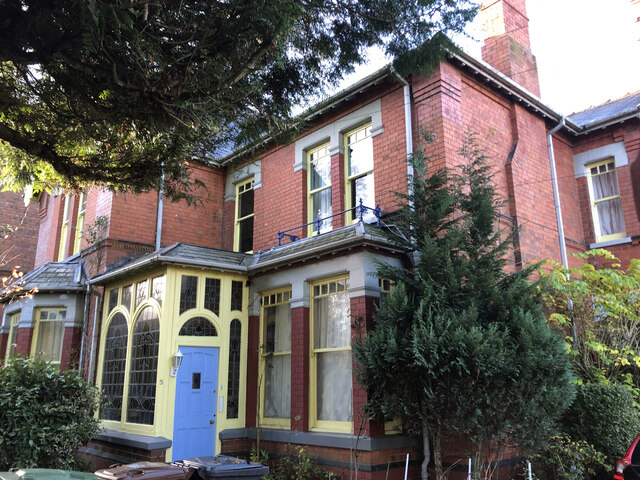
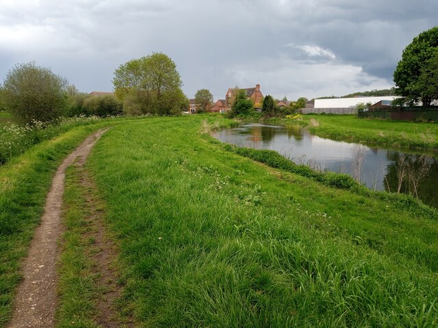
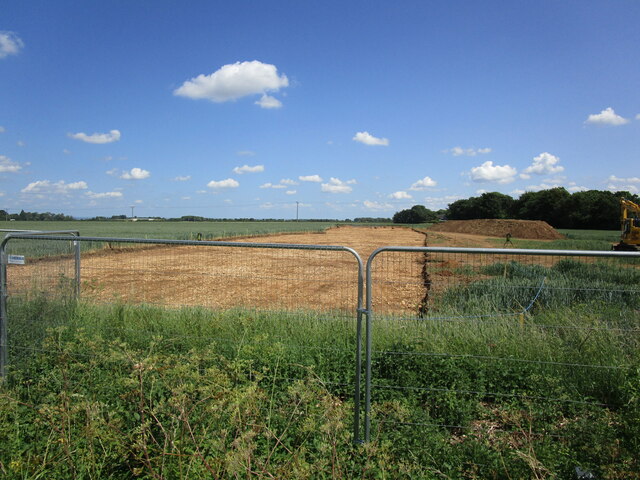
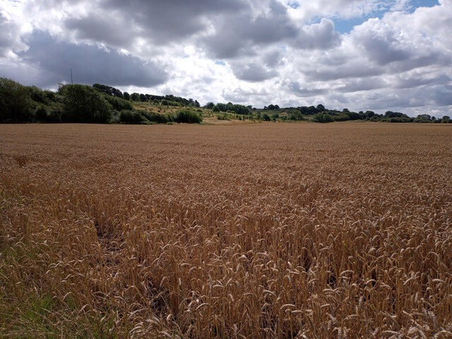
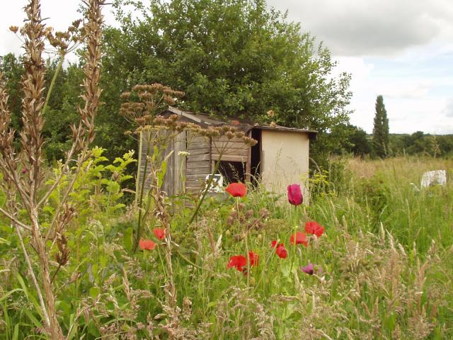
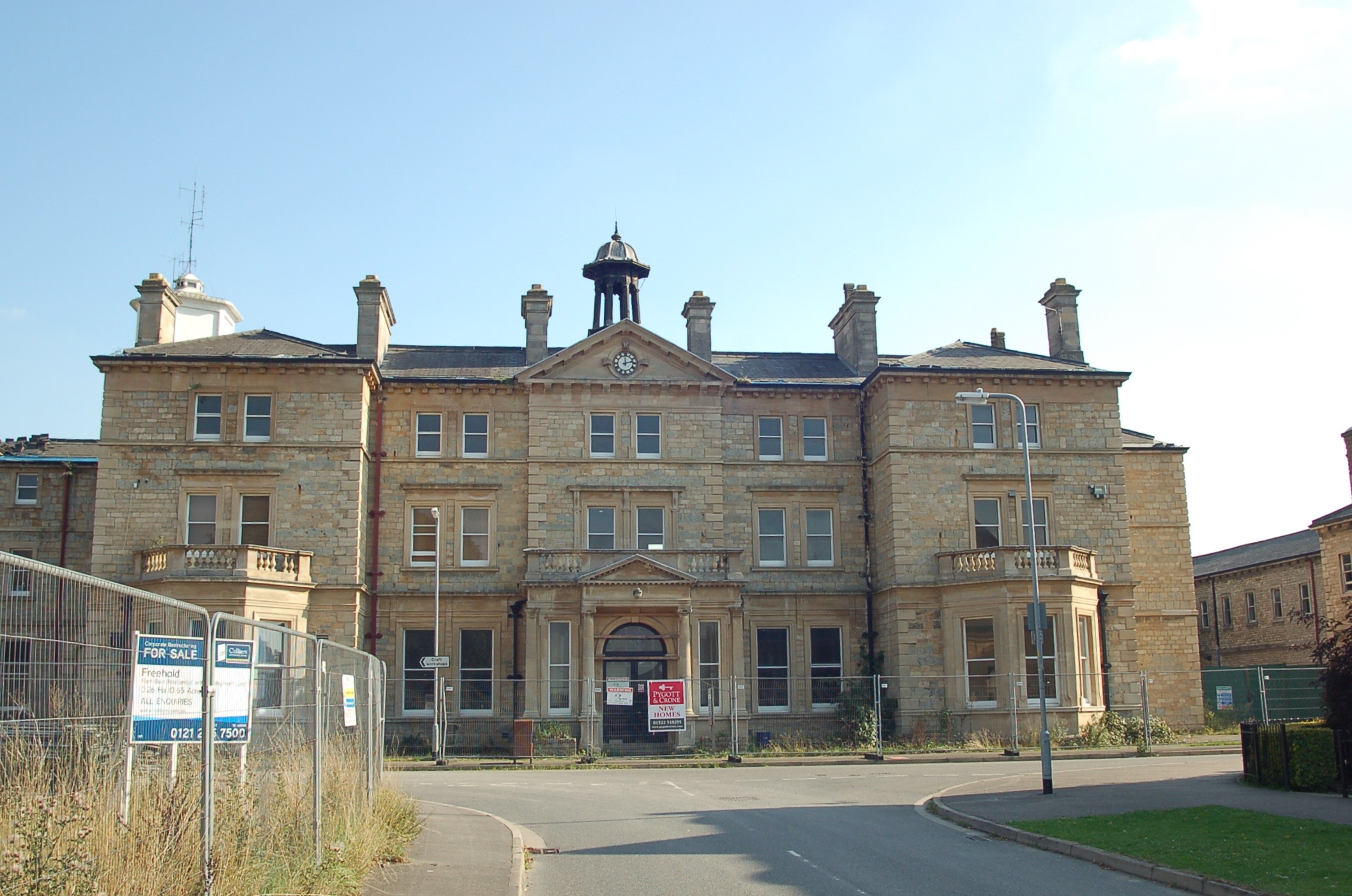
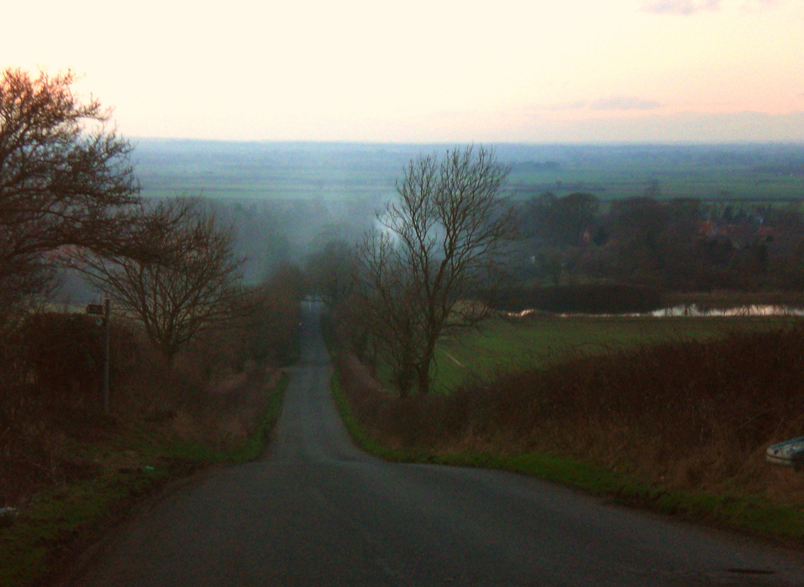
Bracebridge Heath Images

Images are sourced within 2km of 53.193896/-0.533463 or Grid Reference SK9867. Thanks to Geograph Open Source API. All images are credited.

Bridleway to Bracebridge Heath
Lodge, Newark Road, Lincoln A picturesque affair complete with polychrome brick, timber framing, decorative tilework, and fretted bargeboards. Built 1883 for Bracebridge Hall, possibly by Albert Vicars who did the house (which is much less spirited). Grade II listed.
Lodge, Newark Road, Lincoln
A picturesque affair complete with polychrome brick, timber framing, decorative tilework, and fretted bargeboards. Built 1883 for Bracebridge Hall, possibly by Albert Vicars who did the house (which is much less spirited). Grade II listed.
Former hospital, Bracebridge Heath The main building of the former County Pauper Lunatic Asylum, built in 1849-52 by Hamilton & Medland, and then Hamilton and Thomas Percy. Grade II listed.
Many later additions; it was later St John's Hospital. The hospital closed in 1989, and the site was here being redeveloped for housing. A surprising number of the original buildings have survived.
Former hospital, Bracebridge Heath
The main building of the former County Pauper Lunatic Asylum, built in 1849-52 by Hamilton & Medland, and then Hamilton and Thomas Percy. Grade II listed. Many later additions; it was later St John's Hospital. The hospital closed in 1989, and the site was here being redeveloped for housing. A surprising number of the original buildings have survived.
5 Cross O'Cliff Hill, Lincoln It seems to have been built between 1897 and 1913 and called 'Hill Rise'. It is not shown on the 1905 OS map. There are two potential candidates in the planning files, one 1905 and one 1908. It appears to have some substantial outbuildings to the rear. Unusually it has retained the original iron railings on the roadside, most having been removed for the metal in WWII.
5 Cross O'Cliff Hill, Lincoln
It seems to have been built between 1897 and 1913 and called 'Hill Rise'. It is not shown on the 1905 OS map. There are two potential candidates in the planning files, one 1905 and one 1908. It appears to have some substantial outbuildings to the rear. Unusually it has retained the original iron railings on the roadside, most having been removed for the metal in WWII.
Ashleigh, 9 Cross O'Cliff Hill, Lincoln House built for John Lodge (MD Wagon & Engine Co.) architect W Mortimer and Son to planning granted in April 1897. Garage and greenhouse added in 1912. Apparently called Ashleigh from new. In October 2013 planning was granted for conversion to 4 flats. In the grounds to the rear is an annex to be converted to two flats. Prior to this the property had been a training facility for some time, owned by Lincolnshire County Council. Access to 6 parking spaces at the rear had been accessed through a private driveway within the ownership of no. 11.
Ashleigh, 9 Cross O'Cliff Hill, Lincoln
House built for John Lodge (MD Wagon & Engine Co.) architect W Mortimer and Son to planning granted in April 1897. Garage and greenhouse added in 1912. Apparently called Ashleigh from new. In October 2013 planning was granted for conversion to 4 flats. In the grounds to the rear is an annex to be converted to two flats. Prior to this the property had been a training facility for some time, owned by Lincolnshire County Council. Access to 6 parking spaces at the rear had been accessed through a private driveway within the ownership of no. 11.
29-31 Cross O'Cliff Hill, Lincoln Pair of semi-detached houses shown on the 1905 OS map but not the 1886 OS map. Note that the properties are not symmetrical, no.29 occupying only the section with the gable end to the road, 31 having the centre section. Directories I have list them in 1913 but not 1897, suggesting a build date between 1898 and 1904. 1913 they are called 'The Croft' (29, apparently empty) and 'Brentwood' (31). By 1919, now occupied, no. 29 is 'Strathmore' and is shown in 1965 Kelly’s as two flats. 31 has subsequently been converted to at least 5 flats.
29-31 Cross O'Cliff Hill, Lincoln
Pair of semi-detached houses shown on the 1905 OS map but not the 1886 OS map. Note that the properties are not symmetrical, no.29 occupying only the section with the gable end to the road, 31 having the centre section. Directories I have list them in 1913 but not 1897, suggesting a build date between 1898 and 1904. 1913 they are called 'The Croft' (29, apparently empty) and 'Brentwood' (31). By 1919, now occupied, no. 29 is 'Strathmore' and is shown in 1965 Kelly’s as two flats. 31 has subsequently been converted to at least 5 flats.
Brickworks Chimney, Cross O'Cliff Hill, Lincoln Close to the Orchard Walk houses, for some reason this is the only remaining structure from William Bartholomew Best's Cross O'Cliffe Brick & Tile Works. Kelly's Directory of 1872 is the earliest mention with the 1868 directory carrying no reference to the works. However there is a note in the press 1856 about the intended use of the land and the online heritage information and management system for the City claims it to be built in 1857 by R Toynbee. This may be a confusion with “Ward’s Brickyard” that is described in a Great Northern Railway 1863 schedule and plan as further north, roughly in the area of the LSST school. Cross O'Cliffe Brick & Tile Works was known from 1889 as Lincoln Brick Company who probably modernised the works. It closed in 1901 and by 1907 most buildings were ruinous and only the chimney and two buildings remained (both post 1887, known in 1965 as Old Brickyard Cottage and Fieldhouse, demolished by 2004). There is evidence that buildings on the site were previously agricultural, probably for pigs and post-dating the brickworks; it seems the area was used by butcher Zachariah T Priestley for slaughtering work c.1914. In 1992 the building remains were made safe and the 45ft 6in (13.8m) chimney was reduced in height by 17 feet (5m), refurbished and repaired.
Brickworks Chimney, Cross O'Cliff Hill, Lincoln
Close to the Orchard Walk houses, for some reason this is the only remaining structure from William Bartholomew Best's Cross O'Cliffe Brick & Tile Works. Kelly's Directory of 1872 is the earliest mention with the 1868 directory carrying no reference to the works. However there is a note in the press 1856 about the intended use of the land and the online heritage information and management system for the City claims it to be built in 1857 by R Toynbee. This may be a confusion with “Ward’s Brickyard” that is described in a Great Northern Railway 1863 schedule and plan as further north, roughly in the area of the LSST school. Cross O'Cliffe Brick & Tile Works was known from 1889 as Lincoln Brick Company who probably modernised the works. It closed in 1901 and by 1907 most buildings were ruinous and only the chimney and two buildings remained (both post 1887, known in 1965 as Old Brickyard Cottage and Fieldhouse, demolished by 2004). There is evidence that buildings on the site were previously agricultural, probably for pigs and post-dating the brickworks; it seems the area was used by butcher Zachariah T Priestley for slaughtering work c.1914. In 1992 the building remains were made safe and the 45ft 6in (13.8m) chimney was reduced in height by 17 feet (5m), refurbished and repaired.
267-269 Newark Road, Lincoln A pair of stone-built houses, with an 1841 date stone. Both 2 bedroom cottages, no.269 has been extended more than doubling its footprint giving the cottage a total area of about 75 sq m. No.267 has also been extended but to a lesser degree, probably by the addition of a kitchen.
267-269 Newark Road, Lincoln
A pair of stone-built houses, with an 1841 date stone. Both 2 bedroom cottages, no.269 has been extended more than doubling its footprint giving the cottage a total area of about 75 sq m. No.267 has also been extended but to a lesser degree, probably by the addition of a kitchen.
HSL Chairs, 150 Newark Road, Lincoln This was originally Lincoln Tramways Company three bay tram depot. The 1888 OS map shows only one track entering the centre bay but a later photograph shows 3 tracks. It has a datestone of 1882 but the frontage was rebuilt in 1905 to accommodate the increased height of the new electric double-decker cars. The horse tram service assets were purchased by the Lincoln Corporation in July 1904 for the sum of £10,488. After trial running which started on 29 October 1905, the tramway opened for public service on 23 November 1905 with eight tramcars purchased from the Brush Electric Company of Loughborough. It operated as a depot throughout life of the tramway, 1882 to the end of 1929. In 1930 it was let to Mrs E Crack for a motor body building workshop. Bracebridge Motor Body Works occupied the building until 1957 and were then followed by Hutson's garage up to the 1970s . After Hutson's it remained empty and for sale until late 2002 when it was converted to retail and offices. Rails were discovered throughout the building that were retained under a new floor laid over a damp proof membrane. In 2003 it was turned over to a retail shop, Hein Gericke Ltd who were here until sometime after a takeover late in 2012. HSL (High Seat Limited) were in here by November 2015.
HSL Chairs, 150 Newark Road, Lincoln
This was originally Lincoln Tramways Company three bay tram depot. The 1888 OS map shows only one track entering the centre bay but a later photograph shows 3 tracks. It has a datestone of 1882 but the frontage was rebuilt in 1905 to accommodate the increased height of the new electric double-decker cars. The horse tram service assets were purchased by the Lincoln Corporation in July 1904 for the sum of £10,488. After trial running which started on 29 October 1905, the tramway opened for public service on 23 November 1905 with eight tramcars purchased from the Brush Electric Company of Loughborough. It operated as a depot throughout life of the tramway, 1882 to the end of 1929. In 1930 it was let to Mrs E Crack for a motor body building workshop. Bracebridge Motor Body Works occupied the building until 1957 and were then followed by Hutson's garage up to the 1970s . After Hutson's it remained empty and for sale until late 2002 when it was converted to retail and offices. Rails were discovered throughout the building that were retained under a new floor laid over a damp proof membrane. In 2003 it was turned over to a retail shop, Hein Gericke Ltd who were here until sometime after a takeover late in 2012. HSL (High Seat Limited) were in here by November 2015.
Gatehouse Inn, 178 Newark Road, Lincoln The Craft Union Pub Company Inn has a datestone for 1885. In the 19th century, the area was listed under Bracebridge 'a small scattered village' not as part of Lincoln. White's 1872 directory lists in Bracebridge 'Speed Thomas, victualler, Gate'. As you will see, Mrs Speed, presumably his wife, is in the Gatehouse in 1885. The conclusion is that this building replaced an earlier pub. I can't find it in directories that I have before 1872. (Late 19th & early 20th century there is another Gatehouse Hotel listed in Canwick Road). In June 2022 Stonegate Group reported on their website that the Inn was open again after a £200,000 makeover. A search of my directories found the following landlords; 1885 Mrs Catherine Speed, listed as Gate House P.H.; 1889 Robert Hoe, listed as Gate House P.H.; 1894-1926 Thomas Brown; 1930 Mrs Mary A Brown; 1946 Frederick G Brown; 1965 just listed as Gatehouse Hotel.
Gatehouse Inn, 178 Newark Road, Lincoln
The Craft Union Pub Company Inn has a datestone for 1885. In the 19th century, the area was listed under Bracebridge 'a small scattered village' not as part of Lincoln. White's 1872 directory lists in Bracebridge 'Speed Thomas, victualler, Gate'. As you will see, Mrs Speed, presumably his wife, is in the Gatehouse in 1885. The conclusion is that this building replaced an earlier pub. I can't find it in directories that I have before 1872. (Late 19th & early 20th century there is another Gatehouse Hotel listed in Canwick Road). In June 2022 Stonegate Group reported on their website that the Inn was open again after a £200,000 makeover. A search of my directories found the following landlords; 1885 Mrs Catherine Speed, listed as Gate House P.H.; 1889 Robert Hoe, listed as Gate House P.H.; 1894-1926 Thomas Brown; 1930 Mrs Mary A Brown; 1946 Frederick G Brown; 1965 just listed as Gatehouse Hotel.
River Witham north of Bracebridge, Lincoln A public footpath follows a bend of the River Witham, looking northeastwards towards a residential area approximately 2.5 kilometres south of Lincoln city centre and 600 metres north of Bracebridge bridge.

This photograph was taken on a humid afternoon in early May. Viewed from the largely undeveloped western bank of the Witham between Bracebridge and Dixon Street, the riverside homes on the corner of Fairfax Street and Park Lane can be seen (centre) with the white rear of the Aldi supermarket on Newark Road (A1434) extending into frame from the right.

Though much of this footpath is insulated from the noises of the city, here the sounds of ducks splashing and birds chirping are unfortunately drowned out by the constant hum of the local Walkers crisp factory, whose fenced yard of grimy container lorries lines the opposite bank just upstream (south) of this point.
River Witham north of Bracebridge, Lincoln
A public footpath follows a bend of the River Witham, looking northeastwards towards a residential area approximately 2.5 kilometres south of Lincoln city centre and 600 metres north of Bracebridge bridge. This photograph was taken on a humid afternoon in early May. Viewed from the largely undeveloped western bank of the Witham between Bracebridge and Dixon Street, the riverside homes on the corner of Fairfax Street and Park Lane can be seen (centre) with the white rear of the Aldi supermarket on Newark Road (A1434) extending into frame from the right. Though much of this footpath is insulated from the noises of the city, here the sounds of ducks splashing and birds chirping are unfortunately drowned out by the constant hum of the local Walkers crisp factory, whose fenced yard of grimy container lorries lines the opposite bank just upstream (south) of this point.
Preparation works Part of the construction of a major water main linking the north and south of Lincolnshire.
Preparation works
Part of the construction of a major water main linking the north and south of Lincolnshire.
Preparation works Part of the construction of a major water main linking the north and south of Lincolnshire.
Preparation works
Part of the construction of a major water main linking the north and south of Lincolnshire.
River Witham by Bracebridge, Lincoln A public footpath runs along the eastern bank of River Witham looking southwards (upstream) approximately 200 metres south of Bracebridge bridge, the first major crossing of the Witham in the Lincoln city area.

This photograph was taken on a cool and cloudy morning in late July. With the weather threatening another day of rain in the wettest July for some years, it's little wonder there was nobody about either on this path or the one on the opposite bank. Even the river was free of wildlife, the clouds having presumably lost the trust of even the hardiest of ducks.

Here the river is bounded by the fish ponds of the former Bracebridge Hall (now Grosvenor Hall Care Home) to the east and South Witham Marsh to the west, creating a wide corridor of green space between Lincoln's southern suburbs. There's still the distant clanging and revving from the nearby automotive garage, but it's an otherwise peaceful spot.
River Witham by Bracebridge, Lincoln
A public footpath runs along the eastern bank of River Witham looking southwards (upstream) approximately 200 metres south of Bracebridge bridge, the first major crossing of the Witham in the Lincoln city area. This photograph was taken on a cool and cloudy morning in late July. With the weather threatening another day of rain in the wettest July for some years, it's little wonder there was nobody about either on this path or the one on the opposite bank. Even the river was free of wildlife, the clouds having presumably lost the trust of even the hardiest of ducks. Here the river is bounded by the fish ponds of the former Bracebridge Hall (now Grosvenor Hall Care Home) to the east and South Witham Marsh to the west, creating a wide corridor of green space between Lincoln's southern suburbs. There's still the distant clanging and revving from the nearby automotive garage, but it's an otherwise peaceful spot.
Wheat field by Lincoln Cliff, Bracebridge Heath A field of wheat stretches to the foot of Lincoln Cliff, looking southeastwards from beyond Lincoln's eastern suburbs towards the village of Bracebridge Heath, which sits obscured by trees on the top of the escarpment.

This photograph was taken on a warm and breezy morning in late July. Running north-south across central Lincolnshire for approximately 50 miles, Lincoln Cliff (also known as Lincoln Edge) is a ridge of predominantly Jurassic limestone that despite its modest height affords reasonable views to the west of Lincoln, North Hykeham, and beyond.

The footpath on this side of the field is one of many walking routes that link Lincoln and Bracebridge Heath, allowing good local access to the long-distance Viking Way trail that passes along the top of the escarpment. The radio mast rising above the trees on the left sits on the site of the Lincolnshire Headquarters of the East Midlands Ambulance NHS Trust.
Wheat field by Lincoln Cliff, Bracebridge Heath
A field of wheat stretches to the foot of Lincoln Cliff, looking southeastwards from beyond Lincoln's eastern suburbs towards the village of Bracebridge Heath, which sits obscured by trees on the top of the escarpment. This photograph was taken on a warm and breezy morning in late July. Running north-south across central Lincolnshire for approximately 50 miles, Lincoln Cliff (also known as Lincoln Edge) is a ridge of predominantly Jurassic limestone that despite its modest height affords reasonable views to the west of Lincoln, North Hykeham, and beyond. The footpath on this side of the field is one of many walking routes that link Lincoln and Bracebridge Heath, allowing good local access to the long-distance Viking Way trail that passes along the top of the escarpment. The radio mast rising above the trees on the left sits on the site of the Lincolnshire Headquarters of the East Midlands Ambulance NHS Trust.
View towards Bracebridge Low Fields, Lincoln Cliff A view of the Lincolnshire landscape just off the Viking Way atop Lincoln Cliff, looking southwestwards across agricultural fields towards the Lincoln suburb of Bracebridge Low Fields and beyond.

This photograph was taken on a warm and breezy afternoon in mid-August. This view is from the edge of a large concrete square which curiously sits on the hillside not far from the Viking Way trail. Though its use is a mystery, it does provide an excellent vantage point to view the landscape below (and catch a pleasantly strong breeze on a warm summer's day!).
View towards Bracebridge Low Fields, Lincoln Cliff
A view of the Lincolnshire landscape just off the Viking Way atop Lincoln Cliff, looking southwestwards across agricultural fields towards the Lincoln suburb of Bracebridge Low Fields and beyond. This photograph was taken on a warm and breezy afternoon in mid-August. This view is from the edge of a large concrete square which curiously sits on the hillside not far from the Viking Way trail. Though its use is a mystery, it does provide an excellent vantage point to view the landscape below (and catch a pleasantly strong breeze on a warm summer's day!).
Barley field off Folly Lane
Shed 17 A lovely shed, complete with lean-to, on one of the better managed allotment gardens that dominate this square.
Shed 17
A lovely shed, complete with lean-to, on one of the better managed allotment gardens that dominate this square.
Show me another place!

Bracebridge Heath is located at Grid Ref: SK9867 (Lat: 53.193896, Lng: -0.533463)

Administrative County: Lincolnshire

District: North Kesteven

Police Authority: Lincolnshire

What 3 Words

///crystal.inhabited.sulked. Near Bracebridge Heath, Lincolnshire

Nearby Locations

Bracebridge Heath

Related Wikis

Bracebridge Heath

Bracebridge Heath is a village and civil parish in the North Kesteven district of Lincolnshire, England. It is 2 miles (3 km) south of Lincoln and straddles...

St John's Hospital, Bracebridge Heath

St John's Hospital, Bracebridge Heath was a mental health facility at Bracebridge Heath in Lincolnshire. == History == The hospital was designed by John...

Bracebridge Heath Cricket Club

Bracebridge Heath Cricket Club play in the village of Bracebridge Heath on the outskirts of Lincoln, Lincolnshire, England. The club won the 2002 England...

Fens and Anglian system

The Fens and Anglian system is a collection of rivers in East Anglia in England that are navigable and for which the Environment Agency is the navigation...

Lincoln Cliff

The Lincoln Cliff or Lincoln Edge is a portion of a major escarpment that runs north–south through Lindsey and Kesteven in central Lincolnshire and is...

Bracebridge railway station

Bracebridge railway station was a freight only station in Bracebridge, Lincolnshire, England situated just south of Lincoln. It was used for goods services...

Central Lincolnshire

Central Lincolnshire is the name given to a region of Lincolnshire in the East Midlands, England. The area covers the districts of North Kesteven and West...

The Priory Academy LSST

The Priory Academy LSST (formerly the Lincoln School of Science and Technology) is a co-educational non-selective academy school and teaching school situated...

Nearby Amenities

Located within 500m of 53.193896,-0.533463
Bus Stop
Mount Road
Bench: no
Naptan AtcoCode: 270000008638
Naptan Bearing: E
Naptan CommonName: Mount Road
Naptan Indicator: opp
Naptan Landmark: Mount Road
Naptan NaptanCode: lingtmag
Naptan PlusbusZoneRef: LINCLNC
Naptan Street: St John's Road
Naptan Verified: no
Network: 1
Operator: Stagecoach
Shelter: no
Source: naptan_import
Lat/Long: 53.1913457/-0.5358772
Bus Stop
Mount Road
Bench: no
Naptan AtcoCode: 270000008639
Naptan Bearing: W
Naptan CommonName: Mount Road
Naptan Indicator: adj
Naptan Landmark: Mount Road
Naptan NaptanCode: lingtmaj
Naptan PlusbusZoneRef: LINCLNC
Naptan Street: St John's Road
Naptan Verified: no
Network: 1
Operator: Stagecoach
Public Transport: platform
Shelter: no
Source: naptan_import
Lat/Long: 53.191246/-0.5358058
Bus Stop
St John's Road
Naptan AtcoCode: 270000008640
Naptan Bearing: N
Naptan CommonName: St John's Road
Naptan Indicator: opp
Naptan Landmark: St John's Road
Naptan NaptanCode: lingtmam
Naptan PlusbusZoneRef: LINCLNC
Naptan Street: Grantham Road
Naptan Verified: no
Network: School journeys only
Source: naptan_import
Lat/Long: 53.1911921/-0.5365411
Bus Stop
St John's Road
Bench: no
Naptan AtcoCode: 270000008641
Naptan Bearing: S
Naptan CommonName: St John's Road
Naptan Indicator: adj
Naptan Landmark: St John's Road
Naptan NaptanCode: lingtmap
Naptan PlusbusZoneRef: LINCLNC
Naptan Street: Grantham Road
Naptan Verified: no
Network: School journeys only
Shelter: no
Source: naptan_import
Lat/Long: 53.1914871/-0.5364113
Bus Stop
Fernleigh Avenue
Bench: no
Naptan AtcoCode: 270000008642
Naptan Bearing: NE
Naptan CommonName: Fernleigh Avenue
Naptan Indicator: opp
Naptan Landmark: Fernleigh Avenue
Naptan NaptanCode: lingtmat
Naptan PlusbusZoneRef: LINCLNC
Naptan Street: The Crescent
Naptan Verified: no
Network: 1
Operator: Stagecoach
Shelter: no
Source: naptan_import
Lat/Long: 53.1913763/-0.528871
Bus Stop
Fernleigh Avenue
Bench: no
Naptan AtcoCode: 270000008643
Naptan Bearing: SW
Naptan CommonName: Fernleigh Avenue
Naptan Indicator: adj
Naptan Landmark: Fernleigh Avenue
Naptan NaptanCode: lingtmaw
Naptan PlusbusZoneRef: LINCLNC
Naptan Street: The Crescent
Naptan Verified: no
Network: 1
Operator: Stagecoach
Public Transport: platform
Shelter: no
Source: naptan_import
Lat/Long: 53.1911896/-0.529042
Bus Stop
Main Avenue
Bench: yes
Naptan AtcoCode: 270000008644
Naptan Bearing: NW
Naptan CommonName: Main Avenue
Naptan Indicator: adj
Naptan Landmark: Main Avenue
Naptan NaptanCode: lingtmda
Naptan PlusbusZoneRef: LINCLNC
Naptan Street: Sleaford Road
Naptan Verified: no
Network: 1
Operator: Stagecoach
Shelter: yes
Source: naptan_import
Lat/Long: 53.1929879/-0.5305222
Bus Stop
Main Avenue
Bench: no
Naptan AtcoCode: 270000008645
Naptan Bearing: SE
Naptan CommonName: Main Avenue
Naptan Indicator: opp
Naptan Landmark: Main Avenue
Naptan NaptanCode: lingtmdg
Naptan PlusbusZoneRef: LINCLNC
Naptan Street: Sleaford Road
Naptan Verified: no
Network: 1
Operator: Stagecoach
Shelter: no
Source: naptan_import
Lat/Long: 53.1930493/-0.5304004
Bus Stop
The Bull
Bench: yes
Bus: yes
Naptan AtcoCode: 2700LBHJ2556
Naptan Bearing: NW
Naptan CommonName: Library
Naptan Indicator: adj
Naptan Landmark: Library
Naptan NaptanCode: linatgaw
Naptan PlusbusZoneRef: LINCLNC
Naptan Street: London Road
Naptan Verified: no
Network: 1
Operator: Stagecoach
Public Transport: platform
Shelter: yes
Source: naptan_import
Lat/Long: 53.1965002/-0.535003
Bus Stop
The Bull
Bench: no
Naptan AtcoCode: 2700LBHL1775
Naptan Bearing: SE
Naptan CommonName: Library
Naptan Indicator: opp
Naptan Landmark: Library
Naptan NaptanCode: linampgd
Naptan PlusbusZoneRef: LINCLNC
Naptan Street: Sleaford Road
Naptan Verified: no
Network: 1
Operator: Stagecoach
Public Transport: platform
Shelter: no
Source: naptan_import
Lat/Long: 53.1966099/-0.5348296
Bus Stop
St John's Square
Bench: no
Naptan AtcoCode: 2700LBHS1776
Naptan Bearing: E
Naptan CommonName: St John's Square
Naptan Indicator: opp
Naptan Landmark: St John's Square
Naptan NaptanCode: linampgj
Naptan PlusbusZoneRef: LINCLNC
Naptan Street: St John's Road
Naptan Verified: no
Network: 1
Operator: Stagecoach
Shelter: yes
Source: naptan_import
Lat/Long: 53.1915867/-0.5328154
Bus Stop
St John's Square
Bench: no
Naptan AtcoCode: 2700LBHS3643
Naptan Bearing: W
Naptan CommonName: St John's Square
Naptan Indicator: adj
Naptan Landmark: St John's Square
Naptan NaptanCode: lindawdp
Naptan PlusbusZoneRef: LINCLNC
Naptan Street: St John's Road
Naptan Verified: no
Network: 1
Operator: Stagecoach
Public Transport: platform
Shelter: no
Source: naptan_import
Lat/Long: 53.1913783/-0.5334755
Barrier: bollard
Bicycle: yes
Foot: yes
Lat/Long: 53.1945392/-0.5328083
Turning Circle
Lat/Long: 53.1931848/-0.5351131
Traffic Signals
Traffic Signals Direction: forward
Lat/Long: 53.1960553/-0.534433
Traffic Signals
Traffic Signals Direction: backward
Lat/Long: 53.1961/-0.5347227
Traffic Signals
Traffic Signals Direction: backward
Lat/Long: 53.1963763/-0.5347412
Waste Basket
Lat/Long: 53.1901101/-0.5374164
Barrier: cycle_barrier
Lat/Long: 53.1941337/-0.5371001
Barrier: cycle_barrier
Lat/Long: 53.1942405/-0.5371168
Telephone
Booth: KX100
Covered: booth
Operator: British Telecom
Lat/Long: 53.1972693/-0.5354094
Crossing
Crossing: yes
Crossing Ref: pelican
Lat/Long: 53.1957209/-0.5349884
Crossing
Crossing: yes
Crossing Ref: zebra
Lat/Long: 53.1956649/-0.5347631
Bicycle Parking
Lat/Long: 53.1953834/-0.5346764
Waste Basket
Lat/Long: 53.1952317/-0.5354348
Post Box
Lat/Long: 53.1959708/-0.5350081
Post Office
Bracebridge Heath Post Office
Addr City: Lincoln
Addr Country: GB
Addr Postcode: LN4 2LD
Addr Street: Grantham Road
Addr Suburb: Bracebridge Heath
Branch: Bracebridge Heath
Brand: Post Office
Brand Wikidata: Q1783168
Check Date: 2020-02-20
Contact Website: https://www.postoffice.co.uk/branch-finder/1633244/bracebridge-heath
Ref Pol Id: 3921
Lat/Long: 53.1959209/-0.5355837
Waste Basket
Collection Times: Thursday
Waste: dog_excrement
Lat/Long: 53.1968368/-0.5296274
Waste Basket
Collection Times: Thursday
Waste: dog_excrement
Lat/Long: 53.1950934/-0.5294593
Waste Basket
Collection Times: Thursday
Waste: dog_excrement
Lat/Long: 53.1945706/-0.5326644
Waste Basket
Collection Times: Thursday
Lat/Long: 53.1965315/-0.5350268
Waste Basket
Collection Times: Thursday
Waste: dog_excrement
Lat/Long: 53.1963114/-0.535829
Waste Basket
Collection Times: Thursday
Lat/Long: 53.1963314/-0.5358324
Waste Basket
Collection Times: Thursday
Waste: dog_excrement
Lat/Long: 53.1965261/-0.5371923
Waste Basket
Collection Times: Thursday
Waste: dog_excrement
Lat/Long: 53.1965317/-0.5371438
Defibrillator
Emergency: defibrillator
Opening Hours: 24/7
Ref: Call 999. Code required.
Lat/Long: 53.1962761/-0.5358731
Defibrillator
Defibrillator Location: attached to bus shelter, at junction of Grantham Road and St John's Road
Emergency: defibrillator
Indoor: no
Ref: Call 999 but no code required.
Lat/Long: 53.1911921/-0.5365411
Defibrillator
Emergency: defibrillator
Opening Hours: 24/7
Ref: Call 999 but no code required.
Lat/Long: 53.1929974/-0.5304944
Waste Basket
Collection Times: Thursday
Lat/Long: 53.1949794/-0.5269444
Waste Basket
Collection Times: Thursday
Lat/Long: 53.195405/-0.5264458
Waste Basket
Collection Times: Thursday
Lat/Long: 53.1968189/-0.5296676
Noticeboard
Information: board
Operator: Bracebridge Heath Parish Council
Tourism: information
Lat/Long: 53.1967807/-0.5297101
Noticeboard
Information: board
Operator: Bracebridge Heath Parish Council
Tourism: information
Lat/Long: 53.1929984/-0.5305458
Noticeboard
Information: board
Operator: Bracebridge Heath Parish Council
Tourism: information
Lat/Long: 53.191132/-0.5292517
Defibrillator
Emergency: defibrillator
Opening Hours: 24/7
Lat/Long: 53.1911974/-0.5365079
Noticeboard
Information: board
Operator: Bracebridge Heath Parish Council
Tourism: information
Lat/Long: 53.1949657/-0.5356332
Noticeboard
Information: board
Operator: Bracebridge Heath Parish Council
Tourism: information
Lat/Long: 53.1955644/-0.5352898
Waste Basket
Collection Times: Thursday
Lat/Long: 53.1962644/-0.5344874
Information: noticeboard
Operator: Bracebridge Heath Parish Council
Tourism: information
Lat/Long: 53.1910703/-0.5293503
Waste Basket
Collection Times: Thursday
Lat/Long: 53.1930229/-0.5305364
Waste Basket
Collection Times: Thursday
Waste: dog_excrement
Lat/Long: 53.1939141/-0.531833
Post Box
Operator: Royal Mail
Lat/Long: 53.1932148/-0.5309294
Post Box
Operator: Royal Mail
Post Box Type: lamp
Lat/Long: 53.1907314/-0.5290959
Post Box
Operator: Royal Mail
Lat/Long: 53.1906307/-0.5366387
Waste Basket
Collection Times: Thursday
Lat/Long: 53.1915965/-0.5327606
Waste Basket
Collection Times: Thursday
Waste: dog_excrement
Lat/Long: 53.1914317/-0.5329145
Bracebridge Heath
Place: village
Wikidata: Q4953229
Lat/Long: 53.1949272/-0.5345893
Generator Method: photovoltaic
Generator Output Electricity: yes
Generator Source: solar
Generator Type: solar_photovoltaic_panel
Location: roof
Power: generator
Lat/Long: 53.19598/-0.5275163
Generator Method: photovoltaic
Generator Output Electricity: yes
Generator Source: solar
Generator Type: solar_photovoltaic_panel
Location: roof
Power: generator
Lat/Long: 53.1959607/-0.5276236
Generator Method: photovoltaic
Generator Output Electricity: yes
Generator Source: solar
Generator Type: solar_photovoltaic_panel
Location: roof
Power: generator
Lat/Long: 53.1964358/-0.5296353
Generator Method: photovoltaic
Generator Output Electricity: yes
Generator Source: solar
Generator Type: solar_photovoltaic_panel
Location: roof
Power: generator
Lat/Long: 53.1964134/-0.5294529
Generator Method: photovoltaic
Generator Output Electricity: yes
Generator Source: solar
Generator Type: solar_photovoltaic_panel
Location: roof
Power: generator
Lat/Long: 53.1951471/-0.5314726
Generator Method: photovoltaic
Generator Output Electricity: yes
Generator Source: solar
Generator Type: solar_photovoltaic_panel
Location: roof
Power: generator
Lat/Long: 53.1952918/-0.5305338
Generator Method: photovoltaic
Generator Output Electricity: yes
Generator Source: solar
Generator Type: solar_photovoltaic_panel
Location: roof
Power: generator
Lat/Long: 53.1953625/-0.5304372
Generator Method: photovoltaic
Generator Output Electricity: yes
Generator Source: solar
Generator Type: solar_photovoltaic_panel
Location: roof
Power: generator
Lat/Long: 53.1945654/-0.5306089
Generator Method: photovoltaic
Generator Output Electricity: yes
Generator Source: solar
Generator Type: solar_photovoltaic_panel
Location: roof
Power: generator
Lat/Long: 53.1976056/-0.5343023
Generator Method: photovoltaic
Generator Output Electricity: yes
Generator Source: solar
Generator Type: solar_photovoltaic_panel
Location: roof
Power: generator
Lat/Long: 53.1978402/-0.5346939
Generator Method: photovoltaic
Generator Output Electricity: yes
Generator Source: solar
Generator Type: solar_photovoltaic_panel
Location: roof
Power: generator
Lat/Long: 53.1982049/-0.5348334
Generator Method: photovoltaic
Generator Output Electricity: yes
Generator Source: solar
Generator Type: solar_photovoltaic_panel
Location: roof
Power: generator
Lat/Long: 53.1970411/-0.5364011
Generator Method: photovoltaic
Generator Output Electricity: yes
Generator Source: solar
Generator Type: solar_photovoltaic_panel
Location: roof
Power: generator
Lat/Long: 53.196821/-0.5361866
Generator Method: photovoltaic
Generator Output Electricity: yes
Generator Source: solar
Generator Type: solar_photovoltaic_panel
Location: roof
Power: generator
Lat/Long: 53.1968226/-0.5360873
Generator Method: photovoltaic
Generator Output Electricity: yes
Generator Source: solar
Generator Type: solar_photovoltaic_panel
Location: roof
Power: generator
Lat/Long: 53.1960128/-0.5377878
Generator Method: photovoltaic
Generator Output Electricity: yes
Generator Source: solar
Generator Type: solar_photovoltaic_panel
Location: roof
Power: generator
Lat/Long: 53.1950776/-0.5375411
Generator Method: photovoltaic
Generator Output Electricity: yes
Generator Source: solar
Generator Type: solar_photovoltaic_panel
Location: roof
Power: generator
Lat/Long: 53.1944621/-0.5374204
Generator Method: photovoltaic
Generator Output Electricity: yes
Generator Source: solar
Generator Type: solar_photovoltaic_panel
Location: roof
Power: generator
Lat/Long: 53.1943737/-0.5373989
Generator Method: photovoltaic
Generator Output Electricity: yes
Generator Source: solar
Generator Type: solar_photovoltaic_panel
Location: roof
Power: generator
Lat/Long: 53.1946678/-0.538107
Generator Method: photovoltaic
Generator Output Electricity: yes
Generator Source: solar
Generator Type: solar_photovoltaic_panel
Location: roof
Power: generator
Lat/Long: 53.1945987/-0.5386917
Generator Method: photovoltaic
Generator Output Electricity: yes
Generator Source: solar
Generator Type: solar_photovoltaic_panel
Location: roof
Power: generator
Lat/Long: 53.1938788/-0.5396439
Generator Method: photovoltaic
Generator Output Electricity: yes
Generator Source: solar
Generator Type: solar_photovoltaic_panel
Location: roof
Power: generator
Lat/Long: 53.193882/-0.5395822
Generator Method: photovoltaic
Generator Output Electricity: yes
Generator Source: solar
Generator Type: solar_photovoltaic_panel
Location: roof
Power: generator
Lat/Long: 53.1941664/-0.5404701
Generator Method: photovoltaic
Generator Output Electricity: yes
Generator Source: solar
Generator Type: solar_photovoltaic_panel
Location: roof
Power: generator
Lat/Long: 53.1943898/-0.5400355
Generator Method: photovoltaic
Generator Output Electricity: yes
Generator Source: solar
Generator Type: solar_photovoltaic_panel
Location: roof
Power: generator
Lat/Long: 53.1943898/-0.5398531
Generator Method: photovoltaic
Generator Output Electricity: yes
Generator Source: solar
Generator Type: solar_photovoltaic_panel
Location: roof
Power: generator
Lat/Long: 53.1949763/-0.5404808
Generator Method: photovoltaic
Generator Output Electricity: yes
Generator Source: solar
Generator Type: solar_photovoltaic_panel
Location: roof
Power: generator
Lat/Long: 53.194859/-0.5405049
Generator Method: photovoltaic
Generator Output Electricity: yes
Generator Source: solar
Generator Type: solar_photovoltaic_panel
Location: roof
Power: generator
Lat/Long: 53.1947465/-0.540521
Generator Method: photovoltaic
Generator Output Electricity: yes
Generator Source: solar
Generator Type: solar_photovoltaic_panel
Location: roof
Power: generator
Lat/Long: 53.1952125/-0.5404808
Generator Method: photovoltaic
Generator Output Electricity: yes
Generator Source: solar
Generator Type: solar_photovoltaic_panel
Location: roof
Power: generator
Lat/Long: 53.1952125/-0.5399122
Generator Method: photovoltaic
Generator Output Electricity: yes
Generator Source: solar
Generator Type: solar_photovoltaic_panel
Location: roof
Power: generator
Lat/Long: 53.1960337/-0.5392792
Generator Method: photovoltaic
Generator Output Electricity: yes
Generator Source: solar
Generator Type: solar_photovoltaic_panel
Location: roof
Power: generator
Lat/Long: 53.1960417/-0.5393355
Generator Method: photovoltaic
Generator Output Electricity: yes
Generator Source: solar
Generator Type: solar_photovoltaic_panel
Location: roof
Power: generator
Lat/Long: 53.1942886/-0.5383672
Generator Method: photovoltaic
Generator Output Electricity: yes
Generator Source: solar
Generator Type: solar_photovoltaic_panel
Location: roof
Power: generator
Lat/Long: 53.1942886/-0.5384155
Generator Method: photovoltaic
Generator Output Electricity: yes
Generator Source: solar
Generator Type: solar_photovoltaic_panel
Location: roof
Power: generator
Lat/Long: 53.193829/-0.5364306
Generator Method: photovoltaic
Generator Output Electricity: yes
Generator Source: solar
Generator Type: solar_photovoltaic_panel
Location: roof
Power: generator
Lat/Long: 53.1938756/-0.5336438
Generator Method: photovoltaic
Generator Output Electricity: yes
Generator Source: solar
Generator Type: solar_photovoltaic_panel
Location: roof
Power: generator
Lat/Long: 53.1926398/-0.5361007
Generator Method: photovoltaic
Generator Output Electricity: yes
Generator Source: solar
Generator Type: solar_photovoltaic_panel
Location: roof
Power: generator
Lat/Long: 53.1919119/-0.5370744
Generator Method: photovoltaic
Generator Output Electricity: yes
Generator Source: solar
Generator Type: solar_photovoltaic_panel
Location: roof
Power: generator
Lat/Long: 53.1920951/-0.5371119
Generator Method: photovoltaic
Generator Output Electricity: yes
Generator Source: solar
Generator Type: solar_photovoltaic_panel
Location: roof
Power: generator
Lat/Long: 53.192169/-0.5382224
Generator Method: photovoltaic
Generator Output Electricity: yes
Generator Source: solar
Generator Type: solar_photovoltaic_panel
Location: roof
Power: generator
Lat/Long: 53.1921529/-0.5384316
Generator Method: photovoltaic
Generator Output Electricity: yes
Generator Source: solar
Generator Type: solar_photovoltaic_panel
Location: roof
Power: generator
Lat/Long: 53.1921867/-0.53804
Generator Method: photovoltaic
Generator Output Electricity: yes
Generator Source: solar
Generator Type: solar_photovoltaic_panel
Location: roof
Power: generator
Lat/Long: 53.1901409/-0.5374955
Generator Method: photovoltaic
Generator Output Electricity: yes
Generator Source: solar
Generator Type: solar_photovoltaic_panel
Location: roof
Power: generator
Lat/Long: 53.1898324/-0.5358137
Generator Method: photovoltaic
Generator Output Electricity: yes
Generator Source: solar
Generator Type: solar_photovoltaic_panel
Location: roof
Power: generator
Lat/Long: 53.1911553/-0.5300738
Generator Method: photovoltaic
Generator Output Electricity: yes
Generator Source: solar
Generator Type: solar_photovoltaic_panel
Location: roof
Power: generator
Lat/Long: 53.1911055/-0.5304413
Generator Method: photovoltaic
Generator Output Electricity: yes
Generator Source: solar
Generator Type: solar_photovoltaic_panel
Location: roof
Power: generator
Lat/Long: 53.1910958/-0.5305164
Generator Method: photovoltaic
Generator Output Electricity: yes
Generator Source: solar
Generator Type: solar_photovoltaic_panel
Location: roof
Power: generator
Lat/Long: 53.1906475/-0.531203
Generator Method: photovoltaic
Generator Output Electricity: yes
Generator Source: solar
Generator Type: solar_photovoltaic_panel
Location: roof
Power: generator
Lat/Long: 53.1899436/-0.5309402
Generator Method: photovoltaic
Generator Output Electricity: yes
Generator Source: solar
Generator Type: solar_photovoltaic_panel
Location: roof
Power: generator
Lat/Long: 53.1913337/-0.532064
Generator Method: photovoltaic
Generator Output Electricity: yes
Generator Source: solar
Generator Type: solar_photovoltaic_panel
Location: roof
Power: generator
Lat/Long: 53.1981935/-0.5336036
Generator Method: photovoltaic
Generator Output Electricity: yes
Generator Source: solar
Generator Type: solar_photovoltaic_panel
Location: roof
Power: generator
Lat/Long: 53.1974865/-0.5347087
Generator Method: photovoltaic
Generator Output Electricity: yes
Generator Source: solar
Generator Type: solar_photovoltaic_panel
Location: roof
Power: generator
Lat/Long: 53.1974014/-0.5351164
Generator Method: photovoltaic
Generator Output Electricity: yes
Generator Source: solar
Generator Type: solar_photovoltaic_panel
Location: roof
Power: generator
Lat/Long: 53.1973227/-0.5349823
Generator Method: photovoltaic
Generator Output Electricity: yes
Generator Source: solar
Generator Type: solar_photovoltaic_panel
Location: roof
Power: generator
Lat/Long: 53.1972825/-0.5361356
Generator Method: photovoltaic
Generator Output Electricity: yes
Generator Source: solar
Generator Type: solar_photovoltaic_panel
Location: roof
Power: generator
Lat/Long: 53.1951738/-0.5400677
Fuel
Brand: Esso
Brand Wikidata: Q867662
Operator: Rontec
Operator Website: http://www.rontec-servicestations.co.uk/ss_results-id.cfm?id=7171
Operator Wikidata: Q107439152
Lat/Long: 53.1925352/-0.5292293
Shop: convenience
Lat/Long: 53.1924532/-0.5291073
Generator Source: solar
Power: generator
Lat/Long: 53.1922821/-0.5298798
The data included in this document is from www.openstreetmap.org. The data is made available under ODbL.

Have you been to Bracebridge Heath?

Leave your review of Bracebridge Heath below (or comments, questions and feedback).