Braceby and Sapperton

Civil Parish in Lincolnshire South Kesteven

England

Braceby and Sapperton

The Cross Britain Way heading to Pickworth Wood Large fields in Lincolnshire.
The Cross Britain Way heading to Pickworth Wood Credit: Tim Heaton

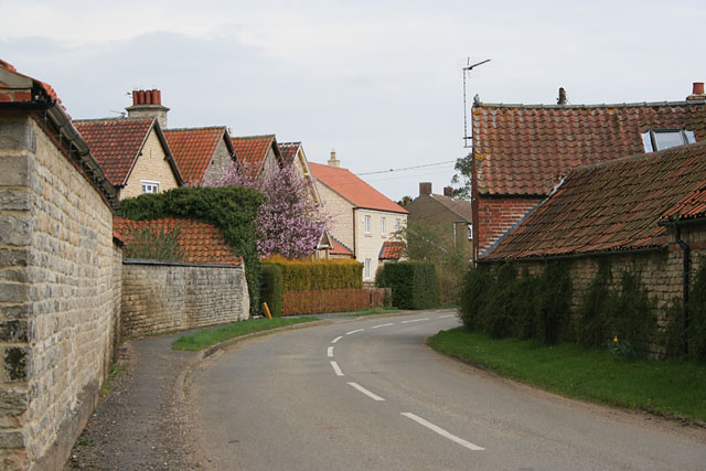
Braceby and Sapperton is a civil parish located in the county of Lincolnshire, England. It is situated in the South Kesteven district and covers an area of approximately 16 square kilometers. The parish is made up of two small villages, Braceby and Sapperton, which are located about 2 miles apart.

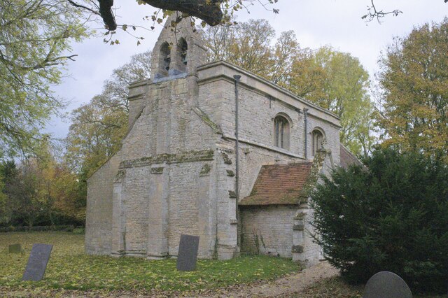
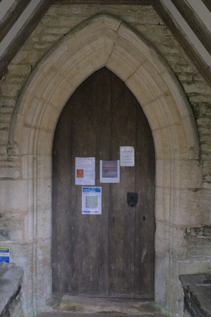
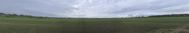
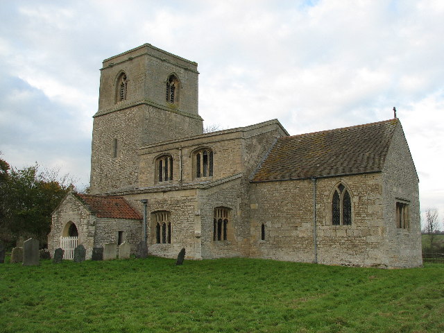
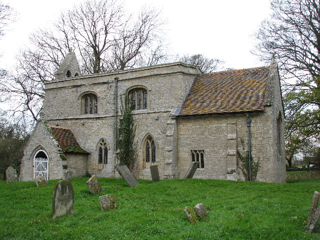
Braceby is a charming village with a population of around 100 residents. It is known for its picturesque countryside and traditional stone cottages. The village features a medieval church, St. Margaret's Church, which dates back to the 12th century and is a prominent landmark in the area.

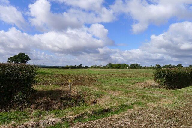
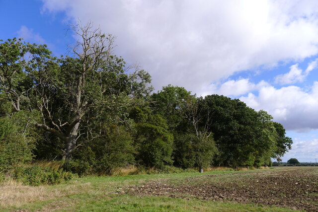
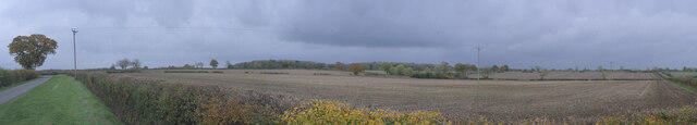
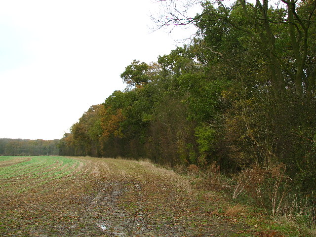
Sapperton, on the other hand, is a slightly larger village with a population of around 200 residents. It is known for its beautiful countryside and tranquil atmosphere. The village is surrounded by farmland and offers stunning views of the rolling hills of Lincolnshire.

Both villages have a strong sense of community and a friendly atmosphere. They offer a peaceful rural lifestyle and are popular among those seeking a quiet retreat from city life. Despite their small size, the villages are well-connected to nearby towns and cities, with good road links to Grantham, Lincoln, and Nottingham.

In terms of amenities, Braceby and Sapperton have limited facilities. There are no shops or pubs in the villages, but residents can access a wider range of services in nearby towns. The primary school serving the area is located in the neighboring village of Horbling.

If you have any feedback on the listing, please let us know in the comments section below.

Braceby and Sapperton Images

Images are sourced within 2km of 52.900823/-0.487907 or Grid Reference TF0134. Thanks to Geograph Open Source API. All images are credited.

The Cross Britain Way heading to Pickworth Wood Large fields in Lincolnshire.
The Cross Britain Way heading to Pickworth Wood
Large fields in Lincolnshire.
The Cross Britain Way crossing fields towards Sapperton The Cross Britain Way is a 279 mile, east-west trail across England and Wales, created to help raise money for Macmillan Cancer Support. Starting at Boston (where the original Macmillan Way starts), it crosses the Fens, the Vale of Belvoir, the Leicestershire/Nottinghamshire Wolds, the National Forest, Cannock Chase, East Shropshire along the Iron Bridge Gorge, the Shropshire Hills, the hills of mid Wales, the Berwyn Mountains, and Snowdonia National Park, to its end at Barmouth. <span class="nowrap"><a title="https://ldwa.org.uk/ldp/members/show_path.php?path_name=Macmillan+Way+-+Cross+Britain+Way" rel="nofollow ugc noopener" href="https://ldwa.org.uk/ldp/members/show_path.php?path_name=Macmillan+Way+-+Cross+Britain+Way">Link</a><img style="margin-left:2px;" alt="External link" title="External link - shift click to open in new window" src="https://s1.geograph.org.uk/img/external.png" width="10" height="10"/></span>
The Cross Britain Way crossing fields towards Sapperton
The Cross Britain Way is a 279 mile, east-west trail across England and Wales, created to help raise money for Macmillan Cancer Support. Starting at Boston (where the original Macmillan Way starts), it crosses the Fens, the Vale of Belvoir, the Leicestershire/Nottinghamshire Wolds, the National Forest, Cannock Chase, East Shropshire along the Iron Bridge Gorge, the Shropshire Hills, the hills of mid Wales, the Berwyn Mountains, and Snowdonia National Park, to its end at Barmouth. LinkExternal link
Sick ash at the edge of Sapperton South Wood Ash dieback?
Sick ash at the edge of Sapperton South Wood
Ash dieback?
Church of St Margaret, Braceby A grade II* listed church with origins in the 13th Century - see <span class="nowrap"><a title="https://historicengland.org.uk/listing/the-list/list-entry/1360324" rel="nofollow ugc noopener" href="https://historicengland.org.uk/listing/the-list/list-entry/1360324">Link</a><img style="margin-left:2px;" alt="External link" title="External link - shift click to open in new window" src="https://s1.geograph.org.uk/img/external.png" width="10" height="10"/></span> .
Church of St Margaret, Braceby
A grade II* listed church with origins in the 13th Century - see LinkExternal link .
Church of St Margaret: the door Wood door within the porch of the church.
Church of St Margaret: the door
Wood door within the porch of the church.
Church of St Margaret: Covid notice On the door seen in <a href="https://www.geograph.org.uk/photo/7018303">TF0135 : Church of St Margaret: the door</a> is the Test&trace checkin QR code and this welcoming notice, very different from so many other churches where precautions start with locking the door.
Church of St Margaret: Covid notice
On the door seen in TF0135 : Church of St Margaret: the door is the Test&trace checkin QR code and this welcoming notice, very different from so many other churches where precautions start with locking the door.
Field near Moor Lane A 90 degree panorama of the field south of Moor Lane
Field near Moor Lane
A 90 degree panorama of the field south of Moor Lane
Field between Braceby and Stibbington
Turn-off to Humby from Humby Road
Pipe delivery This lorry is delivering pipe segments for Project SPAR - the Strategic Pipeline Alliance.  Anglian Water is arranging to pipe surplus water from Elsham in North Lincolnshire to Colchester in Essex, where there is a shortage.

As it happens, the lorry left again still loaded, as there was no crane to unload it.
Pipe delivery
This lorry is delivering pipe segments for Project SPAR - the Strategic Pipeline Alliance. Anglian Water is arranging to pipe surplus water from Elsham in North Lincolnshire to Colchester in Essex, where there is a shortage. As it happens, the lorry left again still loaded, as there was no crane to unload it.
Pipeline route The route for Project SPAR - the Strategic Pipeline Alliance.  Anglian Water is arranging to pipe surplus water from Elsham in North Lincolnshire to Colchester in Essex, where there is a shortage.

The pipe sections, 900mm in diameter, will be welded to form the pipeline.  The river has been covered and sheeted over to prevent contamination, and the archaeology cleared.  You can't open the soil anywhere round here without finding Roman remains or Anglo Saxon burials.  Medieval Lincolnshire was like one enormous village, scatted across the whole wold.
Pipeline route
The route for Project SPAR - the Strategic Pipeline Alliance. Anglian Water is arranging to pipe surplus water from Elsham in North Lincolnshire to Colchester in Essex, where there is a shortage. The pipe sections, 900mm in diameter, will be welded to form the pipeline. The river has been covered and sheeted over to prevent contamination, and the archaeology cleared. You can't open the soil anywhere round here without finding Roman remains or Anglo Saxon burials. Medieval Lincolnshire was like one enormous village, scatted across the whole wold.
Pipe laying site access The route for Project SPAR - the Strategic Pipeline Alliance.  Anglian Water is arranging to pipe surplus water from Elsham in North Lincolnshire to Colchester in Essex, where there is a shortage.
Pipe laying site access
The route for Project SPAR - the Strategic Pipeline Alliance. Anglian Water is arranging to pipe surplus water from Elsham in North Lincolnshire to Colchester in Essex, where there is a shortage.
River protected A temporary bridge has been laid across the East Glen River to allow the construction of this water pipe trunk line as part of project SPAR - an investment by Anglian Water to pipe water from North Lincolnshire to Essex.
River protected
A temporary bridge has been laid across the East Glen River to allow the construction of this water pipe trunk line as part of project SPAR - an investment by Anglian Water to pipe water from North Lincolnshire to Essex.
Haceby Little Wood
Haceby Little Wood
Haceby Church, Dedicated To The Saints Margaret & Barbara First time I have come across a church dedicated to Saint Barbara. Albeit shared with Saint Margaret.
Haceby Church, Dedicated To The Saints Margaret & Barbara
First time I have come across a church dedicated to Saint Barbara. Albeit shared with Saint Margaret.
Braceby Woodland New woodland planted between Haceby & Braceby.
Braceby Woodland
New woodland planted between Haceby & Braceby.
Saint Margaret's Church, Braceby
Edge Of Pickworth Wood.
Show me another place!

Braceby and Sapperton is located at Grid Ref: TF0134 (Lat: 52.900823, Lng: -0.487907)

Administrative County: Lincolnshire

District: South Kesteven

Police Authority: Lincolnshire

What 3 Words

///dockers.dive.gasping. Near Ancaster, Lincolnshire

Nearby Locations

Braceby and Sapperton

Related Wikis

Braceby and Sapperton

Braceby and Sapperton is a civil parish in the South Kesteven district of Lincolnshire, England. According to the 2001 census it had a population of 47...

Ropsley and Humby

Ropsley and Humby is a civil parish in the South Kesteven district of Lincolnshire, England. According to the 2001 Census it had a population of 808, increasing...

Braceby

Braceby is a village in the civil parish of Braceby and Sapperton, in the South Kesteven district of Lincolnshire, England. The village includes a roadside...

Sapperton, Lincolnshire

Sapperton is a village in the civil parish of Braceby and Sapperton, in the South Kesteven district of Lincolnshire, England. The nearest town is Grantham...

Have you been to Braceby and Sapperton?

Leave your review of Braceby and Sapperton below (or comments, questions and feedback).