Bourton

Civil Parish in Dorset North Dorset

England

Bourton

The A303 Taken just north of West Bouton and just south of Bourton.
The A303 Credit: Trevor Harris

Bourton is a civil parish located in the county of Dorset, England. It is situated in the picturesque valley of the River Stour, approximately 3 miles northwest of the town of Gillingham. The parish covers an area of approximately 5 square miles and is home to a population of around 600 residents.

Bourton is a quintessential English village, known for its charm and natural beauty. The landscape is characterized by rolling hills, lush green fields, and meandering streams. The village itself is made up of a collection of traditional thatched-roof cottages, stone buildings, and a few modern houses.

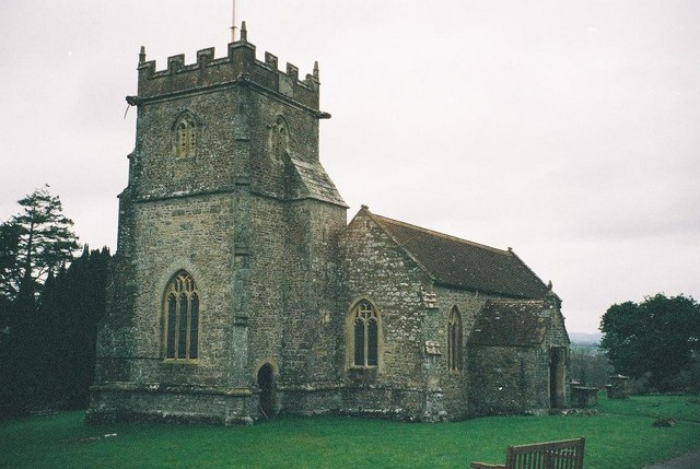
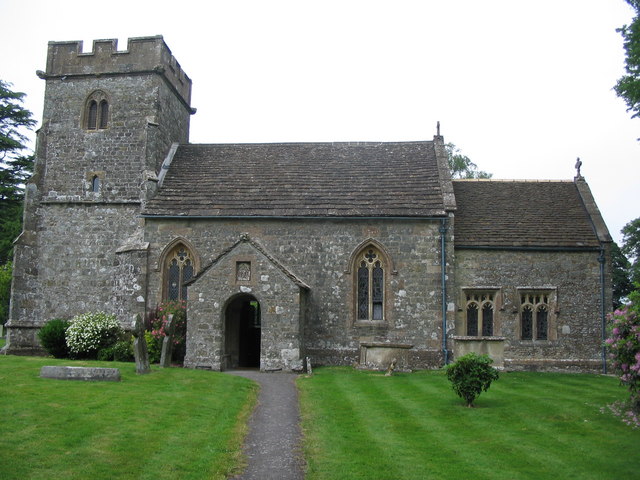
The heart of the village is centered around the parish church, St. George's Church, which dates back to the 13th century. The church is a prominent feature in the village, with its stunning architecture and beautiful stained glass windows.

Bourton is also home to a small primary school, providing education for children in the area. The village has a strong community spirit, with regular events and activities organized by local residents.

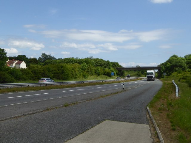
In terms of amenities, Bourton has a village hall, a post office, and a pub, which serves as a social hub for the community. The surrounding countryside offers many opportunities for outdoor activities such as walking, cycling, and fishing.

Overall, Bourton is a tranquil and idyllic village, offering a peaceful escape from the hustle and bustle of city life. Its natural beauty, historic charm, and close-knit community make it a desirable place to live or visit.

If you have any feedback on the listing, please let us know in the comments section below.
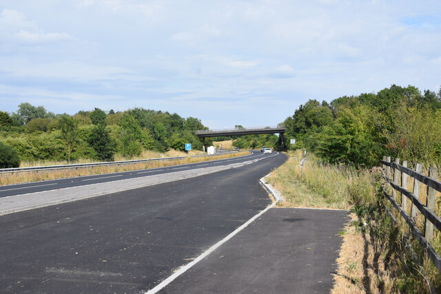
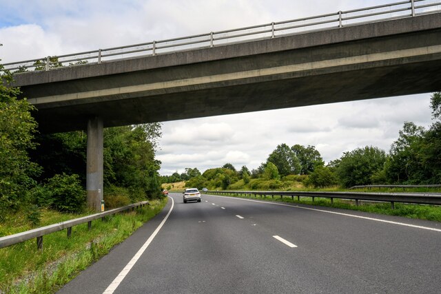
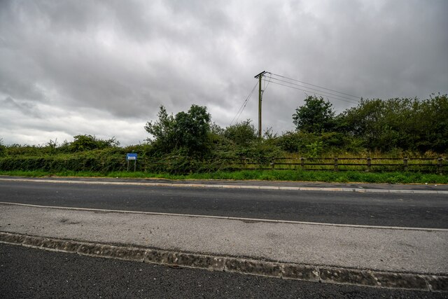
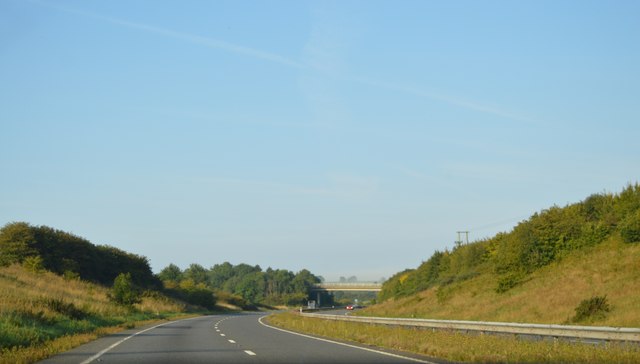
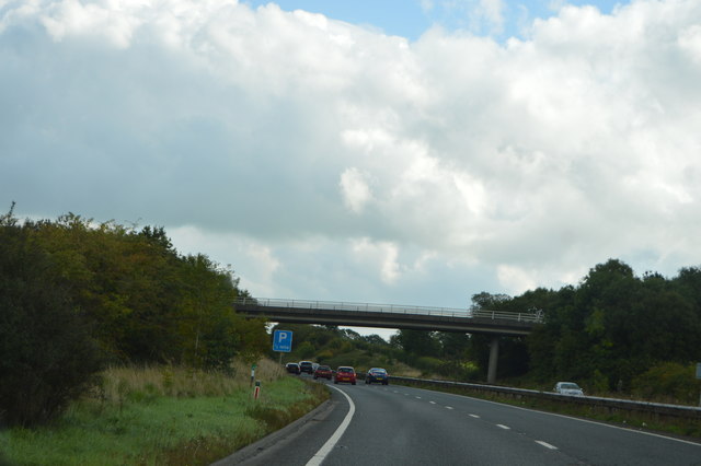
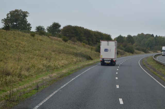
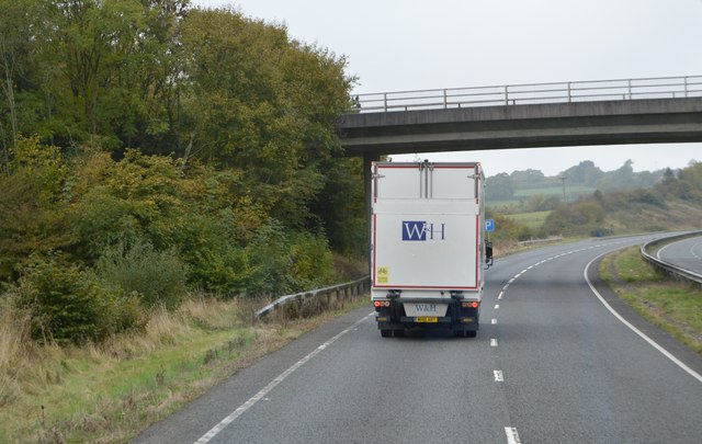
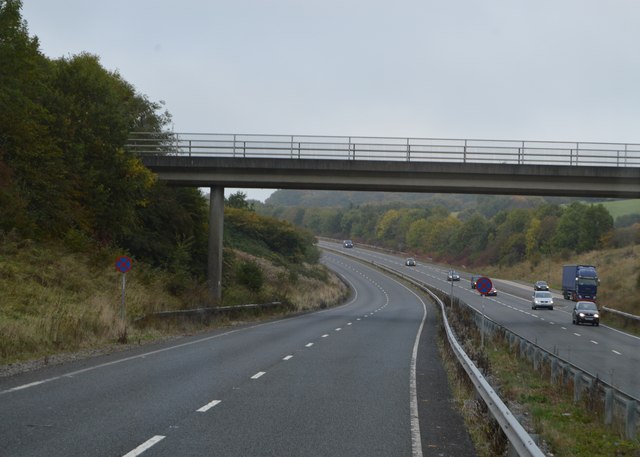
Bourton Images

Images are sourced within 2km of 51.065369/-2.340136 or Grid Reference ST7629. Thanks to Geograph Open Source API. All images are credited.

The A303 Taken just north of West Bouton and just south of Bourton.
The A303
Taken just north of West Bouton and just south of Bourton.
Bourton : A303 Looking along the A303.
Bourton : A303
Looking along the A303.
Bourton : A303 Heading under the West Bourton Road bridge.
Bourton : A303
Heading under the West Bourton Road bridge.
Bourton : A303 Looking along the A303.
Bourton : A303
Looking along the A303.
Bourton : A303 Layby A layby alongside the A303.
Bourton : A303 Layby
A layby alongside the A303.
A303, westbound The A303 is a main trunk road running 92 miles between Basingstoke and Honiton. Along with the A30 and M3 it forms a major route between London and the South West. Much of the road is dual carriageway, but some stretches remain single and prone to congestion.

Wikipedia: <span class="nowrap"><a title="http://en.wikipedia.org/wiki/A303_road" rel="nofollow ugc noopener" href="http://en.wikipedia.org/wiki/A303_road">Link</a><img style="margin-left:2px;" alt="External link" title="External link - shift click to open in new window" src="https://s1.geograph.org.uk/img/external.png" width="10" height="10"/></span>
A303, westbound
The A303 is a main trunk road running 92 miles between Basingstoke and Honiton. Along with the A30 and M3 it forms a major route between London and the South West. Much of the road is dual carriageway, but some stretches remain single and prone to congestion. Wikipedia: LinkExternal link
A303, eastbound The A303 is a main trunk road running 92 miles between Basingstoke and Honiton. Along with the A30 and M3 it forms a major route between London and the South West. Much of the road is dual carriageway, but some stretches remain single and prone to congestion.

Wikipedia: <span class="nowrap"><a title="http://en.wikipedia.org/wiki/A303_road" rel="nofollow ugc noopener" href="http://en.wikipedia.org/wiki/A303_road">Link</a><img style="margin-left:2px;" alt="External link" title="External link - shift click to open in new window" src="https://s1.geograph.org.uk/img/external.png" width="10" height="10"/></span>
A303, eastbound
The A303 is a main trunk road running 92 miles between Basingstoke and Honiton. Along with the A30 and M3 it forms a major route between London and the South West. Much of the road is dual carriageway, but some stretches remain single and prone to congestion. Wikipedia: LinkExternal link
West Bourton Road Bridge, A303 The A303 is a main trunk road running 92 miles between Basingstoke and Honiton. Along with the A30 and M3 it forms a major route between London and the South West. Much of the road is dual carriageway, but some stretches remain single and prone to congestion.

Wikipedia: <span class="nowrap"><a title="http://en.wikipedia.org/wiki/A303_road" rel="nofollow ugc noopener" href="http://en.wikipedia.org/wiki/A303_road">Link</a><img style="margin-left:2px;" alt="External link" title="External link - shift click to open in new window" src="https://s1.geograph.org.uk/img/external.png" width="10" height="10"/></span>
West Bourton Road Bridge, A303
The A303 is a main trunk road running 92 miles between Basingstoke and Honiton. Along with the A30 and M3 it forms a major route between London and the South West. Much of the road is dual carriageway, but some stretches remain single and prone to congestion. Wikipedia: LinkExternal link
A303, westbound The A303 is a main trunk road running 92 miles between Basingstoke and Honiton. Along with the A30 and M3 it forms a major route between London and the South West. Much of the road is dual carriageway, but some stretches remain single and prone to congestion.

Wikipedia: <span class="nowrap"><a title="http://en.wikipedia.org/wiki/A303_road" rel="nofollow ugc noopener" href="http://en.wikipedia.org/wiki/A303_road">Link</a><img style="margin-left:2px;" alt="External link" title="External link - shift click to open in new window" src="https://s1.geograph.org.uk/img/external.png" width="10" height="10"/></span>
A303, westbound
The A303 is a main trunk road running 92 miles between Basingstoke and Honiton. Along with the A30 and M3 it forms a major route between London and the South West. Much of the road is dual carriageway, but some stretches remain single and prone to congestion. Wikipedia: LinkExternal link
West Bourton Road Bridge, A303 The A303 is a main trunk road running 92 miles between Basingstoke and Honiton. Along with the A30 and M3 it forms a major route between London and the South West. Much of the road is dual carriageway, but some stretches remain single and prone to congestion.

Wikipedia: <span class="nowrap"><a title="http://en.wikipedia.org/wiki/A303_road" rel="nofollow ugc noopener" href="http://en.wikipedia.org/wiki/A303_road">Link</a><img style="margin-left:2px;" alt="External link" title="External link - shift click to open in new window" src="https://s1.geograph.org.uk/img/external.png" width="10" height="10"/></span>
West Bourton Road Bridge, A303
The A303 is a main trunk road running 92 miles between Basingstoke and Honiton. Along with the A30 and M3 it forms a major route between London and the South West. Much of the road is dual carriageway, but some stretches remain single and prone to congestion. Wikipedia: LinkExternal link
Footbridge, A303 The A303 is a main trunk road running 92 miles between Basingstoke and Honiton. Along with the A30 and M3 it forms a major route between London and the South West. Much of the road is dual carriageway, but some stretches remain single and prone to congestion.

Wikipedia: <span class="nowrap"><a title="http://en.wikipedia.org/wiki/A303_road" rel="nofollow ugc noopener" href="http://en.wikipedia.org/wiki/A303_road">Link</a><img style="margin-left:2px;" alt="External link" title="External link - shift click to open in new window" src="https://s1.geograph.org.uk/img/external.png" width="10" height="10"/></span>
Footbridge, A303
The A303 is a main trunk road running 92 miles between Basingstoke and Honiton. Along with the A30 and M3 it forms a major route between London and the South West. Much of the road is dual carriageway, but some stretches remain single and prone to congestion. Wikipedia: LinkExternal link
Entering Somerset, A303 The A303 is a main trunk road running 92 miles between Basingstoke and Honiton. Along with the A30 and M3 it forms a major route between London and the South West. Much of the road is dual carriageway, but some stretches remain single and prone to congestion.

Wikipedia: <span class="nowrap"><a title="http://en.wikipedia.org/wiki/A303_road" rel="nofollow ugc noopener" href="http://en.wikipedia.org/wiki/A303_road">Link</a><img style="margin-left:2px;" alt="External link" title="External link - shift click to open in new window" src="https://s1.geograph.org.uk/img/external.png" width="10" height="10"/></span>
Entering Somerset, A303
The A303 is a main trunk road running 92 miles between Basingstoke and Honiton. Along with the A30 and M3 it forms a major route between London and the South West. Much of the road is dual carriageway, but some stretches remain single and prone to congestion. Wikipedia: LinkExternal link
B3081 off the A303 The A303 is a main trunk road running 92 miles between Basingstoke and Honiton. Along with the A30 and M3 it forms a major route between London and the South West. Much of the road is dual carriageway, but some stretches remain single and prone to congestion.

Wikipedia: <span class="nowrap"><a title="http://en.wikipedia.org/wiki/A303_road" rel="nofollow ugc noopener" href="http://en.wikipedia.org/wiki/A303_road">Link</a><img style="margin-left:2px;" alt="External link" title="External link - shift click to open in new window" src="https://s1.geograph.org.uk/img/external.png" width="10" height="10"/></span>
B3081 off the A303
The A303 is a main trunk road running 92 miles between Basingstoke and Honiton. Along with the A30 and M3 it forms a major route between London and the South West. Much of the road is dual carriageway, but some stretches remain single and prone to congestion. Wikipedia: LinkExternal link
A303, Leigh Common The A303 is a main trunk road running 92 miles between Basingstoke and Honiton. Along with the A30 and M3 it forms a major route between London and the South West. Much of the road is dual carriageway, but some stretches remain single and prone to congestion.

Wikipedia: <span class="nowrap"><a title="http://en.wikipedia.org/wiki/A303_road" rel="nofollow ugc noopener" href="http://en.wikipedia.org/wiki/A303_road">Link</a><img style="margin-left:2px;" alt="External link" title="External link - shift click to open in new window" src="https://s1.geograph.org.uk/img/external.png" width="10" height="10"/></span>
A303, Leigh Common
The A303 is a main trunk road running 92 miles between Basingstoke and Honiton. Along with the A30 and M3 it forms a major route between London and the South West. Much of the road is dual carriageway, but some stretches remain single and prone to congestion. Wikipedia: LinkExternal link
A wet entry to Wiltshire, A303 The A303 is a main trunk road running 92 miles between Basingstoke and Honiton. Along with the A30 and M3 it forms a major route between London and the South West. Much of the road is dual carriageway, but some stretches remain single and prone to congestion.

Wikipedia: <span class="nowrap"><a title="http://en.wikipedia.org/wiki/A303_road" rel="nofollow ugc noopener" href="http://en.wikipedia.org/wiki/A303_road">Link</a><img style="margin-left:2px;" alt="External link" title="External link - shift click to open in new window" src="https://s1.geograph.org.uk/img/external.png" width="10" height="10"/></span>
A wet entry to Wiltshire, A303
The A303 is a main trunk road running 92 miles between Basingstoke and Honiton. Along with the A30 and M3 it forms a major route between London and the South West. Much of the road is dual carriageway, but some stretches remain single and prone to congestion. Wikipedia: LinkExternal link
West Bourton Road bridge over A303 Seen from a lay-by on the westbound carriageway
West Bourton Road bridge over A303
Seen from a lay-by on the westbound carriageway
Old Milestone by the B3081, east of Cucklington Carved stone post by the B3081, plate missing, in parish of GILLINGHAM (NORTH DORSET District), a mile East of Cucklington village on B3081, on grass bank in hedge, on South side of road. Dorset 1 (limestone), erected by the Shaftesbury & New Road to Blandford turnpike trust in the 19th century. 

Inscription reads:-
: BOURTON : : (Wincanton 4 / Shaftesbury 7) : : BOURTON :
Carved benchmark at bottom of front face.

Milestone Society National ID: DO_SHWC07.
Old Milestone by the B3081, east of Cucklington
Carved stone post by the B3081, plate missing, in parish of GILLINGHAM (NORTH DORSET District), a mile East of Cucklington village on B3081, on grass bank in hedge, on South side of road. Dorset 1 (limestone), erected by the Shaftesbury & New Road to Blandford turnpike trust in the 19th century. Inscription reads:- : BOURTON : : (Wincanton 4 / Shaftesbury 7) : : BOURTON : Carved benchmark at bottom of front face. Milestone Society National ID: DO_SHWC07.
Old Milestone by the B3081, west of West Bourton Carved stone post by the B3081, plate missing, in parish of BOURTON (NORTH DORSET District), between Tinkers Lane and road to West Bourton, by the road, on South side of road. Dorset 1 (limestone), erected by the Shaftesbury & New Road to Blandford turnpike trust in the 19th century. 

Inscription once read:-
: (BOURTON) : : (Wincanton 3½) : : (Shaftesbury 8) : : (BOURTON) : 
Carved benchmark at bottom of front face.

Milestone Society National ID: DO_SHWC08.
Old Milestone by the B3081, west of West Bourton
Carved stone post by the B3081, plate missing, in parish of BOURTON (NORTH DORSET District), between Tinkers Lane and road to West Bourton, by the road, on South side of road. Dorset 1 (limestone), erected by the Shaftesbury & New Road to Blandford turnpike trust in the 19th century. Inscription once read:- : (BOURTON) : : (Wincanton 3½) : : (Shaftesbury 8) : : (BOURTON) : Carved benchmark at bottom of front face. Milestone Society National ID: DO_SHWC08.
Show me another place!

Bourton is located at Grid Ref: ST7629 (Lat: 51.065369, Lng: -2.340136)

Administrative County: Dorset

District: North Dorset

Police Authority: Dorset

What 3 Words

///undertook.holds.elsewhere. Near Bourton, Dorset

Related Wikis

Bourton, Dorset

Bourton is a village and civil parish in north Dorset, England, situated north of the A303 road on the border with Somerset and Wiltshire between Mere...

Ballands Castle

Ballands Castle was a castle near the village of Penselwood, Somerset, England. == History == Balland Castle was a motte and bailey castle, probably built...

Church of St Michael and All Angels, Penselwood

The Anglican Church of St Michael and All Angels in Penselwood, Somerset, England was built in the 15th century. It is a Grade II* listed building. �...

Silton

Silton is a small village and civil parish in north Dorset, England, situated in the Blackmore Vale four miles (six kilometres) northwest of Gillingham...

Church of St Lawrence, Cucklington

The Anglican Church of St Lawrence in Cucklington, Somerset, England, was built in the 13th century. It is a Grade II* listed building. == History == The...

Penselwood

Penselwood is a village and civil parish in the English county of Somerset. It is located 4 miles (6.4 km) north east of Wincanton, 4 miles (6.4 km) south...
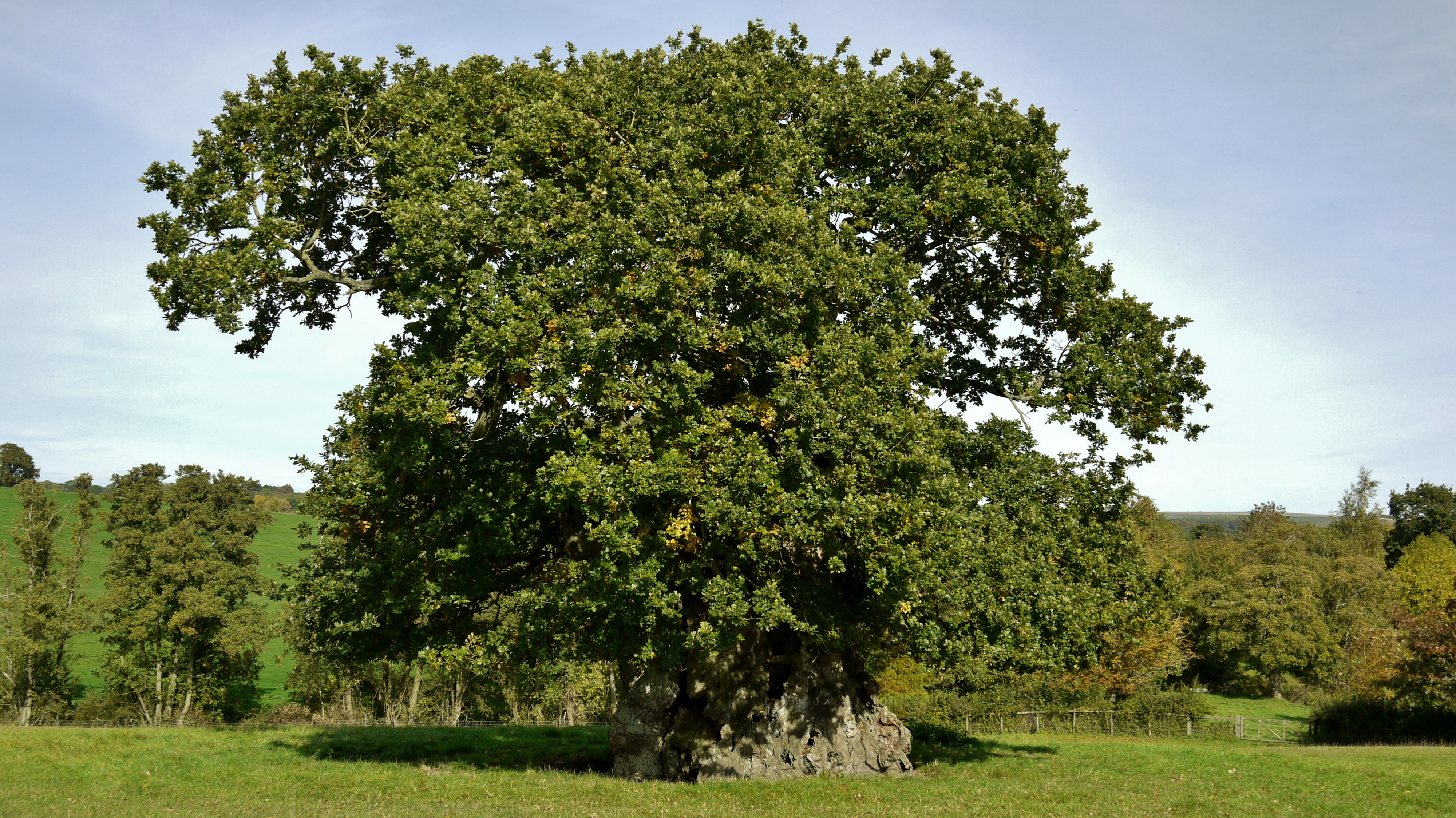
Wyndham's Oak

Wyndham's Oak (sometimes Judge Wyndham's Oak and also known as the Silton Oak or stumpy Silton) is an historic pedunculate oak (Quercus robur) tree in...

Cucklington

Cucklington is a village and parish in Somerset, England, situated on a hill 3 miles (4.8 km) south east of Wincanton and 4 miles (6.4 km) north west of...

Nearby Amenities

Located within 500m of 51.065369,-2.340136
Material: wood
Power: pole
Lat/Long: 51.0677395/-2.336325
Material: wood
Power: pole
Lat/Long: 51.0678802/-2.3384527
Material: wood
Power: pole
Lat/Long: 51.0679876/-2.3400282
Material: wood
Power: pole
Lat/Long: 51.0680974/-2.3417894
Material: wood
Power: pole
Lat/Long: 51.0682369/-2.3438743
The data included in this document is from www.openstreetmap.org. The data is made available under ODbL.

Have you been to Bourton?

Leave your review of Bourton below (or comments, questions and feedback).