Brithdir

Settlement in Montgomeryshire

Wales

Brithdir

St Beuno, Berriew. Powys An unusual Lime tree avenue at St Beuno's Church.
St Beuno, Berriew. Powys Credit: paul wood

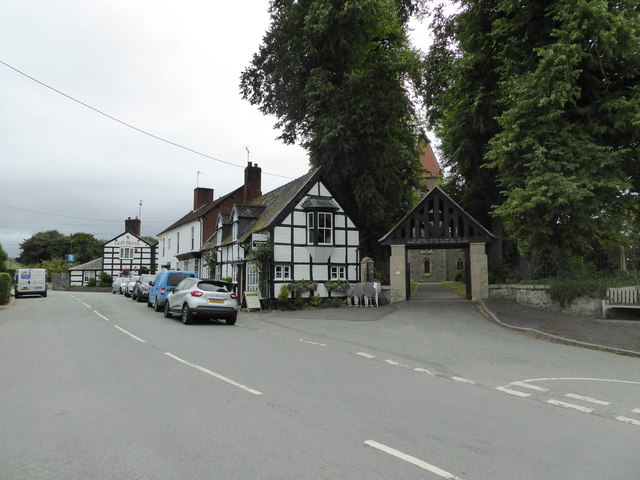
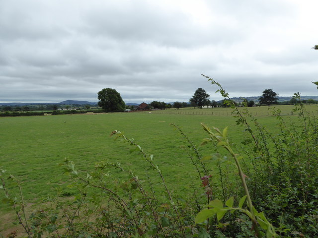
Brithdir is a small village located in Montgomeryshire, Wales. Situated in the heart of the stunning Dyfi Valley, it is surrounded by breathtaking natural beauty. The village is nestled amidst rolling hills, lush green fields, and tranquil woodlands, offering a peaceful and idyllic setting.

With a population of around 500 residents, Brithdir retains its rural charm and close-knit community spirit. The village is well-connected to the nearby towns of Machynlleth and Newtown, providing easy access to essential amenities and services.

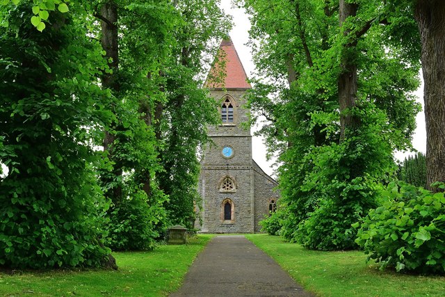
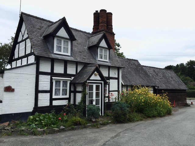
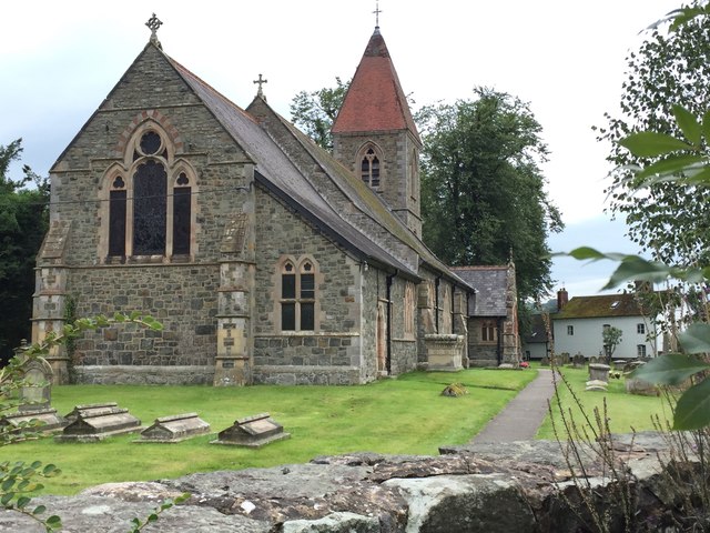
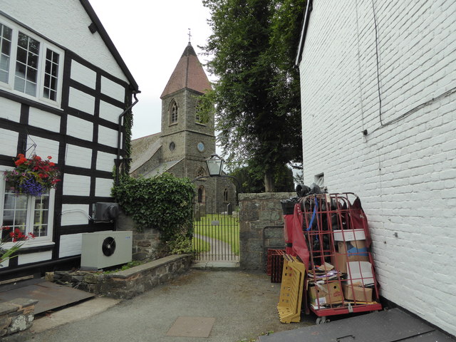
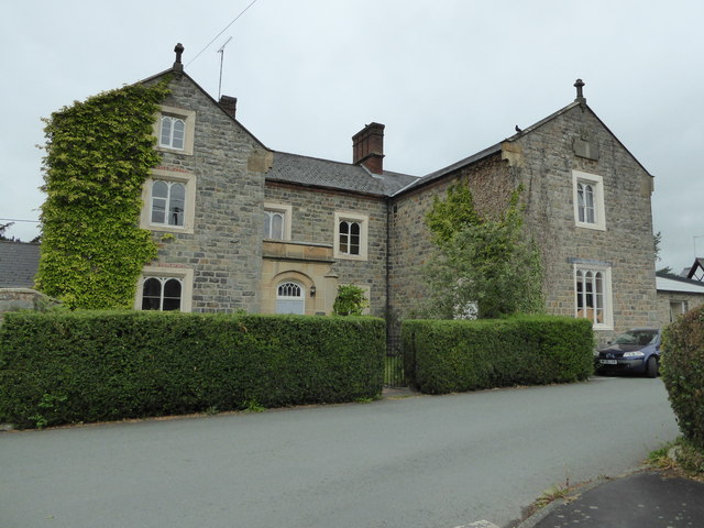
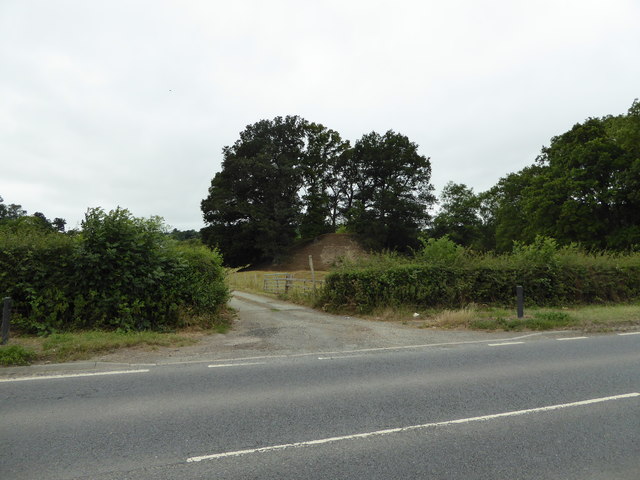
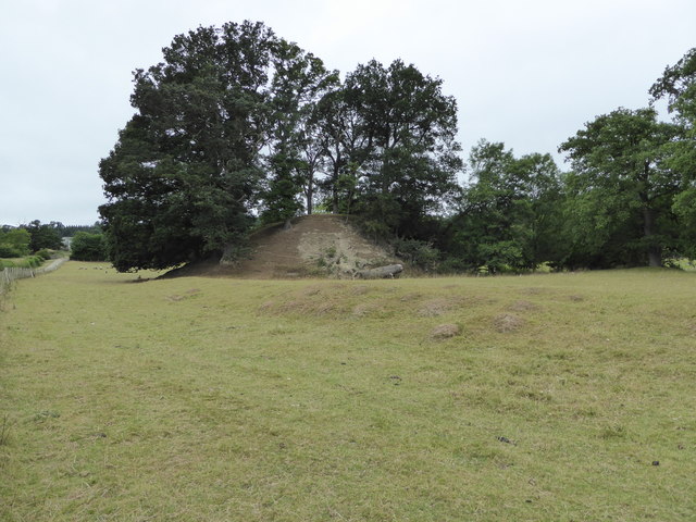
Brithdir boasts a rich history, with evidence of human settlements dating back to the Neolithic period. The area is known for its archaeological sites, including ancient burial mounds and stone circles. The village is also home to several historic buildings, such as the St. David's Church, which dates back to the 12th century, and the Brithdir Hall, a grand manor house that has been beautifully preserved.

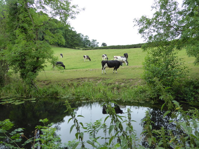
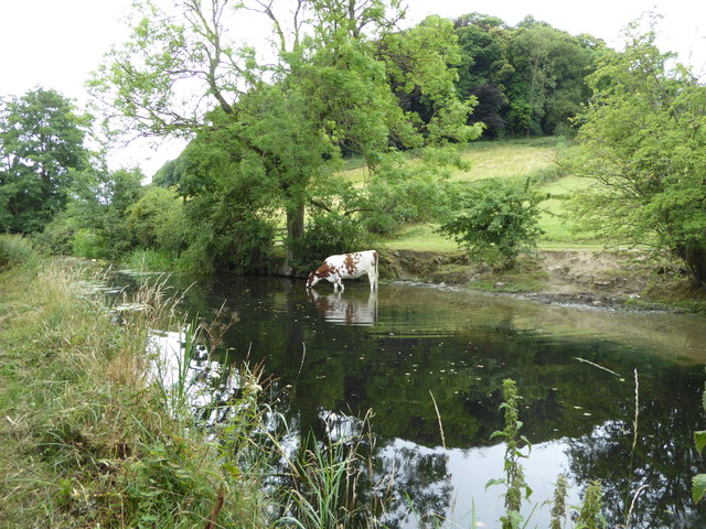
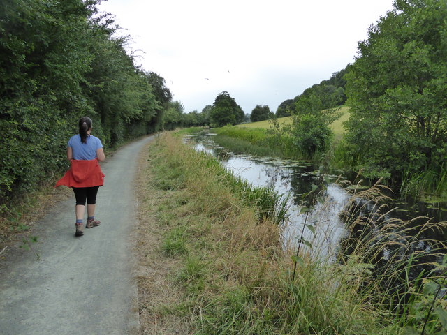
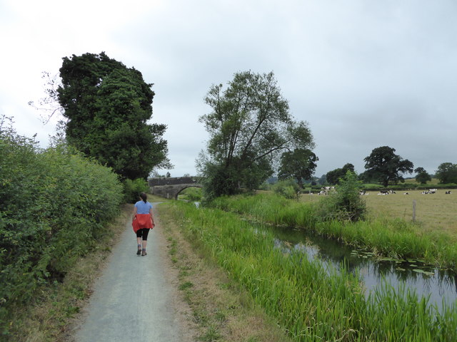
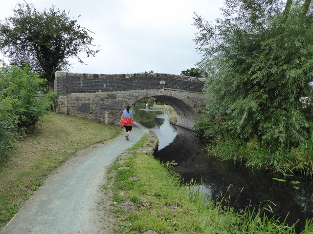
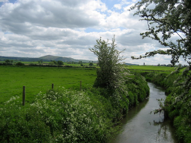
Nature enthusiasts will find Brithdir a haven for outdoor activities. The nearby Dyfi Forest offers miles of scenic trails for hiking, mountain biking, and horse riding. The Dyfi River, renowned for its salmon and trout fishing, attracts anglers from far and wide. The village is also a popular base for birdwatchers, as it lies within the UNESCO Biosphere Reserve of Dyfi Estuary, home to an array of rare bird species.

Brithdir provides a tranquil escape from the hustle and bustle of city life, offering a close connection to nature and a strong sense of community. Whether exploring the historical sites, enjoying outdoor pursuits, or simply embracing the peaceful surroundings, visitors to Brithdir are sure to be captivated by its beauty and charm.

If you have any feedback on the listing, please let us know in the comments section below.

Brithdir Images

Images are sourced within 2km of 52.615173/-3.188952 or Grid Reference SJ1902. Thanks to Geograph Open Source API. All images are credited.

St Beuno, Berriew. Powys An unusual Lime tree avenue at St Beuno's Church.
St Beuno, Berriew. Powys
An unusual Lime tree avenue at St Beuno's Church.
Timbered House An attractive timbered house at Berriew.
Timbered House
An attractive timbered house at Berriew.
St. Beuno's Church Church of St. Beuno, Berriew.
St. Beuno's Church
Church of St. Beuno, Berriew.
Part of Berriew village What a picturesque village this is.
Part of Berriew village
What a picturesque village this is.
View to St. Beuno's church in Berriew <span class="nowrap"><a title="https://en.wikipedia.org/wiki/St_Beuno%27s_Church,_Berriew" rel="nofollow ugc noopener" href="https://en.wikipedia.org/wiki/St_Beuno%27s_Church,_Berriew">Link</a><img style="margin-left:2px;" alt="External link" title="External link - shift click to open in new window" src="https://s1.geograph.org.uk/img/external.png" width="10" height="10"/></span> here.
View to St. Beuno's church in Berriew
LinkExternal link here.
Stable block at Berriew Lovely old stables here.
Stable block at Berriew
Lovely old stables here.
Old school house building in Berriew Lovely historic building in this village of fine buildings.
Old school house building in Berriew
Lovely historic building in this village of fine buildings.
Old tree trunks at Lower Luggy farm Impressive tree trunk remnants. For scale, the trunk is maybe 6 ft high.
Old tree trunks at Lower Luggy farm
Impressive tree trunk remnants. For scale, the trunk is maybe 6 ft high.
Old castle motte beside the road Called Upper Luggy castle motte I believe, <span class="nowrap"><a title="http://www.coflein.gov.uk/en/site/306761/details/upper-luggy-castle" rel="nofollow ugc noopener" href="http://www.coflein.gov.uk/en/site/306761/details/upper-luggy-castle">Link</a><img style="margin-left:2px;" alt="External link" title="External link - shift click to open in new window" src="https://s1.geograph.org.uk/img/external.png" width="10" height="10"/></span> here.
Old castle motte beside the road
Called Upper Luggy castle motte I believe, LinkExternal link here.
Upper Luggy castle motte <span class="nowrap"><a title="http://www.coflein.gov.uk/en/site/306761/details/upper-luggy-castle" rel="nofollow ugc noopener" href="http://www.coflein.gov.uk/en/site/306761/details/upper-luggy-castle">Link</a><img style="margin-left:2px;" alt="External link" title="External link - shift click to open in new window" src="https://s1.geograph.org.uk/img/external.png" width="10" height="10"/></span> here.
Upper Luggy castle motte
LinkExternal link here.
Canal bridge 126 on the Montgomery Canal Lovely bridge here on the Monty.
Canal bridge 126 on the Montgomery Canal
Lovely bridge here on the Monty.
Cow beside the Montgomery Canal This was one relaxed and contented bovine.
Cow beside the Montgomery Canal
This was one relaxed and contented bovine.
Part of the Montgomeryshire Canal near Berriew Cattle graze and drink here on a July day.
Part of the Montgomeryshire Canal near Berriew
Cattle graze and drink here on a July day.
On the towpath of the Monty near Berriew Canal walks are always good but this section is very scenic and pleasant.
On the towpath of the Monty near Berriew
Canal walks are always good but this section is very scenic and pleasant.
View across fields from the Montgomeryshire Canal View towards distant Corndon Hill. There is also a bull dozing on its own in the field nearby.
View across fields from the Montgomeryshire Canal
View towards distant Corndon Hill. There is also a bull dozing on its own in the field nearby.
Bull dozing beside the Montgomeryshire Canal This impressive fellow seems to have his day well planned.
Bull dozing beside the Montgomeryshire Canal
This impressive fellow seems to have his day well planned.
Walking the towpath of the Montgomeryshire Canal Lovely walking.
Walking the towpath of the Montgomeryshire Canal
Lovely walking.
Walking the towpath of the Montgomeryshire Canal A canal designed by an artist I'm sure.
Walking the towpath of the Montgomeryshire Canal
A canal designed by an artist I'm sure.
Show me another place!

Brithdir is located at Grid Ref: SJ1902 (Lat: 52.615173, Lng: -3.188952)

Unitary Authority: Powys

Police Authority: Dyfed Powys

What 3 Words

///curly.crawling.taxi. Near Welshpool, Powys

Related Wikis

Brithdir, Powys

Brithdir is an area in the community of Berriew, Powys, Wales, which is 78 miles (126 km) from Cardiff and 151 miles (243 km) from London. It lies to the...

Belan, Powys

Belan is a hamlet, 3.5 miles (5.6 km) southwest of Welshpool, in Powys, Wales. It belongs to the community of Welshpool. The Belan Locks, built around...

St Beuno's Church, Berriew

St Beuno’s Church is the parish church of Berriew, in the historic county of Montgomeryshire, now Powys. The church stands in an almost oval churchyard...

Berriew F.C.

Berriew Football Club is a Welsh football team based in Berriew. They played in the Ardal Leagues North East, which is in the third level of the Welsh...

Berriew

Berriew (Welsh: Aberriw) is a village and community in Montgomeryshire, Powys, Wales. It is on the Montgomeryshire Canal and the Afon Rhiw, near the confluence...

River Camlad

The River Camlad (or just Camlad) is a minor river in Powys and Shropshire. It forms part of the border between Wales and England in places, before flowing...

Tŷ Mawr, Castle Caereinion

Tŷ Mawr is a Grade I-listed timber framed house in the township of Trefnant in the historic parish of Castle Caereinion, Montgomeryshire, Wales. Originally...

Welshpool Airport

Welshpool Airport (ICAO: EGCW) (Welsh: Maes Awyr y Trallwng; also known as Mid-Wales Airport) is located 2 NM (3.7 km; 2.3 mi) south of Welshpool, Powys...

Nearby Amenities

Located within 500m of 52.615173,-3.188952
Brithdir Lock
Height: 2.74
Seamark Type: gate
Waterway: lock_gate
Lat/Long: 52.6129846/-3.1828344
Brithdir Turning Point
Maxlength: 70Ft
Waterway: Turning_point
Lat/Long: 52.6126031/-3.1842035
Brithdir Lock
Height: 2.74
Seamark Type: gate
Waterway: lock_gate
Lat/Long: 52.6128501/-3.1832327
Place: farm
Lat/Long: 52.6138197/-3.1899456
Place: farm
Lat/Long: 52.6116439/-3.1879286
Place: farm
Lat/Long: 52.6179236/-3.1870274
The data included in this document is from www.openstreetmap.org. The data is made available under ODbL.

Have you been to Brithdir?

Leave your review of Brithdir below (or comments, questions and feedback).