Boothby Pagnell

Civil Parish in Lincolnshire South Kesteven

England

Boothby Pagnell

I hate some folk Look at this catering rubbish dumped on private land with no thought at all.
I hate some folk Credit: Bob Harvey

Boothby Pagnell is a civil parish located in the county of Lincolnshire, in the East Midlands region of England. It is situated approximately 6 miles northeast of Grantham and covers an area of around 3.5 square miles.

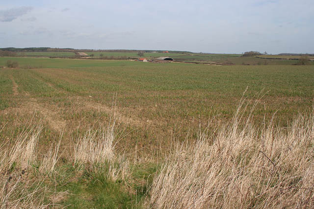
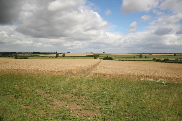
The parish is primarily rural, characterized by rolling countryside and farmland. It is bordered by several other civil parishes, including Honington, Syston, and Normanton. The River Witham flows along its southern boundary.

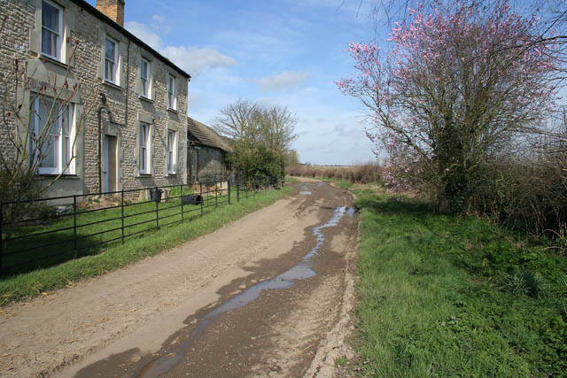
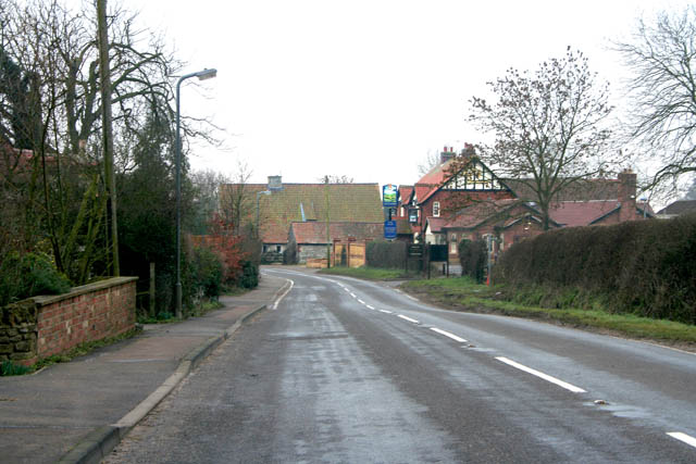
Boothby Pagnell is a small and tight-knit community, with a population of around 200 people according to the latest census. The village itself is picturesque, showcasing traditional Lincolnshire architecture and a peaceful, tranquil atmosphere. Many of the buildings in the village date back to the 18th and 19th centuries, lending it a charming and historic feel.

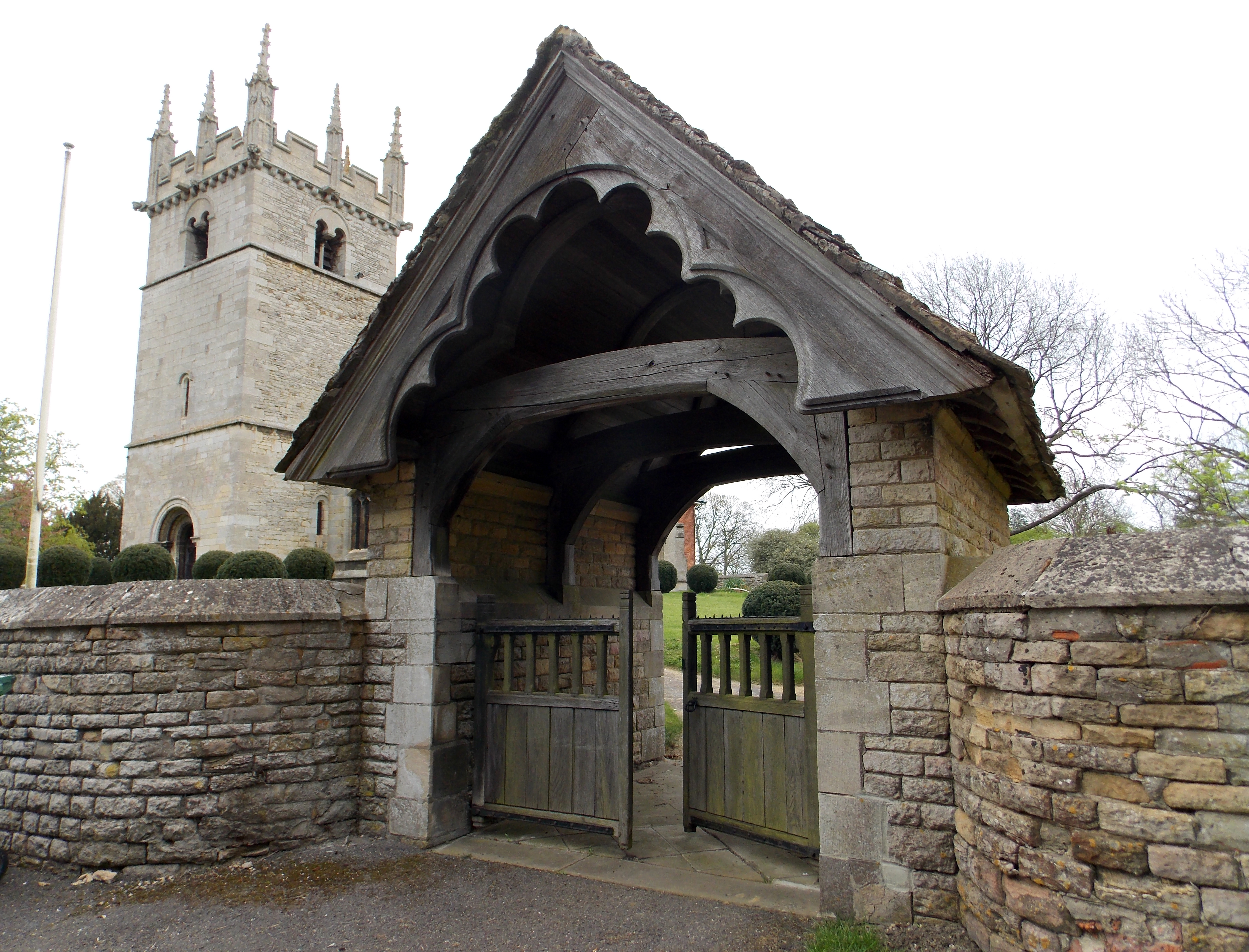
The parish is home to the Grade II* listed St. Andrew's Church, a beautiful place of worship that dates back to the 13th century. It serves as a focal point for the community and hosts regular religious services.

Despite its small size, Boothby Pagnell offers a range of amenities to its residents. These include a village hall, a primary school, and a pub, providing a sense of community and social gathering places.

The surrounding natural beauty makes Boothby Pagnell an attractive destination for outdoor enthusiasts. The area offers opportunities for countryside walks, cycling, and wildlife spotting.

Overall, Boothby Pagnell is a charming and tranquil civil parish that offers a close-knit community, historic architecture, and easy access to the beautiful Lincolnshire countryside.

If you have any feedback on the listing, please let us know in the comments section below.

Boothby Pagnell Images

Images are sourced within 2km of 52.869013/-0.560105 or Grid Reference SK9731. Thanks to Geograph Open Source API. All images are credited.

I hate some folk Look at this catering rubbish dumped on private land with no thought at all.
I hate some folk
Look at this catering rubbish dumped on private land with no thought at all.
Farmland near Stoke Tunnel Farm High flat farmland in this part of Lincolnshire with a crop of winter wheat in the large fields.
Farmland near Stoke Tunnel Farm
High flat farmland in this part of Lincolnshire with a crop of winter wheat in the large fields.
Sycamore Farm, Lower Bassingthorpe A limestone farmhouse with ashlar cut window surrounds. The muddy track leads to the farm in <a href="https://www.geograph.org.uk/photo/367650">SK9529 : Farmland near Stoke Tunnel Farm</a>.
Sycamore Farm, Lower Bassingthorpe
A limestone farmhouse with ashlar cut window surrounds. The muddy track leads to the farm in SK9529 : Farmland near Stoke Tunnel Farm.
Saint Andrew's Church, Boothby Pagnell This Anglican parish church is dedicated to St. Andrew. Some portions of the building date back to 1330. The church was restored in 1895, and seats about 120 people.
Saint Andrew's Church, Boothby Pagnell
This Anglican parish church is dedicated to St. Andrew. Some portions of the building date back to 1330. The church was restored in 1895, and seats about 120 people.
Ingoldsby Wood. Bridleway running alongside Ingoldsby wood.
Ingoldsby Wood.
Bridleway running alongside Ingoldsby wood.
Ponton Road near Boothby Pagnell Bassingthorpe New Plantation to the right.
Ponton Road near Boothby Pagnell
Bassingthorpe New Plantation to the right.
Young cattle at Home Farm, Boothby Pagnell Also known as Manor Farm.
Young cattle at Home Farm, Boothby Pagnell
Also known as Manor Farm.
Farmland near Boothby Pagnell Looking across to Boothby Big Wood which fills nearly half this square. The track on the OS map has disappeared long before its marked end point in this square and this point was reached by walking along field margins.
Farmland near Boothby Pagnell
Looking across to Boothby Big Wood which fills nearly half this square. The track on the OS map has disappeared long before its marked end point in this square and this point was reached by walking along field margins.
Farmland near Boothby Pagnell Looking towards the village.
Farmland near Boothby Pagnell
Looking towards the village.
Ready for harvesting Farmland off the B1176 near Boothby Pagnell.
Ready for harvesting
Farmland off the B1176 near Boothby Pagnell.
B1176 looking towards Old Somerby
Countryside at Brackenbury Fields Boothby Little Wood on the far left.
Countryside at Brackenbury Fields
Boothby Little Wood on the far left.
Brackenbury Fields, Boothby Pagnell A large mixed farm which breeds Texel sheep. See <span class="nowrap"><a title="http://www.texel.co.uk/thebreed/thebreed.php" rel="nofollow ugc noopener" href="http://www.texel.co.uk/thebreed/thebreed.php">Link</a><img style="margin-left:2px;" alt="External link" title="External link - shift click to open in new window" src="https://s1.geograph.org.uk/img/external.png" width="10" height="10"/></span>  for history of the breed.
Brackenbury Fields, Boothby Pagnell
A large mixed farm which breeds Texel sheep. See LinkExternal link for history of the breed.
Ploughed field between Old Somerby and Boothby Pagnell A sea mist has rolled in from the east coast and only a ghostly impression of the countryside is visible.
Ploughed field between Old Somerby and Boothby Pagnell
A sea mist has rolled in from the east coast and only a ghostly impression of the countryside is visible.
Farmland near Old Somerby Looking towards The Lodge, barely visible on the horizon.
Farmland near Old Somerby
Looking towards The Lodge, barely visible on the horizon.
Farm track near Boothby Little Wood This track meets The Mereway, an ancient right of way, at the end of the hedge.
Farm track near Boothby Little Wood
This track meets The Mereway, an ancient right of way, at the end of the hedge.
Gate, and footpath through wheat Part of the bridleway leading south from the road between Old Somerby and Ropsley.
Gate, and footpath through wheat
Part of the bridleway leading south from the road between Old Somerby and Ropsley.
Footpath to Kirton Wood One of a number of footpath and bridleway tracks in this area. According to a sign on the gate "This woodland is managed under the Woodland Grant Scheme".
Footpath to Kirton Wood
One of a number of footpath and bridleway tracks in this area. According to a sign on the gate "This woodland is managed under the Woodland Grant Scheme".
Show me another place!

Boothby Pagnell is located at Grid Ref: SK9731 (Lat: 52.869013, Lng: -0.560105)

Administrative County: Lincolnshire

District: South Kesteven

Police Authority: Lincolnshire

What 3 Words

///innovator.greed.ground. Near Corby Glen, Lincolnshire

Nearby Locations

Boothby Pagnell

Related Wikis

Boothby Pagnell

Boothby Pagnell is a village and civil parish in the South Kesteven district of Lincolnshire, England. The population is now included in the civil parish...

Bitchfield and Bassingthorpe

Bitchfield and Bassingthorpe is a civil parish which includes Boothby Pagnell and Burton Coggles in the South Kesteven district of Lincolnshire, England...

Old Somerby

Old Somerby (pronounced Summerby) is a village and civil parish in the South Kesteven district of Lincolnshire, England, 3 miles (5 km) south-east of Grantham...

Bassingthorpe

Bassingthorpe is a small village in the civil parish of Bitchfield and Bassingthorpe, in the South Kesteven district of Lincolnshire, England. It is 5...

Nearby Amenities

Located within 500m of 52.869013,-0.560105
Boothby Pagnell
Alt Name: Boothby Pagnall
Is In: Lincolnshire, England, UK
Place: village
Lat/Long: 52.866846/-0.5592875
Letter Box
Naptan AtcoCode: 270000008609
Naptan Bearing: S
Naptan BusStopType: CUS
Naptan CommonName: Letter Box
Naptan Indicator: opp
Naptan Landmark: Letter Box
Naptan NaptanCode: lingtjma
Naptan Street: Main Street
Naptan Verified: no
Source: naptan_import
Lat/Long: 52.8677716/-0.5579688
Village Hall
Naptan AtcoCode: 270000014491
Naptan Bearing: NE
Naptan BusStopType: CUS
Naptan CommonName: Village Hall
Naptan Indicator: adj
Naptan Landmark: Village Hall
Naptan NaptanCode: linjptmj
Naptan Street: Ponton Road
Naptan Verified: no
Source: naptan_import
Lat/Long: 52.8659488/-0.5596337
Village Hall
Naptan AtcoCode: 270000014492
Naptan Bearing: SW
Naptan BusStopType: CUS
Naptan CommonName: Village Hall
Naptan Indicator: opp
Naptan Landmark: Village Hall
Naptan NaptanCode: linjptmp
Naptan Street: Ponton Road
Naptan Verified: no
Source: naptan_import
Lat/Long: 52.8658417/-0.5596967
Letter Box
Naptan AtcoCode: 2700LBPP3412
Naptan Bearing: N
Naptan BusStopType: CUS
Naptan CommonName: Letter Box
Naptan Indicator: adj
Naptan Landmark: Letter Box
Naptan NaptanCode: lindagwa
Naptan Street: Main Street
Naptan Verified: no
Source: naptan_import
Lat/Long: 52.8678178/-0.5580713
Brackenbury Farm
Place: farm
Source: Bing
Lat/Long: 52.8679867/-0.5570473
Brackenbury Fields
Place: locality
Source: Bing
Lat/Long: 52.8718363/-0.5552401
Power: pole
Lat/Long: 52.8692786/-0.5666489
Power: pole
Lat/Long: 52.8699943/-0.5668487
Power: pole
Lat/Long: 52.8707083/-0.565761
Power: pole
Lat/Long: 52.8714514/-0.5646962
Power: pole
Lat/Long: 52.8721889/-0.563622
Power: pole
Lat/Long: 52.8728543/-0.5626845
The data included in this document is from www.openstreetmap.org. The data is made available under ODbL.

Have you been to Boothby Pagnell?

Leave your review of Boothby Pagnell below (or comments, questions and feedback).