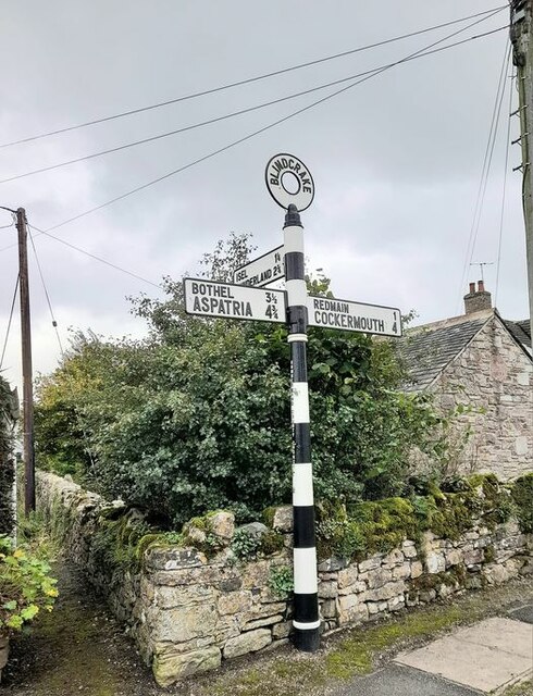
Blindcrake

Civil Parish in Cumberland Allerdale

England

Blindcrake

A595 at Bridekirk turn
A595 at Bridekirk turn Credit: Colin Pyle

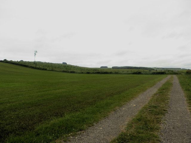
Blindcrake is a civil parish located in the county of Cumberland, in the northwestern part of England. Situated in the Allerdale district, the parish encompasses a small rural area covering approximately 10 square kilometers. It is situated around 10 miles southwest of the town of Cockermouth and lies within the picturesque Lake District National Park.

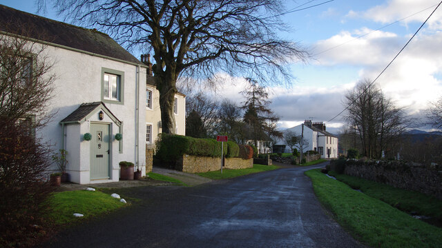
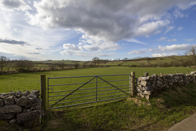
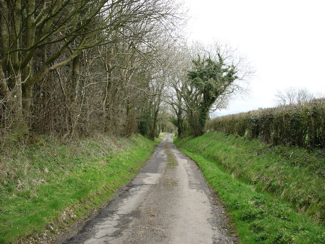
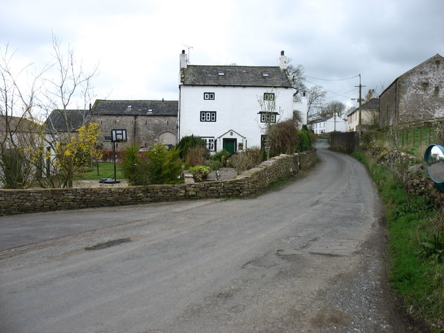
The village of Blindcrake is the main settlement within the parish, with a population of around 200 residents. It is a quintessential English countryside village, characterized by its tranquil setting and charming traditional stone houses. The landscape surrounding Blindcrake is predominantly agricultural, with rolling hills, meadows, and patches of woodland.

Blindcrake is well-known for its strong sense of community and close-knit residents. The village benefits from a range of amenities, including a village hall, a primary school, and a church. The village hall serves as a hub for various community activities and local events, fostering a vibrant social scene.

The parish is also surrounded by several natural attractions, making it an ideal destination for outdoor enthusiasts. The nearby Lake District National Park provides opportunities for hiking, cycling, and wildlife spotting. Additionally, the village is in close proximity to Bassenthwaite Lake, which is renowned for its stunning views and diverse birdlife.

Overall, Blindcrake offers a peaceful and idyllic lifestyle, with its rural beauty, strong community spirit, and access to the stunning natural landscapes of Cumbria.

If you have any feedback on the listing, please let us know in the comments section below.

Blindcrake Images

Images are sourced within 2km of 54.698358/-3.341318 or Grid Reference NY1334. Thanks to Geograph Open Source API. All images are credited.

A595 at Bridekirk turn
Blindcrake Looking west along unnamed road, towards the village green.
Blindcrake
Looking west along unnamed road, towards the village green.
Blindcrake Looking south, on the road to Isel. Gill Beck is on the right. 
The temporary 'Works access 150 yards' sign refers to the recently installed United Utilities Thirlmere to West Cumbria pipeline.
Blindcrake
Looking south, on the road to Isel. Gill Beck is on the right. The temporary 'Works access 150 yards' sign refers to the recently installed United Utilities Thirlmere to West Cumbria pipeline.
Ellers Wood Gateway to field by Ellers wood
Ellers Wood
Gateway to field by Ellers wood
Gateway to field Gateway to field on road to Laal Moota
Gateway to field
Gateway to field on road to Laal Moota
Direction Sign - Signpost in Blindcrake Located on the southwest side of a junction in the village centre by a grit bin, a litter bin and a bus shelter. Blindcrake parish. 3 arms and annulus finial. See also <span class="nowrap"><a title="http://www.geog.port.ac.uk/webmap/thelakes/photos/bvz04.jpg" rel="nofollow ugc noopener" href="http://www.geog.port.ac.uk/webmap/thelakes/photos/bvz04.jpg">Link</a><img style="margin-left:2px;" alt="External link" title="External link - shift click to open in new window" src="https://s1.geograph.org.uk/img/external.png" width="10" height="10"/></span>.

Milestone Society National ID: CU_NY1434B
Direction Sign - Signpost in Blindcrake
Located on the southwest side of a junction in the village centre by a grit bin, a litter bin and a bus shelter. Blindcrake parish. 3 arms and annulus finial. See also LinkExternal link. Milestone Society National ID: CU_NY1434B
The lane to Bridekirk
Farmland near Bridekirk
Redmain village
Redmain village
The lane to Cockermouth
Fields by the road to Bridekirk
Sheep in a field north of Bridekirk Sheep grazing in a field to the north of Bridekirk.
Sheep in a field north of Bridekirk
Sheep grazing in a field to the north of Bridekirk.
Farm track beside a grass field A farm track providing access to fields set back from the road behind the grass field to the left which has recently had a crop of grass removed.
Farm track beside a grass field
A farm track providing access to fields set back from the road behind the grass field to the left which has recently had a crop of grass removed.
Arable field north east of Bridekirk An arable field in which a spring cereal crop (most likely barley) is growing. This field is unusual as most of the fields in the local area are grass and used for grazing animals.
Arable field north east of Bridekirk
An arable field in which a spring cereal crop (most likely barley) is growing. This field is unusual as most of the fields in the local area are grass and used for grazing animals.
Freshly replanted plantation A plantation has been harvested in recent years and replanted with new trees.
Freshly replanted plantation
A plantation has been harvested in recent years and replanted with new trees.
Farm track leaving a country road A farm track diverges to the right from the minor road between Bridekirk and Gilcrux.
Farm track leaving a country road
A farm track diverges to the right from the minor road between Bridekirk and Gilcrux.
Boundary between grass fields A dry stone wall separates two grass fields on the bank to the north of Bridekirk.
Boundary between grass fields
A dry stone wall separates two grass fields on the bank to the north of Bridekirk.
Access track to fields A track used to access fields which lie away from the county road between Gilcrux and Bridekirk.
Access track to fields
A track used to access fields which lie away from the county road between Gilcrux and Bridekirk.
Show me another place!

Blindcrake is located at Grid Ref: NY1334 (Lat: 54.698358, Lng: -3.341318)

Administrative County: Cumbria

District: Allerdale

Police Authority: Cumbria

What 3 Words

///sleeper.registers.upgrading. Near Cockermouth, Cumbria

Nearby Locations

Hags Wood Blindcrake

Related Wikis

Redmain, Cumbria

Redmain is a small hamlet in the Isel Valley and parish of Blindcrake within the Lake District National Park in Cumbria, England. The hamlet lies on the...

Bridekirk

Bridekirk is a village and civil parish in the Cumberland district in the county of Cumbria, England. It is around 3.2 kilometres (2 mi) north of the Derwent...
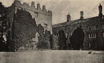
Isel Hall

Isel Hall is an ancient Cumbrian residence that sits on a steep rise on the northern banks of the River Derwent, two miles (3.2 km) south of Bassenthwaite...

Blindcrake

Blindcrake is a village and civil parish within the Isel Valley, in the Lake District National Park, in Cumbria, England, historically part of Cumberland...

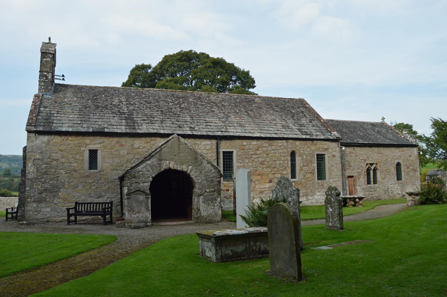
St Michael's Church, Isel

St Michael's Church is located by the side of the River Derwent in the dispersed settlement of Isel, in the civil parish of Blindcrake, Cumbria, England...
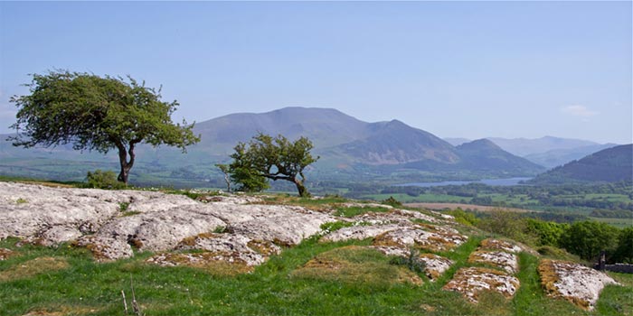
Clints Crags

Clints Crags is a small fell in the north of the English Lake District near Blindcrake, Cumbria. It has its own chapter in Alfred Wainwright's The Outlying...

Cockermouth School

Cockermouth School is a coeducational secondary school and sixth form located in Cockermouth in the English county of Cumbria.Previously a community school...

Watch Hill (Cockermouth)

Watch Hill is a small hill lying on the north-western fringe of the Lake District in England. The name Setmurthy Common is sometimes used (including by...

Nearby Amenities

Located within 500m of 54.698358,-3.341318
Williamsgate
Place: locality
Lat/Long: 54.6967782/-3.339988
Power: pole
Lat/Long: 54.7019753/-3.3388835
Power: pole
Lat/Long: 54.7011849/-3.3387467
Power: pole
Lat/Long: 54.7003216/-3.3385912
Power: pole
Lat/Long: 54.699559/-3.3384436
Power: pole
Lat/Long: 54.6988197/-3.3383364
Power: pole
Lat/Long: 54.6980214/-3.3381674
Power: pole
Lat/Long: 54.6965861/-3.3378321
Power: pole
Lat/Long: 54.6959707/-3.3376524
Power: pole
Lat/Long: 54.6952623/-3.3374485
Power: pole
Lat/Long: 54.6945369/-3.3372259
Power: pole
Lat/Long: 54.6965702/-3.3345157
Power: pole
Lat/Long: 54.6960912/-3.3353838
Power: pole
Lat/Long: 54.695316/-3.3367768
Power: pole
Lat/Long: 54.6945359/-3.3381906
The data included in this document is from www.openstreetmap.org. The data is made available under ODbL.

Have you been to Blindcrake?

Leave your review of Blindcrake below (or comments, questions and feedback).