Blacko

Civil Parish in Yorkshire Pendle

England

Blacko

Moorcock Inn Located on a bend on the A682, this popular country pub dates from the 18th century. It is seen here in 1996 when it was a Thwaites house.
Moorcock Inn Credit: Stephen McKay

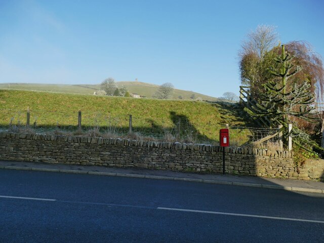
Blacko is a small civil parish located in the county of Yorkshire, England. Situated on the southern edge of the beautiful Pendle Hill, the village offers picturesque views and a tranquil atmosphere. It is part of the borough of Pendle and has a population of around 800 residents.

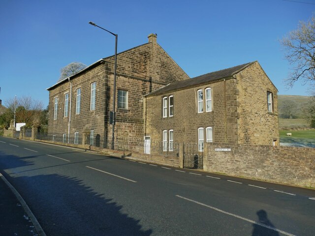
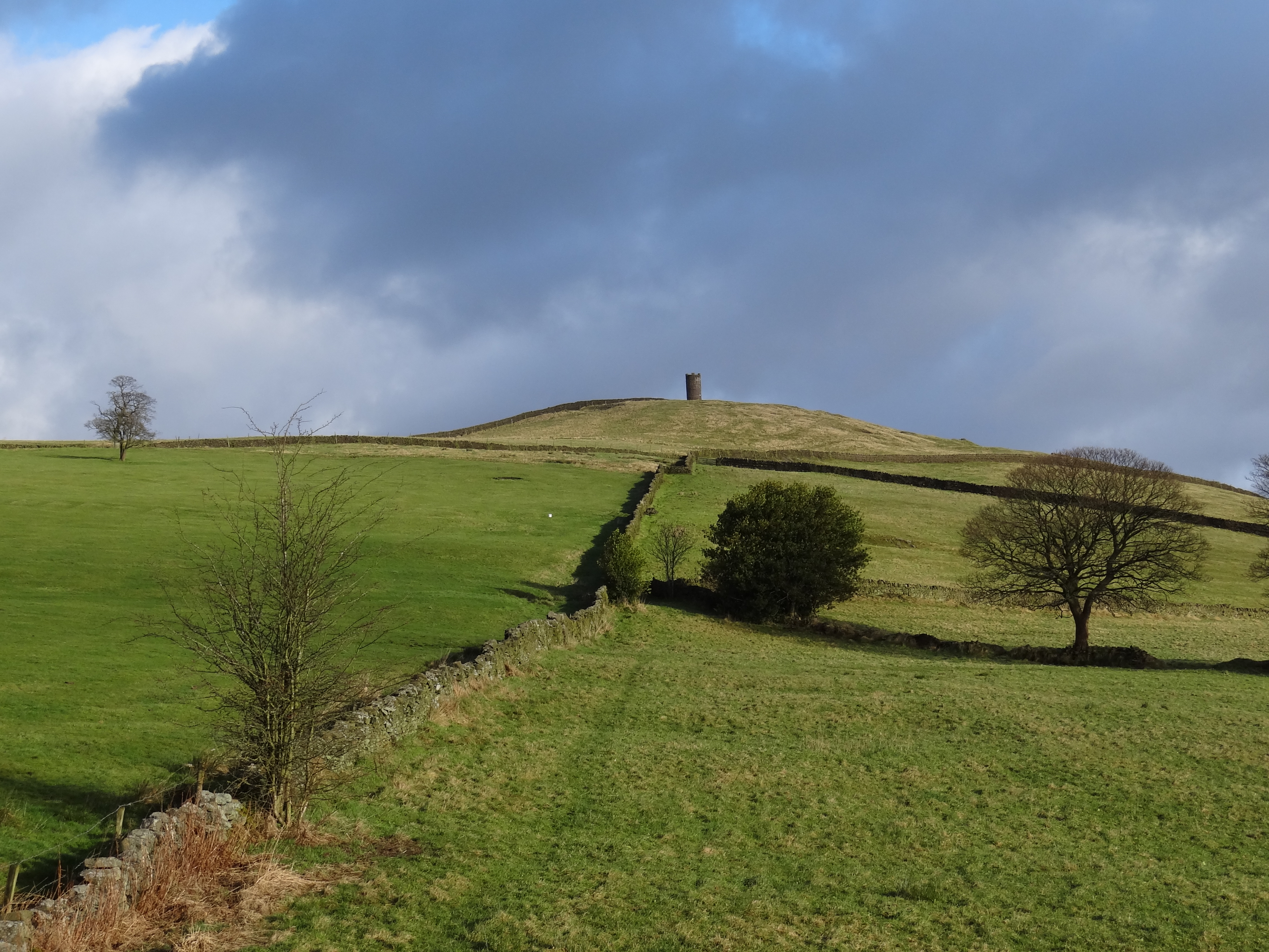
The village is well-known for its historic buildings and charming architecture. The Stansfield Tower, a prominent landmark, stands tall in the center of Blacko. Built in 1890, the tower offers panoramic views of the surrounding countryside and is a popular destination for tourists and locals alike.

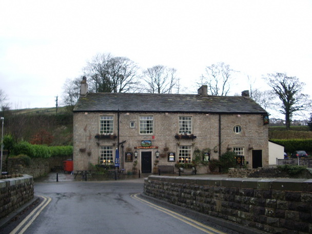
Blacko also boasts a thriving community spirit with various amenities and activities available for residents. The village has a primary school, a village hall, and a local pub, providing essential services and opportunities for socialization. Additionally, there are several walking and hiking trails in the area, allowing outdoor enthusiasts to explore the natural beauty of the region.

The parish is also renowned for its connection to the Pendle Witch Trials of 1612. Nearby Pendle Hill was the site of alleged witchcraft activities, and Blacko played a role in the historical events that unfolded during that time. Today, the village embraces its historical significance and attracts visitors interested in learning about this dark chapter in England's past.

In summary, Blacko, Yorkshire, is a charming civil parish offering a peaceful environment, stunning views, and a strong sense of community. With its historic landmarks and connection to the Pendle Witch Trials, the village presents an intriguing blend of history and natural beauty.

If you have any feedback on the listing, please let us know in the comments section below.

Blacko Images

Images are sourced within 2km of 53.877575/-2.222016 or Grid Reference SD8542. Thanks to Geograph Open Source API. All images are credited.

Moorcock Inn Located on a bend on the A682, this popular country pub dates from the 18th century. It is seen here in 1996 when it was a Thwaites house.
Moorcock Inn
Located on a bend on the A682, this popular country pub dates from the 18th century. It is seen here in 1996 when it was a Thwaites house.
The Cross Gaits, Blacko The grade II listed pub (list entry 1273141) dates probably from the 18th century, and was highly commended by another contributor <a href="https://www.geograph.org.uk/photo/1732505">SD8641 : Blacko, Lancashire:  The 'Cross Gaits'</a> but alas it was closed on a Monday. Not long after my visit I saw a media report that the pub was to be closed and put up for sale in 2023.
The Cross Gaits, Blacko
The grade II listed pub (list entry 1273141) dates probably from the 18th century, and was highly commended by another contributor SD8641 : Blacko, Lancashire: The 'Cross Gaits' but alas it was closed on a Monday. Not long after my visit I saw a media report that the pub was to be closed and put up for sale in 2023.
The Cross Gaits, Blacko - detail See <a href="https://www.geograph.org.uk/photo/7361395">SD8641 : The Cross Gaits, Blacko</a> for context. The stone tablet is dated 1736 and bears the odd inscription 'good ale to morrow for nothing', which could perhaps mean that beer once poured will go off by the next day, or that the pleasures of a night out are forgotten with the morning's hangover.
The Cross Gaits, Blacko - detail
See SD8641 : The Cross Gaits, Blacko for context. The stone tablet is dated 1736 and bears the odd inscription 'good ale to morrow for nothing', which could perhaps mean that beer once poured will go off by the next day, or that the pleasures of a night out are forgotten with the morning's hangover.
Layby opposite the Cross Gaits pub The pub also has its own car park round the back. For a close-up of the old roadsign see <a href="https://www.geograph.org.uk/photo/6687438">SD8641 : Direction Sign – Signpost on Barnoldswick Road</a>. Milestone Society National ID: LA_SD8641
Layby opposite the Cross Gaits pub
The pub also has its own car park round the back. For a close-up of the old roadsign see SD8641 : Direction Sign – Signpost on Barnoldswick Road. Milestone Society National ID: LA_SD8641
Beverley Road on a frosty morning The hoar frost brings out the winter form of the trees.
Beverley Road on a frosty morning
The hoar frost brings out the winter form of the trees.
Entering Blacko from the east A welcome sign on Beverley Road.
Entering Blacko from the east
A welcome sign on Beverley Road.
Playground on Beverley Road, Blacko
Blacko and white The village hardly lives up to its name on a frosty day like this, with pampas grass in the recreation ground and trees in the allotments beyond covered in hoar frost.
Blacko and white
The village hardly lives up to its name on a frosty day like this, with pampas grass in the recreation ground and trees in the allotments beyond covered in hoar frost.
Rear of Blacko primary school See <a href="https://www.geograph.org.uk/photo/4125291">SD8541 : Blacko School</a> for the front of the school building. This rear view on Beverley Road is of interest mainly to show the community defibrillator.
Rear of Blacko primary school
See SD8541 : Blacko School for the front of the school building. This rear view on Beverley Road is of interest mainly to show the community defibrillator.
Roadsign in the centre of Blacko At the junction of Gisburn Road and Beverley Road. See <a href="https://www.geograph.org.uk/photo/6679534">SD8541 : Direction Sign – Signpost in Blacko</a> for a close look. Milestone Society National ID: LA_SD8541B.
Roadsign in the centre of Blacko
At the junction of Gisburn Road and Beverley Road. See SD8541 : Direction Sign – Signpost in Blacko for a close look. Milestone Society National ID: LA_SD8541B.
Blacko Evangelical Chapel Formerly Ebenezer Methodist Chapel <a href="https://www.geograph.org.uk/photo/4455395">SD8541 : Blacko: Ebenezer Chapel</a>.
Blacko Evangelical Chapel
Formerly Ebenezer Methodist Chapel SD8541 : Blacko: Ebenezer Chapel.
Blacko war memorial Close to the chapel, designed by Thomas Arthur Darcy Braddell and erected in 1921. The flagpole was added in 2014 to mark the centenary of the Great War. The memorial was listed grade II in 2018 (list entry 1452765) where a detailed description is given.
Blacko war memorial
Close to the chapel, designed by Thomas Arthur Darcy Braddell and erected in 1921. The flagpole was added in 2014 to mark the centenary of the Great War. The memorial was listed grade II in 2018 (list entry 1452765) where a detailed description is given.
Postbox, Gisburn road, Blacko This is a modern box on a metal pole, but its location, as so often, appears to be dictated by the fact that there used to be a post office just a few metres down the road (now a private house).
Postbox, Gisburn road, Blacko
This is a modern box on a metal pole, but its location, as so often, appears to be dictated by the fact that there used to be a post office just a few metres down the road (now a private house).
Footpath towards Blacko Hill The path appears to be heading to the tower, but actually only goes to the top of this field then joins another path running along the hillside. There is no public access to the tower itself.
Footpath towards Blacko Hill
The path appears to be heading to the tower, but actually only goes to the top of this field then joins another path running along the hillside. There is no public access to the tower itself.
Entering Blacko from the west A name sign on the A682, in a form common in this part of Lancashire. <a href="https://www.geograph.org.uk/photo/6038733">SD8541 : Old Village Signpost by the A6062, Blacko Parish</a> shows it in close-up.  Milestone Society National ID: LA_SD8541.
Entering Blacko from the west
A name sign on the A682, in a form common in this part of Lancashire. SD8541 : Old Village Signpost by the A6062, Blacko Parish shows it in close-up. Milestone Society National ID: LA_SD8541.
View from Blacko to Pendle The hill is 5km almost due west of this end of the village. Viewed here on a frosty December day.
View from Blacko to Pendle
The hill is 5km almost due west of this end of the village. Viewed here on a frosty December day.
Low-lying cloud in the valley of the Pendle Water Typical of a temperature inversion on a still, cold winter day.
Low-lying cloud in the valley of the Pendle Water
Typical of a temperature inversion on a still, cold winter day.
Footpath to Admergill The path follows the line of a fence towards the valley bottom.
Footpath to Admergill
The path follows the line of a fence towards the valley bottom.
Show me another place!

Blacko is located at Grid Ref: SD8542 (Lat: 53.877575, Lng: -2.222016)

Division: West Riding

Administrative County: Lancashire

District: Pendle

Police Authority: Lancashire

What 3 Words

///resonated.freezing.handbook. Near Barrowford, Lancashire

Related Wikis

Blacko

Blacko is a village and civil parish in the Pendle district of Lancashire, England. Before local government reorganisation in 1974 the village lay on...

Higherford

Higherford is a village in the Pendle district of Lancashire, England. Although it is a village in its own right and shown on maps, it is sometimes confused...

Roughlee

Roughlee is a village in the civil parish of Roughlee Booth, in the Pendle district, in the county of Lancashire, England. It is close to Nelson, Barrowford...

Roughlee Booth

Roughlee Booth is a civil parish located in Pendle, Lancashire. It is approximately 449.43 hectares in size and situated in the Forest of Bowland AONB...

Nearby Amenities

Located within 500m of 53.877575,-2.222016
Man Made: tower
Lat/Long: 53.8757728/-2.2150294
The data included in this document is from www.openstreetmap.org. The data is made available under ODbL.

Have you been to Blacko?

Leave your review of Blacko below (or comments, questions and feedback).