Bishopstone

Civil Parish in Herefordshire

England

Bishopstone

Bridge Sollers Bridge According to a plaque on this bridge, the first bridge here was opened in 1896. The present bridge, the second on this site, was opened on 31 March 2004 by Bill Wiggin MP.
Bridge Sollers Bridge Credit: Stephen McKay

Bishopstone is a civil parish located in the county of Herefordshire, England. Situated in the heart of the beautiful Wye Valley, it is approximately 8 miles southwest of Hereford, the county town. The parish covers an area of around 5 square miles and is home to a small population of approximately 250 residents.

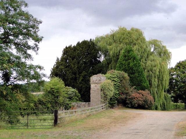
The picturesque village of Bishopstone is nestled amidst rolling countryside, surrounded by lush green fields and woodlands. It is known for its unspoiled natural beauty, making it an ideal destination for outdoor enthusiasts and nature lovers. The River Wye, one of the UK's most stunning rivers, flows nearby, offering opportunities for fishing, boating, and riverside walks.

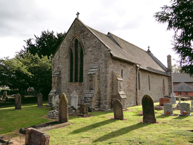
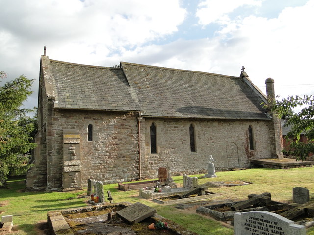
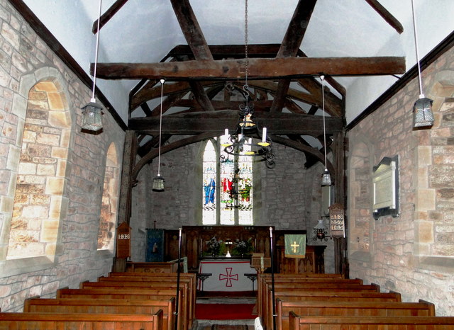
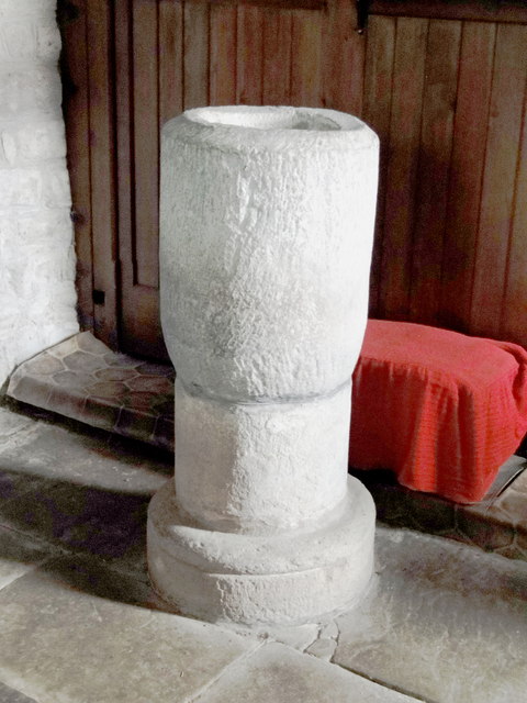
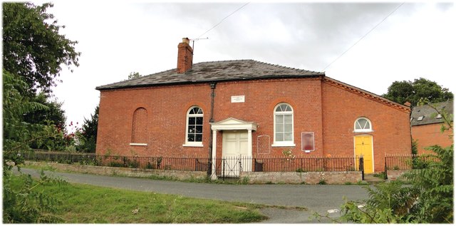
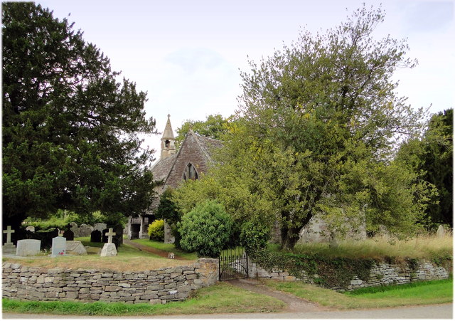
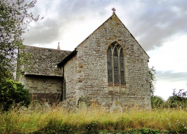
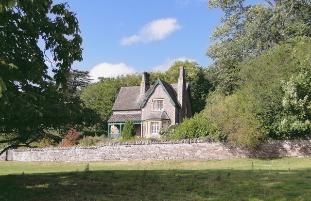
The village itself exudes charm with its traditional stone-built cottages and historic buildings. St. Lawrence Church, dating back to the 13th century, stands as a prominent landmark, showcasing the area's rich history. The local community is close-knit and friendly, with a strong sense of community spirit.

Despite its rural setting, Bishopstone benefits from good transport links, with regular bus services connecting the village to nearby towns and cities. The surrounding area offers a range of amenities, including shops, schools, and healthcare facilities, ensuring residents have easy access to essential services.

Bishopstone provides a tranquil and idyllic setting for those seeking a peaceful rural lifestyle, while still being within reach of urban conveniences. Its stunning natural surroundings and sense of community make it an attractive place to live or visit for those looking to escape the hustle and bustle of city life.

If you have any feedback on the listing, please let us know in the comments section below.

Bishopstone Images

Images are sourced within 2km of 52.083806/-2.848758 or Grid Reference SO4143. Thanks to Geograph Open Source API. All images are credited.

Bridge Sollers Bridge According to a plaque on this bridge, the first bridge here was opened in 1896. The present bridge, the second on this site, was opened on 31 March 2004 by Bill Wiggin MP.
Bridge Sollers Bridge
According to a plaque on this bridge, the first bridge here was opened in 1896. The present bridge, the second on this site, was opened on 31 March 2004 by Bill Wiggin MP.
Bridge Sollers Bridge This modern bridge, replacing one dating from 1896, was opened in 2004.
Bridge Sollers Bridge
This modern bridge, replacing one dating from 1896, was opened in 2004.
The Weir Nursing Home This fine old Georgian house caters for elderly people with care needs and has accommodation for 35 residents.
The Weir Nursing Home
This fine old Georgian house caters for elderly people with care needs and has accommodation for 35 residents.
River Wye, The Weir Two visitors to the National trust's The Weir garden examine the river.
River Wye, The Weir
Two visitors to the National trust's The Weir garden examine the river.
St Michael, Kenchester Lovely and clearly much loved small Norman church away from everything except Court Farm and the humps and bumps of the remains of Magnis, the Roman town.
St Michael, Kenchester
Lovely and clearly much loved small Norman church away from everything except Court Farm and the humps and bumps of the remains of Magnis, the Roman town.
St Michael, Kenchester The North side of this delightful small church, dating from Norman times.
St Michael, Kenchester
The North side of this delightful small church, dating from Norman times.
St Michael, Kenchester Interior, looking East.
St Michael, Kenchester
Interior, looking East.
St Michael, Kenchester The font - a very early piece and tempting to think that as the church is on the site of a Roman town it could be a re-used column.
St Michael, Kenchester
The font - a very early piece and tempting to think that as the church is on the site of a Roman town it could be a re-used column.
Lady Southampton's Chapel, Kenchester Dating from 1830 and still very much in use.
Lady Southampton's Chapel, Kenchester
Dating from 1830 and still very much in use.
St Lawrence, Bishopstone The parish cat stalks the church path, having seen off the last visitor of the day to this highly unusual building.
St Lawrence, Bishopstone
The parish cat stalks the church path, having seen off the last visitor of the day to this highly unusual building.
St Lawrence, Bishopstone The East end, showing the typical 13th century 'Herefordshire' window.
St Lawrence, Bishopstone
The East end, showing the typical 13th century 'Herefordshire' window.
St Lawrence, Bishopstone At my last visit the West end was taped off as the belfry was deemed unsafe. It has since been repaired by someone who clearly knew what they were doing.
St Lawrence, Bishopstone
At my last visit the West end was taped off as the belfry was deemed unsafe. It has since been repaired by someone who clearly knew what they were doing.
Bishopstone Court The 'ruinous gateway of c.1600' noted by Pevsner. A notice about unfriendly dogs prevented a closer look.
Bishopstone Court
The 'ruinous gateway of c.1600' noted by Pevsner. A notice about unfriendly dogs prevented a closer look.
The Steps, Garnons Delightful timber framed house at the intersection of Offa's Dyke and a Roman road.
The Steps, Garnons
Delightful timber framed house at the intersection of Offa's Dyke and a Roman road.
Gardener's Cottage, Garnons Solid Victorian staff house overlooking Garnons park.
Gardener's Cottage, Garnons
Solid Victorian staff house overlooking Garnons park.
Gardener's Cottage, Garnons A full frontal view, involving a jump over the park gate.
Gardener's Cottage, Garnons
A full frontal view, involving a jump over the park gate.
Field of sheep, Bishopstone A field of sheep at Bishopstone.
Field of sheep, Bishopstone
A field of sheep at Bishopstone.
Bridleway to Preston-on-Wye 2 Taken nearly 5 and a half years since the same scene by the same photographer - <a href="https://www.geograph.org.uk/photo/349075">SO4042 : Bridleway to Preston-on-Wye</a>.
Bridleway to Preston-on-Wye 2
Taken nearly 5 and a half years since the same scene by the same photographer - SO4042 : Bridleway to Preston-on-Wye.
Show me another place!

Bishopstone is located at Grid Ref: SO4143 (Lat: 52.083806, Lng: -2.848758)

Unitary Authority: County of Herefordshire

Police Authority: West Mercia

What 3 Words

///replaces.concerned.should. Near Bridge Sollers, Herefordshire

Nearby Locations

Bishopstone Bishopstone

Related Wikis

Bishopstone, Herefordshire

Bishopstone is a village and civil parish in Herefordshire, England, 10 km (6.2 mi) west of Hereford, near the River Wye and the Roman town of Magnis....

Bridge Sollers

Bridge Sollers is a village and civil parish in Herefordshire, England, 10 km (6.2 mi) west of Hereford, on the River Wye. The village consists of 12 households...

Mansel Lacy

Mansel Lacy (alternatively spelled Mansell Lacy) is a small village and civil parish in Herefordshire, England. It is 7 miles (11 km) north west of Hereford...

Kenchester

Kenchester is a parish in Herefordshire, England. It is about 5.5 miles (9 km) west-northwest of Hereford. Kenchester is near the Romano-British town of...

The Weir Garden

The Weir Garden is a National Trust property near Swainshill (see Stretton Sugwas), Herefordshire, lying alongside the River Wye 5 mi (8.0 km) west of...

Magnis (Kenchester)

Magnae, sometimes Magnae Dobunnorum (Latin for "The Greats of the Dobunni") to distinguish it from the Magnae of the Carvetii on Hadrian's Wall in northern...

Byford

Byford is a village and civil parish on the River Wye in Herefordshire, England, about 11 km (7 mi) west of Hereford. According to the 2001 census, it...

Westmoor Flag railway station

Westmoor Flag railway station was a private station to the west of Mansel Lacy, Herefordshire, England. The station was opened in 1863 and may have closed...

Nearby Amenities

Located within 500m of 52.083806,-2.848758
Bus Stop
Telephone Box
Naptan AtcoCode: 2090A087800
Naptan Bearing: W
Naptan BusStopType: CUS
Naptan CommonName: Telephone Box
Naptan Indicator: adj
Naptan Landmark: Telephone Box
Naptan NaptanCode: heradjtg
Naptan Street: N/K
Naptan Verified: no
Source: naptan_import
Lat/Long: 52.0831064/-2.8449301
Bus Stop
Telephone Box
Naptan AtcoCode: 2090A18681
Naptan Bearing: E
Naptan BusStopType: CUS
Naptan CommonName: Telephone Box
Naptan Indicator: opp
Naptan Landmark: Telephone Box
Naptan NaptanCode: herajamd
Naptan Street: N/K
Naptan Verified: no
Source: naptan_import
Lat/Long: 52.0829852/-2.8450398
Bishopstone
Place: hamlet
Source: NLS - OS 1:25k 1st Series 1937-61
Wikidata: Q3783928
Lat/Long: 52.0844576/-2.8463383
Power: pole
Lat/Long: 52.0814165/-2.853629
Power: pole
Lat/Long: 52.0811643/-2.8522021
Power: pole
Lat/Long: 52.0809154/-2.8506947
Power: pole
Lat/Long: 52.0800846/-2.8498659
Power: pole
Lat/Long: 52.0793131/-2.8490236
Power: pole
Lat/Long: 52.0796774/-2.8478113
Power: pole
Lat/Long: 52.0805807/-2.8492516
Power: pole
Lat/Long: 52.081484/-2.8505874
Power: pole
Lat/Long: 52.0823247/-2.8520143
Power: pole
Lat/Long: 52.0832576/-2.8535593
Power: pole
Lat/Long: 52.0844971/-2.8538892
Power: pole
Lat/Long: 52.0855305/-2.8542271
Generator Method: photovoltaic
Generator Output Electricity: yes
Generator Source: solar
Generator Type: solar_photovoltaic_panel
Location: roof
Power: generator
Lat/Long: 52.0828373/-2.8428049
Generator Method: photovoltaic
Generator Output Electricity: yes
Generator Source: solar
Generator Type: solar_photovoltaic_panel
Location: roof
Power: generator
Lat/Long: 52.0831134/-2.8475377
Generator Method: photovoltaic
Generator Output Electricity: yes
Generator Source: solar
Generator Type: solar_photovoltaic_panel
Location: roof
Power: generator
Lat/Long: 52.0832073/-2.8488359
Generator Method: photovoltaic
Generator Output Electricity: yes
Generator Source: solar
Generator Type: solar_photovoltaic_panel
Location: roof
Power: generator
Lat/Long: 52.0829844/-2.8505002
Generator Method: photovoltaic
Generator Output Electricity: yes
Generator Source: solar
Generator Type: solar_photovoltaic_panel
Location: roof
Power: generator
Lat/Long: 52.0828834/-2.8431818
Post Box
Post Box Type: lamp
Lat/Long: 52.0829644/-2.8445341
Telephone
Defibrillator
Booth: K6
Covered: booth
Defibrillator Location: inside red phone box, Bishopstone
Emergency: defibrillator
Man Made: telephone_box
Lat/Long: 52.0829866/-2.8449901
The data included in this document is from www.openstreetmap.org. The data is made available under ODbL.

Have you been to Bishopstone?

Leave your review of Bishopstone below (or comments, questions and feedback).