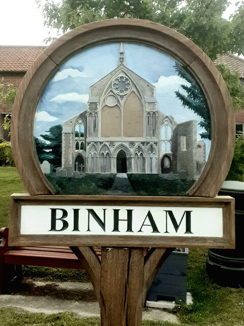
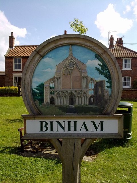
Binham

Civil Parish in Norfolk North Norfolk

England

Binham

Binham Priory View from the dormitory undercroft looking towards the church <span class="nowrap"><a title="https://historicengland.org.uk/listing/the-list/list-entry/1014862?section=official-listing" rel="nofollow ugc noopener" href="https://historicengland.org.uk/listing/the-list/list-entry/1014862?section=official-listing">Link</a><img style="margin-left:2px;" alt="External link" title="External link - shift click to open in new window" src="https://s1.geograph.org.uk/img/external.png" width="10" height="10"/></span>
Binham Priory Credit: Sandy Gerrard

Binham is a small civil parish located in the county of Norfolk, England. It is situated about 3 miles inland from the coastal town of Wells-next-the-Sea and approximately 5 miles northwest of the market town of Fakenham. The parish covers an area of around 8 square miles and is home to a population of around 350 people.

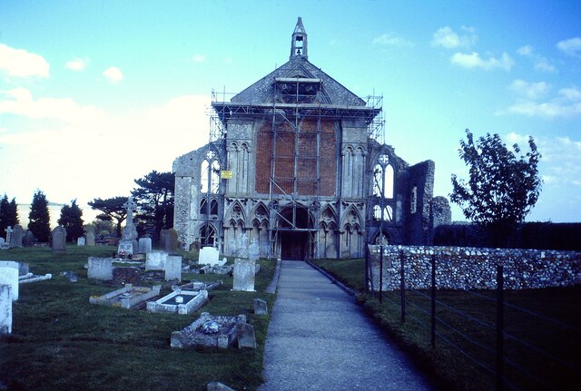
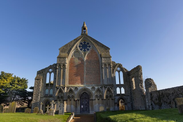
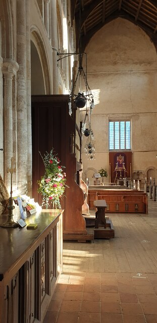
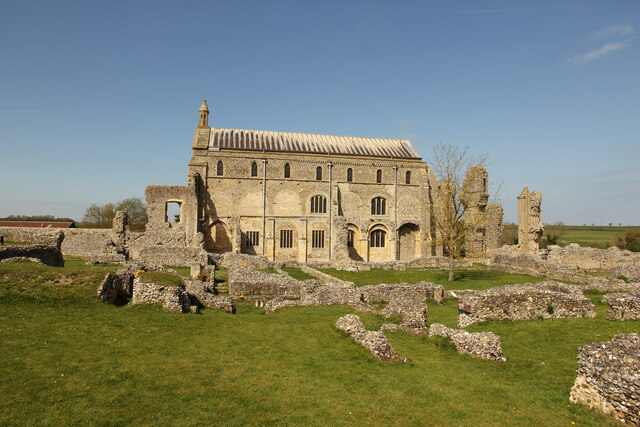
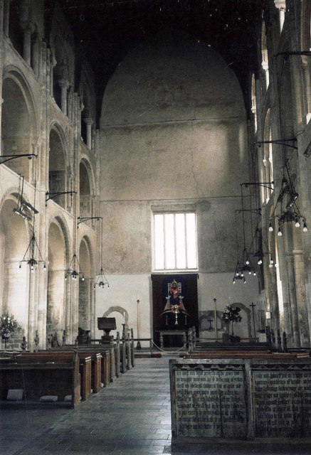
The centerpiece of Binham is the historic Binham Priory, a Benedictine monastery founded in the late 11th century. The priory, now in ruins, is a popular tourist attraction and a Grade I listed building. It is known for its impressive architectural features, including a magnificent west front with a large window and intricate carvings.

The village of Binham itself is a charming and picturesque settlement, with a mix of traditional brick and flint cottages, as well as more modern houses. It offers a peaceful and tranquil setting, surrounded by beautiful countryside and farmland. The village has a community-run village shop and a pub, providing essential amenities to its residents and visitors.

Binham is also well-known for its annual Binham Priory Summer Concerts, a series of classical music performances held in the priory ruins during the summer months. These concerts attract music enthusiasts from near and far and contribute to the cultural vibrancy of the area.

Overall, Binham is a delightful and historic village with a strong sense of community, offering a glimpse into Norfolk's rich heritage and providing a peaceful escape for both residents and visitors.

If you have any feedback on the listing, please let us know in the comments section below.

Binham Images

Images are sourced within 2km of 52.921524/0.935522 or Grid Reference TF9740. Thanks to Geograph Open Source API. All images are credited.

Binham Priory View from the dormitory undercroft looking towards the church <span class="nowrap"><a title="https://historicengland.org.uk/listing/the-list/list-entry/1014862?section=official-listing" rel="nofollow ugc noopener" href="https://historicengland.org.uk/listing/the-list/list-entry/1014862?section=official-listing">Link</a><img style="margin-left:2px;" alt="External link" title="External link - shift click to open in new window" src="https://s1.geograph.org.uk/img/external.png" width="10" height="10"/></span>
Binham Priory
View from the dormitory undercroft looking towards the church LinkExternal link
Binham Priory Church Repairs were being carried out when this photograph was taken in 1989 <span class="nowrap"><a title="https://historicengland.org.uk/listing/the-list/list-entry/1014862?section=official-listing" rel="nofollow ugc noopener" href="https://historicengland.org.uk/listing/the-list/list-entry/1014862?section=official-listing">Link</a><img style="margin-left:2px;" alt="External link" title="External link - shift click to open in new window" src="https://s1.geograph.org.uk/img/external.png" width="10" height="10"/></span>
Binham Priory Church
Repairs were being carried out when this photograph was taken in 1989 LinkExternal link
Binham Priory Kiln south of the dormitory undercroft <span class="nowrap"><a title="https://historicengland.org.uk/listing/the-list/list-entry/1014862?section=official-listing" rel="nofollow ugc noopener" href="https://historicengland.org.uk/listing/the-list/list-entry/1014862?section=official-listing">Link</a><img style="margin-left:2px;" alt="External link" title="External link - shift click to open in new window" src="https://s1.geograph.org.uk/img/external.png" width="10" height="10"/></span>
Binham Priory
Kiln south of the dormitory undercroft LinkExternal link
Binham village sign, refurbished The west end of the famous Binham Priory is featured on the village sign.
Binham village sign, refurbished
The west end of the famous Binham Priory is featured on the village sign.
Binham Priory, Norfolk Binham Priory is an English Heritage building, part of which is still used as a church.
Binham Priory, Norfolk
Binham Priory is an English Heritage building, part of which is still used as a church.
Binham Priory, Norfolk The priory is on the edge of the village.
Binham Priory, Norfolk
The priory is on the edge of the village.
Inside Binham Priory, Norfolk The priory is on the edge of the village.
Inside Binham Priory, Norfolk
The priory is on the edge of the village.
Binham Priory  Norfolk Seen on a winter's day.
Binham Priory Norfolk
Seen on a winter's day.
Binham Priory West front of The Priory Church of St. Mary & The Holy Cross
Binham Priory
West front of The Priory Church of St. Mary & The Holy Cross
Binham Priory View across the ruins to the church
Binham Priory
View across the ruins to the church
Binham Pictorial village sign and Front Street in the North Norfolk village of Binham.
Binham
Pictorial village sign and Front Street in the North Norfolk village of Binham.
Binham Priory Ruins and church at the Priory Church of St Mary and the Holy Cross.
<span class="nowrap"><a title="www.binhampriory.org" rel="nofollow ugc noopener" href="http://www.binhampriory.org">Link</a><img style="margin-left:2px;" alt="External link" title="External link - shift click to open in new window" src="https://s1.geograph.org.uk/img/external.png" width="10" height="10"/></span>
Binham Priory
Ruins and church at the Priory Church of St Mary and the Holy Cross. LinkExternal link
Binham Village Sign The old village sign that represents BINHAM
Binham Village Sign
The old village sign that represents BINHAM
Interior of St Mary & Holy Cross, Binham, Norfolk
St Mary & the Holy Cross, Binham - Poppyhead
Show me another place!

Binham is located at Grid Ref: TF9740 (Lat: 52.921524, Lng: 0.935522)

Administrative County: Norfolk

District: North Norfolk

Police Authority: Norfolk

What 3 Words

///flank.enchanted.glares. Near Wells-next-the-Sea, Norfolk

Nearby Locations

Binham Westgate

Related Wikis

Binham Priory

St Mary's Priory, Binham, or Binham Priory, is a ruined Benedictine priory located in the village of Binham in the English county of Norfolk. Today the...

Binham

Binham is a village and a civil parish in the English county of Norfolk. The village is 29.3 miles (47.2 km) north west of Norwich, 16.9 miles (27.2 km...

Cockthorpe

Cockthorpe is a village and former civil parish, now in the parish of Binham, in the North Norfolk district, in the county of Norfolk, England. It is 5...
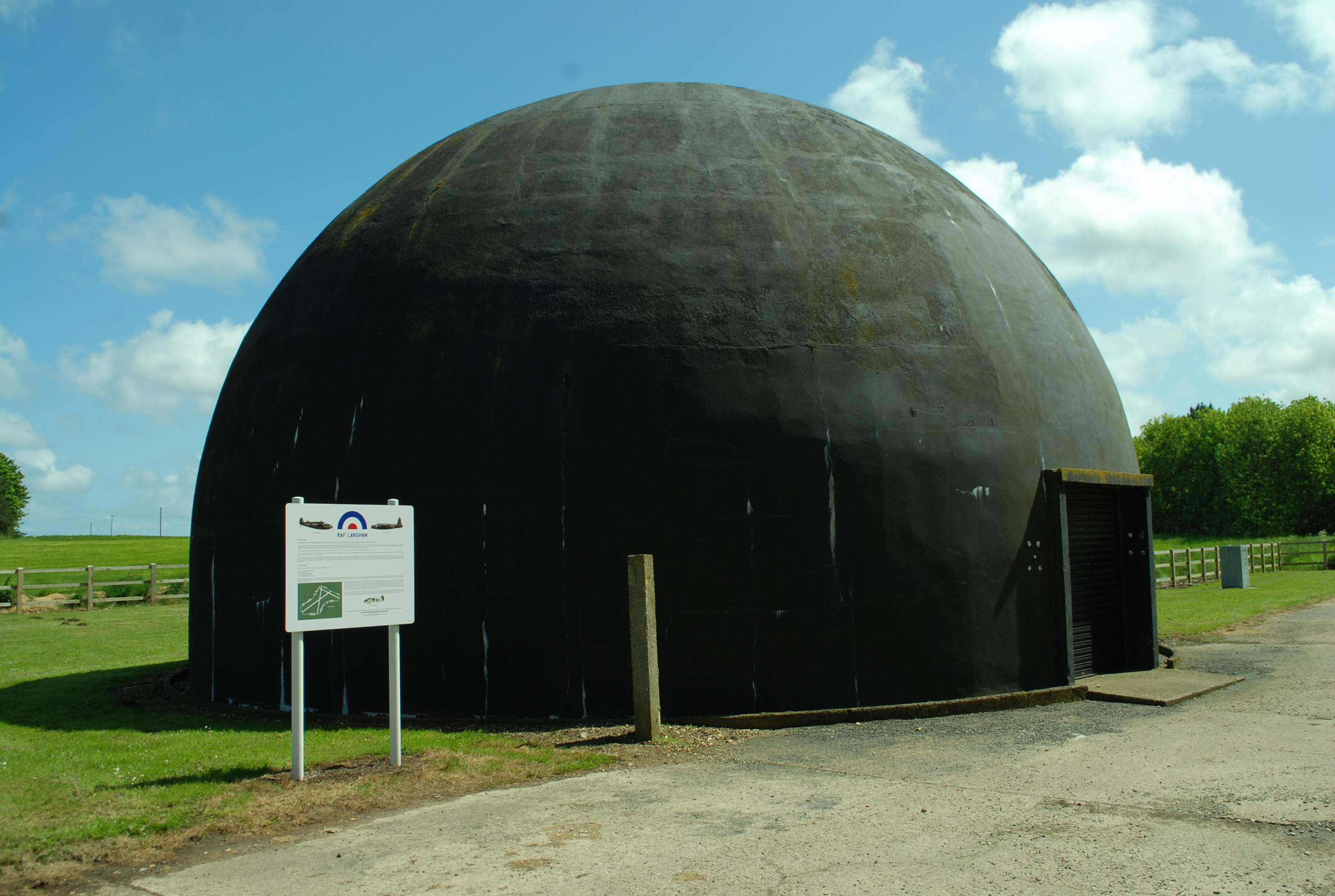
RAF Langham

Royal Air Force Langham or more simply RAF Langham is a former Royal Air Force station, located at Langham, 27.2 miles (43.8 km) northwest of Norwich in...

Walsingham Rural District

Walsingham Rural District was a rural district in the county of Norfolk, England. It was created in 1894. On 1 April 1935 it was enlarged by the addition...
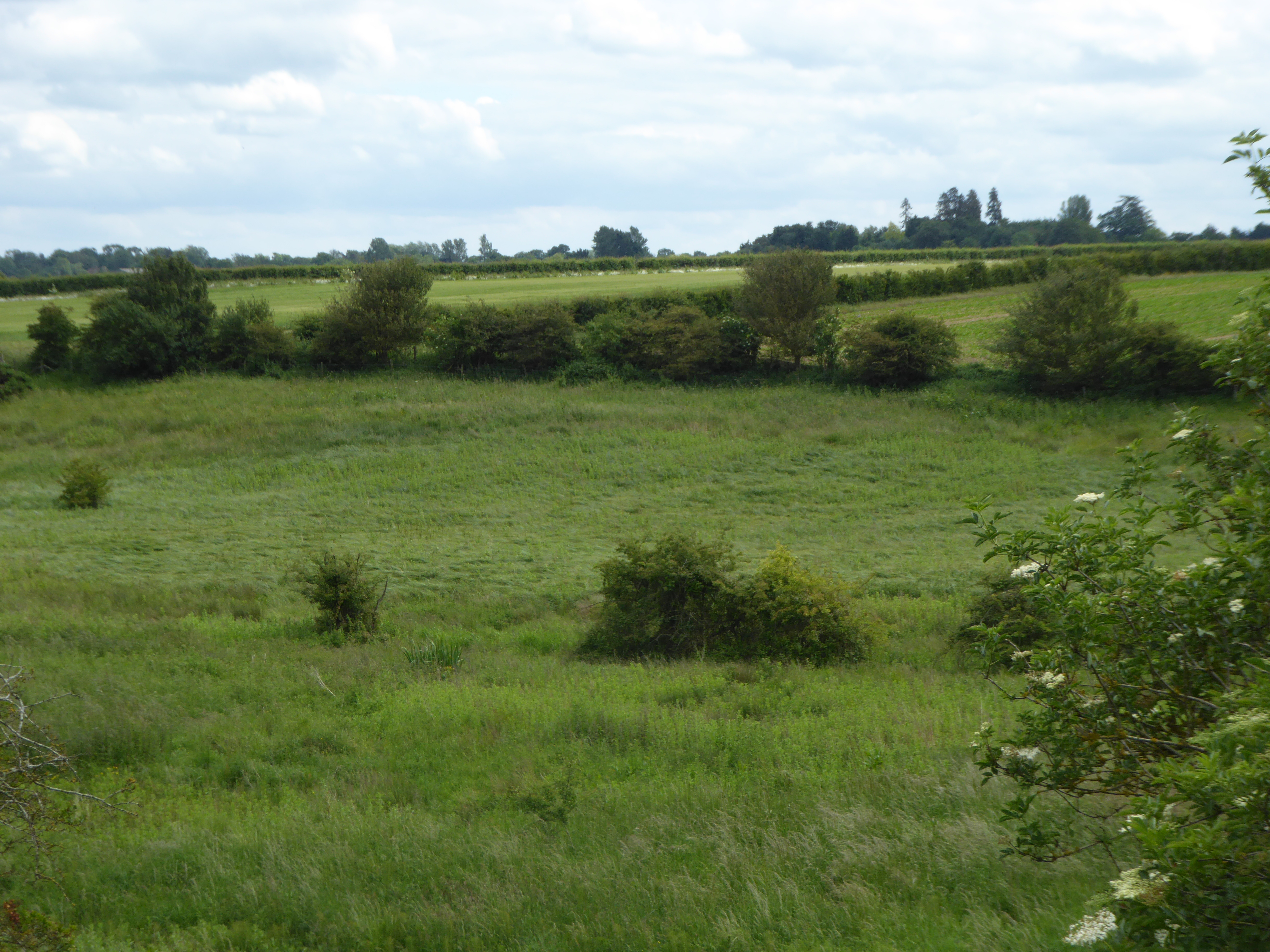
Hindringham Meadows

Hindringham Meadows is a 6.7-hectare (17-acre) Local Nature Reserve near Hindringham, north of Fakenham in Norfolk. It is owned and managed by North Norfolk...

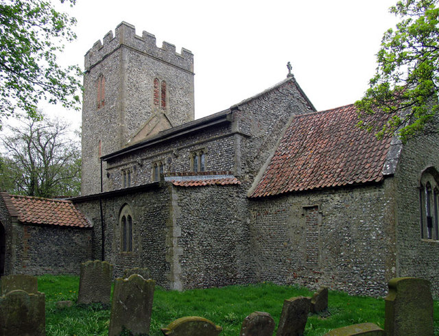
St John and St Mary, Stiffkey

St John the Baptist and St Mary's Church is the parish church of Stiffkey in the English county of Norfolk. It is dedicated to St John the Baptist and...

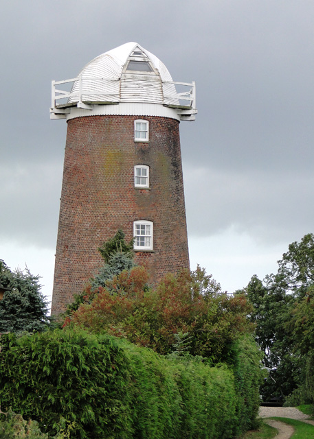
Lower Green Mill, Hindringham

Lower Green Mill is a tower mill at Lower Green, located to the north of the village of Hindringham in the English county of Norfolk. The mill stands on...

Nearby Amenities

Located within 500m of 52.921524,0.935522
Westgate, adj;Westgate, opp
Naptan AtcoCode: 2900B284;2900B285
Naptan Bearing: W;E
Naptan BusStopType: CUS
Naptan CommonName: Westgate
Naptan Indicator: adj;opp
Naptan Landmark: Post Box;opp Post Box
Naptan Locality: Binham
Naptan NaptanCode: nfoadwjt;nfoadwjw
Naptan Street: Warham Road
Naptan Verified: no
Source: naptan_import
Lat/Long: 52.922079/0.9410246
Westgate Farm
Phone: +44 1328830006
Tourism: caravan_site
Lat/Long: 52.9216824/0.9359479
Post Box
Collection Times: Mo-Fr 14:45; Sa 10:15
Operator: Royal Mail
Operator Wikidata: Q638098
Post Box Mounting: building
Post Box Type: wall
Ref: NR21 2111
Royal Cypher: EVIIR
Royal Cypher Wikidata: Q33102324
Lat/Long: 52.9220754/0.9410655
Give Way
Lat/Long: 52.9221881/0.934178
The data included in this document is from www.openstreetmap.org. The data is made available under ODbL.

Have you been to Binham?

Leave your review of Binham below (or comments, questions and feedback).