Billingshurst

Civil Parish in Sussex Horsham

England

Billingshurst

Newbridge Newbridge, on the A272 — a new bridge, because it was built to join the Shipley and Alfold Bar to Newbridge turnpikes. The bridge crosses the River Avon, with the former bridge (now causeway) over the Wey & Arun Canal shortly to the left.
Newbridge Credit: Hugh Craddock

Billingshurst is a civil parish located in the Horsham District of West Sussex, England. Situated approximately 12 miles south-west of Horsham and 8 miles north-east of Pulborough, it covers an area of about 12 square miles.

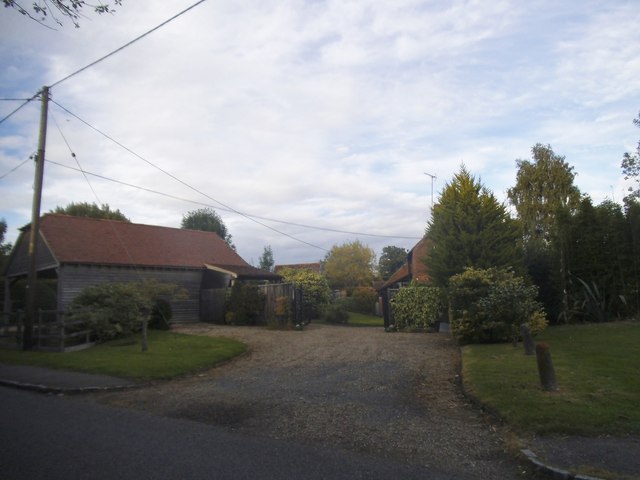
The village of Billingshurst is the main settlement within the parish and serves as a local hub for surrounding rural communities. With a population of around 8,000 people, it offers a range of amenities and facilities including shops, cafes, restaurants, pubs, and a supermarket. The village also has a primary and secondary school, providing education for local residents.

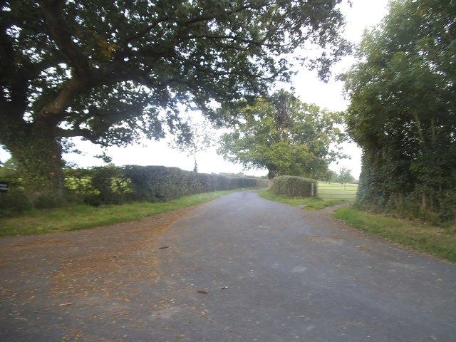
The surrounding countryside is characterized by rolling hills, picturesque farmland, and woodland areas, offering ample opportunities for outdoor activities such as hiking, cycling, and horse riding. The nearby South Downs National Park is a popular destination for nature enthusiasts and offers stunning views of the surrounding landscape.

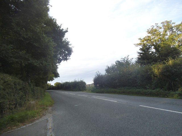
Billingshurst benefits from excellent transport links, with a railway station providing regular services to London, Gatwick Airport, and the south coast. The A29 road runs through the parish, connecting it to nearby towns and cities.

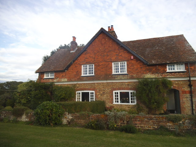
Historically, Billingshurst was an agricultural community, but in recent years it has seen some industrial development, particularly in the retail and service sectors. However, it still retains its rural charm and is known for its sense of community and friendly atmosphere.

Overall, Billingshurst, Sussex, is a thriving civil parish that offers a blend of rural tranquility, modern amenities, and easy access to larger urban centers.

If you have any feedback on the listing, please let us know in the comments section below.

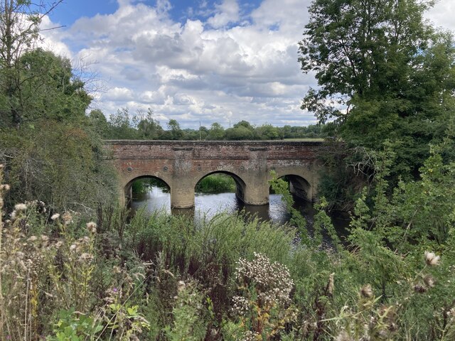
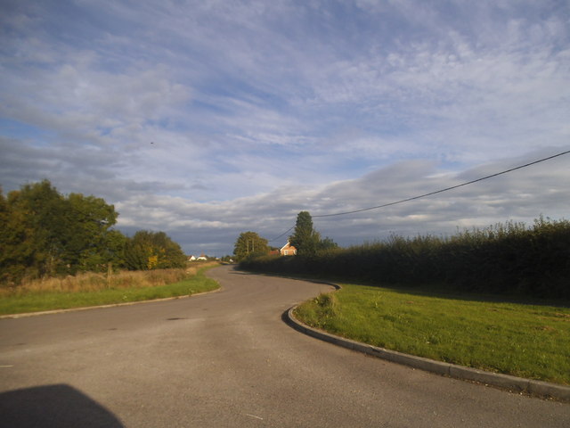
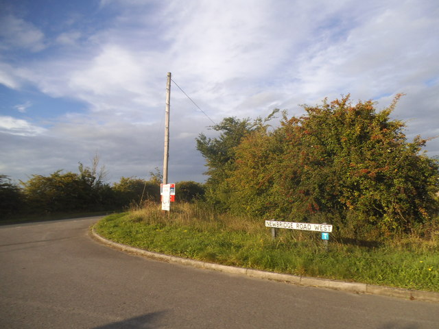
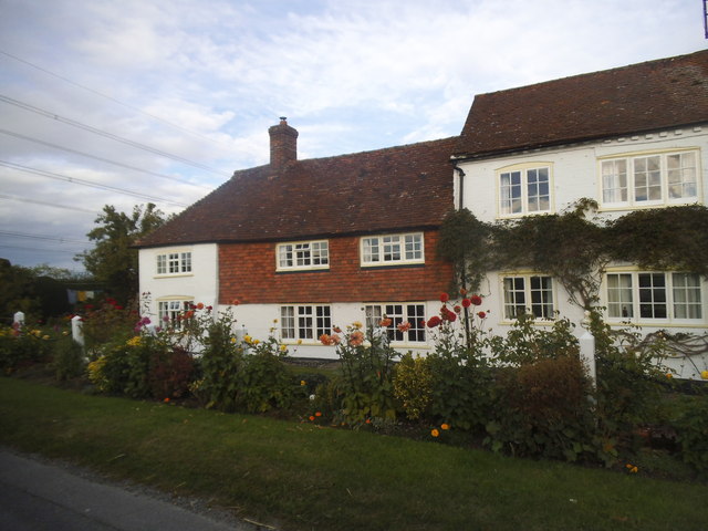
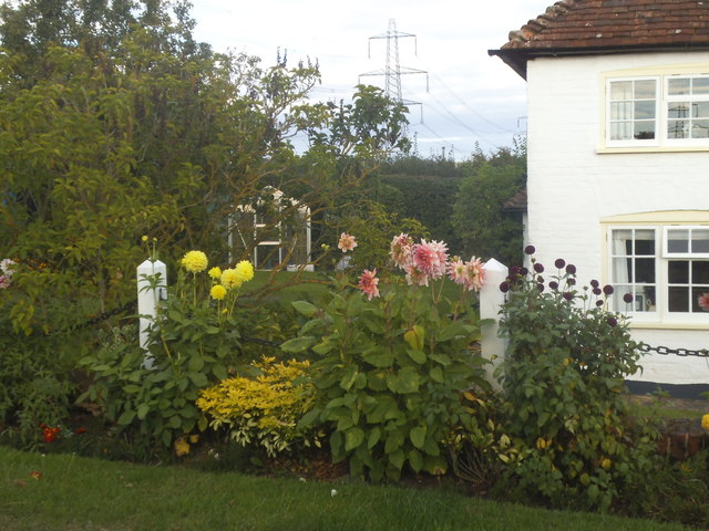
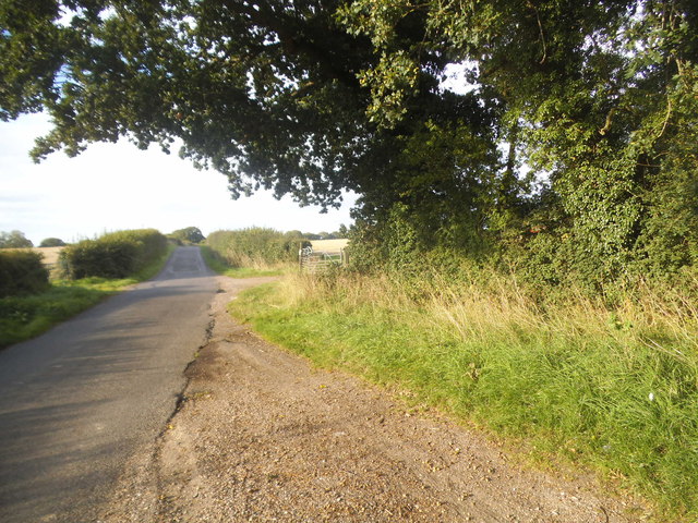
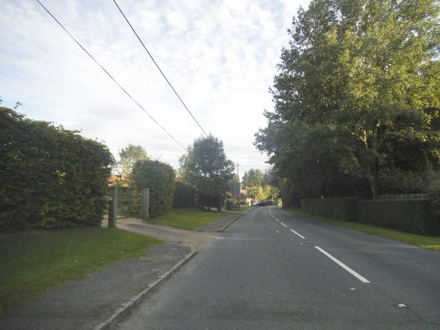
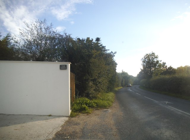
Billingshurst Images

Images are sourced within 2km of 51.020366/-0.451059 or Grid Reference TQ0825. Thanks to Geograph Open Source API. All images are credited.

Newbridge Newbridge, on the A272 — a new bridge, because it was built to join the Shipley and Alfold Bar to Newbridge turnpikes. The bridge crosses the River Avon, with the former bridge (now causeway) over the Wey & Arun Canal shortly to the left.
Newbridge
Newbridge, on the A272 — a new bridge, because it was built to join the Shipley and Alfold Bar to Newbridge turnpikes. The bridge crosses the River Avon, with the former bridge (now causeway) over the Wey & Arun Canal shortly to the left.
Newbridge Road, Billingshurst
Newbridge Road West at the junction of the A272 Newbridge Road was cut in half by the Billingshurst bypass.
Newbridge Road West at the junction of the A272
Newbridge Road was cut in half by the Billingshurst bypass.
Roundabout on the Billingshurst Bypass, Parbrook
Cottage on Rowner Road, Billingshurst
Cottage garden on Rowner Road
Rowner Road, Billingshurst
Lordings Road, Billingshurst
Lordings Road, Adversane The wall and fence has recently replaced a hedge
Lordings Road, Adversane
The wall and fence has recently replaced a hedge
Lordings Road, Adversane
Barn on Lordings Road, Billingshurst
Field entrance on Rowner Road, Billingshurst
The road to Tedfold Farm, Billingshurst
House on Rowner Road, Billingshurst
All a bit muddy
All a bit muddy
Field path goes east from the B2133 See also <a title="https://www.geograph.org.uk/photo/258778" href="https://www.geograph.org.uk/photo/258778">Link</a> from 2006 when there was a different gate.
Field path goes east from the B2133
See also Link from 2006 when there was a different gate.
Footpath junction in Great Lordings Wood
Show me another place!

Billingshurst is located at Grid Ref: TQ0825 (Lat: 51.020366, Lng: -0.451059)

Administrative County: West Sussex

District: Horsham

Police Authority: Sussex

What 3 Words

///dives.flags.structure. Near Billingshurst, West Sussex

Related Wikis

Billingshurst Unitarian Chapel

Billingshurst Unitarian Chapel is a place of worship in Billingshurst in the English county of West Sussex. The cottage-like building was erected in 1754...

Billingshurst

Billingshurst is a village and civil parish in the Horsham District of West Sussex, England. The village lies on the A29 road (the Roman Stane Street)...

The Weald School

The Weald School is a coeducational secondary school and sixth form. It caters for around 1,700 pupils in years 7 to 13, including over 300 in its sixth...

Billingshurst railway station

Billingshurst Railway Station serves the market town of Billingshurst, in West Sussex, England. It is on the Arun Valley Line 44 miles 71 chains (72.2...

Billingshurst F.C.

Billingshurst Football Club is a football club based in Billingshurst, West Sussex, England. They are currently members of the Southern Combination Division...

A29 road

The A29 is a main road in England in Surrey and chiefly in West Sussex that runs for 34.4 miles (55.4 km). == Route == The road starts at the Beare Green...

Coneyhurst Cutting

Coneyhurst Cutting is a 0.2-hectare (0.49-acre) geological Site of Special Scientific Interest south-east of Billingshurst in West Sussex. It is a Geological...

Coppedhall Hanger

Coppedhall Hanger is a 0.6-hectare (1.5-acre) geological Site of Special Scientific Interest north of Billingshurst in West Sussex. It is a Geological...

Related Videos

4 Ash Lane, Billingshurst

An immaculate, nearly new, executive home having been tastefully decorated with a contemporary design throughout. The current ...

Ash Lane, Billingshurst

Built approximately seven years ago is this extremely well presented and maintained two double bedroom, semi detached home.

Saddlers Close, Billingshurst

A spacious and well presented two double bedroom split level freehold Coach House located on a popular Cul-de-Sac location ...

Nearby Amenities

Located within 500m of 51.020366,-0.451059
Mini Roundabout
Direction: clockwise
Lat/Long: 51.0206087/-0.4529196
Mini Roundabout
Direction: clockwise
Lat/Long: 51.0241285/-0.4505628
Post Office
Billingshurst Post Office
Addr City: Billingshurst
Addr Housenumber: 14
Addr Postcode: RH14 9PB
Addr Street: Jengers Mead
Brand: Post Office
Brand Wikidata: Q1783168
Opening Hours: Mo-Fr 09:00-17:30; Sa 09:00-16:00
Ref Pol Id: 132
Website: https://www.postoffice.co.uk/branch-finder/0539120/billingshurst
Lat/Long: 51.0245823/-0.4513074
Library
Billingshurst Library
Wikidata: Q55173665
Lat/Long: 51.023142/-0.45329
Mini Roundabout
Direction: clockwise
Lat/Long: 51.02301/-0.4515847
Billingshurst
Is In: West Sussex, England, UK
Place: town
Lat/Long: 51.0229148/-0.4515772
Dentist
Healthcare: dentist
Postal Code: RH14 9QS
Lat/Long: 51.021358/-0.4526147
Post Box
Collection Plate: CP7
Collection Times: Mo-Fr 17:15; Sa 09:30
Operator: Royal Mail
Operator Wikidata: Q638098
Post Box Type: lamp
Ref: RH14 178
Royal Cypher: EIIR
Royal Cypher Wikidata: Q33102113
Lat/Long: 51.0185818/-0.4560679
Pub
The Kings Arms
Addr City: Billingshurst
Addr Housenumber: 80
Addr Postcode: RH14 9QS
Addr Street: High Street
Fixme: Check status - no longer listed in FHRS Open Data. Update: Has closed
Wikidata: Q26278072
Lat/Long: 51.022357/-0.4521458
Park & Brown Optometrists
Shop: optician
Lat/Long: 51.0241224/-0.4508412
Post Box
Collection Plate: CP7D
Collection Times: Mo-Fr 09:00; Sa 07:00
Operator: Royal Mail
Operator Wikidata: Q638098
Post Box Type: lamp
Ref: RH14 223D
Royal Cypher: EIIR
Royal Cypher Wikidata: Q33102113
Lat/Long: 51.0235139/-0.455433
Recycling
Recycling Cans: yes
Recycling Clothes: yes
Recycling Glass: yes
Recycling Paper: yes
Lat/Long: 51.0229746/-0.4528534
Bus Stop
Jengers Mead
Bus: yes
Naptan AtcoCode: 4400HR0056
Naptan Bearing: NE
Naptan CommonName: Jengers Mead
Naptan Indicator: adj Jengers Mead
Naptan Landmark: Jengers Mead
Naptan NaptanCode: wsxatgtd
Naptan Street: High Street
Naptan Verified: no
Public Transport: platform
Source: naptan_import
Lat/Long: 51.0240509/-0.4507561
Bus Stop
Jengers Mead
Bus: yes
Naptan AtcoCode: 4400HR0057
Naptan Bearing: SW
Naptan BusStopType: CUS
Naptan CommonName: Jengers Mead
Naptan Indicator: opp. Jengers Mead
Naptan Landmark: Jengers Mead
Naptan NaptanCode: wsxatgtg
Naptan Street: High Street
Naptan Verified: no
Public Transport: platform
Source: naptan_import
Lat/Long: 51.0239944/-0.4505583
Bus Stop
Kings Arms
Bus: yes
Naptan AtcoCode: 4400HR0059
Naptan Bearing: N
Naptan CommonName: Kings Arms
Naptan Indicator: o/s pub
Naptan Landmark: East Street
Naptan NaptanCode: wsxatgtm
Naptan Street: High Street
Naptan Verified: no
Public Transport: platform
Source: naptan_import
Lat/Long: 51.0220981/-0.4522418
Weald School
Naptan AtcoCode: 4400HR0060
Naptan Bearing: SW
Naptan BusStopType: CUS
Naptan CommonName: Weald School
Naptan Indicator: o/s school
Naptan Landmark: School
Naptan NaptanCode: wsxatgtp
Naptan Street: Stane Street
Naptan Verified: no
Source: naptan_import
Lat/Long: 51.0174077/-0.4553108
Weald School
Naptan AtcoCode: 4400HR0061
Naptan Bearing: SW
Naptan BusStopType: CUS
Naptan CommonName: Weald School
Naptan Indicator: o/s school
Naptan Landmark: School
Naptan NaptanCode: wsxatgtw
Naptan Street: Stane Street
Naptan Verified: no
Source: naptan_import
Lat/Long: 51.0171411/-0.4555629
Bus Stop
Silver Lane
Bus: yes
Naptan AtcoCode: 4400HR0140
Naptan Bearing: S
Naptan CommonName: Silver Lane
Naptan Indicator: opp school fields
Naptan Landmark: Oaklands
Naptan NaptanCode: wsxatmjd
Naptan Street: Station Road
Naptan Verified: no
Public Transport: platform
Source: naptan_import
Lat/Long: 51.0176787/-0.451054
Bus Stop
Junior School
Bus: yes
Naptan AtcoCode: 4400HR0141
Naptan Bearing: E
Naptan CommonName: Junior School
Naptan Indicator: opp school
Naptan Landmark: Carpenters
Naptan NaptanCode: wsxatmjg
Naptan Street: Station Road
Naptan Verified: no
Public Transport: platform
Source: naptan_import
Lat/Long: 51.0190475/-0.4525483
Junior School
Naptan AtcoCode: 4400HR0142
Naptan Bearing: W
Naptan BusStopType: CUS
Naptan CommonName: Junior School
Naptan Indicator: outside school
Naptan Landmark: Carpenters
Naptan NaptanCode: wsxatmjm
Naptan Street: Station Road
Naptan Verified: no
Source: naptan_import
Lat/Long: 51.0189966/-0.4527781
Bus Stop
Billingshurst Fire Station
Bus: yes
Naptan AtcoCode: 4400HR0143
Naptan Bearing: SE
Naptan CommonName: Billingshurst Fire Station
Naptan Indicator: Frenches Mead
Naptan Landmark: Frenches Mead
Naptan NaptanCode: wsxatmjp
Naptan Street: West Street
Naptan Verified: no
Public Transport: platform
Source: naptan_import
Lat/Long: 51.0215031/-0.455304
Bus Stop
Anvil Close
Bus: yes
Naptan AtcoCode: 4400HR0144
Naptan Bearing: N
Naptan CommonName: Anvil Close
Naptan Indicator: opp Anvil Close
Naptan Landmark: Anvil Close
Naptan NaptanCode: wsxatmjt
Naptan Street: Forge Way
Naptan Verified: no
Public Transport: platform
Source: naptan_import
Lat/Long: 51.021189/-0.4573962
Bus Stop
Forge Way
Bus: yes
Naptan AtcoCode: 4400HR0145
Naptan Bearing: N
Naptan CommonName: Forge Way
Naptan Indicator: opp Cedars Farm Close
Naptan Landmark: Cedars Farm Close
Naptan NaptanCode: wsxatmjw
Naptan Street: Forge Way
Naptan Verified: no
Public Transport: platform
Source: naptan_import
Lat/Long: 51.0196399/-0.4579039
Bus Stop
Belinus Drive
Bus: yes
Naptan AtcoCode: 4400HR0146
Naptan Bearing: W
Naptan CommonName: Belinus Drive
Naptan Indicator: opp Belinus Drive
Naptan Landmark: Belinus Drive
Naptan NaptanCode: wsxatmpa
Naptan Street: Forge Way
Naptan Verified: no
Public Transport: platform
Source: naptan_import
Lat/Long: 51.0184568/-0.4561609
Bus Stop
Belinus Drive
Bus: yes
Naptan AtcoCode: 4400HR0547
Naptan Bearing: E
Naptan CommonName: Belinus Drive
Naptan Indicator: adj Belinus Drive
Naptan Landmark: Bellinus Drive
Naptan NaptanCode: wsxdptjp
Naptan Street: Forge Way
Naptan Verified: no
Public Transport: platform
Source: naptan_import
Lat/Long: 51.0184695/-0.4557613
Bus Stop
Forge Way
Bus: yes
Naptan AtcoCode: 4400HR0548
Naptan Bearing: SE
Naptan CommonName: Forge Way
Naptan Indicator: adj Cedars Farm Close
Naptan Landmark: Cedars Farm Close
Naptan NaptanCode: wsxdptjt
Naptan Street: Forge Way
Naptan Verified: no
Public Transport: platform
Source: naptan_import
Lat/Long: 51.0192946/-0.4576302
Bus Stop
Anvil Close
Bus: yes
Naptan AtcoCode: 4400HR1112
Naptan Bearing: S
Naptan CommonName: Anvil Close
Naptan Indicator: O/s no 11
Naptan Landmark: Anvil Close
Naptan NaptanCode: wsxdtamj
Naptan Street: Forge Way
Naptan Verified: no
Public Transport: platform
Source: naptan_import
Lat/Long: 51.0213561/-0.4571055
Bus Stop
Billingshurst Fire Station
Bus: yes
Naptan AtcoCode: 4400HR1118
Naptan Bearing: NW
Naptan CommonName: Billingshurst Fire Station
Naptan Indicator: Opp Frenches Mead
Naptan Landmark: Frenches Mead
Naptan NaptanCode: wsxdtawt
Naptan Street: West Street
Naptan Verified: no
Public Transport: platform
Source: naptan_import
Lat/Long: 51.0216363/-0.4558557
Bus Stop
Silver Lane
Bus: yes
Naptan AtcoCode: 4400HR1139
Naptan Bearing: N
Naptan CommonName: Silver Lane
Naptan Indicator: opp Silver Lane
Naptan Landmark: Silver Lane
Naptan Street: Station Road
Naptan Verified: no
Public Transport: platform
Source: naptan_import
Lat/Long: 51.0178608/-0.451219
Leisure: sports_centre
Lat/Long: 51.0170976/-0.4541248
Post Box
Collection Plate: CP7
Collection Times: Mo-Fr 16:30; Sa 09:30
Operator: Royal Mail
Operator Wikidata: Q638098
Post Box Type: lamp
Ref: RH14 219
Royal Cypher: EIIR
Royal Cypher Wikidata: Q33102113
Lat/Long: 51.0190264/-0.4489968
Toilets
Lat/Long: 51.0230445/-0.4526573
Telephone
Booth: K6
Covered: booth
Listed Status: Grade II
Lat/Long: 51.0229547/-0.4518331
Leisure: playground
Lat/Long: 51.020943/-0.457675
Shop: yes
Lat/Long: 51.023673/-0.4507351
Veterinary
Lat/Long: 51.0221249/-0.4495952
Access: private
Leisure: swimming_pool
Sport: swimming
Lat/Long: 51.0165191/-0.4527065
Bank
Lat/Long: 51.0242331/-0.451633
Bank
Lat/Long: 51.0226583/-0.4537339
Traffic Signals
Traffic Signals: pedestrian_crossing
Lat/Long: 51.0225106/-0.4519403
Restaurant
Curry Village
Addr City: Billingshurst
Addr Housenumber: 5
Addr Postcode: RH14 9PB
Addr Street: Jengers Mead
Cuisine: indian
Delivery: yes
Fhrs Id: 1072012
Outdoor Seating: no
Takeaway: yes
Website: https://www.curryvillage.co.uk/
Lat/Long: 51.0241169/-0.4516264
Noexit: yes
Lat/Long: 51.0171575/-0.4512267
Crossing
Crossing: zebra
Lat/Long: 51.0171507/-0.4526313
Crossing
Crossing: zebra
Lat/Long: 51.0170752/-0.452806
Crossing
Crossing: zebra
Lat/Long: 51.0168635/-0.4525226
Note: cycleway randomly ends here
Lat/Long: 51.0221052/-0.4570726
Squiggly Paws
Addr City: Billingshurst
Addr Housenumber: 82A
Addr Postcode: RH14 9QS
Addr Street: High Street
Shop: pet_grooming
Website: https://www.squigglypaws.co.uk/
Lat/Long: 51.0222655/-0.4521856
Pharmacy
Lloyds Pharmacy
Addr City: Billingshurst
Addr Housenumber: 56
Addr Postcode: RH14 9NY
Addr Street: High Street
Brand: Lloyds Pharmacy
Brand Wikidata: Q6662870
Brand Wikipedia: en:LloydsPharmacy
Fhrs Id: 546326
Healthcare: pharmacy
Source Addr: FHRS Open Data
Lat/Long: 51.0234136/-0.4514761
Fast Food
Charcoal Grill
Addr City: Billingshurst
Addr Housenumber: 34
Addr Postcode: RH14 9PF
Addr Street: High Street
Cuisine: kebab
Fhrs Id: 205845
Source Addr: FHRS Open Data
Lat/Long: 51.0239897/-0.4508083
The Wine Shop
Addr City: Billingshurst
Addr Street: Jengers Mead
Shop: convenience
Lat/Long: 51.0246396/-0.4510701
Post Box
Collection Plate: CP7D
Collection Times: Mo-Fr 09:00; Sa 07:00
Operator: Royal Mail
Operator Wikidata: Q638098
Post Box Type: lamp
Ref: RH14 2D
Royal Cypher: EIIR
Royal Cypher Wikidata: Q33102113
Lat/Long: 51.0236619/-0.4495157
Post Box
Collection Plate: CP1
Collection Times: Mo-Fr 17:00; Sa 12:00
Operator: Royal Mail
Operator Wikidata: Q638098
Post Box Type: pillar
Ref: RH14 227
Royal Cypher: EIIR
Royal Cypher Wikidata: Q33102113
Lat/Long: 51.0244904/-0.4512149
Coral
Addr City: Billingshurst
Addr Street: Jengers Mead
Brand: Coral
Brand Wikidata: Q54621344
Brand Wikipedia: en:Coral (bookmaker)
Shop: bookmaker
Lat/Long: 51.0241599/-0.4509669
Fast Food
Jack Fuller's Traditional Fish & Chips
Addr City: Billingshurst
Addr Housenumber: 12
Addr Postcode: RH14 9PB
Addr Street: Jengers Mead
Cuisine: fish_and_chips
Fhrs Id: 151783
Lat/Long: 51.0244177/-0.4514075
Fast Food
Blue Dragon
Addr City: Billingshurst
Addr Housenumber: 17
Addr Postcode: RH14 9PB
Addr Street: Jengers Mead
Cuisine: chinese
Fhrs Id: 406284
Takeaway: only
Lat/Long: 51.0246696/-0.4511317
Mary How Trust Shop
Addr City: Billingshurst
Addr Street: Jengers Mead
Shop: charity
Lat/Long: 51.024594/-0.4509592
Post Box
Collection Plate: CP8-LC
Collection Times: Mo-Fr 18:00; Sa 12:30
Operator: Royal Mail
Operator Wikidata: Q638098
Post Box Type: wall
Ref: RH14 501
Royal Cypher: no
Lat/Long: 51.0229566/-0.4517783
Washout Hydrant
Fire Hydrant
Emergency: fire_hydrant
Fire Hydrant Type: underground
Survey Date: 2018-11-11
Water Source: main
Lat/Long: 51.020485/-0.4451215
Addr City: Billingshurst
Addr Housenumber: 15
Addr Street: Station Road
Lat/Long: 51.0171838/-0.4508053
Addr City: Billingshurst
Addr Housenumber: 25
Addr Street: Station Road
Lat/Long: 51.0169683/-0.4507645
Noexit: yes
Lat/Long: 51.0165952/-0.4492372
Addr City: Billingshurst
Addr Housenumber: 1
Addr Street: Saville Gardens
Lat/Long: 51.0171176/-0.4503031
Addr City: Billingshurst
Addr Housenumber: 4
Addr Street: Saville Gardens
Lat/Long: 51.0171346/-0.4500829
Addr City: Billingshurst
Addr Housenumber: 5
Addr Street: Saville Gardens
Lat/Long: 51.0170994/-0.4498887
Addr City: Billingshurst
Addr Housenumber: 8
Addr Street: Saville Gardens
Lat/Long: 51.0169604/-0.449868
Parking
Capacity: 2
Parking: surface
Lat/Long: 51.0205167/-0.4480756
Parking
Capacity: 2
Parking: surface
Lat/Long: 51.0204996/-0.4479438
Addr City: Billingshurst
Addr Housenumber: 13
Addr Street: Cleve Way
Lat/Long: 51.0189055/-0.4510746
Addr City: Billingshurst
Addr Housenumber: 27
Addr Street: Cleve Way
Lat/Long: 51.0191436/-0.4515716
Addr City: Billingshurst
Addr Housenumber: 29
Addr Street: Cleve Way
Lat/Long: 51.0191851/-0.4513787
Addr City: Billingshurst
Addr Housenumber: 14
Addr Street: Cleve Way
Lat/Long: 51.0192833/-0.4505052
Addr City: Billingshurst
Addr Housenumber: 2
Addr Street: Station Road
Lat/Long: 51.0187198/-0.4518958
Addr City: Billingshurst
Addr Housenumber: 12
Addr Street: Station Road
Lat/Long: 51.0183081/-0.4515819
Addr City: Billingshurst
Addr Housenumber: 3
Addr Street: Station Road
Lat/Long: 51.0188051/-0.4515155
Addr City: Billingshurst
Addr Housenumber: 7
Addr Street: Station Road
Lat/Long: 51.0185395/-0.4511814
KLou's Hair & Nails
Office: salon
Phone: +44 1403 762648
Lat/Long: 51.0245615/-0.4509629
Cafe
Whispers
Addr City: Billingshurst
Addr Housenumber: 64
Addr Postcode: RH14 9NY
Addr Street: High Street
Fhrs Id: 151787
Lat/Long: 51.0230957/-0.4524101
Pets Corner
Addr City: Billingshurst
Addr Housenumber: 47-55
Addr Postcode: RH14 9PP
Addr Street: High Street
Brand: Pets Corner
Brand Wikidata: Q17018476
Shop: pet
Website: https://www.petscorner.co.uk/billingshurst
Lat/Long: 51.0232834/-0.451174
Austin's Hardware
Addr City: Billingshurst
Addr Housenumber: 48-52
Addr Postcode: RH14 9NY
Addr Street: High Street
Shop: hardware
Website: https://localhomehardware.co.uk/austens-billingshurst/
Lat/Long: 51.0235649/-0.4512983
Pub
The Billi Tap
Addr City: Billingshurst
Addr Housenumber: 44
Addr Postcode: RH14 9NY
Addr Street: High Street
Website: https://www.brollybrewing.co.uk/the-billi-tap
Lat/Long: 51.023683/-0.4511266
The data included in this document is from www.openstreetmap.org. The data is made available under ODbL.

Have you been to Billingshurst?

Leave your review of Billingshurst below (or comments, questions and feedback).