Beverston

Civil Parish in Gloucestershire Cotswold

England

Beverston

Farmland This lane runs between the A46 and Chavenage house. The hay has been harvested and is lying ready to be collected. This part of the Cotswolds is exposed and this road is one of the windiest. Historic maps show a windmill nearby.
Farmland Credit: Peter Kwan

Beverston is a civil parish located in the county of Gloucestershire, England. It is situated in the southern part of the county, approximately 4 miles northeast of the town of Tetbury. The parish covers an area of around 5 square miles and is home to a small population.

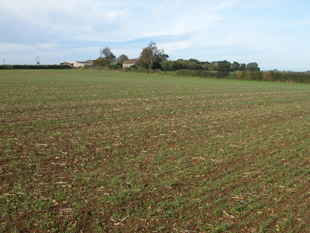
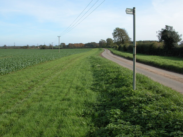
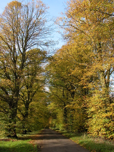
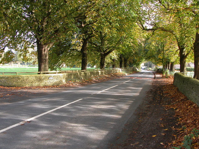
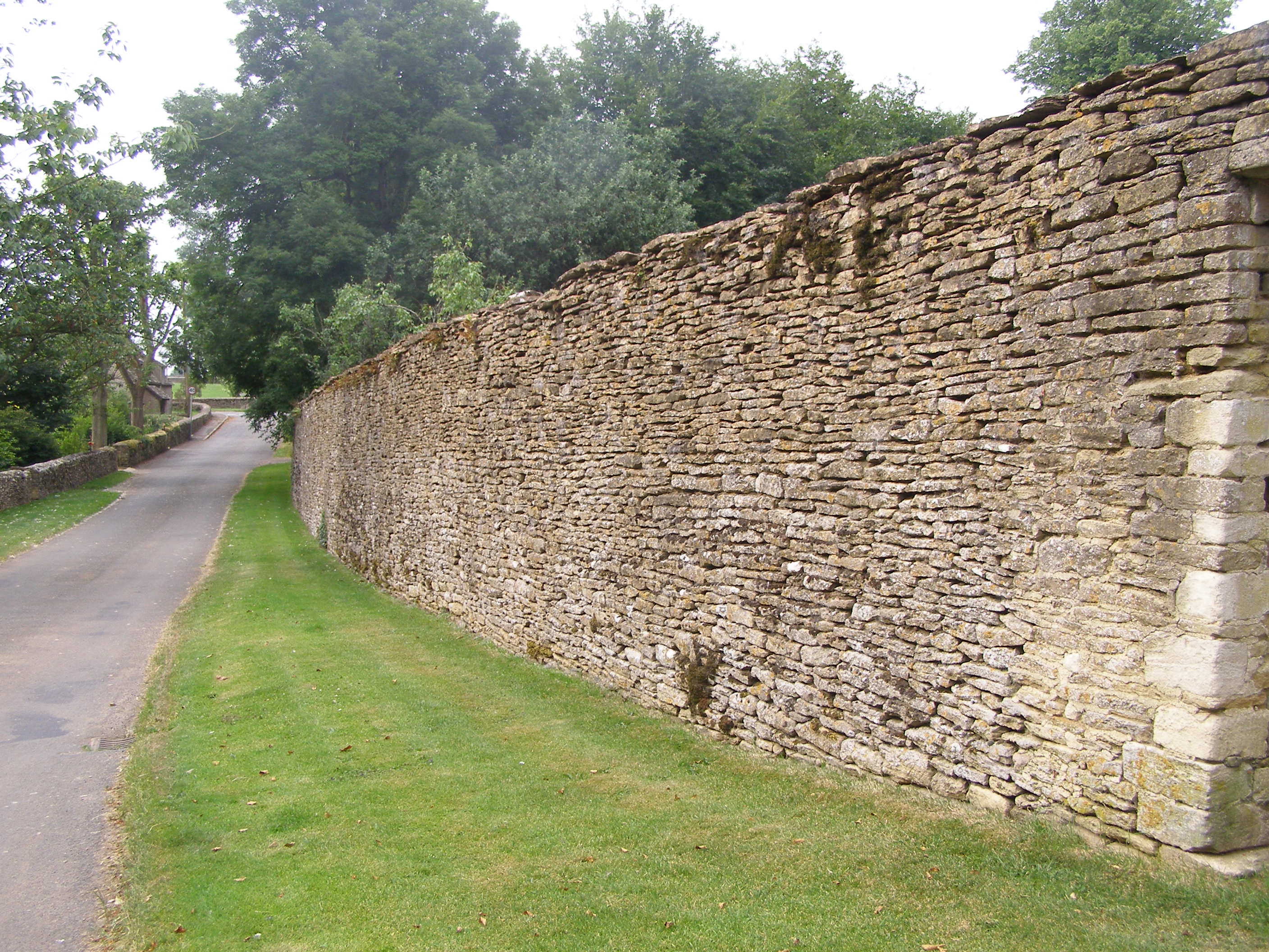
The village of Beverston itself is a charming and picturesque settlement, known for its idyllic rural setting. It is surrounded by rolling hills, lush green fields, and dense woodlands, creating a tranquil and peaceful atmosphere. The village is characterized by its traditional Cotswold stone houses and buildings, which add to the area's charm and beauty.

One of the notable features of Beverston is Beverston Castle, a medieval fortress that dates back to the 12th century. The castle, now in ruins, was once a stronghold of the Berkeley family, who were prominent landowners in the area. Despite its dilapidated state, Beverston Castle remains a popular tourist attraction, drawing visitors from near and far.

The parish also boasts a thriving agricultural sector, with farming being a significant part of the local economy. The fertile land surrounding Beverston provides ideal conditions for the cultivation of crops and the rearing of livestock.

Overall, Beverston, Gloucestershire, offers a serene and picturesque rural retreat, with its stunning natural landscapes, historical landmarks, and strong agricultural traditions. It is a place where visitors can immerse themselves in the beauty of the countryside and experience the charm of a traditional English village.

If you have any feedback on the listing, please let us know in the comments section below.

Beverston Images

Images are sourced within 2km of 51.644973/-2.207793 or Grid Reference ST8594. Thanks to Geograph Open Source API. All images are credited.

Farmland This lane runs between the A46 and Chavenage house. The hay has been harvested and is lying ready to be collected. This part of the Cotswolds is exposed and this road is one of the windiest. Historic maps show a windmill nearby.
Farmland
This lane runs between the A46 and Chavenage house. The hay has been harvested and is lying ready to be collected. This part of the Cotswolds is exposed and this road is one of the windiest. Historic maps show a windmill nearby.
Beverston Castle Originally a fortified manor house from 1229. Only one of the gate house towers and parts of the wall remain.
Beverston Castle
Originally a fortified manor house from 1229. Only one of the gate house towers and parts of the wall remain.
Cranmore Cottages and Cranmore Dairy Cranmore Cottages and to the left Cranmore Dairy viewed from the footpath as is crosses the field to the south-east.
Cranmore Cottages and Cranmore Dairy
Cranmore Cottages and to the left Cranmore Dairy viewed from the footpath as is crosses the field to the south-east.
Road to Chavenage Green Viewed from near Cranmore Cottages.
Road to Chavenage Green
Viewed from near Cranmore Cottages.
Chavenage House Chavenage House is a privately owned Cotswold manor house which is open to the public through the summer months. See: <span class="nowrap"><a title="http://www.hha.org.uk/Property/373/Chavenage-House#opening" rel="nofollow ugc noopener" href="http://www.hha.org.uk/Property/373/Chavenage-House#opening">Link</a><img style="margin-left:2px;" alt="External link" title="External link - shift click to open in new window" src="https://s1.geograph.org.uk/img/external.png" width="10" height="10"/></span>

The house has been used for a number of film and TV productions including the 2015 BBC remake of 'Poldark' when it was the setting for Trenwith.  It was also featured in Nick Crane's 'Great British Journeys'.  Additional text added March 2015.
Chavenage House
Chavenage House is a privately owned Cotswold manor house which is open to the public through the summer months. See: LinkExternal link The house has been used for a number of film and TV productions including the 2015 BBC remake of 'Poldark' when it was the setting for Trenwith. It was also featured in Nick Crane's 'Great British Journeys'. Additional text added March 2015.
Autumn colours at Chavenage Green Avenue of trees (Lime I think) on the road through Chavenage Green.
Autumn colours at Chavenage Green
Avenue of trees (Lime I think) on the road through Chavenage Green.
The A4135 approaching Beverston Approaching the village of Beverston from the west the A4135 passes between this avenue of trees.
The A4135 approaching Beverston
Approaching the village of Beverston from the west the A4135 passes between this avenue of trees.
Beverston church The church is dedicated to St Mary the Virgin and is situated near Beverston Castle.
Beverston church
The church is dedicated to St Mary the Virgin and is situated near Beverston Castle.
Beverston Castle The castle was founded by Maurice de Gaunt in 1229. In the early 14th century, Thomas, Lord Berkeley remodelled the castle. It was slighted during the civil war. It is a substantial castle though it is difficult to see as much is obscured by trees. The castle is privately owned. See: <span class="nowrap"><a title="http://www.castleuk.net/castle_lists_midlands/162/beverstoncastle.htm" rel="nofollow ugc noopener" href="http://www.castleuk.net/castle_lists_midlands/162/beverstoncastle.htm">Link</a><img style="margin-left:2px;" alt="External link" title="External link - shift click to open in new window" src="https://s1.geograph.org.uk/img/external.png" width="10" height="10"/></span>
Beverston Castle
The castle was founded by Maurice de Gaunt in 1229. In the early 14th century, Thomas, Lord Berkeley remodelled the castle. It was slighted during the civil war. It is a substantial castle though it is difficult to see as much is obscured by trees. The castle is privately owned. See: LinkExternal link
Oak tree beside the Macmillan Way, Beverston In the distance the town of Tetbury can just be seen including the spire of the church.
Oak tree beside the Macmillan Way, Beverston
In the distance the town of Tetbury can just be seen including the spire of the church.
Cattle feeder beside Broad Newell Covert The 1940s OS map indicates the footpath passing through here follows the route of a Roman road, though this is not shown on the current map.
Cattle feeder beside Broad Newell Covert
The 1940s OS map indicates the footpath passing through here follows the route of a Roman road, though this is not shown on the current map.
Approaching Hookshouse A view looking north along Hookshouse Lane towards a converted barn at Hookshouse.
Approaching Hookshouse
A view looking north along Hookshouse Lane towards a converted barn at Hookshouse.
Converted barn at Hookshouse A view looking to the northwest from Hookshouse Lane towards a converted barn at Hookshouse.
Converted barn at Hookshouse
A view looking to the northwest from Hookshouse Lane towards a converted barn at Hookshouse.
Footpath from Hookshouse Lane A view looking north towards the start of the public footpath from Hookshouse Lane to the A4135.
Footpath from Hookshouse Lane
A view looking north towards the start of the public footpath from Hookshouse Lane to the A4135.
Cotswold Farmland A view looking to the northeast over Cotswold farmland from the start of the public footpath from Hookshouse Lane to the A4135.
Cotswold Farmland
A view looking to the northeast over Cotswold farmland from the start of the public footpath from Hookshouse Lane to the A4135.
Oldown A view looking to the northwest from hookshouse Lane across a paddock towards Oldown.
Oldown
A view looking to the northwest from hookshouse Lane across a paddock towards Oldown.
Autumn gold in winter. A view looking north from Hookshouse Lane across a paddock at Oldown, towards a stand of trees catching the winter sunshine.
Autumn gold in winter.
A view looking north from Hookshouse Lane across a paddock at Oldown, towards a stand of trees catching the winter sunshine.
Hookshouse Lane A view looking to the southwest along Hookshouse Lane near Oldown.
Hookshouse Lane
A view looking to the southwest along Hookshouse Lane near Oldown.
Show me another place!

Beverston is located at Grid Ref: ST8594 (Lat: 51.644973, Lng: -2.207793)

Administrative County: Gloucestershire

District: Cotswold

Police Authority: Gloucestershire

What 3 Words

///unguarded.infuses.blocks. Near Tetbury, Gloucestershire

Related Wikis

Beverston Castle

Beverston Castle, also known as Beverstone Castle or Tetbury Castle, was constructed as a medieval stone fortress in the village of Beverston, Gloucestershire...

St Mary's Church, Beverston

The Church of Saint Mary the Virgin is the parish church of Beverston, Gloucestershire, England, and a Grade II* listed building. The church is of Norman...

Beverston

Beverston is a village and civil parish in the Cotswold district of Gloucestershire, England. According to the 2001 census it had a population of 132,...

RAF Babdown Farm

Royal Air Force Babdown Farm or more simply RAF Babdown Farm is a former Royal Air Force relief landing ground located 2.9 miles (4.7 km) west of Tetbury...
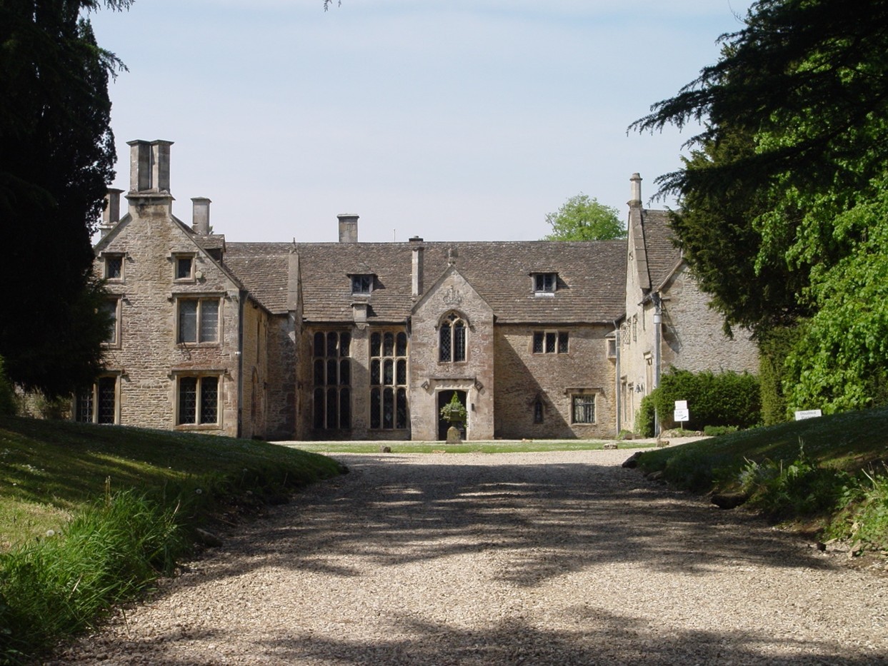
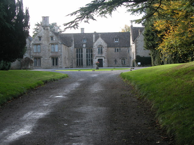
Chavenage House

Chavenage House, Beverston, Gloucestershire is a country house dating from the late 16th century. The house was built in 1576 and is constructed of Cotswold...

Calcot Manor

Calcot Manor is a historic building in Calcot, three and a half miles west of Tetbury on A 4135 in Gloucestershire, England, near the junction of roads...

Veizey's Quarry

Veizey's Quarry (grid reference ST881944) is a 1.4 hectare geological Site of Special Scientific Interest near Tetbury in Gloucestershire, notified in...

Tetbury Upton

Tetbury Upton is a small village and civil parish in the Cotswolds area of Gloucestershire, England. The parish extends in an arc around the north, west...

Nearby Amenities

Located within 500m of 51.644973,-2.207793
Bus Stop
Castle
Bus: yes
Naptan AtcoCode: 1600GL389
Naptan Bearing: SE
Naptan CommonName: Castle
Naptan NaptanCode: glodjdga
Naptan Street: A4135
Naptan Verified: no
Public Transport: platform
Source: naptan_import
Lat/Long: 51.6432093/-2.2019798
Telephone
Booth: K6
Covered: booth
Operator: BT
Operator Wikidata: Q593786
Payment Electronic Purses: yes
Payment Telephone Cards: yes
Lat/Long: 51.6431838/-2.2017184
Description: Norman Church
Tourism: attraction
Lat/Long: 51.6447515/-2.2013693
Barrier: stile
Foot: yes
Lat/Long: 51.645166/-2.2082371
Milestone
Wikidata: Q26382132
Lat/Long: 51.6437337/-2.2042832
The data included in this document is from www.openstreetmap.org. The data is made available under ODbL.

Have you been to Beverston?

Leave your review of Beverston below (or comments, questions and feedback).