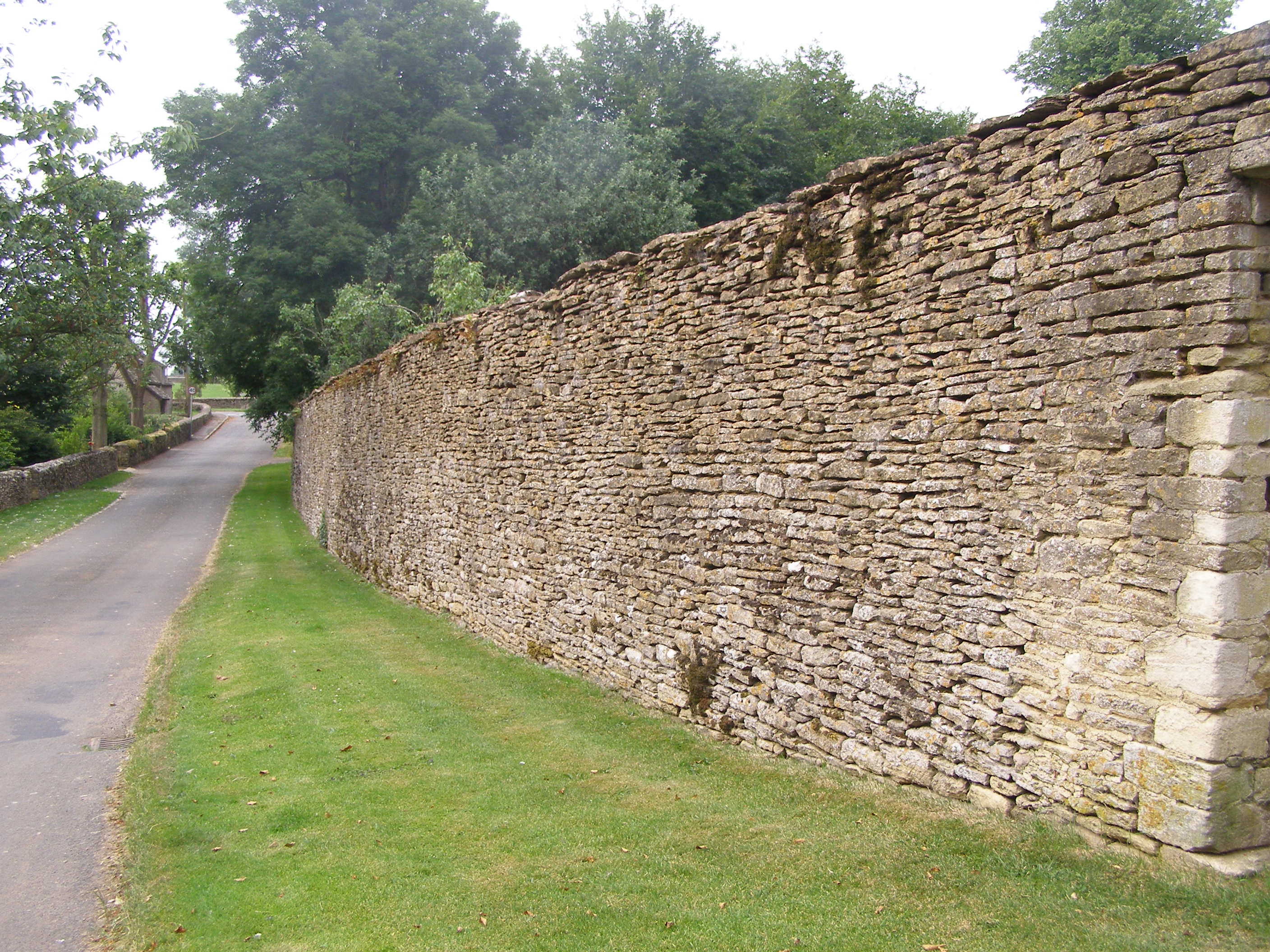
Beverston Old Brake

Wood, Forest in Gloucestershire Cotswold

England

Beverston Old Brake

Stone Stile, Beverstone Opposite the entrance to Chavenage House looking NNE. On the Gloucestershire footpath NBE9, the alternative view looking SSW is <a href="https://www.geograph.org.uk/photo/7051091">ST8795 : Stone Stile, Beverstone</a>.
Stone Stile, Beverstone Credit: Mr Red

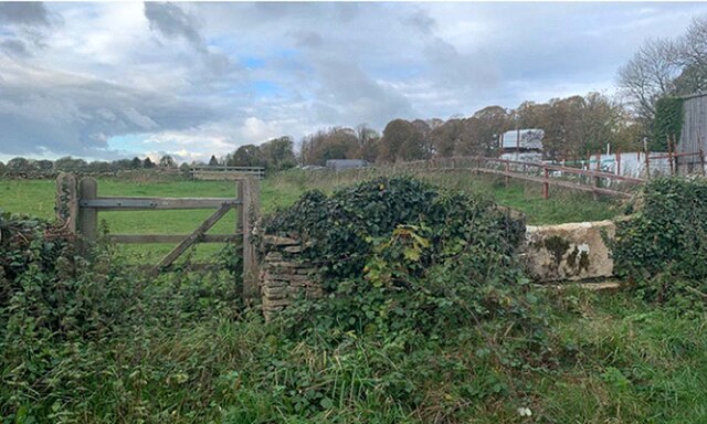
Beverston Old Brake is a quaint woodland area located in Gloucestershire, England. Situated near the village of Beverston, this forested landscape is a hidden gem that offers a unique and tranquil experience for nature enthusiasts and outdoor lovers.

The woodland of Beverston Old Brake spans over an area of approximately 100 acres, encompassing a diverse range of tree species including oak, beech, and birch. These majestic trees provide a lush canopy, creating a peaceful atmosphere and offering a picturesque backdrop for visitors.

The forest is intersected by several walking trails, allowing visitors to explore the area and immerse themselves in the natural beauty of the surroundings. These trails meander through the woodland, leading to charming spots such as babbling brooks, enchanting clearings, and ancient trees.

Beverston Old Brake is also home to a rich variety of wildlife, making it a popular spot for birdwatchers and animal enthusiasts. Visitors may encounter a range of bird species, including woodpeckers, owls, and various songbirds. Additionally, the forest provides a habitat for deer, foxes, and other mammals, offering the opportunity for wildlife spotting and observation.

The history of Beverston Old Brake can be traced back centuries, with remnants of ancient earthworks and archaeological sites scattered throughout the area. These historical features add a layer of intrigue and fascination to the woodland, making it an intriguing destination for history enthusiasts.

Overall, Beverston Old Brake in Gloucestershire is a captivating woodland that offers a serene escape from the hustle and bustle of everyday life. With its diverse flora and fauna, delightful walking trails, and rich history, it is a perfect destination for those seeking solace and a connection with nature.

If you have any feedback on the listing, please let us know in the comments section below.

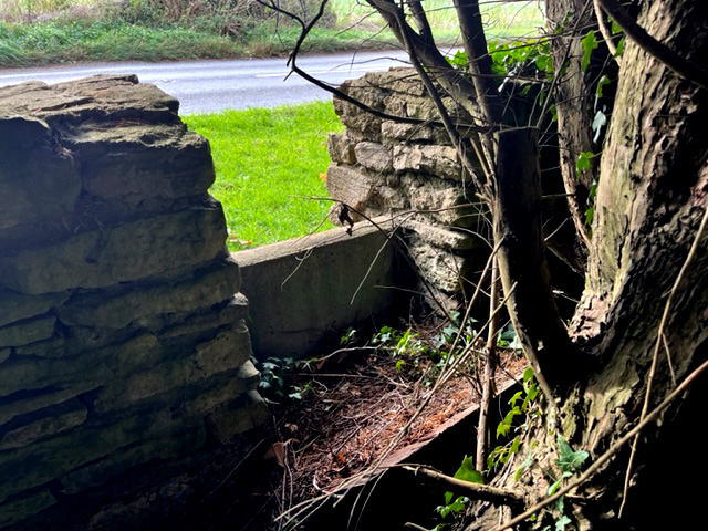
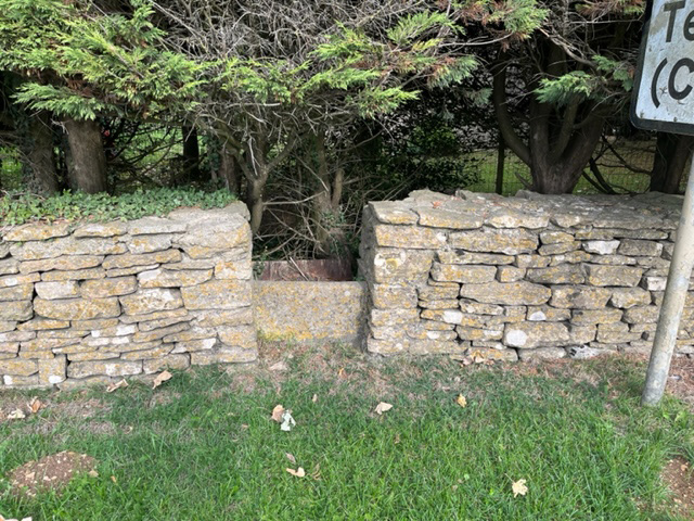
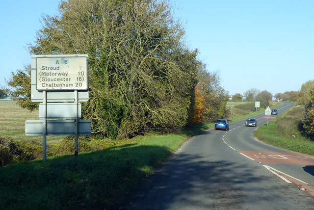
Beverston Old Brake Images

Images are sourced within 2km of 51.648586/-2.2091623 or Grid Reference ST8594. Thanks to Geograph Open Source API. All images are credited.

Stone Stile, Beverstone Opposite the entrance to Chavenage House looking NNE. On the Gloucestershire footpath NBE9, the alternative view looking SSW is <a href="https://www.geograph.org.uk/photo/7051091">ST8795 : Stone Stile, Beverstone</a>.
Stone Stile, Beverstone
Opposite the entrance to Chavenage House looking NNE. On the Gloucestershire footpath NBE9, the alternative view looking SSW is ST8795 : Stone Stile, Beverstone.
Stone Stile, Beverstone Opposite the entrance to Chavenage House looking SSW. On the Gloucestershire footpath NBE9, the alternative view looking NNE is <a href="https://www.geograph.org.uk/photo/7051089">ST8795 : Stone Stile, Beverstone</a>.
Stone Stile, Beverstone
Opposite the entrance to Chavenage House looking SSW. On the Gloucestershire footpath NBE9, the alternative view looking NNE is ST8795 : Stone Stile, Beverstone.
Stone Stile, Chavenage Half buried remains of a stone stile. This at the kissing gate from the road, on the Gloucestershire footpath NBE10 across Lodge Farm.
Stone Stile, Chavenage
Half buried remains of a stone stile. This at the kissing gate from the road, on the Gloucestershire footpath NBE10 across Lodge Farm.
Chavenage Lane
Chavenage Lane
Entrance to Wild Carrot, Chavenage Wild Carrot is part of the Chavenage estate, and includes a cafe under tepees, more tepees and shepherd's huts for glamping, and facilities for cyclists including bike tours. I stopped there to warm up beside the log burner in the bar in one of the barns. <span class="nowrap"><a title="https://www.wildcarrot.co.uk/" rel="nofollow ugc noopener" href="https://www.wildcarrot.co.uk/">Link</a><img style="margin-left:2px;" alt="External link" title="External link - shift click to open in new window" src="https://s1.geograph.org.uk/img/external.png" width="10" height="10"/></span>
Entrance to Wild Carrot, Chavenage
Wild Carrot is part of the Chavenage estate, and includes a cafe under tepees, more tepees and shepherd's huts for glamping, and facilities for cyclists including bike tours. I stopped there to warm up beside the log burner in the bar in one of the barns. LinkExternal link
Stone barn at Chavenage and Wild Carrot bar Wild Carrot is an events/cafe business situated within the former Chavenage Farm yard. To the right is a converted byre, now housing a bar for evening and other events, and extra seating for the cafe. In the foreground is a pole for hooking up bicycles while their owners rest and warm up in the cafe. <span class="nowrap"><a title="https://www.wildcarrot.co.uk/" rel="nofollow ugc noopener" href="https://www.wildcarrot.co.uk/">Link</a><img style="margin-left:2px;" alt="External link" title="External link - shift click to open in new window" src="https://s1.geograph.org.uk/img/external.png" width="10" height="10"/></span>
Stone barn at Chavenage and Wild Carrot bar
Wild Carrot is an events/cafe business situated within the former Chavenage Farm yard. To the right is a converted byre, now housing a bar for evening and other events, and extra seating for the cafe. In the foreground is a pole for hooking up bicycles while their owners rest and warm up in the cafe. LinkExternal link
Inside Wild Carrot cafe The cafe, housed in a double-tepee, is located next to the Macmillan Way, and is popular with cyclists and walkers.
Inside Wild Carrot cafe
The cafe, housed in a double-tepee, is located next to the Macmillan Way, and is popular with cyclists and walkers.
Road junction near Chavenage Green
Stone Stile, Chavenage Near Wildlife World and Chavenage House looking NW from Chavenage Lane ( bridleway NBE8), the stile has no public right of way over it.
Stone Stile, Chavenage
Near Wildlife World and Chavenage House looking NW from Chavenage Lane ( bridleway NBE8), the stile has no public right of way over it.
Stone Stile, Kingscote In the perimeter wall of Gumstool Inn / Calcote Spa SE of the crossroads, A4135 to Tetbury. Not on a registered footpath and close to the boundary with Beverstone, looking out. 
The view from the road is <a href="https://www.geograph.org.uk/photo/7309080">ST8494 : Stone Stile, Kingscote</a>.
Stone Stile, Kingscote
In the perimeter wall of Gumstool Inn / Calcote Spa SE of the crossroads, A4135 to Tetbury. Not on a registered footpath and close to the boundary with Beverstone, looking out. The view from the road is ST8494 : Stone Stile, Kingscote.
Stone Stile, Kingscote In the perimeter wall of Gumstool Inn / Calcote Spa SE of the crossroads, A4135 to Tetbury. Not on a registered footpath and close to the boundary with Beverstone, looking in.
The view to the road is <a href="https://www.geograph.org.uk/photo/7309078">ST8494 : Stone Stile, Kingscote</a>.
Stone Stile, Kingscote
In the perimeter wall of Gumstool Inn / Calcote Spa SE of the crossroads, A4135 to Tetbury. Not on a registered footpath and close to the boundary with Beverstone, looking in. The view to the road is ST8494 : Stone Stile, Kingscote.
The route of Chavenage Lane
Field corner
Field corner
Barn at Chavanage Manor
A46 heading north A '4' seems to have come off the sign.
A46 heading north
A '4' seems to have come off the sign.
Primroses in the churchyard, Beverston
Pilgrim's Barn, Beverston Probably dates from the fourteenth century <span class="nowrap"><a title="https://historicengland.org.uk/listing/the-list/list-entry/1341160?section=official-list-entry" rel="nofollow ugc noopener" href="https://historicengland.org.uk/listing/the-list/list-entry/1341160?section=official-list-entry">Link</a><img style="margin-left:2px;" alt="External link" title="External link - shift click to open in new window" src="https://s1.geograph.org.uk/img/external.png" width="10" height="10"/></span>
Pilgrim's Barn, Beverston
Probably dates from the fourteenth century LinkExternal link
St Mary's church, Beverston Small parish church largely of the thirteenth and fourteenth centuries though on older foundations <span class="nowrap"><a title="https://historicengland.org.uk/listing/the-list/list-entry/1153025?section=official-list-entry" rel="nofollow ugc noopener" href="https://historicengland.org.uk/listing/the-list/list-entry/1153025?section=official-list-entry">Link</a><img style="margin-left:2px;" alt="External link" title="External link - shift click to open in new window" src="https://s1.geograph.org.uk/img/external.png" width="10" height="10"/></span>
St Mary's church, Beverston
Small parish church largely of the thirteenth and fourteenth centuries though on older foundations LinkExternal link
Show me another place!

Beverston Old Brake is located at Grid Ref: ST8594 (Lat: 51.648586, Lng: -2.2091623)

Administrative County: Gloucestershire

District: Cotswold

Police Authority: Gloucestershire

What 3 Words

///guises.score.reactions. Near Tetbury, Gloucestershire

Related Wikis

St Mary's Church, Beverston

The Church of Saint Mary the Virgin is the parish church of Beverston, Gloucestershire, England, and a Grade II* listed building. The church is of Norman...

Beverston Castle

Beverston Castle, also known as Beverstone Castle or Tetbury Castle, was constructed as a medieval stone fortress in the village of Beverston, Gloucestershire...

Beverston

Beverston is a village and civil parish in the Cotswold district of Gloucestershire, England. According to the 2001 census it had a population of 132,...

RAF Babdown Farm

Royal Air Force Babdown Farm or more simply RAF Babdown Farm is a former Royal Air Force relief landing ground located 2.9 miles (4.7 km) west of Tetbury...

Calcot Manor

Calcot Manor is a historic building in Calcot, three and a half miles west of Tetbury on A 4135 in Gloucestershire, England, near the junction of roads...
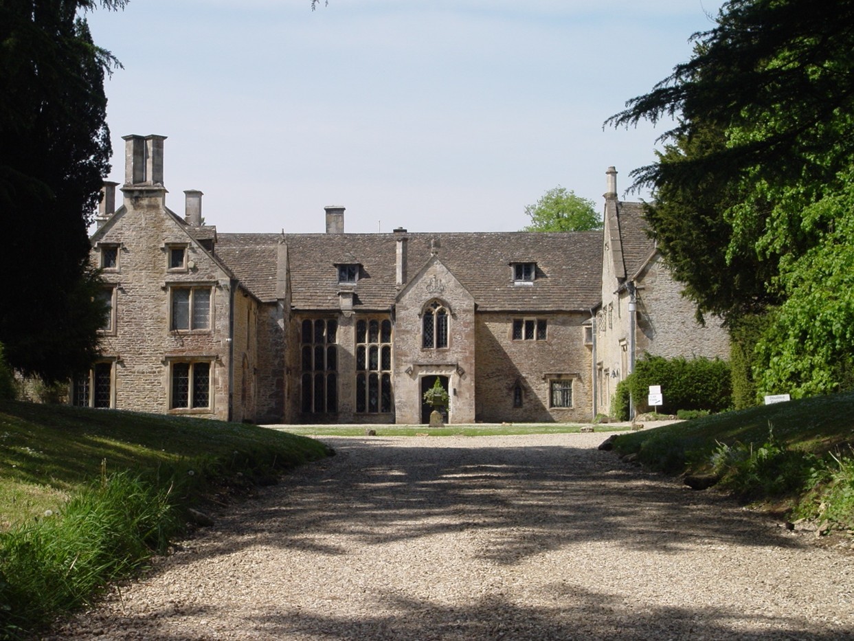
Chavenage House

Chavenage House, Beverston, Gloucestershire is a country house dating from the late 16th century. The house was built in 1576 and is constructed of Cotswold...

Veizey's Quarry

Veizey's Quarry (grid reference ST881944) is a 1.4 hectare geological Site of Special Scientific Interest near Tetbury in Gloucestershire, notified in...

Tetbury Upton

Tetbury Upton is a small village and civil parish in the Cotswolds area of Gloucestershire, England. The parish extends in an arc around the north, west...

Related Videos

🇬🇧RARE : Seeing The King's Hidden Highgrove Home

The timestamp is below. l was lucky enough to visit The King's private garden at his Highgrove estate in Gloucestershire.

Staying in a Castle - TSV 22 September

This month we were on holiday in Tetbury, staying at Beverstone Castle, and visiting the surrounding area, we went to some ...

🇬🇧 I Toured King Charles' Private Garden & Saw His Home.

What an amazing day! I visited King Charles' home, Highgrove House in Gloucestershire. I stood beside the House and toured it's ...

HIGHGROVE GARDENS Royal Afternoon Tea | Private Residence of King Charles III | JOS ATKIN

Highgrove House Afetrnoon Tea & Tour. Highgrove is the private residence of King Charles III & Queen Camilla. I went along and ...

Nearby Amenities

Located within 500m of 51.648586,-2.2091623
Barrier: stile
Foot: yes
Lat/Long: 51.645166/-2.2082371
Barrier: stile
Foot: yes
Lat/Long: 51.6497578/-2.2025051
The data included in this document is from www.openstreetmap.org. The data is made available under ODbL.

Have you been to Beverston Old Brake?

Leave your review of Beverston Old Brake below (or comments, questions and feedback).