Bewaldeth and Snittlegarth

Civil Parish in Cumberland Allerdale

England

Bewaldeth and Snittlegarth

Beckgrains Bridge Scrubland at Beckgrains Bridge
Beckgrains Bridge Credit: P Gaskell

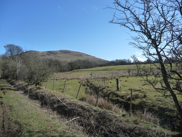
Bewaldeth and Snittlegarth is a civil parish located in the county of Cumberland, England. Situated in the picturesque Lake District National Park, it covers an area of approximately 16 square kilometers. The parish is made up of two small villages, Bewaldeth and Snittlegarth, which are surrounded by stunning natural beauty and rolling hills.

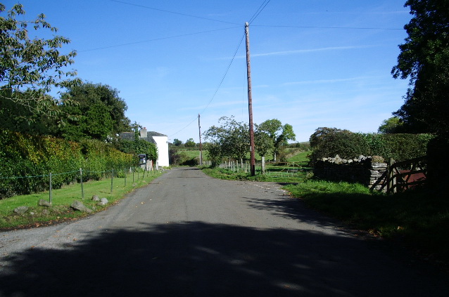
Bewaldeth, the larger of the two villages, is situated on the western side of Bassenthwaite Lake. It is a tranquil and charming village, with a population of around 100 residents. The village is known for its traditional stone-built houses and beautiful church, St. George's Church, which dates back to the 18th century.

Snittlegarth, on the other hand, is a smaller hamlet located to the south of Bewaldeth. It is home to a handful of houses and farms, offering a peaceful and rural atmosphere. The hamlet provides stunning views of the surrounding countryside, with its rolling fields and meadows.

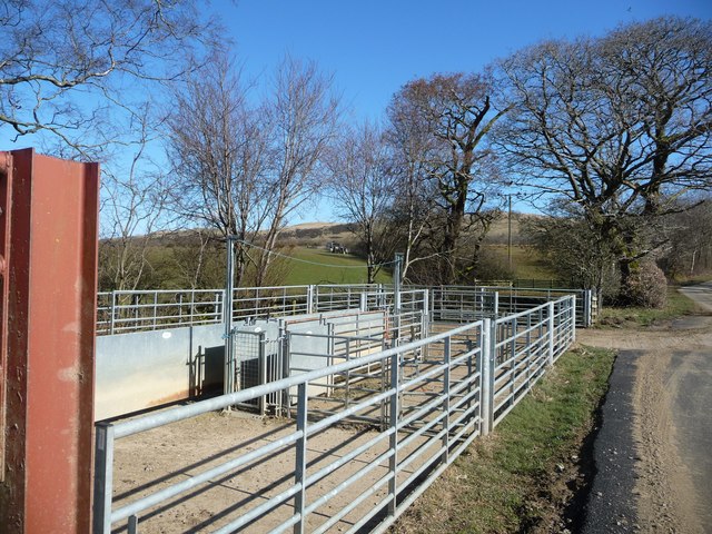
The area is a popular destination for outdoor enthusiasts, offering a range of activities such as hiking, cycling, and birdwatching. The nearby Bassenthwaite Lake provides opportunities for fishing and boating, while the surrounding hills and forests offer scenic walks and wildlife spotting.

Bewaldeth and Snittlegarth, with their idyllic countryside setting and charming villages, offer a peaceful retreat for those looking to escape the hustle and bustle of city life.

If you have any feedback on the listing, please let us know in the comments section below.

Bewaldeth and Snittlegarth Images

Images are sourced within 2km of 54.711018/-3.236928 or Grid Reference NY2035. Thanks to Geograph Open Source API. All images are credited.

Beckgrains Bridge Scrubland at Beckgrains Bridge
Beckgrains Bridge
Scrubland at Beckgrains Bridge
Rough grazing on slope of Whittas Park Whittas Park is an area of roughly vegetated ground north-west from Binsey in the north-western Lake District. Binsey lies to the left side of the image with the Skiddaw group of mountains to the right.
Rough grazing on slope of Whittas Park
Whittas Park is an area of roughly vegetated ground north-west from Binsey in the north-western Lake District. Binsey lies to the left side of the image with the Skiddaw group of mountains to the right.
Field with Binsey beyond The field lies on the west side of a minor road close to the low hill, Caer Mote.
Field with Binsey beyond
The field lies on the west side of a minor road close to the low hill, Caer Mote.
Road running west from Bewaldeth Heading towards Isel.
Road running west from Bewaldeth
Heading towards Isel.
Trees along Bewaldeth Beck On the north side of the road to Isel.
Trees along Bewaldeth Beck
On the north side of the road to Isel.
Issue-fed tributary of Bewaldeth Beck The hill on the horizon is Binsey.
Issue-fed tributary of Bewaldeth Beck
The hill on the horizon is Binsey.
Sheepfold alongside Bewaldeth Beck On the north side of the road to Isel.
Sheepfold alongside Bewaldeth Beck
On the north side of the road to Isel.
On Binsey Above Binsey's West Crag looking NW through early evening mist.
On Binsey
Above Binsey's West Crag looking NW through early evening mist.
View of Binsey From the road.
View of Binsey
From the road.
Track to Binsey Binsey ahead.
Track to Binsey
Binsey ahead.
View of Bassenthwaite Lake Looking SSW.
View of Bassenthwaite Lake
Looking SSW.
Binsey from the south Looking up at Binsey from the road.
Binsey from the south
Looking up at Binsey from the road.
Path descending Binsey
Old Boundary Marker Parish Boundary Marker 400 metres northwest of Binsey trig point. On boundary of High Ireby and Snittlegarth and Bewaldeth parishes. Inscribed HI and B on its faces.

Milestone Society National ID: CU_BEWSNI01pb
Old Boundary Marker
Parish Boundary Marker 400 metres northwest of Binsey trig point. On boundary of High Ireby and Snittlegarth and Bewaldeth parishes. Inscribed HI and B on its faces. Milestone Society National ID: CU_BEWSNI01pb
A farm track This track is a Right of Way and is one of the standard routes when climbing Binsey.
A farm track
This track is a Right of Way and is one of the standard routes when climbing Binsey.
West Crag, Binsey
West Crag, Binsey
The track to Binsey This track leaves the A591 near Bewaldeth and climbs gently to this gate. The hillside behind is all Access Land. There is a path, but it is not always very clear.
The track to Binsey
This track leaves the A591 near Bewaldeth and climbs gently to this gate. The hillside behind is all Access Land. There is a path, but it is not always very clear.
Bird House Farm
Bird House Farm
Show me another place!

Bewaldeth and Snittlegarth is located at Grid Ref: NY2035 (Lat: 54.711018, Lng: -3.236928)

Administrative County: Cumbria

District: Allerdale

Police Authority: Cumbria

What 3 Words

///sublet.submerge.debt. Near Aspatria, Cumbria

Nearby Locations

Bewaldeth and Snittlegarth

Related Wikis

Bewaldeth and Snittlegarth

Bewaldeth and Snittlegarth is a civil parish in Cumbria, England, historically part of Cumberland. It lies north of Bassenthwaite Lake, in the Lake District...

Caer Mote

Caer Mote is a hill of 289 metres (948 ft) in the north of the English Lake District near Bothel, Cumbria. Its summit lies just outside the boundary of...

Binsey

Binsey is a hill on the northern edge of the Lake District in Cumbria, England. It is detached from the rest of the Lakeland hills, and thus provides a...

Sunderland, Cumbria

Sunderland is a hamlet and former civil parish, within the Lake District National Park, now in the parish of Blindcrake in the Allerdale district of the...

Nearby Amenities

Located within 500m of 54.711018,-3.236928
Turning Circle
Lat/Long: 54.7102147/-3.2423562
Power: pole
Lat/Long: 54.7081309/-3.2318044
Power: pole
Lat/Long: 54.7082006/-3.2332125
Power: pole
Lat/Long: 54.7077156/-3.2347548
Power: pole
Lat/Long: 54.7072058/-3.2362783
Power: pole
Lat/Long: 54.7066959/-3.2378098
Fixme: continue
Lat/Long: 54.7103278/-3.2405252
Fixme: continue
Lat/Long: 54.7104313/-3.2425146
Fixme: Is this something notable?
Lat/Long: 54.710127/-3.2403674
Fixme: continue
Lat/Long: 54.7100911/-3.2387483
Fixme: check and continue if necessary
Lat/Long: 54.7105102/-3.2428513
The data included in this document is from www.openstreetmap.org. The data is made available under ODbL.

Have you been to Bewaldeth and Snittlegarth?

Leave your review of Bewaldeth and Snittlegarth below (or comments, questions and feedback).