Beckingham
Civil Parish in Nottinghamshire Bassetlaw
England
Beckingham

Beckingham is a civil parish located in the Bassetlaw district of Nottinghamshire, England. It is situated on the banks of the River Trent, approximately 18 miles east of the city of Nottingham. The village has a population of around 1,200 residents.
The history of Beckingham can be traced back to Roman times, with evidence of a Roman settlement found in the area. The village grew during the medieval period and was an important agricultural center. Today, it retains much of its rural character, with a mix of traditional and modern houses.
The village is well-served by amenities, including a primary school, a post office, a village hall, and a local pub. There are also several shops and businesses that cater to the needs of the community. The nearby town of Retford provides additional services and facilities.
Beckingham offers a range of recreational activities for residents and visitors. The village is surrounded by beautiful countryside, providing opportunities for walking, cycling, and horse riding. The River Trent is popular for fishing and boating enthusiasts. There are also several local sports clubs and a golf course nearby.
Transport links in Beckingham are good, with regular bus services connecting the village to nearby towns and cities. The A631 road passes through the village, providing easy access to Retford, Gainsborough, and Lincoln.
Overall, Beckingham is a picturesque village with a strong sense of community and a range of amenities. Its proximity to the River Trent and the surrounding countryside makes it an attractive place to live or visit.
If you have any feedback on the listing, please let us know in the comments section below.
Beckingham Images
Images are sourced within 2km of 53.401185/-0.824755 or Grid Reference SK7890. Thanks to Geograph Open Source API. All images are credited.


Beckingham is located at Grid Ref: SK7890 (Lat: 53.401185, Lng: -0.824755)
Administrative County: Nottinghamshire
District: Bassetlaw
Police Authority: Nottinghamshire
What 3 Words
///unstable.composes.leaves. Near Beckingham, Nottinghamshire
Nearby Locations
Related Wikis
Beckingham, Nottinghamshire
Beckingham is a village and civil parish in the Bassetlaw district of Nottinghamshire, England, about 3 miles west of Gainsborough, Lincolnshire. According...
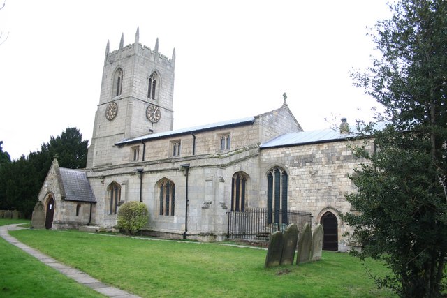
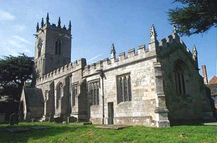
All Saints' Church, Beckingham
All Saints' Church, Beckingham is a Grade II* listed parish church in the Church of England in Beckingham, Nottinghamshire, England. == History == The...
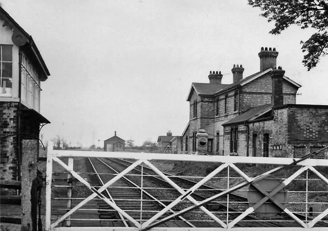
Beckingham railway station
Beckingham railway station was a station in Beckingham, Nottinghamshire on the line between Gainsborough and Doncaster. The station opened on 16 July 1867...
St Martin of Tours' Church, Saundby
St Martin of Tours' Church is a redundant Anglican church in the village of Saundby, Nottinghamshire, England. It is recorded in the National Heritage...
Nearby Amenities
Located within 500m of 53.401185,-0.824755Have you been to Beckingham?
Leave your review of Beckingham below (or comments, questions and feedback).