Beauworth

Civil Parish in Hampshire Winchester

England

Beauworth

New water pipe from Lane End reservoir Aerial.
New water pipe from Lane End reservoir Credit: Peter Facey

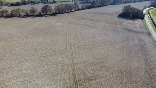
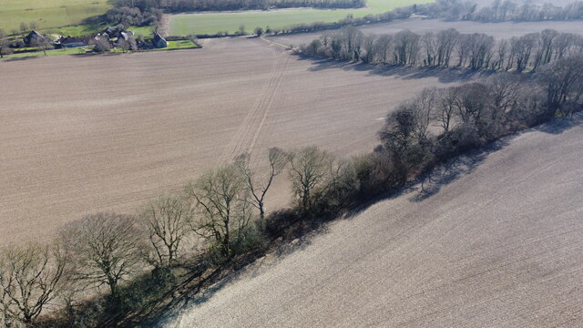
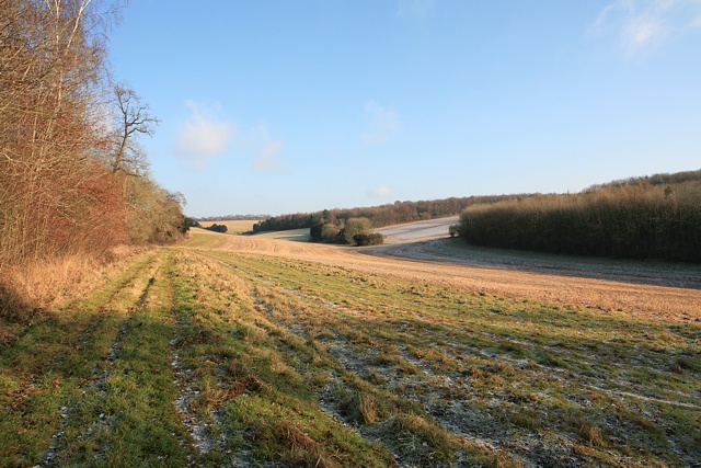
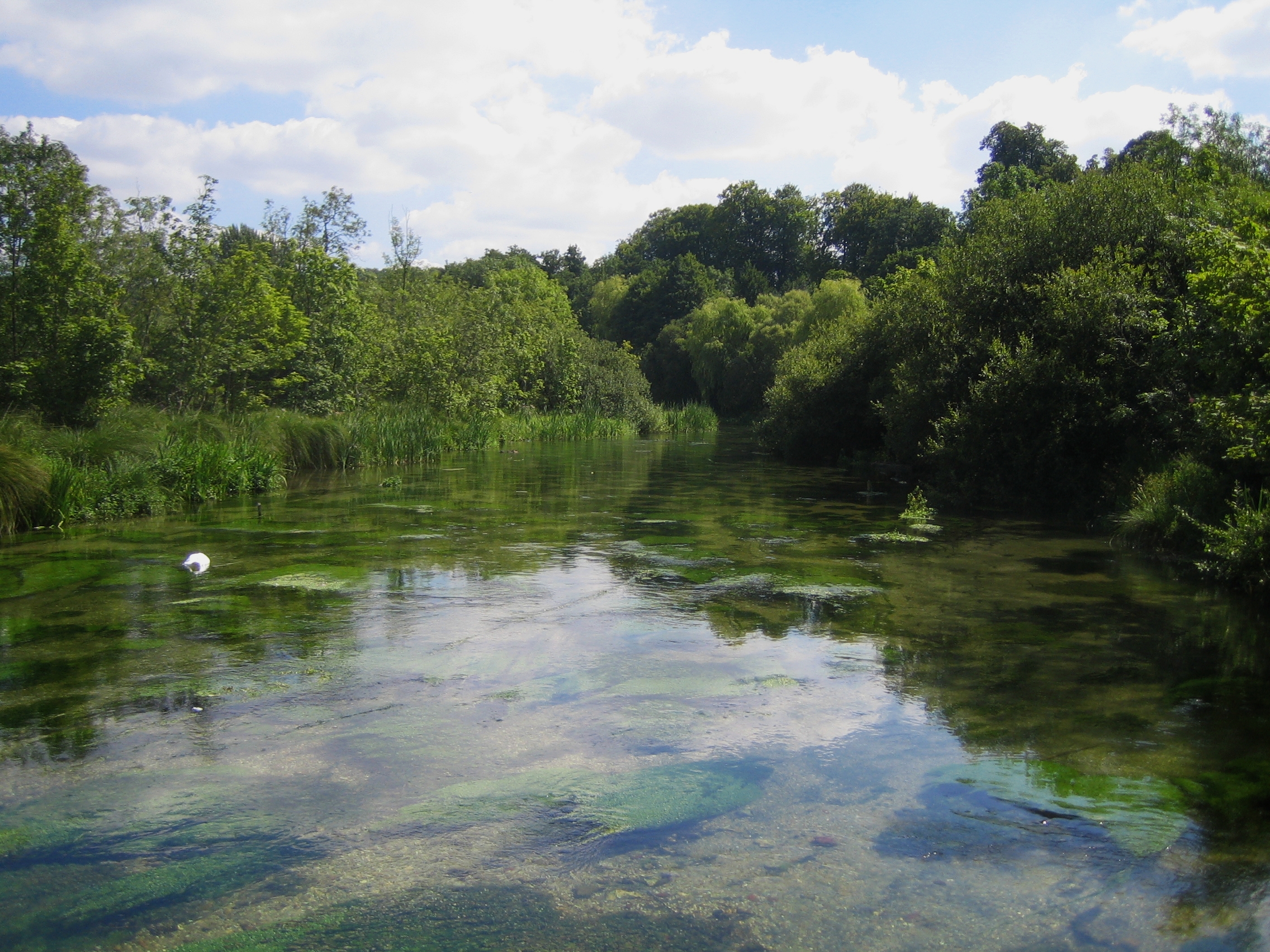
Beauworth is a civil parish located in the county of Hampshire, England. It is situated in the South Downs National Park and covers an area of approximately 4 square miles. The parish is surrounded by picturesque countryside and is known for its rural charm and natural beauty.

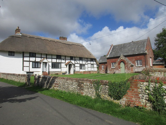
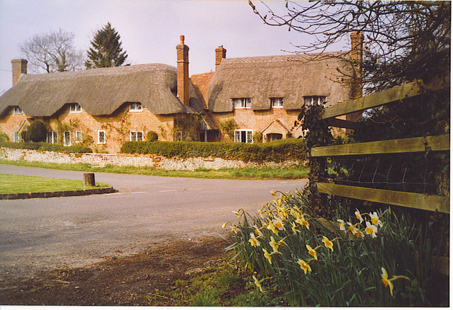
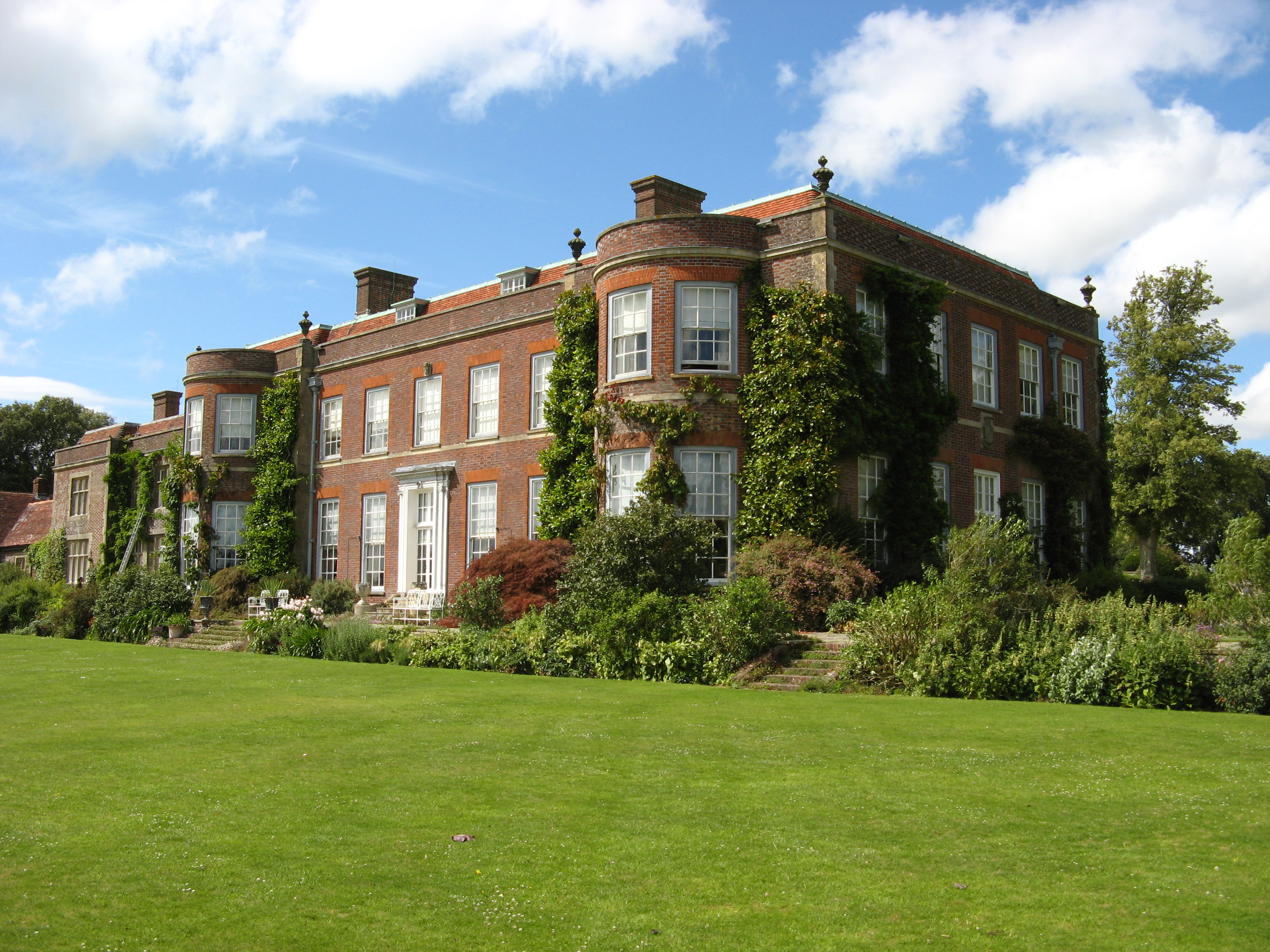
The village of Beauworth itself is small and has a population of around 150 residents. It is characterized by its quaint cottages and historic buildings, many of which date back to the 17th and 18th centuries. The village church, St. Edith's, is a prominent landmark and is a Grade II listed building.

The parish is predominantly agricultural, with farming being the main source of income for the local community. The fertile land and favorable climate make it ideal for growing crops and rearing livestock. The rolling hills and open fields provide stunning views and attract visitors who enjoy hiking and exploring the countryside.

Despite its small size, Beauworth has a strong sense of community and residents take pride in maintaining the village's rural character. There is a village hall that serves as a focal point for social gatherings and events. The parish also has a primary school, providing education for the local children.

Overall, Beauworth is a charming and idyllic village in Hampshire, offering a peaceful and rural lifestyle for its residents. Its natural beauty and close-knit community make it a desirable place to live and visit.

If you have any feedback on the listing, please let us know in the comments section below.

Beauworth Images

Images are sourced within 2km of 51.022255/-1.192097 or Grid Reference SU5625. Thanks to Geograph Open Source API. All images are credited.

New water pipe from Lane End reservoir Aerial.
New water pipe from Lane End reservoir
Aerial.
New water pipe from Lane End reservoir Aerial.
New water pipe from Lane End reservoir
Aerial.
New water pipe from Lane End reservoir Aerial.
New water pipe from Lane End reservoir
Aerial.
Refurbished barn on Holden Lane Earlier (and opposite direction) see <a title="https://www.geograph.org.uk/photo/3914644" href="https://www.geograph.org.uk/photo/3914644">Link</a> .
Refurbished barn on Holden Lane
Earlier (and opposite direction) see Link .
Anti-Gypsy trenching on Holden Farm This recently-dug trench is not for drainage, as evidenced by the fact that there are bunds on both sides of it and there is nothing flowing into it. It is an example of the works that farmers find themselves forced to do to prevent unlawful occupation of their land by so-called travellers. It is a pity that lawyers are incapable of realising the trouble that they cause.
Anti-Gypsy trenching on Holden Farm
This recently-dug trench is not for drainage, as evidenced by the fact that there are bunds on both sides of it and there is nothing flowing into it. It is an example of the works that farmers find themselves forced to do to prevent unlawful occupation of their land by so-called travellers. It is a pity that lawyers are incapable of realising the trouble that they cause.
Massive straw wall at Lane End Two walls of rectangular straw bales, side by side.
Massive straw wall at Lane End
Two walls of rectangular straw bales, side by side.
Dappled light on the road to Lane End Down Strong midday summer sun coming through deciduous woodland.
Dappled light on the road to Lane End Down
Strong midday summer sun coming through deciduous woodland.
Dappled light in Stonywalls Plantation Midday sun in early June, filtering through deciduous woodland.
Dappled light in Stonywalls Plantation
Midday sun in early June, filtering through deciduous woodland.
Looking south-southeast at Lane End Down About 170 metres above sea level.
Looking south-southeast at Lane End Down
About 170 metres above sea level.
Looking east at Lane End Down About 170 metres above sea level.
Looking east at Lane End Down
About 170 metres above sea level.
Wheatfield and Millbarrow Plantation
Salt Lane Heavy rain ahead.
Salt Lane
Heavy rain ahead.
View up field beside Longwood Dean Lane
Fast-moving clouds seen from Longwood Dean Lane Waiting for the right photographic moment on an afternoon of sunshine and showers.
Fast-moving clouds seen from Longwood Dean Lane
Waiting for the right photographic moment on an afternoon of sunshine and showers.
Edge of field beside Longwood Dean Lane
Thatched cottages by the green at Beauworth
A272 The A272 is a very rural A road, which follows an east to west route from near Heathfield to Winchester, passing through the Sussex countryside. It runs 86 miles from Sutton Scotney to Five Ashes <a href="https://www.geograph.org.uk/photo/6669405">TQ5523 : A267, A272 junction</a>.
<span class="nowrap"><a title="http://www.sabre-roads.org.uk/wiki/index.php?title=A272" rel="nofollow ugc noopener" href="http://www.sabre-roads.org.uk/wiki/index.php?title=A272">Link</a><img style="margin-left:2px;" alt="External link" title="External link - shift click to open in new window" src="https://s1.geograph.org.uk/img/external.png" width="10" height="10"/></span> 
Wikipedia: <span class="nowrap"><a title="http://en.wikipedia.org/wiki/A272_road" rel="nofollow ugc noopener" href="http://en.wikipedia.org/wiki/A272_road">Link</a><img style="margin-left:2px;" alt="External link" title="External link - shift click to open in new window" src="https://s1.geograph.org.uk/img/external.png" width="10" height="10"/></span>
A272
The A272 is a very rural A road, which follows an east to west route from near Heathfield to Winchester, passing through the Sussex countryside. It runs 86 miles from Sutton Scotney to Five Ashes TQ5523 : A267, A272 junction. LinkExternal link Wikipedia: LinkExternal link
Beauworth, Church Cottages and Village Hall The cottages date from about 1600 and were once one house <span class="nowrap"><a title="http://www.britishlistedbuildings.co.uk/101095173-church-cottages-beauworth#.WYeCGumQysw" rel="nofollow ugc noopener" href="http://www.britishlistedbuildings.co.uk/101095173-church-cottages-beauworth#.WYeCGumQysw">Link</a><img style="margin-left:2px;" alt="External link" title="External link - shift click to open in new window" src="https://s1.geograph.org.uk/img/external.png" width="10" height="10"/></span> The Village Hall is the former school and is more or less contemporary with the adjacent church (1838) <span class="nowrap"><a title="http://www.britishlistedbuildings.co.uk/101095174-village-hall-beauworth#.WYeCcumQysw" rel="nofollow ugc noopener" href="http://www.britishlistedbuildings.co.uk/101095174-village-hall-beauworth#.WYeCcumQysw">Link</a><img style="margin-left:2px;" alt="External link" title="External link - shift click to open in new window" src="https://s1.geograph.org.uk/img/external.png" width="10" height="10"/></span>
Beauworth, Church Cottages and Village Hall
The cottages date from about 1600 and were once one house LinkExternal link The Village Hall is the former school and is more or less contemporary with the adjacent church (1838) LinkExternal link
Show me another place!

Beauworth is located at Grid Ref: SU5625 (Lat: 51.022255, Lng: -1.192097)

Administrative County: Hampshire

District: Winchester

Police Authority: Hampshire

What 3 Words

///tumble.breakaway.sweeter. Near New Alresford, Hampshire

Nearby Locations

Beauworth

Related Wikis

Beauworth

Beauworth () is a village and civil parish in the City of Winchester district of Hampshire, England, about eight miles east of Winchester. As of 2013...

Preshaw

Preshaw (variously named Presshawe, Presthawe, and Preishawe in old documents) is a manor to the north of Corhampton in the United Kingdom. In the 19th...

Kilmeston

Kilmeston is a small village and civil parish in the City of Winchester district of Hampshire, England. Historically the village has been known as Chelmestune...

Betty Mundy's Bottom

Betty Mundy's Bottom is a wooded valley in the South Downs of Hampshire. There are a variety of folk tales about the name, which goes back centuries....

Cheriton, Hampshire

Cheriton is a village and civil parish near Alresford in Hampshire, England. The settlement is close to the site of the 1644 Battle of Cheriton, fought...

Hinton Ampner

Hinton Ampner is a village and country house estate with gardens and former civil parish, now in the parish of Bramdean and Hinton Ampner, in the Winchester...

Itchen Way

The Itchen Way is a 31.80-mile (51.18 km) long-distance footpath following the River Itchen in Hampshire, England, from its source near Hinton Ampner House...

Beacon Hill, Warnford

There are two hills in Hampshire called Beacon Hill; the other one is near BurghclereBeacon Hill, Warnford is a 46.4-hectare (115-acre) biological Site...

Nearby Amenities

Located within 500m of 51.022255,-1.192097
Millbarrow Farm
Residence: farm
Source: OS OpenData StreetView
Lat/Long: 51.020215/-1.1871023
Windmill Farm
Building: farm
Lat/Long: 51.0198584/-1.1899672
The data included in this document is from www.openstreetmap.org. The data is made available under ODbL.

Have you been to Beauworth?

Leave your review of Beauworth below (or comments, questions and feedback).