Beaworthy

Civil Parish in Devon West Devon

England

Beaworthy

Old Wayside Cross in St Alban's churchyard, Beaworthy Ashbury Cross, a wayside cross which has been moved, with an old head, shaft and base. Standing just inside St Alban's churchyard in Beaworthy parish, on a grass bank under trees. It was brought from Ashbury Cross on Broadbury Down around 1880. 

Milestone Society National ID: DVWD_BEA02
Old Wayside Cross in St Alban's churchyard, Beaworthy Credit: A Rosevear

Beaworthy is a small civil parish located in the county of Devon, England. Situated in the heart of the West Devon district, it covers an area of approximately 6 square miles and is home to a population of around 700 residents. The parish is nestled in the picturesque countryside, surrounded by rolling hills, lush green fields, and quaint villages.

The village of Beaworthy itself is the primary settlement within the parish. It is a charming rural community with a rich history dating back centuries. The village features a mix of old stone cottages, traditional thatched roofs, and more modern houses. It retains much of its traditional character and offers a peaceful and idyllic setting for its inhabitants.

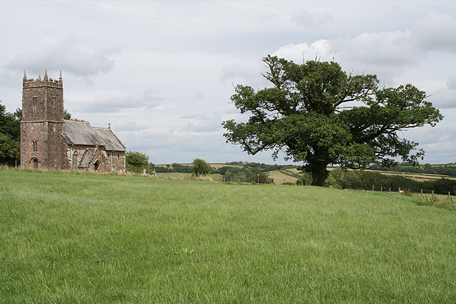
Beaworthy is well-served by amenities and facilities to cater to the needs of its residents. It has a primary school, a village hall, a local pub, and a community shop, providing essential services and a sense of community for its inhabitants. The village also has a church, St. Alban's, which serves as a spiritual and social center for the local community.

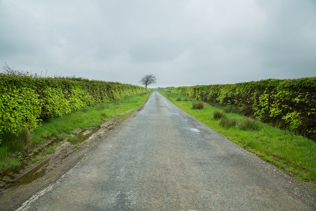
The surrounding countryside offers ample opportunities for outdoor activities and exploration. There are numerous footpaths and bridleways, making it an ideal location for walking, hiking, and horse riding. The area is also known for its beautiful landscapes, attracting nature lovers and outdoor enthusiasts.

Overall, Beaworthy is a charming and peaceful civil parish in Devon, offering a close-knit community, stunning scenery, and a rich cultural heritage.

If you have any feedback on the listing, please let us know in the comments section below.

Beaworthy Images

Images are sourced within 2km of 50.762613/-4.174979 or Grid Reference SX4698. Thanks to Geograph Open Source API. All images are credited.

Old Wayside Cross in St Alban's churchyard, Beaworthy Ashbury Cross, a wayside cross which has been moved, with an old head, shaft and base. Standing just inside St Alban's churchyard in Beaworthy parish, on a grass bank under trees. It was brought from Ashbury Cross on Broadbury Down around 1880. 

Milestone Society National ID: DVWD_BEA02
Old Wayside Cross in St Alban's churchyard, Beaworthy
Ashbury Cross, a wayside cross which has been moved, with an old head, shaft and base. Standing just inside St Alban's churchyard in Beaworthy parish, on a grass bank under trees. It was brought from Ashbury Cross on Broadbury Down around 1880. Milestone Society National ID: DVWD_BEA02
A3079 south of Halwill Junction
A3079 at Hole Ball Cross
A3079 Metherell Cross The sign warns of a staggered junction, but in fact the two are some distance apart.
The right turn doubles back to Hender Barrow.
A3079 Metherell Cross
The sign warns of a staggered junction, but in fact the two are some distance apart. The right turn doubles back to Hender Barrow.
A3079 near Patchacott Cross Heading across the high land of Broadbury.
A3079 near Patchacott Cross
Heading across the high land of Broadbury.
Byway to Patchacott
Byway to Patchacott
Permissive Bridleway - Northcombe Plantation
Road to Patchacott
Road to Patchacott
Disused railway bridge The bridge once carried the Meldon Junction to Holsworthy Branch railway.
Disused railway bridge
The bridge once carried the Meldon Junction to Holsworthy Branch railway.
Madworthy Methodist Church
Disused railway bridge The bridge once carried the now dismantled Meldon Junction to Holsworthy Branch railway.
Disused railway bridge
The bridge once carried the now dismantled Meldon Junction to Holsworthy Branch railway.
Converted railway house by dismantled railway Taken from an overbridge on the dismantled Meldon Junction to Holsworthy Branch railway, part of the old track bed can be seen in the foreground.
Converted railway house by dismantled railway
Taken from an overbridge on the dismantled Meldon Junction to Holsworthy Branch railway, part of the old track bed can be seen in the foreground.
Bridge over dismantled railway The bridge carries the road to Patchacott over the trackbed of the dismantled railway from Medlon Junction to Holsworthy.
Bridge over dismantled railway
The bridge carries the road to Patchacott over the trackbed of the dismantled railway from Medlon Junction to Holsworthy.
Public Byway to the lane to Beamsworthy
Road across Broadbury The road shown further westwards and in a different season at <a href="https://www.geograph.org.uk/photo/487823">SX4497 : Road across Broadbury</a>. Here it approaches a track on the right leading to Rowden.
Road across Broadbury
The road shown further westwards and in a different season at SX4497 : Road across Broadbury. Here it approaches a track on the right leading to Rowden.
Access road to Rowden Farm A sign at the gate offers free-range eggs, DIY livery, small bale straw. illustrating the range of activity at the farm
Access road to Rowden Farm
A sign at the gate offers free-range eggs, DIY livery, small bale straw. illustrating the range of activity at the farm
Minor road west of Metherell Cross
Road to Metehrell Farm and campsite
Show me another place!

Beaworthy is located at Grid Ref: SX4698 (Lat: 50.762613, Lng: -4.174979)

Administrative County: Devon

District: West Devon

Police Authority: Devon & Cornwall

What 3 Words

///begins.graph.beanbag. Near Hatherleigh, Devon

Nearby Locations

Beaworthy

Related Wikis

Beaworthy

Beaworthy is a village and civil parish in the West Devon district of Devon, England. According to the 2001 census it had a population of 236. == Notable... ==

Ashbury railway station

Ashbury railway station was located on the Okehampton to Bude Line 3¾ miles east of Halwill Junction, and served the hamlet of Ashbury and the village...

Broadbury Castle

Broadbury Castle (grid reference SX48379580) is an archaeological earthwork close to Beaworthy in Devon, England. It comprises a single bank and ditch...

Halwill Junction railway station

Halwill Junction Railway Station was a railway station in Halwill Junction, near the villages of Halwill and Beaworthy in Devon, England. It opened in...

Odham

Odham is a village in Devon, England.

Eworthy

Eworthy is a hamlet in Devon, England. It is situated close to Germansweek. There is a Methodist chapel in the hamlet. == References ==

Ashbury, Devon

Ashbury is a village and former civil parish, now in the parish of Northlew, in the West Devon district, in the county of Devon, England. It is 5 miles...

Northlew

Northlew is a village and civil parish in the West Devon district of the county of Devon, England. To the west of the village, but within the parish, are...

Nearby Amenities

Located within 500m of 50.762613,-4.174979
Generator Method: photovoltaic
Generator Output Electricity: yes
Generator Source: solar
Generator Type: solar_photovoltaic_panel
Location: roof
Power: generator
Lat/Long: 50.7616381/-4.1701001
The data included in this document is from www.openstreetmap.org. The data is made available under ODbL.

Have you been to Beaworthy?

Leave your review of Beaworthy below (or comments, questions and feedback).