Beaumont-cum-Moze

Civil Parish in Essex Tendring

England

Beaumont-cum-Moze

Cottages on Harwich Road Looking towards Beaumont Cum Moze on the B1414.
Cottages on Harwich Road Credit: Glyn Baker

Beaumont-cum-Moze is a civil parish located in the county of Essex in England. It is situated near the mouth of the River Colne and is approximately 7 miles southeast of the town of Colchester.

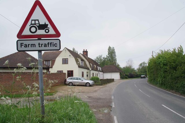
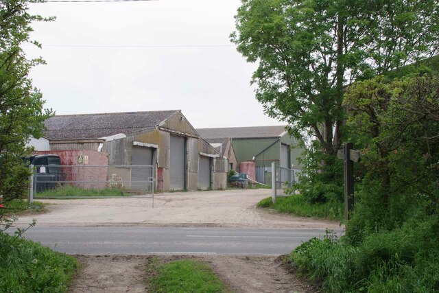
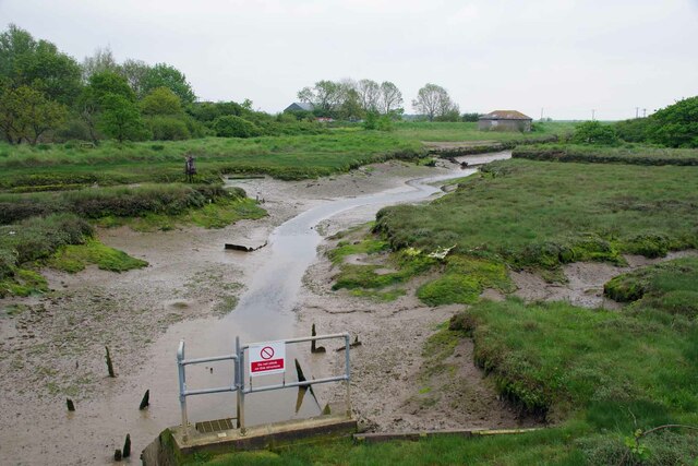
The parish covers an area of around 10 square miles and is made up of mainly rural and agricultural land. It is surrounded by picturesque countryside, including farmland and woodland areas. The River Colne estuary provides a stunning backdrop to the parish, with its marshlands and tidal creeks.

Historically, Beaumont-cum-Moze was part of the ancient parish of Great Bromley. Over the years, it has had a small population and remains a relatively quiet and peaceful area. The main settlement within the parish is the village of Beaumont, which is home to a few hundred residents.

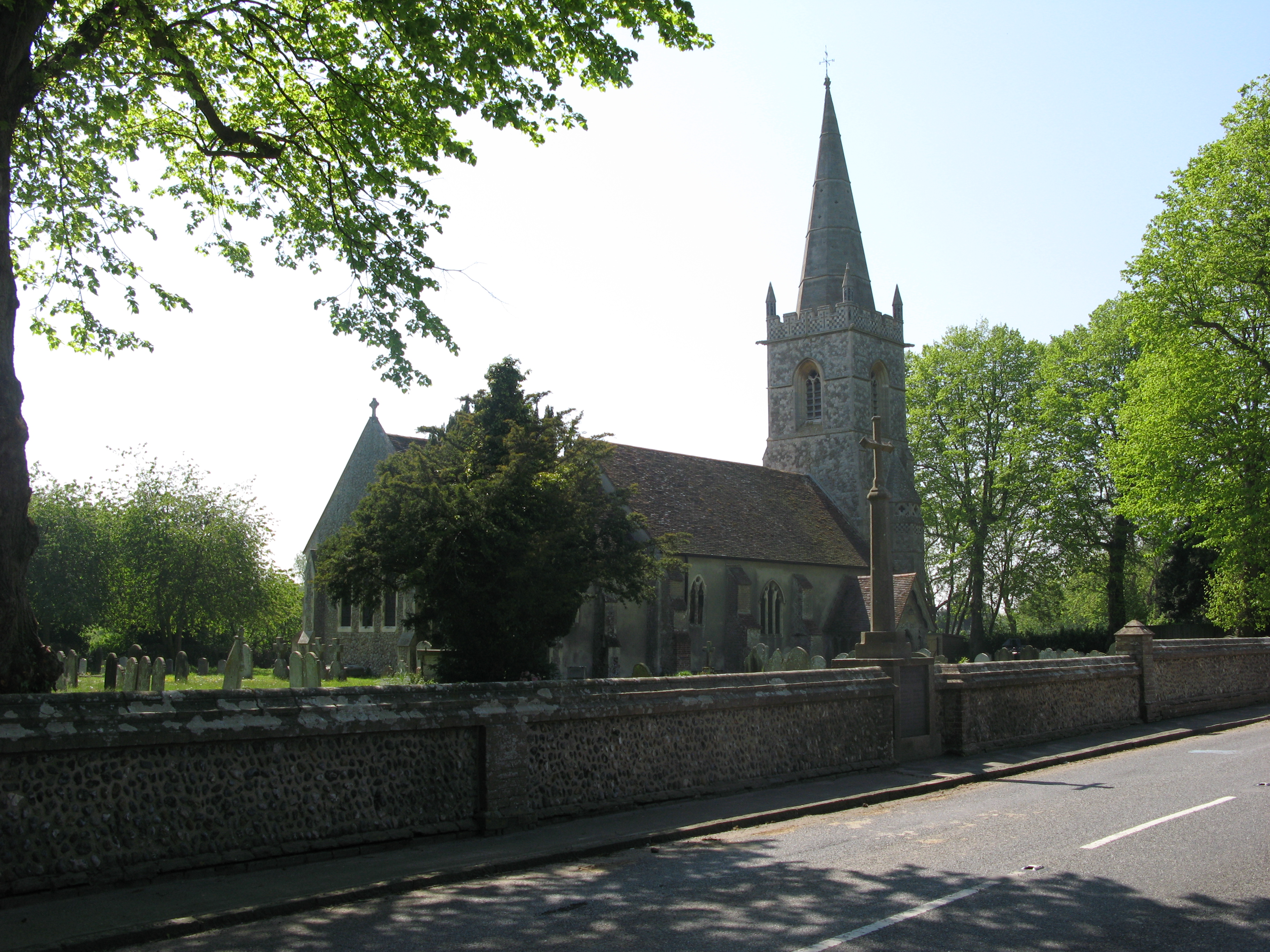
The village features a mix of old and new buildings, with some historic cottages and farmhouses still standing. There is a local church, St Leonard's, which dates back to the 12th century and is a Grade I listed building. The church is known for its beautiful architecture and stained glass windows.

The parish is well-connected to the surrounding areas by road, with the A120 running through it, providing easy access to Colchester and other nearby towns. Despite its rural location, Beaumont-cum-Moze is within reach of amenities and services, with shops, schools, and healthcare facilities available in nearby towns.

Overall, Beaumont-cum-Moze offers a tranquil and picturesque setting, ideal for those seeking a peaceful countryside lifestyle.

If you have any feedback on the listing, please let us know in the comments section below.

Beaumont-cum-Moze Images

Images are sourced within 2km of 51.879557/1.160553 or Grid Reference TM1724. Thanks to Geograph Open Source API. All images are credited.

Cottages on Harwich Road Looking towards Beaumont Cum Moze on the B1414.
Cottages on Harwich Road
Looking towards Beaumont Cum Moze on the B1414.
Glebehill Cottages on the B1414 The track to the left leads to farmland.
Glebehill Cottages on the B1414
The track to the left leads to farmland.
Footpath 159_11 Past Horseshoes The seat in the garden was decorated with carved horseshoes reflecting the name of the property.
Footpath 159_11 Past Horseshoes
The seat in the garden was decorated with carved horseshoes reflecting the name of the property.
Beaumont Cum Moze Footpath 11 The path crosses the B1414 then joins up with Great Oakley footpath 7 and finally ends up at <a href="https://www.geograph.org.uk/photo/7484308">TM1926 : Footpath 1 Beaumont Cum Moze</a> outside Great Oakley.
Beaumont Cum Moze Footpath 11
The path crosses the B1414 then joins up with Great Oakley footpath 7 and finally ends up at TM1926 : Footpath 1 Beaumont Cum Moze outside Great Oakley.
Old Barn and Footpath 159_10 Beaumont Cum Moze footpath 10 and decaying barn.
Old Barn and Footpath 159_10
Beaumont Cum Moze footpath 10 and decaying barn.
Beaumont Cum Moze Footpath 26 The last house in the terrace is getting an extension.
Beaumont Cum Moze Footpath 26
The last house in the terrace is getting an extension.
Coronation Villas Beaumont Cum Moze Every one of the houses has been so stripped of original features it is very difficult to work out which coronation was being marked. 1902, 1911 or 1937 . However they do look pre WW2.
Coronation Villas Beaumont Cum Moze
Every one of the houses has been so stripped of original features it is very difficult to work out which coronation was being marked. 1902, 1911 or 1937 . However they do look pre WW2.
Old School House Panorama The thatched house is the old school in Beaumont Cum Moze.
Old School House Panorama
The thatched house is the old school in Beaumont Cum Moze.
Farm Track near Northfield Farm
The Way to Lower Barn Farm Clearly the far has diversified and rents out industrial units.
The Way to Lower Barn Farm
Clearly the far has diversified and rents out industrial units.
Unnamed Stream at Beaumont Bridge
Quay Lane Looking towards <a href="https://www.geograph.org.uk/photo/7484386">TM1824 : Cut Farm</a>
Quay Lane
Looking towards TM1824 : Cut Farm
Cut Farm The sign reads Cut Farm  Beaumont Livery.
Cut Farm
The sign reads Cut Farm Beaumont Livery.
Sea Wall Footpath Beaumont Cum Moze 28 Near Beaumont Quay.
Sea Wall Footpath Beaumont Cum Moze 28
Near Beaumont Quay.
Last Mooring of a Thames Barge In the nineteenth and early twentieth centuries Thames barges would collect hay and straw from farms all over East Anglia and deliver it to London to feed horses. The manure from the horses was shipped back to the farms to fertilise the fields. After WW1 motor transport began to replace horses making the trade uneconomic. Over the years countless barges like this one were moored up in quiet creeks and left to rot.
Last Mooring of a Thames Barge
In the nineteenth and early twentieth centuries Thames barges would collect hay and straw from farms all over East Anglia and deliver it to London to feed horses. The manure from the horses was shipped back to the farms to fertilise the fields. After WW1 motor transport began to replace horses making the trade uneconomic. Over the years countless barges like this one were moored up in quiet creeks and left to rot.
Beaumont Quay Cut Farm Sluice Looking towards <a href="https://www.geograph.org.uk/photo/7484398">TM1924 : Beaumont Quay</a>
Beaumont Quay Cut Farm Sluice
Looking towards TM1924 : Beaumont Quay
Beaumont Quay In former times Thames barges would moor here to load up with hay to feed London's horses. For a close look see <a href="https://www.geograph.org.uk/photo/4078381">TM1924 : Beaumont Quay, Beaumont cum Moze</a>
Beaumont Quay
In former times Thames barges would moor here to load up with hay to feed London's horses. For a close look see TM1924 : Beaumont Quay, Beaumont cum Moze
Beaumont Quay Middle Sluice Panorama
Show me another place!

Beaumont-cum-Moze is located at Grid Ref: TM1724 (Lat: 51.879557, Lng: 1.160553)

Administrative County: Essex

District: Tendring

Police Authority: Essex

What 3 Words

///slouched.trickled.strongly. Near Thorpe le Soken, Essex

Related Wikis

Beaumont-cum-Moze

Beaumont-cum-Moze (grid reference TM175250) is a civil parish in the Tendring district of Essex, England. According to the 2001 census it had a population...
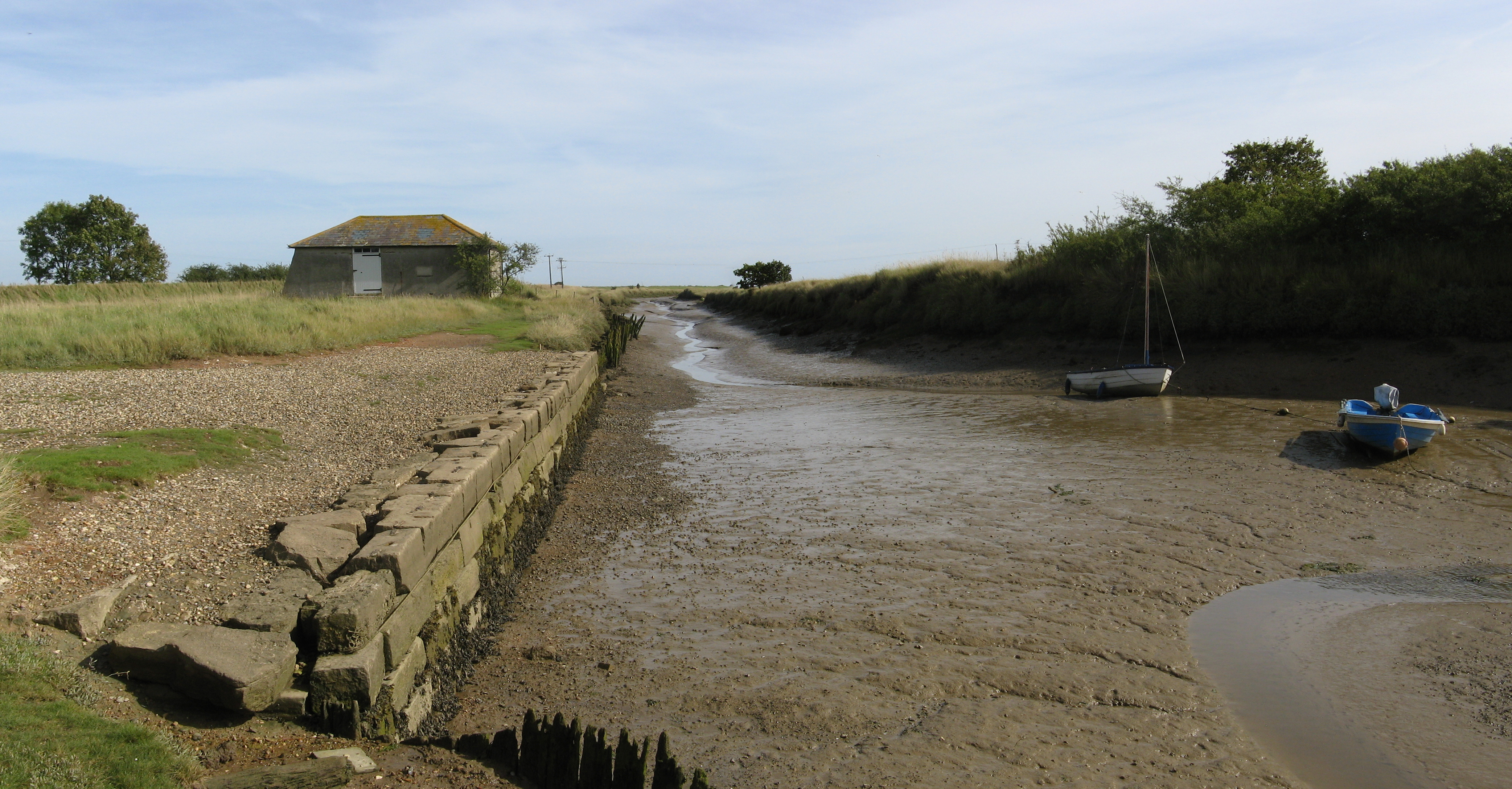
Beaumont Cut

Beaumont Cut was a 1-kilometre-long (1,090 yd) canal linking Beaumont Quay, in the parish of Beaumont-cum-Moze, Tendring, Essex, England, with Hamford...

Stones Green

Stones Green is a hamlet near the village of Wix and the town of Harwich, in the Tendring district, in the English county of Essex. == References == A...

Comarques, Thorpe-le-Soken

Comarques is an 18th-century country house in Thorpe-le-Soken, Essex, England. It has been attributed to the architect, Sir Robert Taylor. Named after...

Landermere Wharf

Landermere Wharf, sometimes called Landermere Quay, is a former dock area suitable for lying at anchor in the Tendring district of Essex, England.The wharf...

Thorpe-le-Soken

Thorpe-le-Soken is a village and civil parish in the Tendring district of Essex, England. It is located east of Colchester, west of Walton-on-the-Naze...

Thorpe Hall (Thorpe-le-Soken)

Thorpe Hall was a manor house built in the Georgian style at Thorpe-le-Soken in Essex, England. == History == The Thorpe Manor estate belonged to the Dean...

Tendring

Tendring is a village and civil parish in Essex. It gives its name to the Tendring District and before that the Tendring Hundred. Its name was given to...

Nearby Amenities

Located within 500m of 51.879557,1.160553
Post Box
Mapillary: 675328500477357
Post Box Mounting: pier
Post Box Type: lamp
Postal Code: CO16 0AR
Ref: CO16 37
Survey Date: 2022-10-18
Lat/Long: 51.8805208/1.1656367
Bus Stop
Chapel Road
Naptan AtcoCode: 150029012001
Naptan Bearing: S
Naptan CommonName: Harwich Road
Naptan Crossing: Chapel Road
Naptan Indicator: S-bound
Naptan Landmark: Harwich Road
Naptan NaptanCode: esxgdjtm
Naptan Street: Harwich Road
Public Transport: platform
Shelter: yes
Source: naptan_import; survey
Lat/Long: 51.8816398/1.1648844
Bus Stop
Chapel Road
Layby: yes
Naptan AtcoCode: 150029012002
Naptan Bearing: N
Naptan CommonName: Harwich Road
Naptan Crossing: Chapel Road
Naptan Indicator: N-bound
Naptan Landmark: Harwich Road
Naptan NaptanCode: esxgdjtp
Naptan Street: Harwich Road
Public Transport: platform
Source: naptan_import; survey
Lat/Long: 51.8820854/1.1648952
Barrier: stile
Foot: yes
Lat/Long: 51.8820407/1.1583537
Power: pole
Source: bing
Lat/Long: 51.8819429/1.1662715
Beaumont-cum-Moze
Place: village
Wikidata: Q2092966
Wikipedia: en:Beaumont-cum-Moze
Lat/Long: 51.8803508/1.1650317
Power: pole
Source: bing
Transformer: distribution
Lat/Long: 51.8781812/1.1661499
Power: pole
Source: bing
Lat/Long: 51.8783367/1.1672611
Power: pole
Source: bing
Transformer: distribution
Lat/Long: 51.8817588/1.159581
Power: pole
Source: bing
Lat/Long: 51.8823383/1.1604075
Power: pole
Source: bing
Lat/Long: 51.8829299/1.1612463
Power: pole
Source: bing
Lat/Long: 51.8835244/1.1620693
Defibrillator
Defibrillator Location: On exterior wall of hall near the entrance
Emergency: defibrillator
Ref GB The Circuit: 8F6E0B71-CDD0-4ABB-AAB2-AEC500C86BCF
Lat/Long: 51.881632/1.1646376
The data included in this document is from www.openstreetmap.org. The data is made available under ODbL.

Have you been to Beaumont-cum-Moze?

Leave your review of Beaumont-cum-Moze below (or comments, questions and feedback).