Barton

Civil Parish in Yorkshire Richmondshire

England

Barton

Power lines by the A1(M)
Power lines by the A1(M) Credit: Anthony Parkes

Barton is a civil parish located in the county of Yorkshire, England. Situated in the North East region of the country, Barton is part of the East Riding of Yorkshire district. The parish covers an area of approximately 3 square miles.

Barton is a charming village with a rich history dating back to medieval times. It is renowned for its picturesque landscapes and rural beauty, surrounded by rolling hills and fertile farmland. The village is situated on the banks of the River Humber, providing stunning views and a tranquil atmosphere.

The parish is home to a small but close-knit community. The population of Barton is estimated to be around 3,000 people. The village offers a range of amenities for its residents, including a primary school, a church, and several local businesses such as shops and pubs. The village also has a community center that hosts various events and activities throughout the year.

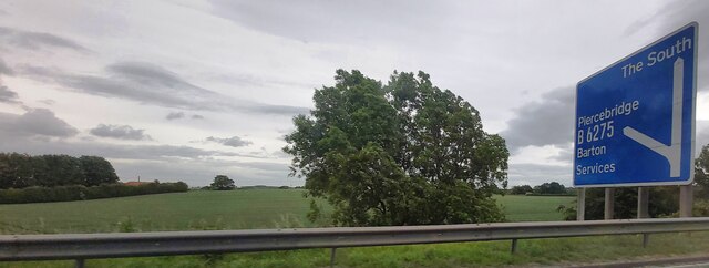
Barton is well-connected to neighboring towns and cities through a good transport network. The village is located near the A15 road, which provides easy access to Hull, Scunthorpe, and other nearby towns. The village also has a railway station, offering regular services to destinations across the region.

Overall, Barton is a peaceful and picturesque village with a strong sense of community. Its beautiful surroundings, historical charm, and convenient location make it an attractive place to live or visit in Yorkshire.

If you have any feedback on the listing, please let us know in the comments section below.
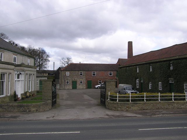
Barton Images

Images are sourced within 2km of 54.473306/-1.645035 or Grid Reference NZ2308. Thanks to Geograph Open Source API. All images are credited.

Power lines by the A1(M)
Fields by the A1(M)
Fields by the A1(M)
OS Flush Bracket 2179 - Little Hangbank Bridge This area has a very unusual concentration of 2GL Flush Brackets
<span class="nowrap"><a title="https://www.bench-marks.org.uk/bm10212" rel="nofollow ugc noopener" href="https://www.bench-marks.org.uk/bm10212">Link</a><img style="margin-left:2px;" alt="External link" title="External link - shift click to open in new window" src="https://s1.geograph.org.uk/img/external.png" width="10" height="10"/></span>

<span class="nowrap"><a title="https://www.bench-marks.org.uk/help/flush" rel="nofollow ugc noopener" href="https://www.bench-marks.org.uk/help/flush">Link</a><img style="margin-left:2px;" alt="External link" title="External link - shift click to open in new window" src="https://s1.geograph.org.uk/img/external.png" width="10" height="10"/></span>
2GL Series
Flush brackets were first used during the 2nd Geodetic Levelling of England & Wales between 1912 and 1921. The 2GL series was numbered from OSBM 1 to OSBM 3000 and did not have a prefix letter. The vast majority of the flush brackets in the 2GL series were placed on walls and buildings, but a small number were used on triangulation pillars. There are 48 examples of these listed in the database, all in the range OSBM 2732 to OSBM 2999.

In addition to England and Wales, the survey also covered part of the southeast of Scotland, in roughly the area between Newcastleton, Dunbar, and Berwick upon Tweed.
OS Flush Bracket 2179 - Little Hangbank Bridge
This area has a very unusual concentration of 2GL Flush Brackets LinkExternal link LinkExternal link 2GL Series Flush brackets were first used during the 2nd Geodetic Levelling of England & Wales between 1912 and 1921. The 2GL series was numbered from OSBM 1 to OSBM 3000 and did not have a prefix letter. The vast majority of the flush brackets in the 2GL series were placed on walls and buildings, but a small number were used on triangulation pillars. There are 48 examples of these listed in the database, all in the range OSBM 2732 to OSBM 2999. In addition to England and Wales, the survey also covered part of the southeast of Scotland, in roughly the area between Newcastleton, Dunbar, and Berwick upon Tweed.
Little Hangbank Bridge Little Hangbank Bridge almost directly behind white rubbish
Little Hangbank Bridge
Little Hangbank Bridge almost directly behind white rubbish
Section of Dere Street - A Roman Road
Sheep pasture above Clow Beck Green pastures with what appear to be lines of old ridge and furrow.
Sheep pasture above Clow Beck
Green pastures with what appear to be lines of old ridge and furrow.
Roadworks on A1(M) A temporary 50mph limit enforced by average speed cameras for roadworks, although there are no actual works visible in this shot.
Roadworks on A1(M)
A temporary 50mph limit enforced by average speed cameras for roadworks, although there are no actual works visible in this shot.
Recently Reopened Quarry, Little Hangbank
View West From Dere Street General view west across arable fields to the raised ground mapped as Micklow Woods which doesn't seem to consist of any trees.
View West From Dere Street
General view west across arable fields to the raised ground mapped as Micklow Woods which doesn't seem to consist of any trees.
View East From Hangbank Cottages Along the line of the Public Footpath.
View East From Hangbank Cottages
Along the line of the Public Footpath.
Road from Middleton Tyas to Croft-on-Tees
Grass airstrip seen from Middleton Tyas to Croft-on-Tees road
The back road from Middleton Tyas to Barton, North Yorkshire
Ford at Barton, near Darlington
Village cross in Barton village, near Darlington The Half Moon public house is in the background. The road on the left was formerly the Great North Road, until bypassed by the A1(M) and A66(M).
Village cross in Barton village, near Darlington
The Half Moon public house is in the background. The road on the left was formerly the Great North Road, until bypassed by the A1(M) and A66(M).
A1(M) near Barton Just south of here, the A1 attains motorway status, and at this point follows the line of an old railway. Looking north.
A1(M) near Barton
Just south of here, the A1 attains motorway status, and at this point follows the line of an old railway. Looking north.
Willow Bridge Garage A rare small, petrol garage on the old A1 trunk road, recently up for sale.
Willow Bridge Garage
A rare small, petrol garage on the old A1 trunk road, recently up for sale.
Brettanby Manor Lodge
Show me another place!

Barton is located at Grid Ref: NZ2308 (Lat: 54.473306, Lng: -1.645035)

Division: North Riding

Administrative County: North Yorkshire

District: Richmondshire

Police Authority: North Yorkshire

What 3 Words

///sizes.connected.rejoins. Near High Coniscliffe, Co. Durham

Nearby Locations

Barton

Related Wikis

Barton, North Yorkshire

Barton is a village and civil parish in North Yorkshire, England. According to the 2011 census it had a population of 837. It is situated near the border...

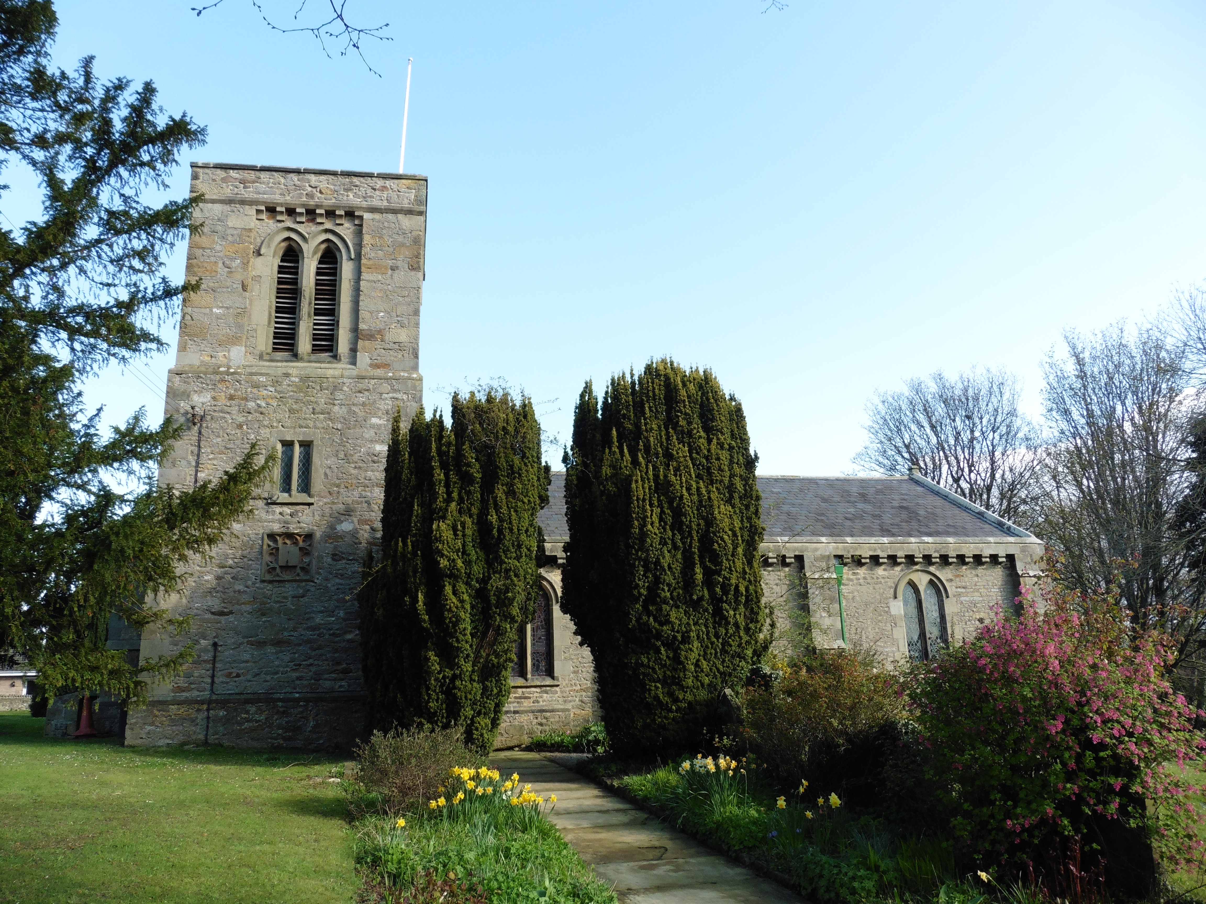
St Cuthbert and St Mary's Church, Barton

St Cuthbert and St Mary's Church is the parish church of Barton, North Yorkshire, in England. In the medieval period, Barton was served by two churches...

Newton Morrell

Newton Morrell is a village and civil parish in the Richmondshire district of North Yorkshire, England. It is 6 miles (9 km) from Darlington and 2 miles...

Middleton Lodge

Middleton Lodge is a Georgian Palladian mansion set within 200 acres (0.81 km2) of open countryside, on the outskirts of the village of Middleton Tyas...

Nearby Amenities

Located within 500m of 54.473306,-1.645035
Barton
Place: village
Lat/Long: 54.4740037/-1.6465968
Ford: yes
Lat/Long: 54.4728611/-1.6455399
Bus: yes
Public Transport: stop_position
Lat/Long: 54.4727661/-1.6508511
Bus: yes
Public Transport: stop_position
Lat/Long: 54.4749234/-1.6433459
Bus: yes
Public Transport: stop_position
Lat/Long: 54.4751222/-1.64117
Turning Circle
Lat/Long: 54.4728494/-1.6430295
Turning Circle
Lat/Long: 54.4739096/-1.6429986
Turning Loop
Lat/Long: 54.4729928/-1.6441074
Turning Circle
Lat/Long: 54.4738485/-1.6454682
Turning Circle
Lat/Long: 54.4737491/-1.6440688
Turning Circle
Lat/Long: 54.4728482/-1.6464291
Historic: memorial
Memorial: war_memorial
Lat/Long: 54.4736669/-1.6478511
Post Office
Barton Post Office
Addr City: Richmond
Addr County: North Yorkshire
Addr Housenumber: 31
Addr Postcode: DL10 6JH
Addr Street: Silver Street
Addr Village: Barton
Branch: Barton
Brand: Post Office
Brand Wikidata: Q1783168
Check Date: 2020-02-20
Contact Website: https://www.postoffice.co.uk/branch-finder/2693097/barton
Fhrs Id: 837833
Ref Pol Id: 10715
Lat/Long: 54.4741692/-1.6464888
Historic: memorial
Memorial: cross
Lat/Long: 54.4738079/-1.6474034
Grit Bin
Access: yes
Lat/Long: 54.4736219/-1.6469657
Grit Bin
Access: yes
Lat/Long: 54.4727766/-1.6451767
Bench
Backrest: yes
Material: wood
Seats: 2
Lat/Long: 54.4729931/-1.6457916
Bench
Backrest: yes
Material: wood
Seats: 2
Lat/Long: 54.4727067/-1.6457005
Waste Basket
Waste: dog_excrement
Lat/Long: 54.4728645/-1.6451417
Waste Basket
Waste: dog_excrement
Lat/Long: 54.4720329/-1.6429958
Waste Basket
Waste: dog_excrement
Lat/Long: 54.4748923/-1.6426681
Waste Basket
Waste: dog_excrement
Lat/Long: 54.4746604/-1.6443714
Grit Bin
Access: yes
Lat/Long: 54.4747805/-1.6440576
Bench
Backrest: yes
Material: wood
Seats: 2
Lat/Long: 54.4735142/-1.6470555
Waste Basket
Waste: trash
Lat/Long: 54.4735213/-1.6470288
Waste Basket
Waste: trash
Lat/Long: 54.4729874/-1.6457675
Bus Stop
Bench: no
Bin: yes
Bus: yes
Kerb: lowered
Public Transport: platform
Shelter: yes
Tactile Paving: no
Lat/Long: 54.4737102/-1.6477501
Waste Basket
Waste: trash
Lat/Long: 54.4741961/-1.6465537
Waste Basket
Waste: trash
Lat/Long: 54.4742199/-1.6464389
Bus Stop
Bench: yes
Bin: yes
Bus: yes
Kerb: raised
Naptan AtcoCode: 3200YNA90380
Naptan NaptanCode: 32090380
Public Transport: platform
Shelter: yes
Tactile Paving: no
Lat/Long: 54.4749975/-1.6433689
Waste Basket
Waste: trash
Lat/Long: 54.4750649/-1.6419991
Bench
Backrest: yes
Material: wood
Seats: 2
Lat/Long: 54.4750619/-1.642039
Waste Basket
Waste: dog_excrement
Lat/Long: 54.4735449/-1.6470601
Bus Stop
Bench: no
Bin: yes
Bus: yes
Kerb: raised
Naptan AtcoCode: 3200YNA90379
Naptan NaptanCode: 32090379
Public Transport: platform
Shelter: yes
Tactile Paving: no
Lat/Long: 54.4750778/-1.6411534
Waste Basket
Waste: dog_excrement
Lat/Long: 54.4760455/-1.6394034
Bus Stop
Bench: no
Bin: no
Bus: yes
Kerb: raised
Naptan AtcoCode: 3200YNA90382
Naptan NaptanCode: 32090382
Public Transport: platform
Shelter: no
Tactile Paving: no
Lat/Long: 54.4727851/-1.6509398
Waste Basket
Waste: dog_excrement
Lat/Long: 54.4767457/-1.6474009
Street Lamp
Lamp Mount: pole
Lamp Type: led
Ref: 4
Lat/Long: 54.4727694/-1.6451817
Street Lamp
Lamp Mount: pole
Lamp Type: led
Ref: 1
Lat/Long: 54.4728236/-1.6457235
Street Lamp
Lamp Mount: pole
Lamp Type: led
Ref: 3
Lat/Long: 54.4726898/-1.64465
Street Lamp
Lamp Mount: pole
Lamp Type: sodium
Ref: 1
Lat/Long: 54.4724052/-1.6435045
Street Lamp
Lamp Mount: pole
Lamp Type: led
Ref: 2
Lat/Long: 54.4725529/-1.6440629
Street Lamp
Lamp Mount: pole
Lamp Type: led
Ref: 1
Lat/Long: 54.4737605/-1.6473072
Street Lamp
Lamp Mount: pole
Lamp Type: led
Ref: 2
Lat/Long: 54.4735022/-1.6469961
Street Lamp
Lamp Mount: pole
Lamp Type: led
Ref: 3
Lat/Long: 54.4732297/-1.6465616
Street Lamp
Lamp Mount: pole
Lamp Type: led
Ref: 4
Lat/Long: 54.4730305/-1.6459308
Turning Circle
Lat/Long: 54.4729989/-1.6473137
Natural: tree_stump
Lat/Long: 54.4725439/-1.6452595
Turning Circle
Lat/Long: 54.4756737/-1.6437796
Turning Circle
Lat/Long: 54.4756982/-1.6433771
Turning Circle
Lat/Long: 54.4752004/-1.6433675
Height: 0.5
Man Made: street_cabinet
Lat/Long: 54.4760719/-1.6395559
Turning Circle
Lat/Long: 54.4717239/-1.64707
Bus: yes
Public Transport: stop_position
Lat/Long: 54.473756/-1.6478692
Public Bookcase
Note: shelves in bus shelter
Public Bookcase Type: shelf
Lat/Long: 54.4737151/-1.6476812
Power: pole
Lat/Long: 54.47654/-1.6496497
Give Way
Direction: backward
Lat/Long: 54.47639/-1.6470423
The data included in this document is from www.openstreetmap.org. The data is made available under ODbL.

Have you been to Barton?

Leave your review of Barton below (or comments, questions and feedback).