Barnstaple

Civil Parish in Devon North Devon

England

Barnstaple

The River Yeo in Barnstaple
The River Yeo in Barnstaple Credit: Tony Atkin

Barnstaple is a civil parish located in the county of Devon, England. Situated on the banks of the River Taw, it is the main town of North Devon and serves as the administrative center for the district. With a population of around 34,000 people, Barnstaple is the largest town in the area.

The town has a rich history dating back to Saxon times, and evidence of its past can be seen in the architecture and layout of the town. Barnstaple's medieval street pattern still exists in parts of the town, with narrow winding streets and historic buildings.

Barnstaple offers a variety of amenities and services to its residents and visitors. High Street, the main shopping area, is bustling with a mix of independent shops, national retailers, cafes, and restaurants. The Pannier Market, held in a historic building, is a popular spot for locals and tourists alike, offering a range of goods including fresh produce, crafts, and antiques.

The town is also known for its vibrant cultural scene. The Queen's Theatre hosts a range of performances, including plays, musicals, and concerts, while the Museum of Barnstaple and North Devon showcases the area's history and heritage.

The surrounding countryside provides ample opportunities for outdoor activities, with the Tarka Trail, a scenic walking and cycling route, passing through the town. Additionally, the nearby North Devon coast offers beautiful beaches and stunning coastal walks.

Overall, Barnstaple is a charming town with a rich history, offering a mix of amenities, cultural attractions, and access to the picturesque Devon countryside.

If you have any feedback on the listing, please let us know in the comments section below.
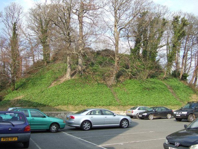
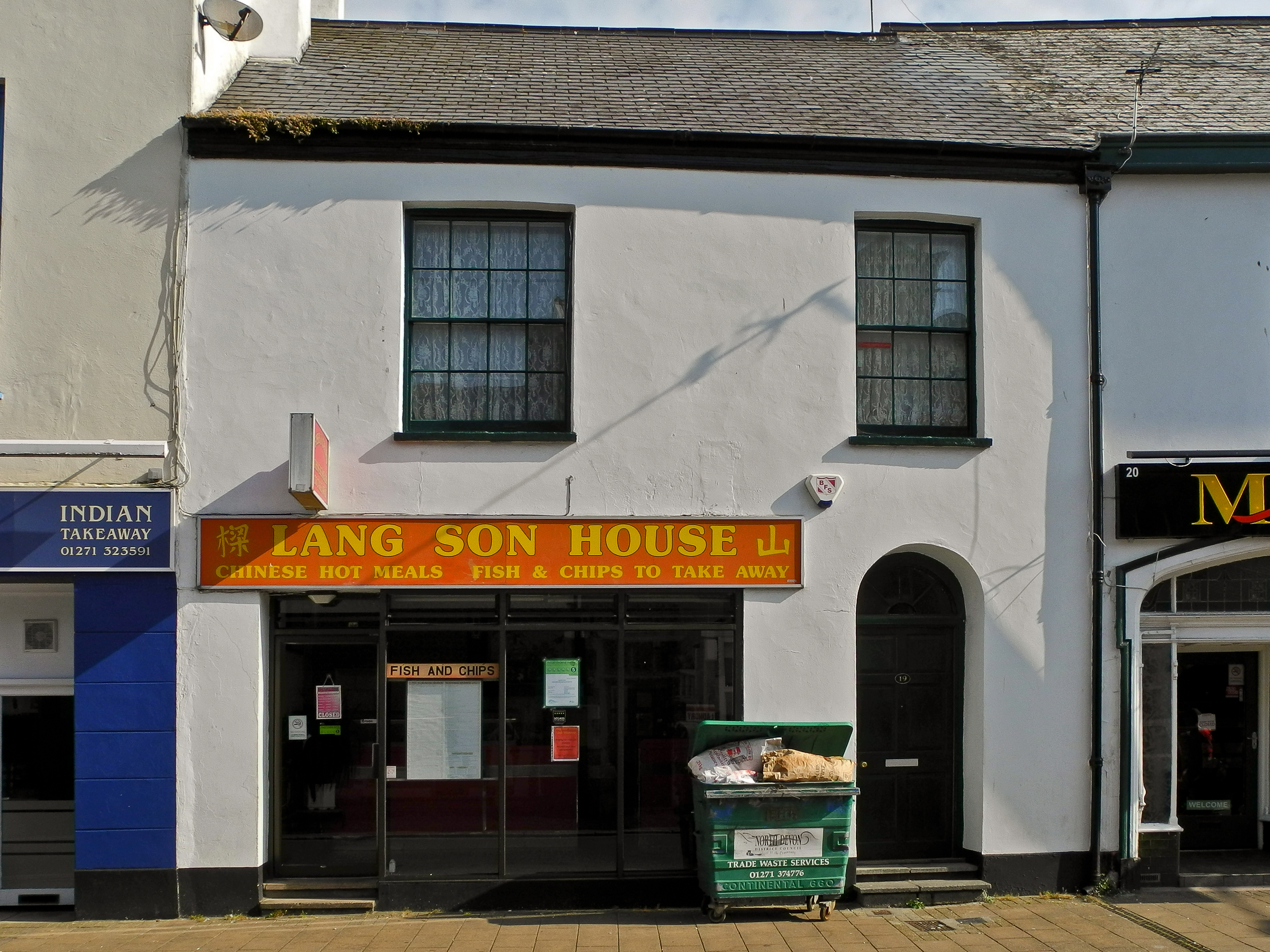
Barnstaple Images

Images are sourced within 2km of 51.080694/-4.05197 or Grid Reference SS5633. Thanks to Geograph Open Source API. All images are credited.

The River Yeo in Barnstaple
Civic Centre, Barnstaple, from south bank of river Taw
Barnstaple estate Forches housing estates in Barnstaple.
Barnstaple estate
Forches housing estates in Barnstaple.
Bridge over Pottington Creek, Barnstaple This stylish modern bridge was built to replace Pottington Swing Bridge which was demolished after the Barnstaple to Ilfracombe railway closed.
Bridge over Pottington Creek, Barnstaple
This stylish modern bridge was built to replace Pottington Swing Bridge which was demolished after the Barnstaple to Ilfracombe railway closed.
Barnstaple Long Bridge Barnstaple Long Bridge was built in the 14th century  and is still the main river crossing for several miles. However a new bridge is being built slightly downstream to take much of the passing traffic out of the town centre. It is expected to open in 2006.
Barnstaple Long Bridge
Barnstaple Long Bridge was built in the 14th century and is still the main river crossing for several miles. However a new bridge is being built slightly downstream to take much of the passing traffic out of the town centre. It is expected to open in 2006.
The Iron Bridge, Barnstaple The Iron bridge used to carry the link between the ex-Great Western Railway and Southern Railway lines in Barnstaple. This allowed GW trains from Taunton  to continue through to Ilfracombe. Despite the line closing in the early 1960s and the value of the metal for scrap, the bridge survived to become a pedestrian and cycle bridge.
The Iron Bridge, Barnstaple
The Iron bridge used to carry the link between the ex-Great Western Railway and Southern Railway lines in Barnstaple. This allowed GW trains from Taunton to continue through to Ilfracombe. Despite the line closing in the early 1960s and the value of the metal for scrap, the bridge survived to become a pedestrian and cycle bridge.
Barnstaple fast food Strategically situated beside one of the main roads of Barnstaple.
Barnstaple fast food
Strategically situated beside one of the main roads of Barnstaple.
Barnstaple street There's a lot of houses in Barnstaple with this brickwork style.
Barnstaple street
There's a lot of houses in Barnstaple with this brickwork style.
Barnstaple Long Bridge on a crisp morning. I'm not sure what the word for this stuff is - the mist that rises from a river on a cold morning - but it looks pretty.
Barnstaple Long Bridge on a crisp morning.
I'm not sure what the word for this stuff is - the mist that rises from a river on a cold morning - but it looks pretty.
View of Bradiford from Poleshill Lane
Almshouses and Church, Pilton Pevsner says that these Almshouses were built in 1849 in 'pretty-imitation Tudor' style. St Mary's Church is behind them.
Almshouses and Church, Pilton
Pevsner says that these Almshouses were built in 1849 in 'pretty-imitation Tudor' style. St Mary's Church is behind them.
New Road Bridge over the Taw Under construction (Mar 2006), this bridge is part of the new western bypass for the town.
New Road Bridge over the Taw
Under construction (Mar 2006), this bridge is part of the new western bypass for the town.
Long Bridge Plaque inscription says "Barnstaple Long Bridge, Ministry of Transport, built in the 13th century, widened about 1796 and again in 1963"
Long Bridge
Plaque inscription says "Barnstaple Long Bridge, Ministry of Transport, built in the 13th century, widened about 1796 and again in 1963"
Albert Memorial The tower is for Albert, the building on the right is a Museum and information centre
Albert Memorial
The tower is for Albert, the building on the right is a Museum and information centre
Castle Mound Norman castle mound in Barnstaple, now trapped in the car park.
Castle Mound
Norman castle mound in Barnstaple, now trapped in the car park.
Tesco Walkway through the carpark
Tesco
Walkway through the carpark
Barnstaple Station An Exeter train is about to depart.
Barnstaple Station
An Exeter train is about to depart.
Barnstaple Station The station was once an important junction with the line from Exeter branching to Ilfracombe, Torrington and Taunton. It is now a terminus with a single platform. Viewed from a road bridge over the old route to Torrington.
Barnstaple Station
The station was once an important junction with the line from Exeter branching to Ilfracombe, Torrington and Taunton. It is now a terminus with a single platform. Viewed from a road bridge over the old route to Torrington.
Show me another place!

Barnstaple is located at Grid Ref: SS5633 (Lat: 51.080694, Lng: -4.05197)

Administrative County: Devon

District: North Devon

Police Authority: Devon & Cornwall

What 3 Words

///effort.couches.ducks. Near Barnstaple, Devon

Nearby Locations

Derby Barnstaple

Related Wikis

Barnstaple Rural District

Barnstaple Rural District was a rural district in the administrative county of Devon, England, from 1894 to 1974, covering a coastal area in the north...

Bear Street drill hall, Barnstaple

The Bear Street drill hall is a former military installation in Barnstaple, Devon. It is a Grade II listed building. == History == The building was completed...

Barnstaple Cemetery

Barnstaple Cemetery (properly Bear Street Cemetery) is the burial ground for the town of Barnstaple in Devon and is managed by North Devon Council.The...

North Devon

North Devon is a local government district in Devon, England. Its council is based just outside Barnstaple, the district's largest town. The district also...

Nearby Amenities

Located within 500m of 51.080694,-4.05197
Crossing
Button Operated: yes
Crossing: traffic_signals
Lat/Long: 51.0781252/-4.0577166
Crossing
Crossing: traffic_signals
Lat/Long: 51.0783749/-4.0560522
Traffic Signals
Lat/Long: 51.0829733/-4.0550588
Crossing
Crossing: traffic_signals
Crossing Markings: yes
Lat/Long: 51.0785063/-4.0549194
Crossing
Button Operated: yes
Crossing: traffic_signals
Crossing Markings: yes
Lat/Long: 51.0786016/-4.05483
Traffic Signals
Lat/Long: 51.0811657/-4.054616
Created By: Potlatch 0.10f
Description: Territorial Army Centre
Military: barracks
Lat/Long: 51.0788535/-4.0535765
Crossing
Button Operated: yes
Crossing: traffic_signals
Lat/Long: 51.0795543/-4.0542412
Fuel
Taw Service Station
Brand: Esso
Brand Wikidata: Q867662
Brand Wikipedia: en:Esso
Contact Website: https://www.esso.co.uk/en-gb/find-station/esso-barnstaple-essotawgarages-100201422
Operator: Brend Group
Lat/Long: 51.0766023/-4.049833
Parking
Created By: Potlatch 0.10f
Lat/Long: 51.0833982/-4.0559697
Crossing
Crossing: unmarked
Crossing Markings: no
Kerb: flush
Tactile Paving: yes
Lat/Long: 51.0801269/-4.0579508
Crossing
Crossing: unmarked
Crossing Markings: no
Kerb: flush
Tactile Paving: yes
Lat/Long: 51.0801818/-4.0581338
Crossing
Crossing: unmarked
Crossing Markings: no
Kerb: flush
Tactile Paving: yes
Lat/Long: 51.0800141/-4.0581561
Crossing
Crossing: unmarked
Crossing Markings: no
Kerb: flush
Tactile Paving: yes
Traffic Calming: table
Lat/Long: 51.079665/-4.0582456
Addr City: Barnstaple
Addr Housenumber: 39-40
Addr Postcode: EX31 1SB
Addr Street: Boutport Street
Lat/Long: 51.0802609/-4.0579331
Pub
The Underground
Lat/Long: 51.0784465/-4.0580558
Traffic Signals
Source: survey
Lat/Long: 51.083987/-4.0515343
Doctors
Brannam Medical Centre
Healthcare: doctor
Source: local_knowledge
Lat/Long: 51.0774365/-4.0562187
Traffic Calming: island
Lat/Long: 51.0769203/-4.0504557
Bus Stop
Bus: yes
Public Transport: platform
Lat/Long: 51.0841095/-4.0492613
Bus Stop
Bus: yes
Public Transport: platform
Source: survey
Lat/Long: 51.0839361/-4.0488469
Mini Roundabout
Direction: clockwise
Source: local_knowledge
Lat/Long: 51.0822611/-4.0512747
Fort Hill
Is In: Barnstaple
Place: suburb
Lat/Long: 51.0797583/-4.0503121
Derby
Is In: Barnstaple
Name Lt: Derbis
Place: suburb
Lat/Long: 51.0834518/-4.0489603
Crossing
Crossing: traffic_signals
Crossing Island: yes
Source: local_knowledge
Lat/Long: 51.0774942/-4.0522253
Save On Tyres
Addr City: Barnstaple
Addr Housenumber: 29
Addr Postcode: EX32 7BX
Addr Street: Bear Street
Shop: car_repair
Lat/Long: 51.0810632/-4.0547794
Bus Stop
Barnstaple Bus Station
Bus: yes
Public Transport: platform
Ref: K
Wheelchair: yes
Lat/Long: 51.0787761/-4.0562588
Bus Stop
Barnstaple Bus Station
Bus: yes
Public Transport: platform
Wheelchair: yes
Lat/Long: 51.0789044/-4.0565002
Bus Stop
Barnstaple Bus Station
Bus: yes
Public Transport: platform
Wheelchair: yes
Lat/Long: 51.0789514/-4.056409
Bus Stop
Barnstaple Bus Station
Bus: yes
Public Transport: platform
Wheelchair: yes
Lat/Long: 51.0788774/-4.0566236
Bus Stop
Barnstaple Bus Station
Bus: yes
Public Transport: platform
Wheelchair: yes
Lat/Long: 51.0786009/-4.0565646
Bus Stop
Barnstaple Bus Station
Bus: yes
Public Transport: platform
Wheelchair: yes
Lat/Long: 51.0788149/-4.0566929
Bus Stop
Barnstaple Bus Station
Bus: yes
Public Transport: platform
Wheelchair: yes
Lat/Long: 51.0787289/-4.0563554
Bus Stop
Barnstaple Bus Station
Bus: yes
Public Transport: platform
Wheelchair: yes
Lat/Long: 51.0786784/-4.0564573
Bus Stop
Bus: yes
Public Transport: platform
Lat/Long: 51.0804439/-4.0582668
Crossing
Crossing: uncontrolled
Crossing Markings: zebra
Note: Not a proper zebra crossing, no Belisha beacons
Lat/Long: 51.0802985/-4.0566461
Crossing
Crossing: uncontrolled
Crossing Markings: zebra
Note: Not a proper zebra crossing, no Belisha beacons
Traffic Calming: table
Lat/Long: 51.0807594/-4.0565475
Post Box
Post Box Type: lamp
Royal Cypher: EIIR
Lat/Long: 51.0811162/-4.0535863
Addr City: Barnstaple
Addr Housename: Summerland Terrace
Lat/Long: 51.0786636/-4.055295
Spar
Brand: Spar
Brand Wikidata: Q610492
Brand Wikipedia: en:Spar (retailer)
Shop: convenience
Lat/Long: 51.0765062/-4.0496533
Give Way
Direction: forward
Lat/Long: 51.0785029/-4.0538478
Give Way
Direction: forward
Lat/Long: 51.0786267/-4.0542586
Doctors
Boutport Medical Centre
Addr City: Barnstaple
Addr Housenumber: 110
Addr Postcode: EX31 1TD
Addr Street: Boutport Street
Healthcare: doctor
Opening Hours: 07:30 - 18:00
Phone: +44 1237 324106
Website: http://boutportmedical.co.uk
Wikidata: Q26664864
Lat/Long: 51.0815725/-4.0587687
Give Way
Direction: forward
Lat/Long: 51.0768348/-4.0504753
Pub
Flukey's Bar
Lat/Long: 51.083485/-4.055431
Cafe
Ballantyne's Cafe
Lat/Long: 51.0804896/-4.058772
Cafe
The Tea Emporium
Lat/Long: 51.0805045/-4.0586678
Berry's Butchers
Shop: butcher
Lat/Long: 51.0805304/-4.0584859
Post Box
Collection Times: Mo-Fr 18:00; Sa 13:00
Post Box Apertures: 2
Post Box Design: type_c
Post Box Type: pillar
Ref: EX31 115;EX31 15
Royal Cypher: EIIR
Royal Cypher Wikidata: Q33102113
Lat/Long: 51.080252/-4.057996
Card & Gift Outlet
Addr City: Barnstaple
Addr Housenumber: 48a
Addr Postcode: EX32 7DB
Addr Street: Bear Street
Shop: card;gift
Lat/Long: 51.0810787/-4.0574735
Generator Output Electricity: yes
Generator Source: solar
Generator Type: solar_photovoltaic_panel
Location: roof
Power: generator
Lat/Long: 51.0775628/-4.0496381
Generator Output Electricity: yes
Generator Source: solar
Generator Type: solar_photovoltaic_panel
Location: roof
Power: generator
Lat/Long: 51.0775544/-4.0495777
Generator Output Electricity: yes
Generator Source: solar
Generator Type: solar_photovoltaic_panel
Location: roof
Power: generator
Lat/Long: 51.0781888/-4.049909
Generator Output Electricity: yes
Generator Source: solar
Generator Type: solar_photovoltaic_panel
Location: roof
Power: generator
Lat/Long: 51.0785857/-4.0483171
Generator Output Electricity: yes
Generator Source: solar
Generator Type: solar_photovoltaic_panel
Location: roof
Power: generator
Lat/Long: 51.0780869/-4.0503958
Generator Output Electricity: yes
Generator Source: solar
Generator Type: solar_photovoltaic_panel
Location: roof
Power: generator
Lat/Long: 51.0785318/-4.0504065
Generator Method: photovoltaic
Generator Output Electricity: yes
Generator Source: solar
Generator Type: solar_photovoltaic_panel
Location: roof
Power: generator
Lat/Long: 51.0805555/-4.0496059
Generator Method: photovoltaic
Generator Output Electricity: yes
Generator Source: solar
Generator Type: solar_photovoltaic_panel
Location: roof
Power: generator
Lat/Long: 51.0804747/-4.0501624
Generator Method: photovoltaic
Generator Output Electricity: yes
Generator Source: solar
Generator Type: solar_photovoltaic_panel
Location: roof
Power: generator
Lat/Long: 51.080548/-4.0503649
Generator Method: photovoltaic
Generator Output Electricity: yes
Generator Source: solar
Generator Type: solar_photovoltaic_panel
Location: roof
Power: generator
Lat/Long: 51.080794/-4.0504669
Generator Method: photovoltaic
Generator Output Electricity: yes
Generator Source: solar
Generator Type: solar_photovoltaic_panel
Location: roof
Power: generator
Lat/Long: 51.0805404/-4.0507606
Generator Method: photovoltaic
Generator Output Electricity: yes
Generator Source: solar
Generator Type: solar_photovoltaic_panel
Location: roof
Power: generator
Lat/Long: 51.0805202/-4.050955
Generator Method: photovoltaic
Generator Output Electricity: yes
Generator Source: solar
Generator Type: solar_photovoltaic_panel
Location: roof
Power: generator
Lat/Long: 51.0805395/-4.0511629
Generator Method: photovoltaic
Generator Output Electricity: yes
Generator Source: solar
Generator Type: solar_photovoltaic_panel
Location: roof
Power: generator
Lat/Long: 51.0833493/-4.0513989
Generator Method: photovoltaic
Generator Output Electricity: yes
Generator Source: solar
Generator Type: solar_photovoltaic_panel
Location: roof
Power: generator
Lat/Long: 51.0825691/-4.0508437
Generator Method: photovoltaic
Generator Output Electricity: yes
Generator Source: solar
Generator Type: solar_photovoltaic_panel
Location: roof
Power: generator
Lat/Long: 51.0825186/-4.0508249
Generator Method: photovoltaic
Generator Output Electricity: yes
Generator Source: solar
Generator Type: solar_photovoltaic_panel
Location: roof
Power: generator
Lat/Long: 51.0823518/-4.0515867
Generator Method: photovoltaic
Generator Output Electricity: yes
Generator Source: solar
Generator Type: solar_photovoltaic_panel
Location: roof
Power: generator
Lat/Long: 51.0829246/-4.0517744
Generator Output Electricity: yes
Generator Source: solar
Generator Type: solar_photovoltaic_panel
Location: roof
Power: generator
Lat/Long: 51.0848488/-4.0509617
Generator Output Electricity: yes
Generator Source: solar
Generator Type: solar_photovoltaic_panel
Location: roof
Power: generator
Lat/Long: 51.0844579/-4.0512353
Generator Output Electricity: yes
Generator Source: solar
Generator Type: solar_photovoltaic_panel
Location: roof
Power: generator
Lat/Long: 51.0847123/-4.0499237
Generator Output Electricity: yes
Generator Source: solar
Generator Type: solar_photovoltaic_panel
Location: roof
Power: generator
Lat/Long: 51.0795799/-4.0452674
Generator Output Electricity: yes
Generator Source: solar
Generator Type: solar_photovoltaic_panel
Location: roof
Power: generator
Lat/Long: 51.078884/-4.0473408
Generator Output Electricity: yes
Generator Source: solar
Generator Type: solar_photovoltaic_panel
Location: roof
Power: generator
Lat/Long: 51.0788654/-4.046005
Generator Output Electricity: yes
Generator Source: solar
Generator Type: solar_photovoltaic_panel
Location: roof
Power: generator
Lat/Long: 51.0788738/-4.0460774
Generator Output Electricity: yes
Generator Source: solar
Generator Type: solar_photovoltaic_panel
Location: roof
Power: generator
Lat/Long: 51.0791468/-4.0461364
Generator Output Electricity: yes
Generator Source: solar
Generator Type: solar_photovoltaic_panel
Location: roof
Power: generator
Lat/Long: 51.0786801/-4.0459782
Generator Output Electricity: yes
Generator Source: solar
Generator Type: solar_photovoltaic_panel
Location: roof
Power: generator
Lat/Long: 51.0830055/-4.0461633
Generator Method: photovoltaic
Generator Output Electricity: yes
Generator Source: solar
Generator Type: solar_photovoltaic_panel
Location: roof
Power: generator
Lat/Long: 51.0777847/-4.0554718
Generator Method: photovoltaic
Generator Output Electricity: yes
Generator Source: solar
Generator Type: solar_photovoltaic_panel
Location: roof
Power: generator
Lat/Long: 51.0774831/-4.0564026
Generator Method: photovoltaic
Generator Output Electricity: yes
Generator Source: solar
Generator Type: solar_photovoltaic_panel
Location: roof
Power: generator
Lat/Long: 51.0774561/-4.0563435
Generator Method: photovoltaic
Generator Output Electricity: yes
Generator Source: solar
Generator Type: solar_photovoltaic_panel
Location: roof
Power: generator
Lat/Long: 51.0794149/-4.0529452
Generator Method: photovoltaic
Generator Output Electricity: yes
Generator Source: solar
Generator Type: solar_photovoltaic_panel
Location: roof
Power: generator
Lat/Long: 51.0794124/-4.052976
Generator Method: photovoltaic
Generator Output Electricity: yes
Generator Source: solar
Generator Type: solar_photovoltaic_panel
Location: roof
Power: generator
Lat/Long: 51.0794587/-4.0530203
Generator Method: photovoltaic
Generator Output Electricity: yes
Generator Source: solar
Generator Type: solar_photovoltaic_panel
Location: roof
Power: generator
Lat/Long: 51.0794604/-4.0529707
Generator Method: photovoltaic
Generator Output Electricity: yes
Generator Source: solar
Generator Type: solar_photovoltaic_panel
Location: roof
Power: generator
Lat/Long: 51.0775013/-4.0508585
Generator Method: photovoltaic
Generator Output Electricity: yes
Generator Source: solar
Generator Type: solar_photovoltaic_panel
Location: roof
Power: generator
Lat/Long: 51.0775392/-4.0509349
Crossing
Crossing: uncontrolled
Crossing Markings: zebra
Note: Not a proper zebra crossing, no Belisha beacons
Traffic Calming: table
Lat/Long: 51.0806199/-4.0565326
Crossing
Crossing: uncontrolled
Crossing Markings: zebra
Note: Not a proper zebra crossing, no Belisha beacons
Traffic Calming: table
Lat/Long: 51.080478/-4.0565083
Bus Stop
Bus: yes
Public Transport: platform
Lat/Long: 51.0789721/-4.0562239
Give Way
Lat/Long: 51.0787874/-4.0556702
Crossing
Lat/Long: 51.0786549/-4.0562319
Crossing
Lat/Long: 51.0786015/-4.0563286
Crossing
Lat/Long: 51.0786904/-4.056102
Crossing
Lat/Long: 51.0785444/-4.0564317
Crossing
Lat/Long: 51.0789891/-4.0564358
Crossing
Lat/Long: 51.0790337/-4.0565579
Crossing
Lat/Long: 51.0789967/-4.0566626
Crossing
Lat/Long: 51.078954/-4.056783
Street Lamp
Lat/Long: 51.0808471/-4.0582221
Give Way
Lat/Long: 51.0810695/-4.0583955
Street Lamp
Ref: 9
Lat/Long: 51.0810876/-4.0584662
Collyers
Office: estate_agent
Phone: +44 1271 377237
Lat/Long: 51.0810657/-4.0569263
Addr Housename: Queen's Walk Apartments
Lat/Long: 51.0809903/-4.0566782
Barrier: bollard
Foot: yes
Lat/Long: 51.0808506/-4.0565813
Barrier: bollard
Fixme: Add conditional restrictions for times when open to motor vehicles
Foot: yes
Lat/Long: 51.0813053/-4.0585803
Colour: green
Man Made: street_cabinet
Lat/Long: 51.0812633/-4.0584273
Vending Machine
Vending: parking_tickets
Lat/Long: 51.0813983/-4.0584687
Street Lamp
Lat/Long: 51.0813456/-4.0584386
Man Made: surveillance
Surveillance: public
Surveillance Type: camera
Lat/Long: 51.0813429/-4.0584374
Boutport Chiropody Clinic
Addr Housenumber: 28
Addr Street: Boutport Street
Healthcare: podiatrist
Phone: +44 1271 323392
Lat/Long: 51.0813424/-4.0583814
Street Lamp
Lat/Long: 51.0818269/-4.0588025
Bench
Backrest: yes
Material: wood
Lat/Long: 51.0811527/-4.0583814
Bench
Backrest: yes
Material: wood
Lat/Long: 51.0812302/-4.0585165
Barnstaple Travel Clinic
Addr Housenumber: 102
Addr Street: Boutport Street
Fixme: Not sure how to tag this. Not an amenity=clinic under the usual OSM tagging conventions. Probably a small private company doing travel vaccinations etc.
Image: https://archive.org/details/barnstaple-2021-09-10/PXL_20210910_144757762.jpg
Level: 1
Lat/Long: 51.0809911/-4.0586181
Cafe
Pannier Market Café
Lat/Long: 51.0807291/-4.0589239
Addr Housenumber: 55
Addr Street: Boutport Street
Lat/Long: 51.0792844/-4.0582674
Street Lamp
Ref: 13A
Lat/Long: 51.0792995/-4.0583147
Traffic Calming: table
Lat/Long: 51.0792214/-4.0584253
Street Lamp
Lat/Long: 51.0814975/-4.0565957
Stage Door
Entrance: service
Lat/Long: 51.0808221/-4.0584197
Entrance: main
Lat/Long: 51.0807164/-4.0583822
Fire Hydrant
Emergency: fire_hydrant
Fire Hydrant Type: underground
Lat/Long: 51.0804214/-4.0582131
Taxi
A1 Taxi Service
Office: taxi
Phone: +44 1271 322922
Lat/Long: 51.0804915/-4.0583955
Bicycle Parking
Bicycle Parking: stands
Lat/Long: 51.0805758/-4.0581782
Bench
Backrest: no
Lat/Long: 51.0805518/-4.0581641
Street Lamp
Lat/Long: 51.0801358/-4.0577209
Fire Hydrant
Emergency: fire_hydrant
Fire Hydrant Type: underground
Lat/Long: 51.0801516/-4.0578879
Crossing
Crossing: unmarked
Crossing Markings: no
Kerb: flush
Tactile Paving: yes
Lat/Long: 51.0802131/-4.0580682
Telephone
Booth: KX100
Operator: BT
Operator Wikidata: Q593786
Lat/Long: 51.0801313/-4.0581846
Telephone
Booth: KX100
Operator: BT
Operator Wikidata: Q593786
Lat/Long: 51.0801387/-4.0581866
Telephone
Booth: KX100
Operator: BT
Operator Wikidata: Q593786
Lat/Long: 51.0801471/-4.0581856
Street Lamp
Lat/Long: 51.0800315/-4.0582426
Bus Stop
Bus: yes
Naptan AtcoCode: 1100DEA10756
Naptan NaptanCode: dvnamwat
Public Transport: platform
Shelter: yes
Lat/Long: 51.0803512/-4.0580877
Atm
Brand: Barclays
Brand Wikidata: Q245343
Operator: Barclays
Operator Wikidata: Q245343
Lat/Long: 51.0803969/-4.0580477
Bar
Rumours
Lat/Long: 51.0800075/-4.0579422
Bank
Yorkshire Building Society
Atm: yes
Brand: Yorkshire Building Society
Brand Wikidata: Q12073381
Note: Included in Thomas Westcott office
Lat/Long: 51.079713/-4.0580796
Street Lamp
Lat/Long: 51.0797004/-4.0582956
Fire Hydrant
Emergency: fire_hydrant
Fire Hydrant Type: underground
Lat/Long: 51.0794042/-4.0583371
Training
Hair Academy Southwest
Phone: +44 1271 377737
Training: hairdressing
Lat/Long: 51.0791165/-4.0586489
Give Way
Direction: forward
Lat/Long: 51.078707/-4.0539711
Give Way
Direction: forward
Lat/Long: 51.0773349/-4.0513058
Telephone
Booth: KX100
Operator: BT
Operator Wikidata: Q593786
Lat/Long: 51.0787496/-4.0559721
Telephone
Booth: KX100
Operator: BT
Operator Wikidata: Q593786
Lat/Long: 51.0787414/-4.0559718
Clock
Display: analog
Lat/Long: 51.0786155/-4.0558489
Clock
Display: analog
Lat/Long: 51.0786107/-4.0559613
Studio
The Voice
Studio: radio
Lat/Long: 51.0783287/-4.0566158
Entrance: main
Lat/Long: 51.0797585/-4.0566652
Atm
Booth: KXPlus
Brand: Cashzone
Brand Wikidata: Q110738461
Network: Allpoint
Network Wikidata: Q4733264
Operator: Cash Zone
Lat/Long: 51.0798141/-4.0568445
Post Box
Operator: Royal Mail
Operator Wikidata: Q638098
Post Box Apertures: 2
Post Box Type: wall
Royal Cypher: no
Lat/Long: 51.0800536/-4.0565336
Access: private
Barrier: lift_gate
Operator: Royal Mail
Lat/Long: 51.0800816/-4.0564019
Customer Service Point
Entrance: main
Lat/Long: 51.0801214/-4.0561659
Vending Machine
Vending: parking_tickets
Lat/Long: 51.0804325/-4.0550146
Car Wash
Devon Hand Car Wash & Valeting Centre
Opening Hours: Mo-Su 08:00-19:00
Lat/Long: 51.080906/-4.0549274
GS Financial Services Ltd
Office: financial_advisor
Lat/Long: 51.0810535/-4.0551862
Glover Stanbury
Office: accountant
Lat/Long: 51.0810543/-4.0552224
Vending Machine
Vending: parking_tickets
Lat/Long: 51.0808028/-4.0556851
Entrance: home
Lat/Long: 51.0808516/-4.0562423
Vending Machine
Operator: North Devon Council
Vending: parking_tickets
Lat/Long: 51.0806844/-4.0565159
Camera Mount: pole
Man Made: surveillance
Surveillance: public
Surveillance Type: camera
Lat/Long: 51.080676/-4.0565106
Crossing
Crossing: unmarked
Crossing Island: yes
Crossing Markings: no
Lat/Long: 51.0830735/-4.0558865
Give Way
Lat/Long: 51.0824833/-4.0548437
Street Lamp
Lat/Long: 51.0824737/-4.0550722
Crossing
Crossing: traffic_signals
Crossing Island: yes
Lat/Long: 51.0810274/-4.0546146
Street Lamp
Lat/Long: 51.079098/-4.0542347
Addr Housenumber: 2
Addr Parentstreet: Queen Street
Addr Substreet: Summerland Terrace
Lat/Long: 51.078747/-4.0553773
Addr Housenumber: 1
Addr Parentstreet: Queen Street
Addr Substreet: Summerland Terrace
Lat/Long: 51.078766/-4.0554296
Turning Circle
Lat/Long: 51.0799332/-4.054096
Street Lamp
Lat/Long: 51.0811077/-4.05325
Man Made: street_cabinet
Lat/Long: 51.0811721/-4.0527875
Street Lamp
Lat/Long: 51.0811676/-4.0526436
The data included in this document is from www.openstreetmap.org. The data is made available under ODbL.

Have you been to Barnstaple?

Leave your review of Barnstaple below (or comments, questions and feedback).