Barnardiston

Civil Parish in Suffolk St Edmundsbury

England

Barnardiston

Trundley Wood Viewed from the Stour Valley Path, near Great Wratting.
Trundley Wood Credit: Bob Jones

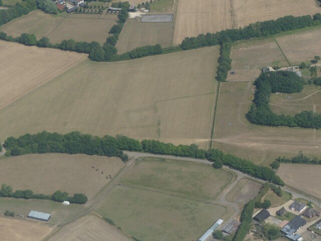
Barnardiston is a civil parish located in the county of Suffolk, England. Situated in the East Anglian region, it is a small and picturesque village that covers an area of approximately 5 square miles. The civil parish is named after the Barnardiston family, who were prominent landowners in the area during the medieval period.

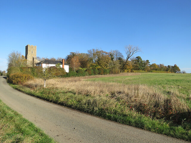
The village is surrounded by beautiful countryside and offers a peaceful and idyllic setting for its residents. It is situated about 12 miles north of the market town of Haverhill and 18 miles southeast of the county town of Bury St Edmunds. The nearest railway station is located in Sudbury, approximately 10 miles to the east.

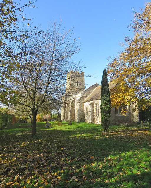
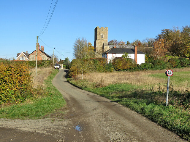
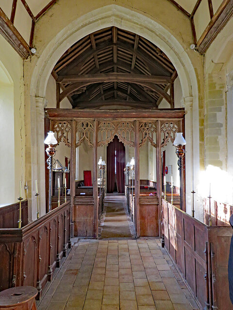
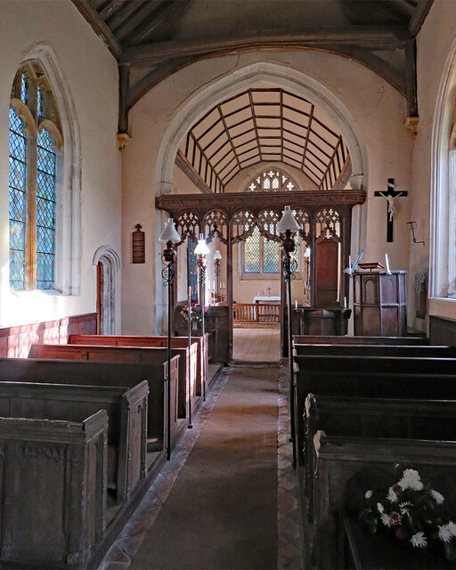
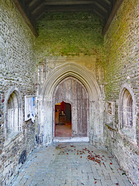
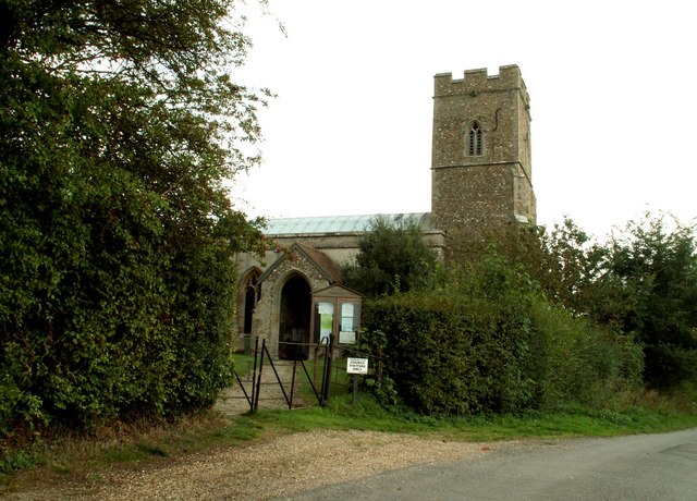
Barnardiston is home to a tight-knit community, with a population of around 200 residents. The village has a small primary school, which serves the local area, and the parish church of St. Katherine, which dates back to the 12th century. The church is a notable landmark in the village and attracts visitors due to its historic architecture and tranquil atmosphere.

The village offers limited amenities, with no shops or commercial establishments within its boundaries. However, there are a few services available nearby, including shops, pubs, and healthcare facilities in the neighboring towns and villages.

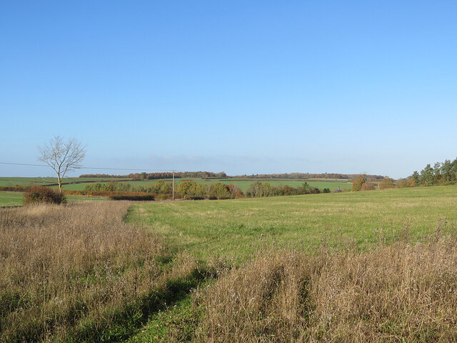
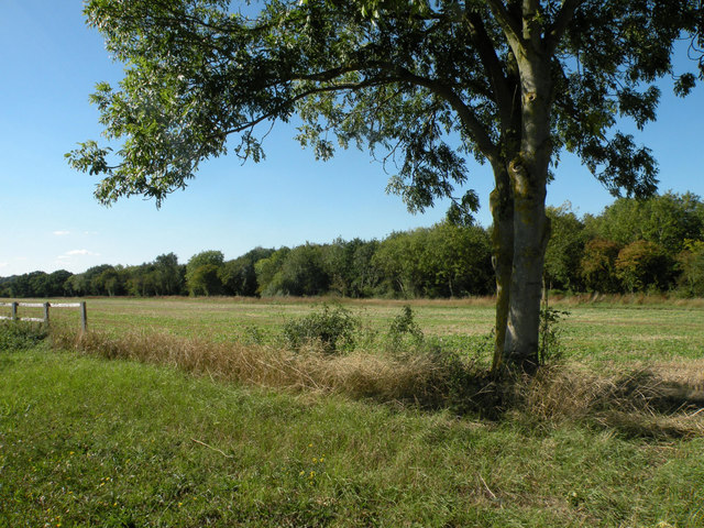
Barnardiston is a popular destination for tourists and nature enthusiasts who enjoy exploring the surrounding countryside, which features rolling hills, meandering rivers, and charming walking trails. The village also benefits from its proximity to larger towns, allowing residents to access a wider range of amenities and employment opportunities.

Overall, Barnardiston is a charming and peaceful civil parish that offers a rural lifestyle in a beautiful setting.

If you have any feedback on the listing, please let us know in the comments section below.

Barnardiston Images

Images are sourced within 2km of 52.117976/0.498776 or Grid Reference TL7149. Thanks to Geograph Open Source API. All images are credited.

Trundley Wood Viewed from the Stour Valley Path, near Great Wratting.
Trundley Wood
Viewed from the Stour Valley Path, near Great Wratting.
Barnardiston: All Saints' Church and Church Cottage Church Lane serves Leys Farm, then becomes a track to Kedington. The church is prettily placed on a hillock on the edge of the village. The picture was taken on a mild and sunny November morning.
Barnardiston: All Saints' Church and Church Cottage
Church Lane serves Leys Farm, then becomes a track to Kedington. The church is prettily placed on a hillock on the edge of the village. The picture was taken on a mild and sunny November morning.
Barnardiston: All Saints A small and pleasing Grade II* listed mediaeval church. The south wall of the chancel shows how necessary the substantial buttresses are. Norman Scarfe (in the Shell Guide) and Nikolaus Pevsner had more to say about the interior than the external fabric.
Barnardiston: All Saints
A small and pleasing Grade II* listed mediaeval church. The south wall of the chancel shows how necessary the substantial buttresses are. Norman Scarfe (in the Shell Guide) and Nikolaus Pevsner had more to say about the interior than the external fabric.
Barnardiston: All Saints' Church and churchyard Pleasing colours on a sunny November morning. The church is Grade II* listed and has 13th-, 14th- and 15th-century elements.
Barnardiston: All Saints' Church and churchyard
Pleasing colours on a sunny November morning. The church is Grade II* listed and has 13th-, 14th- and 15th-century elements.
Barnardiston: a view from Church Lane Gently rolling country on the edge of Suffolk, dissected by streams which are tributaries of the infant River Stour, which rises just over the county border, in Cambridgeshire.
Barnardiston: a view from Church Lane
Gently rolling country on the edge of Suffolk, dissected by streams which are tributaries of the infant River Stour, which rises just over the county border, in Cambridgeshire.
Barnardiston: Church Lane and All Saints The mediaeval parish church's Grade II* listing begins "A small church with a substantial tower that stands on high ground, and so can be seen from some distance".
Barnardiston: Church Lane and All Saints
The mediaeval parish church's Grade II* listing begins "A small church with a substantial tower that stands on high ground, and so can be seen from some distance".
Barnardiston: All Saints - chancel and screen This small, simple and pleasing church has several attractive features. "Screen. One-light divisions, arches with tracery over" (Nikolaus Pevsner).
Barnardiston: All Saints - chancel and screen
This small, simple and pleasing church has several attractive features. "Screen. One-light divisions, arches with tracery over" (Nikolaus Pevsner).
Barnardiston: All Saints - nave and chancel A simple 14th-century church in a small Suffolk village.
Barnardiston: All Saints - nave and chancel
A simple 14th-century church in a small Suffolk village.
Barnardiston: All Saints - porch and north doorway "The N porch has an exceptionally tall entrance. Handsome C14 N doorway" (Nikolaus Pevsner). Though the porch is high, you have to bend down to unlock and get through the ogee-topped opening cut into the main door.
Barnardiston: All Saints - porch and north doorway
"The N porch has an exceptionally tall entrance. Handsome C14 N doorway" (Nikolaus Pevsner). Though the porch is high, you have to bend down to unlock and get through the ogee-topped opening cut into the main door.
Cropmark on field west of Hundon: aerial 2022
Except Permit Holders Except permit holders on Steeplechase near to Barnardiston, Suffolk.
Except Permit Holders
Except permit holders on Steeplechase near to Barnardiston, Suffolk.
A143 towards Bury St Edmunds
Woods at Sowley Green
Old Road/Pathway, Near HMP Highpoint This is an old road that runs around the area that used to be the military training grounds. This picture was taken around a year before the then disused fields were put back into use as a location for a solar farm.
Old Road/Pathway, Near HMP Highpoint
This is an old road that runs around the area that used to be the military training grounds. This picture was taken around a year before the then disused fields were put back into use as a location for a solar farm.
Sowley Green, Suffolk Unusual brickwork on three isolated houses
Sowley Green, Suffolk
Unusual brickwork on three isolated houses
Entrance to Barnardiston Hall Preparatory School Barnardiston Hall Preparatory School caters for girls and boys aged 2-13 years.
Entrance to Barnardiston Hall Preparatory School
Barnardiston Hall Preparatory School caters for girls and boys aged 2-13 years.
Part of Bury Road at Sowley Green
Farm track at Sowley Green This little-used track leads southwards from Bury Road, between Sowley Green and Great Thurlow.
Farm track at Sowley Green
This little-used track leads southwards from Bury Road, between Sowley Green and Great Thurlow.
Show me another place!

Barnardiston is located at Grid Ref: TL7149 (Lat: 52.117976, Lng: 0.498776)

Administrative County: Suffolk

District: St Edmundsbury

Police Authority: Suffolk

What 3 Words

///dockers.moon.donation. Near Kedington, Suffolk

Nearby Locations

Barnardiston Glass Wood

Related Wikis

Barnardiston

Barnardiston ( bar-nər-DIS-tən) is a village and parish in the West Suffolk district of Suffolk, England. The village is located about four miles north...

Babel Green

Babel Green is a village in Suffolk, England. There are 3969 places (city, towns, hamlets …) within a radius of 100 kilometers / 62 miles from the center...

RAF Stradishall

Royal Air Force Stradishall or more simply RAF Stradishall is a former Royal Air Force station located 7 miles (11 km) north east of Haverhill, Suffolk...

Trundley and Wadgell's Wood, Great Thurlow

Trundley and Wadgell's Wood, Great Thurlow is a 79.4-hectare (196-acre) biological Site of Special Scientific Interest east of Great Thurlow in Suffolk...

HM Prison Highpoint South

HM Prison Highpoint South (formerly called Highpoint prison) is a Category C men's prison, located in the village of Stradishall (near Haverhill) in Suffolk...

HM Prison Highpoint North

HM Prison Highpoint North (formerly called Highpoint Prison and Edmunds Hill Prison) is a Category C men's prison, located in the village of Stradishall...

Bedford Free School

Bedford Free School is a mixed secondary free school located in Bedford, Bedfordshire, England. The school opened in September 2012, and educates pupils...

Kedington

Kedington is a village and civil parish in the West Suffolk district of Suffolk in eastern England, located between the towns of Clare and Haverhill in...

Nearby Amenities

Located within 500m of 52.117976,0.498776
The data included in this document is from www.openstreetmap.org. The data is made available under ODbL.

Have you been to Barnardiston?

Leave your review of Barnardiston below (or comments, questions and feedback).