Barling Magna

Civil Parish in Essex Rochford

England

Barling Magna

River Roach, looking downstream from Stannets Creek
River Roach, looking downstream from Stannets Creek Credit: Mr James D

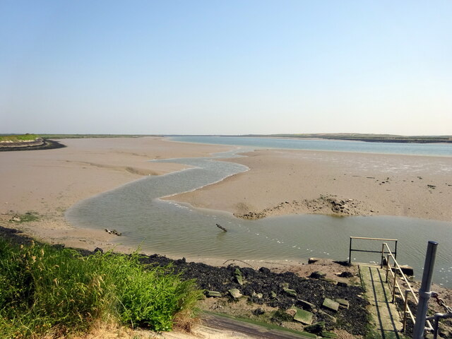
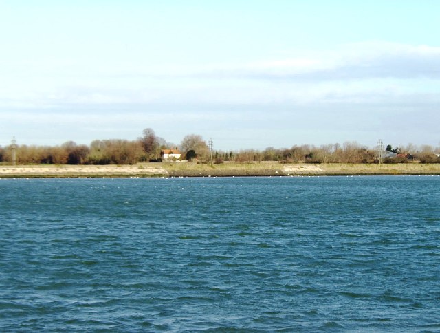
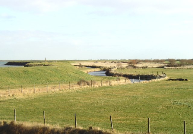
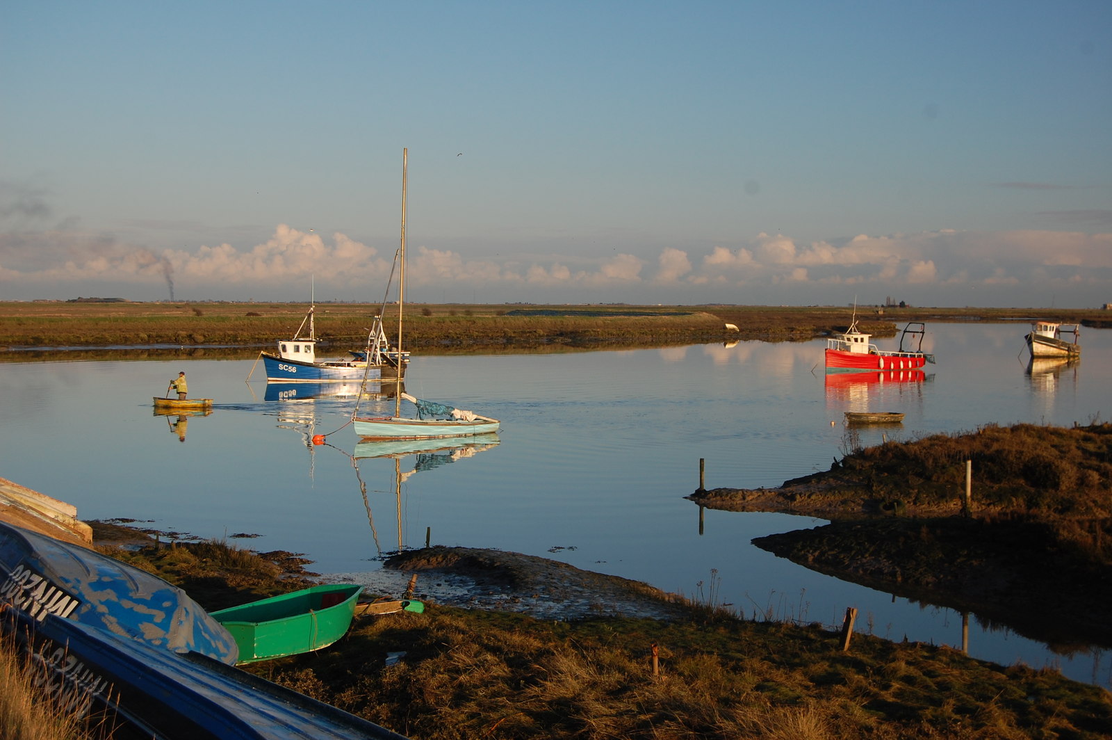
Barling Magna is a civil parish located in the county of Essex, England. Situated approximately four miles southeast of the town of Southend-on-Sea, it covers an area of about 3.5 square miles. The parish is bordered by the River Roach to the east, and other nearby settlements include Barling and Little Wakering.

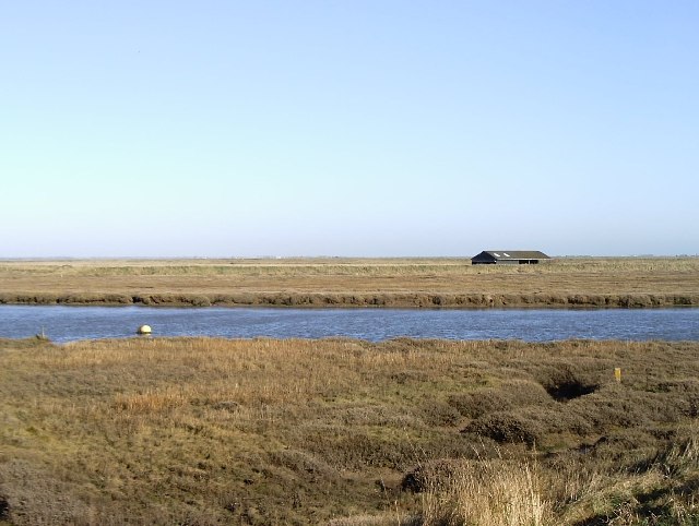
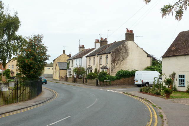
Barling Magna is a rural area consisting primarily of farmland and scattered residential properties. The landscape is characterized by open fields, hedgerows, and small pockets of woodland. The parish is known for its picturesque countryside, offering residents and visitors opportunities for peaceful walks and outdoor activities.

The historic St. Giles Church, dating back to the 12th century, is a prominent feature of Barling Magna. This Grade I listed building showcases beautiful architectural details and serves as a focal point for the community. The church holds regular religious services and occasional events.

The parish lacks significant commercial or industrial developments, with only a few small businesses and amenities available. However, the nearby town of Southend-on-Sea provides a wider range of services, including shopping centers, restaurants, and entertainment venues.

Barling Magna is well-connected to neighboring areas via road and public transportation. The A127 road passes just north of the parish, offering easy access to Southend-on-Sea and other nearby towns. Bus services also provide links to surrounding areas.

With its tranquil countryside and close proximity to urban amenities, Barling Magna offers residents a peaceful and rural lifestyle within reach of larger towns and cities.

If you have any feedback on the listing, please let us know in the comments section below.

Barling Magna Images

Images are sourced within 2km of 51.575079/0.799031 or Grid Reference TQ9489. Thanks to Geograph Open Source API. All images are credited.

River Roach, looking downstream from Stannets Creek
Barling Marsh Much of Barling Marsh has been given over to a landfill site and the extraction of sand and gravel. Vehicles reach the site by means of a dedicated road <a href="https://www.geograph.org.uk/gridref/TQ9288">TQ9288</a>. Taken from the berm beside Barlinghall Creek looking west.
Barling Marsh
Much of Barling Marsh has been given over to a landfill site and the extraction of sand and gravel. Vehicles reach the site by means of a dedicated road TQ9288. Taken from the berm beside Barlinghall Creek looking west.
River Roach This river is short, and in its lower reaches wide and tidal. Taken from Barling Marsh Sluice on the southern bank facing north.
River Roach
This river is short, and in its lower reaches wide and tidal. Taken from Barling Marsh Sluice on the southern bank facing north.
River bank near Barling The River Roach is on the far left and the water at the foot of the sea wall is a drainage channel. Taken near Roper's Farm looking east.
River bank near Barling
The River Roach is on the far left and the water at the foot of the sea wall is a drainage channel. Taken near Roper's Farm looking east.
Looking towards Barling Ness Barling Ness is at the far end of the drainage channel. The water on the left is Paglesham Reach of the River Roach and the land just discernible on the horizon is Potton Island.
Looking towards Barling Ness
Barling Ness is at the far end of the drainage channel. The water on the left is Paglesham Reach of the River Roach and the land just discernible on the horizon is Potton Island.
Essex Creeks The land with the farm buildings (just outside the gridsquare in <a href="https://www.geograph.org.uk/gridref/TQ9590">TQ9590</a>) on it is Potton Island to which there is no public access. The part of the mainland across the water to the right of the island is separated from it by Potton Creek. The water on the left is known as The Violet and that on the right is Barlinghall Creek.
Essex Creeks
The land with the farm buildings (just outside the gridsquare in TQ9590) on it is Potton Island to which there is no public access. The part of the mainland across the water to the right of the island is separated from it by Potton Creek. The water on the left is known as The Violet and that on the right is Barlinghall Creek.
Great Potton farm buildings, Potton Island Although Potton Island is owned by the Ministry of Defence, much of the island has been used for farming. Taken from the mainland looking north across Potton Creek.
Great Potton farm buildings, Potton Island
Although Potton Island is owned by the Ministry of Defence, much of the island has been used for farming. Taken from the mainland looking north across Potton Creek.
Seawall footpath, Paglesham Eastend This view looks south-west as the footpath passes close to Paglesham.
Seawall footpath, Paglesham Eastend
This view looks south-west as the footpath passes close to Paglesham.
Blackedge Point Looking at Blackedge Point and on across Paglesham Reach from the seawall footpath.
Blackedge Point
Looking at Blackedge Point and on across Paglesham Reach from the seawall footpath.
Drainage channel south of Barling Ness The curving drainage channel separates the large landfill site (left) from the sea wall and footpath. The water on the right is known as The Violet through which Barlinghall and Potton Creeks join the River Roach.
Drainage channel south of Barling Ness
The curving drainage channel separates the large landfill site (left) from the sea wall and footpath. The water on the right is known as The Violet through which Barlinghall and Potton Creeks join the River Roach.
The Violet The Violet is the creek through which Barlinghall Creek and Potton Creek reach the River Roach. The land beyond it is Potton Island.
The Violet
The Violet is the creek through which Barlinghall Creek and Potton Creek reach the River Roach. The land beyond it is Potton Island.
A flock of seagulls Gulls above the land-fill site on Barling Marsh
A flock of seagulls
Gulls above the land-fill site on Barling Marsh
Barling Marsh The northern edge of the landfill
Barling Marsh
The northern edge of the landfill
Barling Ness The Violet (to right) enters Paglesham Reach on the River Roach
Barling Ness
The Violet (to right) enters Paglesham Reach on the River Roach
Little Wakering, St Mary the Virgin
Path from Little Wakering Road to Common Road, Great Wakering Although not on the footpath cottages and farm buildings at Little Wakering Wick can be seen ahead.
Path from Little Wakering Road to Common Road, Great Wakering
Although not on the footpath cottages and farm buildings at Little Wakering Wick can be seen ahead.
Farm buildings at Little Wakering Wick The track ahead is not a public footpath, the latter having diverged just to the right of the camera.
Farm buildings at Little Wakering Wick
The track ahead is not a public footpath, the latter having diverged just to the right of the camera.
Cottages at Little Wakering Wick As seen from the footpath from Little Wakering Road to Common Road, Great Wakering. The farmhouse itself is just out of view to the right.
Cottages at Little Wakering Wick
As seen from the footpath from Little Wakering Road to Common Road, Great Wakering. The farmhouse itself is just out of view to the right.
Show me another place!

Barling Magna is located at Grid Ref: TQ9489 (Lat: 51.575079, Lng: 0.799031)

Administrative County: Essex

District: Rochford

Police Authority: Essex

What 3 Words

///nudge.quantity.dice. Near Great Wakering, Essex

Related Wikis

Barling, Essex

Barling is a village and former civil parish, now in the civil parish of Barling Magna in the Rochford district, in the county of Essex, England. It is...

Potton Island

Potton Island is a sparsely populated island west of Foulness in Essex, England. It is connected to the mainland by a swing bridge with a traffic light...

White Ensign F.C.

White Ensign Football Club is a football club based in Southend-on-Sea, Essex, England. They are currently members of the Essex Senior League and play...

Great Wakering Rovers F.C.

Great Wakering Rovers Football Club is a football club located in Great Wakering, near Southend on Sea in Essex, England. The club are members of the Essex...

Rushley Island

Rushley Island is a small uninhabited island in Essex, England. It is the smallest of six islands comprising an archipelago in Essex, and is privately...

HMS Beagle

HMS Beagle was a Cherokee-class 10-gun brig-sloop of the Royal Navy, one of more than 100 ships of this class. The vessel, constructed at a cost of £7...

Paglesham

Paglesham ( PAG-əl-shəm) is a village and civil parish in the north east of the Rochford Rural District, Essex. The parish includes two hamlets of Eastend...

Great Wakering

Great Wakering is a village in the Rochford District in Essex, England. It is approximately four miles east of Southend. Great Wakering consists mainly...

Nearby Amenities

Located within 500m of 51.575079,0.799031
Source: PGS
Lat/Long: 51.5776164/0.8047972
Source: PGS
Lat/Long: 51.5773964/0.8041213
Source: PGS
Lat/Long: 51.5772164/0.8038853
Source: PGS
Lat/Long: 51.5770563/0.803263
Source: PGS
Lat/Long: 51.576937/0.802671
Source: PGS
Lat/Long: 51.576743/0.801718
Source: PGS
Lat/Long: 51.5765829/0.8007632
Source: PGS
Lat/Long: 51.5764629/0.7995723
Source: PGS
Lat/Long: 51.5763496/0.7984887
Source: PGS
Lat/Long: 51.5762095/0.7975874
Source: PGS
Lat/Long: 51.5760028/0.7967613
Source: PGS
Lat/Long: 51.5756961/0.7962034
Source: PGS
Lat/Long: 51.5754961/0.7959459
Source: PGS
Lat/Long: 51.5752494/0.7957313
Source: PGS
Lat/Long: 51.574856/0.7956455
Source: PGS
Lat/Long: 51.5745026/0.7956348
Source: PGS
Lat/Long: 51.5740825/0.7958172
Source: PGS
Lat/Long: 51.573429/0.796536
Source: PGS
Lat/Long: 51.5729089/0.797566
Source: PGS
Lat/Long: 51.5725355/0.7986174
Source: PGS
Lat/Long: 51.5724955/0.7995723
Source: PGS
Lat/Long: 51.5728822/0.8006559
Source: PGS
Lat/Long: 51.5727556/0.800849
Source: PGS
Lat/Long: 51.5726422/0.803263
Source: PGS
Lat/Long: 51.5724421/0.8035956
Source: PGS
Lat/Long: 51.5724355/0.8039496
Source: PGS
Lat/Long: 51.5726555/0.8044432
Source: PGS
Lat/Long: 51.5725088/0.8045612
Source: PGS
Lat/Long: 51.5722354/0.8039604
Source: PGS
Lat/Long: 51.5710147/0.7977037
Source: PGS
Lat/Long: 51.5725822/0.795506
Source: PGS
Lat/Long: 51.5722888/0.7946906
Source: PGS
Lat/Long: 51.5727022/0.7952915
Source: PGS
Lat/Long: 51.5743826/0.7939611
Source: PGS
Lat/Long: 51.5750827/0.7936714
Source: PGS
Lat/Long: 51.5757361/0.7938109
Source: PGS
Lat/Long: 51.576659/0.794663
Source: PGS
Lat/Long: 51.577175/0.794844
Source: PGS
Lat/Long: 51.5774388/0.7962797
Source: PGS
Lat/Long: 51.5777218/0.7969847
Source: PGS
Lat/Long: 51.577998/0.797684
Source: PGS
Lat/Long: 51.578071/0.7984856
Source: PGS
Lat/Long: 51.5778437/0.7988238
Source: PGS
Lat/Long: 51.5778992/0.8001553
Source: PGS
Lat/Long: 51.577923/0.800567
Source: PGS
Lat/Long: 51.57821/0.802198
Source: PGS
Lat/Long: 51.578481/0.803008
The data included in this document is from www.openstreetmap.org. The data is made available under ODbL.

Have you been to Barling Magna?

Leave your review of Barling Magna below (or comments, questions and feedback).