Barlborough

Civil Parish in Derbyshire Bolsover

England

Barlborough

A6135 at M1 junction roundabout
A6135 at M1 junction roundabout Credit: Colin Pyle

Barlborough is a civil parish located in the county of Derbyshire, England. It is situated in the northeast part of the county, near the border with South Yorkshire. The parish covers an area of approximately 4 square miles and is home to a population of around 3,000 residents.

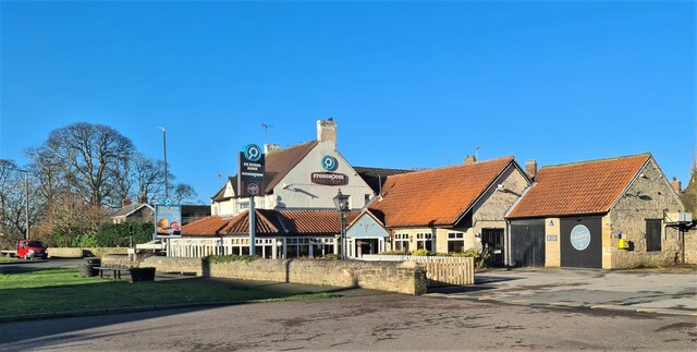
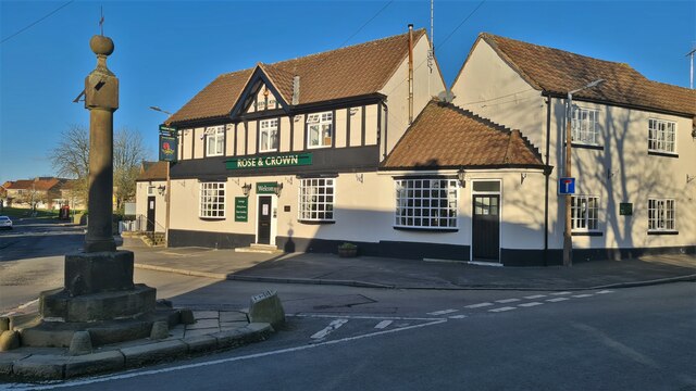
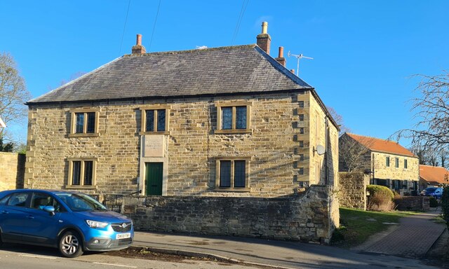
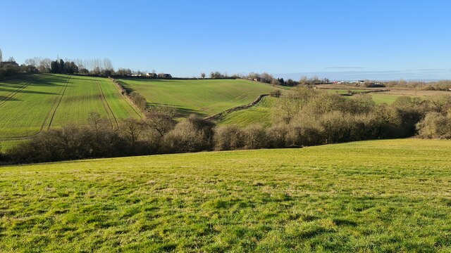
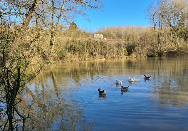
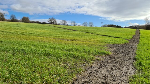
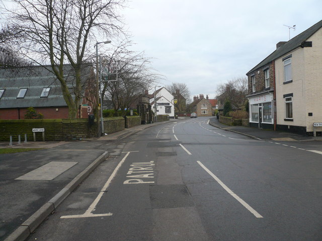
Barlborough is known for its picturesque countryside, with rolling hills and beautiful landscapes. The parish is predominantly rural, with a few small residential areas and farms scattered throughout. The village of Barlborough serves as the main settlement within the parish and offers a range of amenities such as shops, pubs, and a primary school.

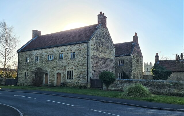
One of the notable features of Barlborough is the Barlborough Hall, an impressive Grade I listed building. The hall dates back to the 16th century and is surrounded by stunning gardens and parkland. It is privately owned but occasionally opens to the public for special events and weddings.

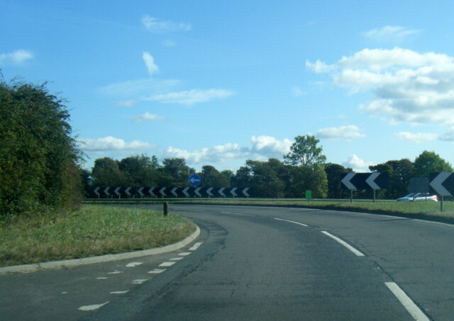
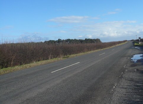
The parish is well-connected in terms of transportation, with easy access to major roads such as the M1 motorway and the A619. This allows for convenient travel to nearby towns and cities, including Sheffield and Chesterfield. The parish also benefits from a local bus service, providing regular links to neighboring communities.

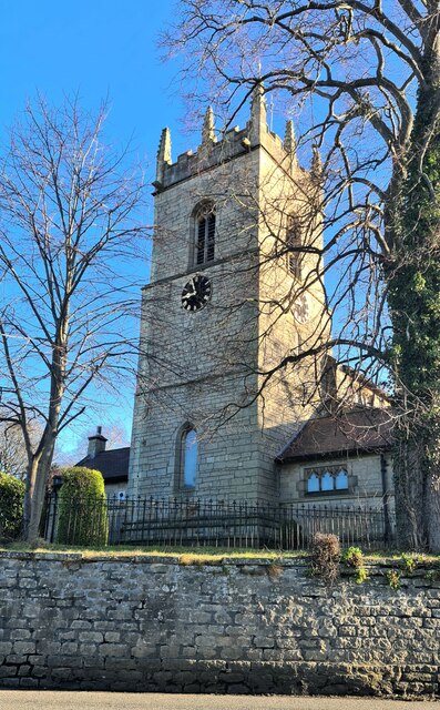
Overall, Barlborough offers a peaceful and idyllic setting for residents and visitors alike, with its charming village, natural beauty, and historical landmarks.

If you have any feedback on the listing, please let us know in the comments section below.

Barlborough Images

Images are sourced within 2km of 53.294208/-1.290881 or Grid Reference SK4777. Thanks to Geograph Open Source API. All images are credited.

A6135 at M1 junction roundabout
A619 Worksop Road with wind turbine ahead
Stonehouse, De Rodes Arms restaurant, Barlborough Carvery and pizzas
Stonehouse, De Rodes Arms restaurant, Barlborough
Carvery and pizzas
Derelict building by Woodhouse Lane
Road works on Chesterfield Road, Barlborough
Lay by on A619 above M1
St James the Great parish church, Barlborough
Rose & Crown and Village Cross, Barlborough
Old cottages, Barlborough But have they been totally rebuilt?
Old cottages, Barlborough
But have they been totally rebuilt?
Old Hospital, Barlborough Dating to 1752
Old Hospital, Barlborough
Dating to 1752
Farmland near Barlborough
Fishing lake by Quarrydam Cottages Track blocked by fallen tree after 3 separate gales and heavy rain in a week
Fishing lake by Quarrydam Cottages
Track blocked by fallen tree after 3 separate gales and heavy rain in a week
Ducks on lake below Quarrydam Cottages Fishing pond
Ducks on lake below Quarrydam Cottages
Fishing pond
Gates to Park House, Spinkhill Look carefully and you'll see the Alsatian guard dog.
Gates to Park House, Spinkhill
Look carefully and you'll see the Alsatian guard dog.
Tracks leading up to Barlborough
Stepping stones across boggy area Towards Woodhouse Lane
Stepping stones across boggy area
Towards Woodhouse Lane
Looking towards Grange Farm
M1 near Romley House Farm
Show me another place!

Barlborough is located at Grid Ref: SK4777 (Lat: 53.294208, Lng: -1.290881)

Administrative County: Derbyshire

District: Bolsover

Police Authority: Derbyshire

What 3 Words

///bulletins.digestion.thank. Near Barlborough, Derbyshire

Related Wikis

New Barlborough

New Barlborough is an area of Barlborough village, Bolsover, Derbyshire, England, consisting of several housing estates and a single row of houses along...

Barlborough Hall

Barlborough Hall is a Grade I listed 16th-century country house in Barlborough, Chesterfield, Derbyshire. It was built in around 1583-84 for Sir Francis...

Barlborough

Barlborough is a village and civil parish in the Bolsover district of Derbyshire, England. According to the 2001 census it had a population of 3,018,...

A616 road

The A616 is a road that links Newark-on-Trent, Nottinghamshire, to the M1 motorway at Junction 30, then reappears at Junction 35A and goes on to Huddersfield...

Spinkhill Tunnel

Spinkhill Tunnel is a disused twin-track railway tunnel south of Spinkhill railway station in Derbyshire, England. == History == The 501 yards long tunnel...

Mount St Mary's College

Mount St Mary's College is an independent, co-educational, day and boarding school situated at Spinkhill, Derbyshire, England. It was founded in 1842 by...

Barlborough Common

Barlborough Common is an area in Derbyshire, England. It is located to the south of Barlborough. The land has undergone extensive open-cast mining and...

Spinkhill

Spinkhill is a small village in North East Derbyshire, England. It is approximately one mile south of the nearest town, Killamarsh, and half a mile north...

Related Videos

The Walk - EP 95 - Railway Explore - Upperthorpe & Killamarsh To Spinkhill Tunnel - Derbyshire

Following on from my walk around the lost railways of Killamarsh in Derbyshire ...

193: Barlborough, Spinkhill and Renishaw (Bolsover and North East Derbyshire 2023)

BOLSOVER AND NORTH EAST DERBYSHIRE WALK FEATURING BARLBOROUGH, SPINKHILL AND RENISHAW "Barlborough ...

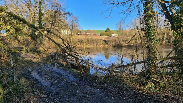
LITTER LEFT BY ANGLERS!!! Me and Hollie get to work 🚮

Just a few clips of me and hollie cleaning up the Res. We found drugs, money, tackle and 10 unopened bottles of beer!! This is a ...

Nearby Amenities

Located within 500m of 53.294208,-1.290881
Turning Circle
Lat/Long: 53.2900329/-1.2935115
Post Office
Barlborough Post Office
Addr City: Chesterfield
Addr Country: GB
Addr Housenumber: 15
Addr Postcode: S43 4EY
Addr Street: High Street
Addr Suburb: Barlborough
Brand: Post Office
Brand Wikidata: Q1783168
Fhrs Id: 17317
Opening Hours: Mo-Sa 07:00-21:00; Su 08:00-21:00
Ref Pol Id: 14973
Website: https://www.postoffice.co.uk/branch-finder/4303407/barlborough
Lat/Long: 53.2901968/-1.2888174
Post Box
Brand: Royal Mail
Brand Wikidata: Q638098
Collection Times: Mo-Fr 16:00; Sa 10:30
Operator: Royal Mail
Operator Wikidata: Q638098
Post Box Type: pillar
Ref: S43 113
Royal Cypher: EIIR
Royal Cypher Wikidata: Q33102113
Lat/Long: 53.2902396/-1.2888675
Barrier: bollard
Lat/Long: 53.290559/-1.2884181
Pub
Royal Oak
Addr City: Chesterfield
Addr Postcode: S43 4EU
Addr Street: High Street
Addr Suburb: Barlborough
Fhrs Id: 894018
Old Fhrs Id: 427654
Source: FHRS Open Data;http://www.geograph.org.uk/photo/3183176
Lat/Long: 53.2900491/-1.2900125
Historic: wayside_cross
Source: http://www.geograph.org.uk/photo/3183176
Lat/Long: 53.290354/-1.2871585
Barrier: stile
Lat/Long: 53.2930076/-1.292712
Telephone
Booth: K6
Covered: booth
Man Made: telephone_box
Old Phone: +44 1246 810331
Lat/Long: 53.2903972/-1.288547
Bus Stop
Bus: yes
Public Transport: platform
Shelter: no
Lat/Long: 53.2904075/-1.2879292
Defibrillator
Access: yes
Check Date: 2023-03-09
Defibrillator Location: outside Royal Oak pub, Barlborough - on corner of building
Emergency: defibrillator
Indoor: no
Lat/Long: 53.2900197/-1.2899011
Generator Method: photovoltaic
Generator Output Electricity: yes
Generator Source: solar
Generator Type: solar_photovoltaic_panel
Location: roof
Power: generator
Lat/Long: 53.2910007/-1.2905254
Generator Method: photovoltaic
Generator Output Electricity: yes
Generator Source: solar
Generator Type: solar_photovoltaic_panel
Location: roof
Power: generator
Lat/Long: 53.291137/-1.2918987
Generator Method: photovoltaic
Generator Output Electricity: yes
Generator Source: solar
Generator Type: solar_photovoltaic_panel
Location: roof
Power: generator
Lat/Long: 53.2913358/-1.2907319
Generator Method: photovoltaic
Generator Output Electricity: yes
Generator Source: solar
Generator Type: solar_photovoltaic_panel
Location: roof
Power: generator
Lat/Long: 53.2913262/-1.2900667
Generator Method: photovoltaic
Generator Output Electricity: yes
Generator Source: solar
Generator Type: solar_photovoltaic_panel
Location: roof
Power: generator
Lat/Long: 53.291339/-1.2899434
Generator Method: photovoltaic
Generator Output Electricity: yes
Generator Source: solar
Generator Type: solar_photovoltaic_panel
Location: roof
Power: generator
Lat/Long: 53.2913358/-1.2897744
Generator Method: photovoltaic
Generator Output Electricity: yes
Generator Source: solar
Generator Type: solar_photovoltaic_panel
Location: roof
Power: generator
Lat/Long: 53.2911887/-1.2868982
Generator Method: photovoltaic
Generator Output Electricity: yes
Generator Source: solar
Generator Type: solar_photovoltaic_panel
Location: roof
Power: generator
Lat/Long: 53.291163/-1.2868123
Generator Method: photovoltaic
Generator Output Electricity: yes
Generator Source: solar
Generator Type: solar_photovoltaic_panel
Location: roof
Power: generator
Lat/Long: 53.2911646/-1.2867614
Generator Method: photovoltaic
Generator Output Electricity: yes
Generator Source: solar
Generator Type: solar_photovoltaic_panel
Location: roof
Power: generator
Lat/Long: 53.2902411/-1.2874775
Generator Method: photovoltaic
Generator Output Electricity: yes
Generator Source: solar
Generator Type: solar_photovoltaic_panel
Location: roof
Power: generator
Lat/Long: 53.2899049/-1.2909451
Generator Method: photovoltaic
Generator Output Electricity: yes
Generator Source: solar
Generator Type: solar_photovoltaic_panel
Location: roof
Power: generator
Lat/Long: 53.2907595/-1.2900359
Generator Method: photovoltaic
Generator Output Electricity: yes
Generator Source: solar
Generator Type: solar_photovoltaic_panel
Location: roof
Power: generator
Lat/Long: 53.2906905/-1.2900519
Generator Method: photovoltaic
Generator Output Electricity: yes
Generator Source: solar
Generator Type: solar_photovoltaic_panel
Location: roof
Power: generator
Lat/Long: 53.2907146/-1.2899178
Bench
Lat/Long: 53.2903593/-1.2888767
Man Made: village_sign
Lat/Long: 53.2903925/-1.2886293
Advertising: board
Lat/Long: 53.2903861/-1.2886541
Turning Circle
Lat/Long: 53.2900632/-1.2926432
Traffic Calming: cushion
Lat/Long: 53.2903585/-1.2878584
Give Way
Lat/Long: 53.2904202/-1.2871393
Bus Stop
Bus: yes
Public Transport: platform
Shelter: no
Lat/Long: 53.2903223/-1.2878748
The data included in this document is from www.openstreetmap.org. The data is made available under ODbL.

Have you been to Barlborough?

Leave your review of Barlborough below (or comments, questions and feedback).