Barford

Civil Parish in Norfolk South Norfolk

England

Barford

Barnham Broom: Track to Bickerston Cottage
Barnham Broom: Track to Bickerston Cottage Credit: Michael Garlick

Barford is a civil parish located in Norfolk, England. It is situated about 8 miles southwest of the city of Norwich and falls within the district of South Norfolk. The parish covers an area of approximately 4.5 square miles and has a population of around 1,500 residents.

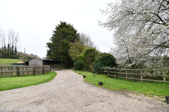
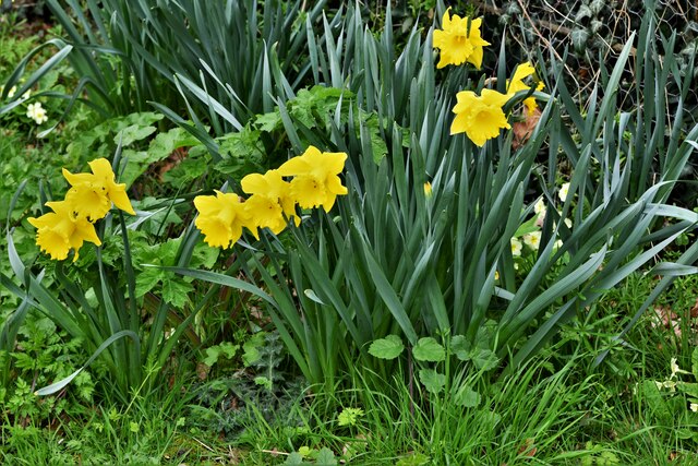
The village of Barford is known for its picturesque countryside and is surrounded by rolling hills and farmland, providing a tranquil and scenic environment. It is predominantly a residential area, with a mix of traditional and modern houses scattered throughout the village.

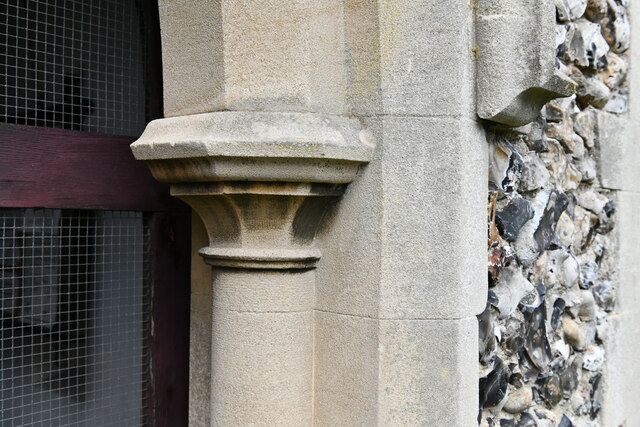
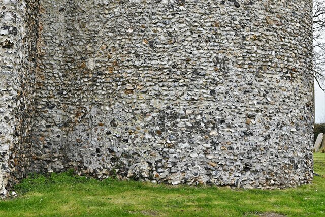
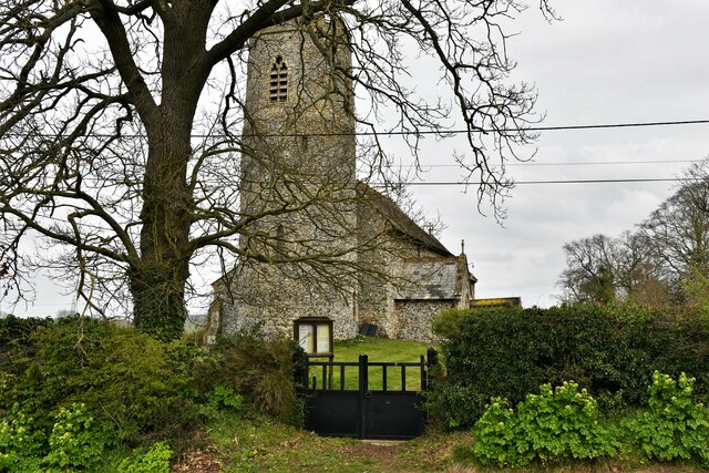
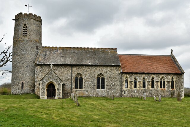
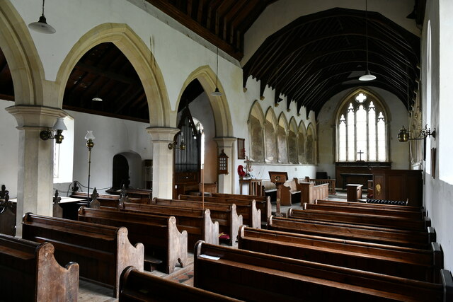
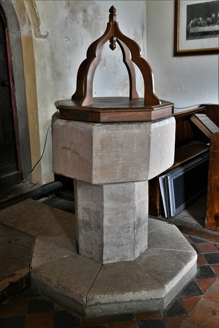
Barford is well-served by amenities, including a primary school, a village hall, a post office, and a pub. The village also boasts a beautiful church, St. Botolph's, which dates back to the 13th century and is a prominent historical landmark in the area. The church features stunning architectural details and is often visited by tourists and locals alike.

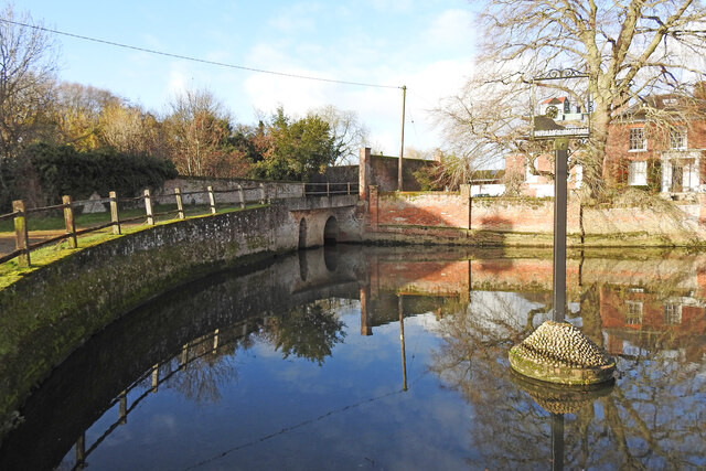
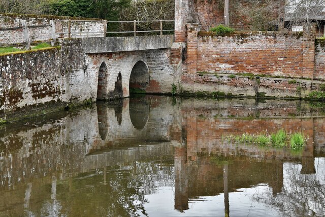
The parish offers various recreational opportunities, with several footpaths and bridleways that allow residents and visitors to explore the surrounding countryside. The nearby River Yare provides additional opportunities for boating and fishing enthusiasts.

Barford benefits from its proximity to Norwich, which offers a wider range of amenities, including shopping centers, restaurants, and cultural attractions. The village is well-connected to the rest of the county by road, with the A47 passing nearby, providing easy access to Norwich and other parts of Norfolk.

Overall, Barford is a charming and idyllic village that provides a peaceful rural lifestyle while still being within reach of larger urban centers.

If you have any feedback on the listing, please let us know in the comments section below.

Barford Images

Images are sourced within 2km of 52.625377/1.113727 or Grid Reference TG1007. Thanks to Geograph Open Source API. All images are credited.

Barnham Broom: Track to Bickerston Cottage
Barnham Broom: Pylons
Barnham Broom: Track at Hollandshill Farm
The millpond at Wramplingham The mill which originally stood left on the left of the scene, (the lower part of the mill's wall still standing) and the tail race exiting from under the arches into this millpond. The mill was demolished in 1945. 
A semblance of the mill as it was, can be seen on the village sign <a href="https://www.geograph.org.uk/photo/6693890">TG1106 : Wramplingham village sign</a>
The millpond at Wramplingham
The mill which originally stood left on the left of the scene, (the lower part of the mill's wall still standing) and the tail race exiting from under the arches into this millpond. The mill was demolished in 1945. A semblance of the mill as it was, can be seen on the village sign TG1106 : Wramplingham village sign
Wramplingham: Entering the village from the north
Wramplingham: The mill pond
Wramplingham: Village sign situated in the mill pond
Wramplingham: The mill pond, village sign and River House
Wramplingham: The Mill House
Wramplingham, St. Peter and St. Paul's Church: Round tower with a polygonal top
Wramplingham, St. Peter and St. Paul's Church: The chancel southern aspect
Wramplingham, St. Peter and St. Paul's Church: South porch right capital
Wramplingham, St. Peter and St. Paul's Church: Round tower base detail
Wramplingham, St. Peter and St. Paul's Church: Western aspect
Wramplingham, St. Peter and St. Paul's Church: Southern aspect
Wramplingham, St. Peter and St. Paul's Church: A small area of daffodils
Wramplingham, St. Peter and St. Paul's Church: The nave
Wramplingham, St. Peter and St. Paul's Church: The font
Show me another place!

Barford is located at Grid Ref: TG1007 (Lat: 52.625377, Lng: 1.113727)

Administrative County: Norfolk

District: South Norfolk

Police Authority: Norfolk

What 3 Words

///magnitude.canny.stands. Near Hethersett, Norfolk

Nearby Locations

Barford

Related Wikis

Barford, Norfolk

Barford is a village and civil parish in the English county of Norfolk, situated some 4 miles (6 km) north of Wymondham and 8 miles (13 km) west of Norwich...
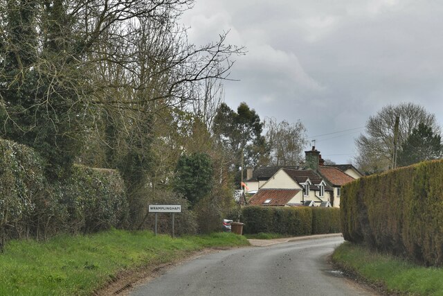
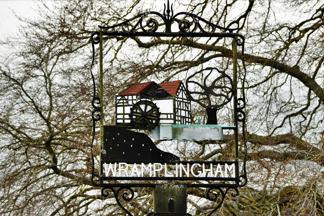
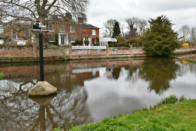
Wramplingham

Wramplingham is a village and civil parish in the English county of Norfolk. It is situated on the River Tiffey some 4 miles (6.4 km) north of Wymondham...

River Tiffey

The River Tiffey is a small river in Norfolk, England and a tributary of the River Yare. It rises near Hethel and passes through Wymondham before flowing...

Colton, Norfolk

Colton is a village and former civil parish, 8 miles (13 km) west of Norwich, now in the parish of Marlingford and Colton, in the South Norfolk district...

Marlingford and Colton

Marlingford and Colton, formerly Marlingford is a civil parish in the English county of Norfolk, made from the villages of Colton and Marlingford. It covers...

Carleton Forehoe

Carleton Forehoe is a village and former civil parish 9 miles (14 km) west of Norwich, now in the parish of Kimberley, in the South Norfolk district, in...

Marlingford

Marlingford is a village and former civil parish, 6 miles (9.7 km) west of Norwich, now in the parish of Marlingford and Colton, in the South Norfolk district...

Barnham Broom

Barnham Broom is a village and civil parish in the English county of Norfolk. The village is situated on the River Yare, 9 miles (15 km) West of Norwich...

Nearby Amenities

Located within 500m of 52.625377,1.113727
village hall, adj
Naptan AtcoCode: 2900B051
Naptan Bearing: NW
Naptan BusStopType: CUS
Naptan CommonName: village hall
Naptan Indicator: adj
Naptan Landmark: village hall
Naptan Locality: Barford
Naptan NaptanCode: nfoadpdj
Naptan ShortCommonName: village hall
Naptan Street: Chapel Street
Naptan Verified: no
Source: naptan_import
Lat/Long: 52.6260641/1.1202676
Bus Stop
Bus Shelter, adj
Naptan AtcoCode: 2900B052
Naptan Bearing: NW
Naptan CommonName: Bus Shelter
Naptan Indicator: adj
Naptan Locality: Barford
Naptan NaptanCode: nfoadpdm
Naptan Street: Watton Road
Naptan Verified: no
Source: naptan_import
Lat/Long: 52.6233331/1.1198392
Bus Stop
village hall, opp
Bench: no
Bin: no
Lit: no
Naptan AtcoCode: 2900B053
Naptan Bearing: SE
Naptan CommonName: village hall
Naptan Indicator: opp
Naptan Landmark: village hall
Naptan Locality: Barford
Naptan NaptanCode: nfoadpdp
Naptan ShortCommonName: village hall
Naptan Street: Chapel Street
Naptan Verified: no
Shelter: no
Source: naptan_import
Tactile Paving: no
Lat/Long: 52.6260024/1.1202509
Bus Stop
Bus Shelter, opp
Naptan AtcoCode: 2900B054
Naptan Bearing: SE
Naptan CommonName: Bus Shelter
Naptan Indicator: opp
Naptan Locality: Barford
Naptan NaptanCode: nfoadpdt
Naptan Street: Watton Road
Naptan Verified: no
Source: naptan_import
Lat/Long: 52.6233445/1.1200912
Bus Stop
opp Hall, opp
Naptan AtcoCode: 2900B058
Naptan Bearing: S
Naptan CommonName: opp Hall
Naptan Indicator: opp
Naptan Landmark: Hall entrance
Naptan Locality: Barford
Naptan NaptanCode: nfogpjgj
Naptan ShortCommonName: Hall
Naptan Street: Cock Street
Source: naptan_import;survey
Lat/Long: 52.625657/1.1197096
Entrance: main
Lat/Long: 52.6287181/1.1116934
Grit Bin
Colour: yellow
Lat/Long: 52.6275055/1.1133101
Waste Basket
Waste: dog_excrement
Lat/Long: 52.6275165/1.1133027
Bench
Backrest: yes
Colour: silver
Inscription: Miriam and George Smith / "In heavenly love abiding"
Material: wood
Lat/Long: 52.6291765/1.1108992
Give Way
Lat/Long: 52.6282628/1.1125213
Barford
Colour: black
Inscription: AD 700
Man Made: village_sign
Material: metal
Old Name: Barley Ford
Lat/Long: 52.6260072/1.1198339
Give Way
Lat/Long: 52.6261015/1.1196961
Entrance: main
Lat/Long: 52.6262406/1.1199256
Barrier: swing_gate
Lat/Long: 52.6263285/1.1204951
Defibrillator
Defibrillator Location: On exterior wall of Barford & Wramplingham Village Hall, to the right of the main entrance.
Emergency: defibrillator
Indoor: no
Ref GB The Circuit: 037D0641-7259-49FF-B6FC-ADDE0160EF1D
Lat/Long: 52.6262135/1.1200218
Telephone
Addr Postcode: NR9 4AY
Addr Street: Chapel Street
Addr Village: Barford
Booth: KX100
Covered: booth
Phone: +44 1603 759611
Lat/Long: 52.6260888/1.120343
Post Box
Collection Times: Mo-Fr 16:45; Sa 10:30
Post Box Mounting: building
Post Box Type: wall
Ref: NR9 922
Royal Cypher: VR
Royal Cypher Wikidata: Q33102356
Lat/Long: 52.6243269/1.1193788
Bus Stop
Lat/Long: 52.6257548/1.1195972
Give Way
Lat/Long: 52.6235367/1.1193786
Power: pole
Lat/Long: 52.6226742/1.1162744
Power: pole
Lat/Long: 52.6222598/1.1172098
The data included in this document is from www.openstreetmap.org. The data is made available under ODbL.

Have you been to Barford?

Leave your review of Barford below (or comments, questions and feedback).