Bardwell

Civil Parish in Suffolk St Edmundsbury

England

Bardwell

Bardwell Watermill The 19th century mill straddles The Black Bourn river, has three floors with the lucum on the north side. It has a brick ground storey, and is timber-framed above, with C20 replacement tarred weatherboarding and a slate roof. The internal undershot waterwheel is now without its paddles but can be seen here. <a title="https://www.geograph.org.uk/photo/6980462" href="https://www.geograph.org.uk/photo/6980462">Link</a>  All the working machinery has been removed, apart from a few pieces on the top floor.
The miller's house which is undergoing restoration, adjoins the mill.
<a title="https://www.geograph.org.uk/photo/6980599" href="https://www.geograph.org.uk/photo/6980599">Link</a>
Bardwell Watermill Credit: Adrian S Pye

Bardwell is a civil parish located in the county of Suffolk, England. It is situated about 10 miles northeast of the town of Bury St Edmunds and approximately 80 miles northeast of London. The village of Bardwell is the main settlement within the parish.

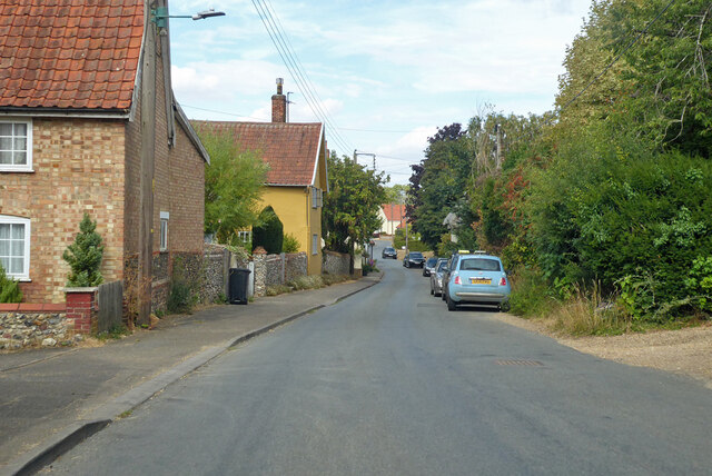
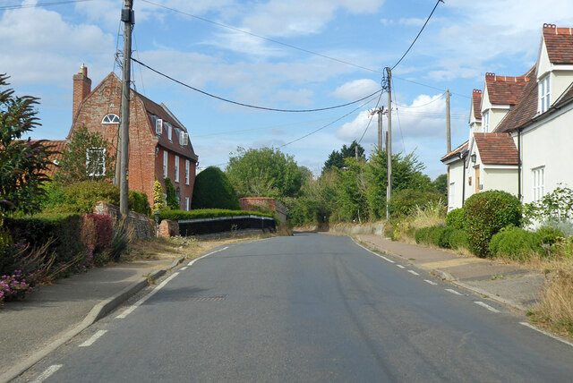
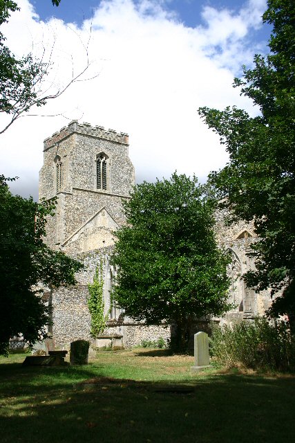
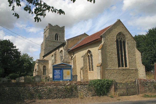
Bardwell is a picturesque village with a rich history dating back to the Anglo-Saxon era. It is known for its well-preserved medieval church, St. Peter and St. Paul, which features a striking 15th-century tower. The village is also home to several charming thatched cottages and traditional timber-framed houses, giving it a quintessentially English feel.

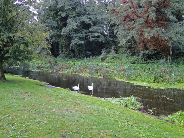
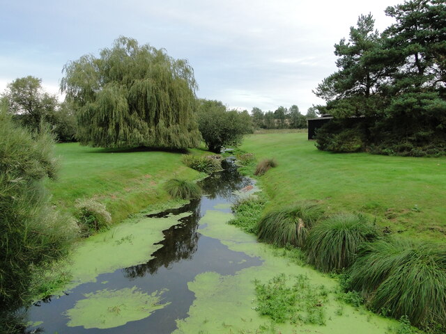
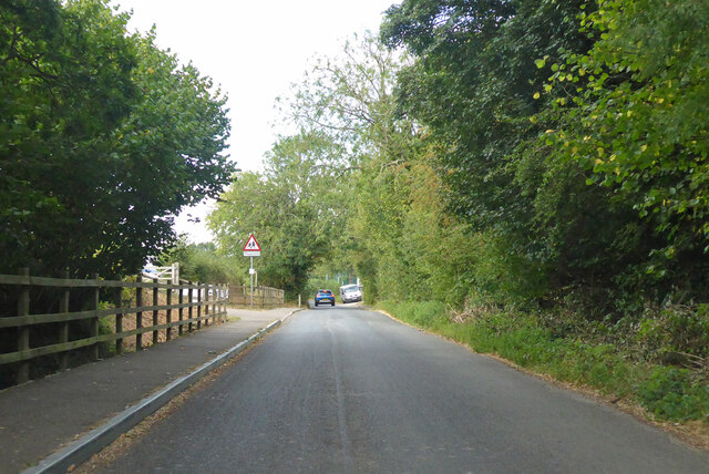
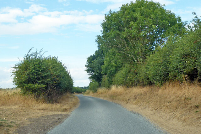
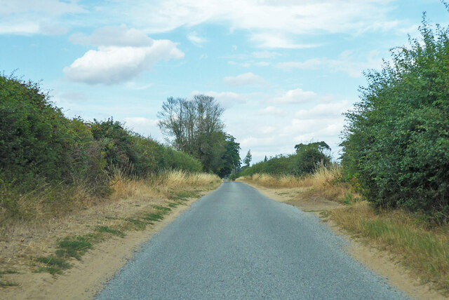
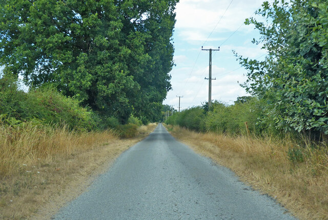
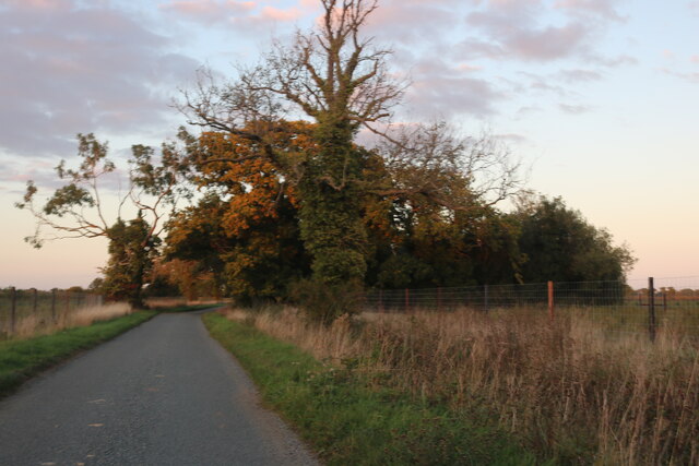
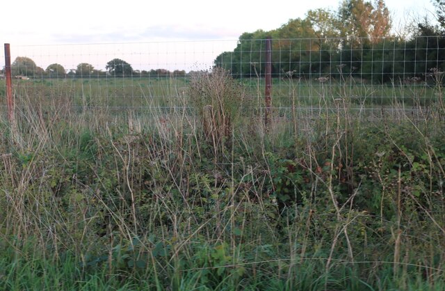
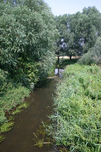
The parish is surrounded by beautiful countryside, with rolling fields and meadows dotted with grazing livestock. It is an ideal location for outdoor enthusiasts, offering plenty of opportunities for walking, cycling, and horse riding. The River Blackbourne flows through the village, adding to its scenic charm.

Bardwell has a strong sense of community, with a range of amenities and services available to its residents. These include a primary school, a village hall, a post office, and a local pub. The village hosts various events throughout the year, including a summer fete and a Christmas market, which bring the community together.

Overall, Bardwell, Suffolk is a peaceful and picturesque civil parish that offers a tranquil countryside lifestyle with a close-knit community.

If you have any feedback on the listing, please let us know in the comments section below.

Bardwell Images

Images are sourced within 2km of 52.336604/0.849494 or Grid Reference TL9474. Thanks to Geograph Open Source API. All images are credited.

Bardwell Watermill The 19th century mill straddles The Black Bourn river, has three floors with the lucum on the north side. It has a brick ground storey, and is timber-framed above, with C20 replacement tarred weatherboarding and a slate roof. The internal undershot waterwheel is now without its paddles but can be seen here. <a title="https://www.geograph.org.uk/photo/6980462" href="https://www.geograph.org.uk/photo/6980462">Link</a>  All the working machinery has been removed, apart from a few pieces on the top floor.
The miller's house which is undergoing restoration, adjoins the mill.
<a title="https://www.geograph.org.uk/photo/6980599" href="https://www.geograph.org.uk/photo/6980599">Link</a>
Bardwell Watermill
The 19th century mill straddles The Black Bourn river, has three floors with the lucum on the north side. It has a brick ground storey, and is timber-framed above, with C20 replacement tarred weatherboarding and a slate roof. The internal undershot waterwheel is now without its paddles but can be seen here. Link All the working machinery has been removed, apart from a few pieces on the top floor. The miller's house which is undergoing restoration, adjoins the mill. Link
Bardwell Watermill, the undershot wheel The wheel has lost all its paddles but is still in situ in the millrace.
The 19th century mill straddles The Black Bourn river, has three floors with the lucum on the north side. It has a brick ground storey, and is timber-framed above, with C20 replacement tarred weatherboarding and a slate roof. The internal undershot waterwheel is now without its paddles but can be seen here. All the working machinery has been removed, apart from a few pieces on the top floor.
The miller's house which is undergoing restoration, adjoins the mill. <a title="https://www.geograph.org.uk/photo/6980455" href="https://www.geograph.org.uk/photo/6980455">Link</a>
Bardwell Watermill, the undershot wheel
The wheel has lost all its paddles but is still in situ in the millrace. The 19th century mill straddles The Black Bourn river, has three floors with the lucum on the north side. It has a brick ground storey, and is timber-framed above, with C20 replacement tarred weatherboarding and a slate roof. The internal undershot waterwheel is now without its paddles but can be seen here. All the working machinery has been removed, apart from a few pieces on the top floor. The miller's house which is undergoing restoration, adjoins the mill. Link
Bardwell Watermill The 19th century mill straddles The Black Bourn river, has three floors with the lucum on the north side. It has a brick ground storey, and is timber-framed above, with C20 replacement tarred weatherboarding and a slate roof. The internal undershot waterwheel is now without its paddles but can be seen here. <a title="https://www.geograph.org.uk/photo/6980462" href="https://www.geograph.org.uk/photo/6980462">Link</a> All the working machinery has been removed, apart from a few pieces on the top floor.
The miller's house which is undergoing restoration, adjoins the mill.
<a title="https://www.geograph.org.uk/photo/6980455" href="https://www.geograph.org.uk/photo/6980455">Link</a>
Bardwell Watermill
The 19th century mill straddles The Black Bourn river, has three floors with the lucum on the north side. It has a brick ground storey, and is timber-framed above, with C20 replacement tarred weatherboarding and a slate roof. The internal undershot waterwheel is now without its paddles but can be seen here. Link All the working machinery has been removed, apart from a few pieces on the top floor. The miller's house which is undergoing restoration, adjoins the mill. Link
The tailrace at Bardwell Watermill This is the water that has been through the mill and is about to rejoin the Black Bourn on its course to the Little Ouse south of Thetford.
To see the mill : <a href="https://www.geograph.org.uk/photo/6980455">TL9374 : Bardwell Watermill</a> 
<a href="https://www.geograph.org.uk/photo/6980462">TL9374 : Bardwell Watermill, the undershot wheel</a> 
<a href="https://www.geograph.org.uk/photo/6980599">TL9374 : Bardwell Watermill</a> 
<a href="https://www.geograph.org.uk/photo/6980609">TL9374 : Swans on the headrace at Bardwell watermill</a>
The tailrace at Bardwell Watermill
This is the water that has been through the mill and is about to rejoin the Black Bourn on its course to the Little Ouse south of Thetford. To see the mill : TL9374 : Bardwell Watermill TL9374 : Bardwell Watermill, the undershot wheel TL9374 : Bardwell Watermill TL9374 : Swans on the headrace at Bardwell watermill
Low Street, Bardwell Entering the village from the Ixworth direction.
Low Street, Bardwell
Entering the village from the Ixworth direction.
Low Street, Bardwell Mansard House, formerly Street Farmhouse, on the left, is a grade II listed building, mid 18th century.
Low Street, Bardwell
Mansard House, formerly Street Farmhouse, on the left, is a grade II listed building, mid 18th century.
Spring Road, Bardwell Heading north out of the village.
Spring Road, Bardwell
Heading north out of the village.
Lane towards Coney Weston From Bardwell.
Lane towards Coney Weston
From Bardwell.
Lane towards Coney Weston From Bardwell.
Lane towards Coney Weston
From Bardwell.
Lane towards Coney Weston From Bardwell.
Lane towards Coney Weston
From Bardwell.
Heath Road between Sapiston and Coney Weston
Field by Heath Road
Field by Heath Road
Bardwell Church St Peter and St Paul church has six bells, unusual for a village of this size.
Bardwell Church
St Peter and St Paul church has six bells, unusual for a village of this size.
Bardwell Mill Bardwell tower mill was built in late 1829 or early 1830; it replaced the village’s old post mill which was sold and moved away a few years later. A small mill of four storeys, it stands in company with its original outbuildings which include the miller’s cottage and an old bakery, which is still in use today.
Bardwell Mill
Bardwell tower mill was built in late 1829 or early 1830; it replaced the village’s old post mill which was sold and moved away a few years later. A small mill of four storeys, it stands in company with its original outbuildings which include the miller’s cottage and an old bakery, which is still in use today.
The Black Bourn River At Harling Bridge, on the minor road between Bardwell and Ixworth Thorpe.
The Black Bourn River
At Harling Bridge, on the minor road between Bardwell and Ixworth Thorpe.
Thorpe Carr A private farm track leading to Thorpe Carr, from the minor road between Bardwell and Ixworth Thorpe.
Thorpe Carr
A private farm track leading to Thorpe Carr, from the minor road between Bardwell and Ixworth Thorpe.
Bardwell recreation ground This recreational area is located to the east of Spring Lane, Bardwell.
Bardwell recreation ground
This recreational area is located to the east of Spring Lane, Bardwell.
Show me another place!

Bardwell is located at Grid Ref: TL9474 (Lat: 52.336604, Lng: 0.849494)

Administrative County: Suffolk

District: St Edmundsbury

Police Authority: Suffolk

What 3 Words

///combines.frown.blackouts. Near Ixworth, Suffolk

Nearby Locations

Bardwell

Related Wikis

Bowbeck

Bowbeck is a hamlet in Suffolk, England. == External links == Media related to Bowbeck at Wikimedia Commons
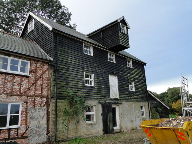
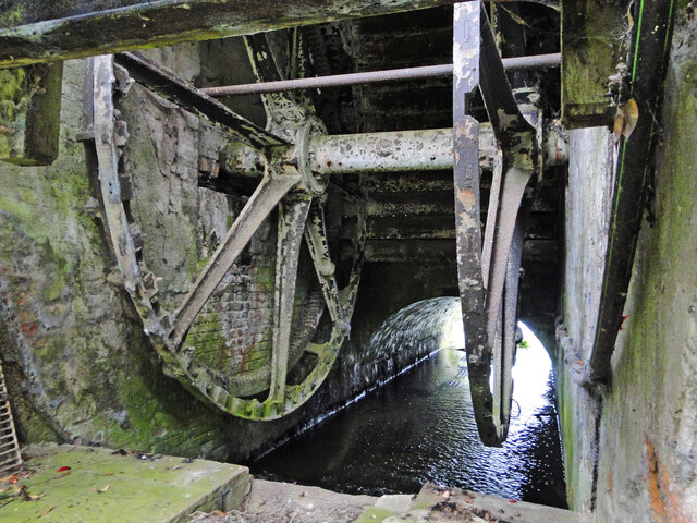
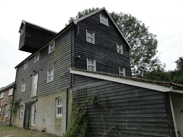
Bardwell Windmill

Bardwell Mill is a Grade II* listed tower mill at Bardwell, Suffolk, England, which is under restoration. == History == Bardwell Mill was built in 1823...

Stanton Chare

Stanton Chare is a hamlet in West Suffolk district, Suffolk, England. It is near the large village of Stanton. The A143 road and B1111 road are nearby...

Bardwell, Suffolk

Bardwell is a village and civil parish in the West Suffolk district of Suffolk, England. == Location == Bardwell is located about ten miles north-east...

St John the Baptist's Church, Stanton

St John the Baptist's Church is a redundant Anglican church in the village of Stanton, Suffolk, England. It is recorded in the National Heritage List...

St Andrew's Church, Sapiston

St Andrew's Church is a redundant Anglican church in the village of Sapiston, Suffolk, England. It is recorded in the National Heritage List for England...

Sapiston

Sapiston is a small village and civil parish in the West Suffolk district of Suffolk in eastern England, located near the Suffolk-Norfolk border. It is...

Barningham, Suffolk

Barningham is a village and civil parish in the West Suffolk district of Suffolk, England, about twelve miles north-east of Bury St Edmunds. According...

Nearby Amenities

Located within 500m of 52.336604,0.849494
Give Way
Lat/Long: 52.3351531/0.8473176
Give Way
Lat/Long: 52.3352637/0.8471381
Give Way
Lat/Long: 52.3352887/0.8472143
The data included in this document is from www.openstreetmap.org. The data is made available under ODbL.

Have you been to Bardwell?

Leave your review of Bardwell below (or comments, questions and feedback).