Bardon Mill

Civil Parish in Northumberland

England

Bardon Mill

Small enclosed area of lazy-beds south-west of Greenlee The fertility of the soil here is shown in the foreground molehills.

Lazy bed is a traditional method of arable cultivation. Rather like cord rig cultivation, parallel banks of ridge and furrow are dug by spade although lazy beds have banks that are bigger, up to 2.5 metres (8 ft 2 in) in width, with narrow drainage channels between them. It was used in southern parts of Britain from the post-Roman period until the post-medieval period, and across much of Ireland and Scotland until the 19th century.

Although it is largely extinct, it is still to be found in parts of the Hebrides and the west of Ireland. In these places, the method used is normally to lift up sods of peat and apply desalinated seaweed fertiliser to improve the ground. Potatoes were often grown in this way in these regions, until the potato blight Phytophthora infestans caused potato famine in the Highlands and Ireland.
<span class="nowrap"><a title="https://en.wikipedia.org/wiki/Lazy_bed" rel="nofollow ugc noopener" href="https://en.wikipedia.org/wiki/Lazy_bed">Link</a><img style="margin-left:2px;" alt="External link" title="External link - shift click to open in new window" src="https://s1.geograph.org.uk/img/external.png" width="10" height="10"/></span>
Small enclosed area of lazy-beds south-west of Greenlee Credit: Andrew Curtis

Bardon Mill is a civil parish located in the county of Northumberland, England. Situated in the Tyne Valley, it lies approximately 4 miles to the east of Hexham and is surrounded by stunning countryside and picturesque landscapes. The parish covers an area of about 24 square kilometers and is home to a population of around 1,000 residents.

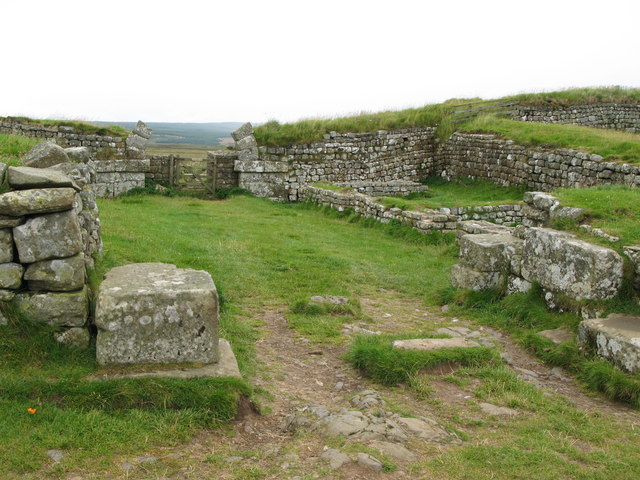
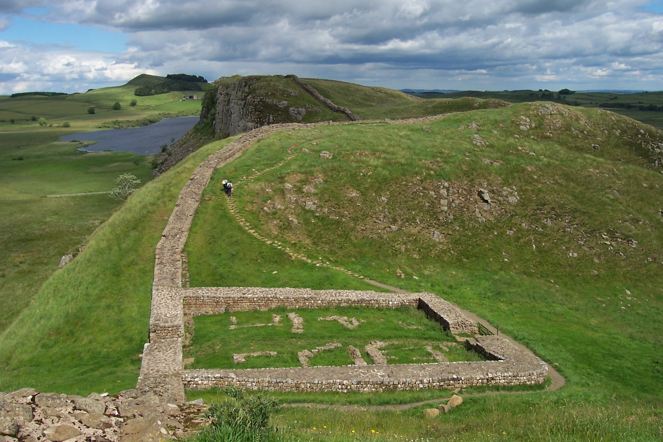
The village of Bardon Mill itself is a small, close-knit community with a rich history dating back centuries. It is perhaps best known for its proximity to the Roman fort of Vindolanda, which attracts a significant number of tourists each year. The fort, located on Hadrian's Wall, offers visitors a glimpse into Roman life with its well-preserved ruins and fascinating artifacts.

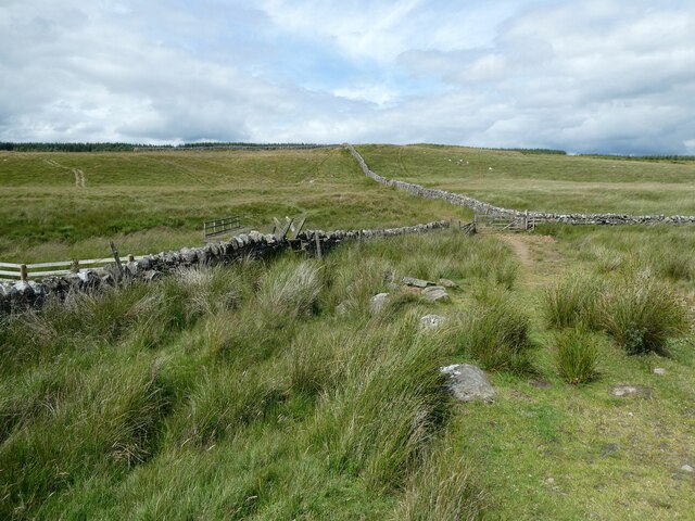
In addition to its historical significance, Bardon Mill is also renowned for its natural beauty. The surrounding area offers numerous opportunities for outdoor activities, such as walking, cycling, and birdwatching. The village is located near the North Pennines Area of Outstanding Natural Beauty, providing residents and visitors with breathtaking views and tranquil surroundings.

The parish of Bardon Mill is well-served by local amenities, including a primary school, a post office, a village shop, and a pub. The community spirit is strong, with various clubs and societies offering opportunities for social engagement and participation.

Overall, Bardon Mill is a charming and vibrant civil parish, offering a perfect blend of history, natural beauty, and community spirit.

If you have any feedback on the listing, please let us know in the comments section below.

Bardon Mill Images

Images are sourced within 2km of 55.013184/-2.349625 or Grid Reference NY7768. Thanks to Geograph Open Source API. All images are credited.

Small enclosed area of lazy-beds south-west of Greenlee The fertility of the soil here is shown in the foreground molehills.

Lazy bed is a traditional method of arable cultivation. Rather like cord rig cultivation, parallel banks of ridge and furrow are dug by spade although lazy beds have banks that are bigger, up to 2.5 metres (8 ft 2 in) in width, with narrow drainage channels between them. It was used in southern parts of Britain from the post-Roman period until the post-medieval period, and across much of Ireland and Scotland until the 19th century.

Although it is largely extinct, it is still to be found in parts of the Hebrides and the west of Ireland. In these places, the method used is normally to lift up sods of peat and apply desalinated seaweed fertiliser to improve the ground. Potatoes were often grown in this way in these regions, until the potato blight Phytophthora infestans caused potato famine in the Highlands and Ireland.
<span class="nowrap"><a title="https://en.wikipedia.org/wiki/Lazy_bed" rel="nofollow ugc noopener" href="https://en.wikipedia.org/wiki/Lazy_bed">Link</a><img style="margin-left:2px;" alt="External link" title="External link - shift click to open in new window" src="https://s1.geograph.org.uk/img/external.png" width="10" height="10"/></span>
Small enclosed area of lazy-beds south-west of Greenlee
The fertility of the soil here is shown in the foreground molehills. Lazy bed is a traditional method of arable cultivation. Rather like cord rig cultivation, parallel banks of ridge and furrow are dug by spade although lazy beds have banks that are bigger, up to 2.5 metres (8 ft 2 in) in width, with narrow drainage channels between them. It was used in southern parts of Britain from the post-Roman period until the post-medieval period, and across much of Ireland and Scotland until the 19th century. Although it is largely extinct, it is still to be found in parts of the Hebrides and the west of Ireland. In these places, the method used is normally to lift up sods of peat and apply desalinated seaweed fertiliser to improve the ground. Potatoes were often grown in this way in these regions, until the potato blight Phytophthora infestans caused potato famine in the Highlands and Ireland. LinkExternal link
Sheepfold near East Stonefolds
Pastureland north of Greenlee Lough
Site of well below Greenlee
The Pennine Way near Cragend
The Pennine Way near East Stonefolds
Track on the moor Quad bike track and carrying a path.
Track on the moor
Quad bike track and carrying a path.
Path across moorland We have this path all to ourselves.
Path across moorland
We have this path all to ourselves.
National Trail waymarker acorn on the Pennine Way near East Stonefolds farm The patina of weathering caught my eye.
National Trail waymarker acorn on the Pennine Way near East Stonefolds farm
The patina of weathering caught my eye.
Walking near East Stonefolds A farmyard has to be traversed. No problem as it turned out. My ninja lead scout assesses the lie of the land, the likely presence of a one-eyed farm dog, the restlessness of the native population and the nearest exit points as we approach. I relax in the resulting cocoon of ever vigilant protectiveness and follow along safe in the knowledge that the best nose in the business is constantly whiffling the wind in front of me, a pair of never-resting beady peepers are scanning windows, doors, gateways and cracks in fences for any attempt to repel boarders and we pass through like two shadows with barely a creak of boot leather, a scent of sweaty oxter and are soon through and approaching a second farmstead.
Walking near East Stonefolds
A farmyard has to be traversed. No problem as it turned out. My ninja lead scout assesses the lie of the land, the likely presence of a one-eyed farm dog, the restlessness of the native population and the nearest exit points as we approach. I relax in the resulting cocoon of ever vigilant protectiveness and follow along safe in the knowledge that the best nose in the business is constantly whiffling the wind in front of me, a pair of never-resting beady peepers are scanning windows, doors, gateways and cracks in fences for any attempt to repel boarders and we pass through like two shadows with barely a creak of boot leather, a scent of sweaty oxter and are soon through and approaching a second farmstead.
Barns at East Stonefold Nice old barns.
Barns at East Stonefold
Nice old barns.
Path detouring around West Stonefold farm This farm is boxed around by the path now.
Path detouring around West Stonefold farm
This farm is boxed around by the path now.
Natural "Rock Art"
Natural "Rock Art"
Rhododendrons on a Bield (sheepfold)
Mud and Ice What looks like a field entrance is the access to the next stage of the Pennine Way. The mud is ankle deep and the water in the ruts is frozen over. Pretty off-putting, really.
Mud and Ice
What looks like a field entrance is the access to the next stage of the Pennine Way. The mud is ankle deep and the water in the ruts is frozen over. Pretty off-putting, really.
Wildflower meadow below Greenlee The footpath from the farm south towards Greenlee Lough descends through this meadow thick with buttercups and yellow rattle. It is owned by the National Trust and stands out in views from afar.
Wildflower meadow below Greenlee
The footpath from the farm south towards Greenlee Lough descends through this meadow thick with buttercups and yellow rattle. It is owned by the National Trust and stands out in views from afar.
East Stonefolds Farm The farm did not seem to be active. I recall passing this way some ten years ago and being accosted by a very tatty (but surprisingly friendly) farm cat who accompanied me almost to the Pennine Way before saying goodbye. Sadly, probably long gone.
East Stonefolds Farm
The farm did not seem to be active. I recall passing this way some ten years ago and being accosted by a very tatty (but surprisingly friendly) farm cat who accompanied me almost to the Pennine Way before saying goodbye. Sadly, probably long gone.
Ford and footbridge, Greenlee Burn On the footpath which links Greenlee to West Stonefolds.
Ford and footbridge, Greenlee Burn
On the footpath which links Greenlee to West Stonefolds.
Show me another place!

Bardon Mill is located at Grid Ref: NY7768 (Lat: 55.013184, Lng: -2.349625)

Unitary Authority: Northumberland

Police Authority: Northumbria

What 3 Words

///intrigues.scaffold.newly. Near Bardon Mill, Northumberland

Nearby Locations

Bardon Mill

Related Wikis

Milecastle 37

Milecastle 37 is one of the milecastles on Hadrian's Wall. It is immediately west of the Housesteads Roman Fort (grid reference NY78506869). == Description... ==

Milecastle 38

Milecastle 38 (Hotbank) was a milecastle on Hadrian's Wall in the vicinity of Hotbank Farm, (grid reference NY77276813). It is notable for the joint inscription...

Housesteads Roman Fort

Housesteads Roman Fort is the remains of an auxiliary fort on Hadrian's Wall, at Housesteads, Northumberland, England, south of Broomlee Lough. The fort...

Crag Lough

Crag Lough is an inland lake at the southern edge of Northumberland National Park, 2.5 miles (4.0 km) north of Bardon Mill, and 0.5 miles (0.8 km) north...

Knag Burn Gateway

The Knag Burn Gateway is a gateway which was built into Hadrian's Wall some time after construction of the wall itself, generally acknowledged to be during...

Broomlee Lough

Broomlee Lough is an inland lake in Northumberland, England at the southern edge of Northumberland National Park. The lough lies immediately north of the...

Sycamore Gap Tree

The Sycamore Gap Tree or Robin Hood Tree was a sycamore tree standing next to Hadrian's Wall near Crag Lough in Northumberland, England. It was located...

Milecastle 39

Milecastle 39 (Castle Nick) is a milecastle on Hadrian's Wall (grid reference NY76066773). == Description == Milecastle 39 is located northeast of Once...

Nearby Amenities

Located within 500m of 55.013184,-2.349625
Barrier: stile
Material: wood
Source: survey;bing;gps
Stile: ladder
Lat/Long: 55.0117763/-2.3439285
Barrier: stile
Material: wood
Source: survey;gps
Stile: ladder
Lat/Long: 55.0117493/-2.3440741
Ele: 315
Lat/Long: 55.0107875/-2.3478341
Ele: 320
Lat/Long: 55.0099262/-2.3524368
Ford: yes
Lat/Long: 55.01343/-2.345619
Rapishaw Gap
Natural: saddle
Source: NLS OS 1:10k
Lat/Long: 55.011861/-2.34402
The data included in this document is from www.openstreetmap.org. The data is made available under ODbL.

Have you been to Bardon Mill?

Leave your review of Bardon Mill below (or comments, questions and feedback).