Bardon

Civil Parish in Leicestershire North West Leicestershire

England

Bardon

Light and Shade, Bardon Hill Near Coalville this path leads to/ from Bardon Hill. It was a lovely morning.
Light and Shade, Bardon Hill Credit: David Bremner

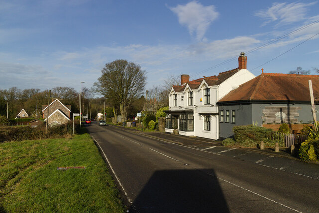
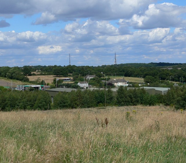
Bardon is a civil parish located in the district of North West Leicestershire, in the county of Leicestershire, England. It is situated about 3 miles northwest of Coalville and covers an area of approximately 5 square miles. The parish includes the villages of Bardon Hill and Bardon Park, as well as parts of the larger settlement of Coalville.

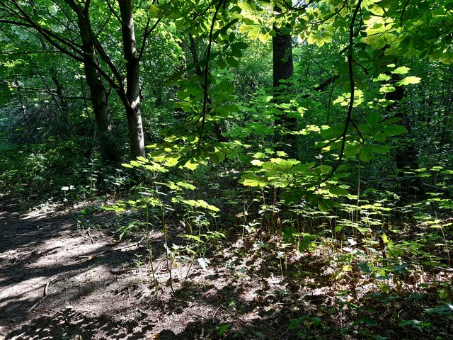
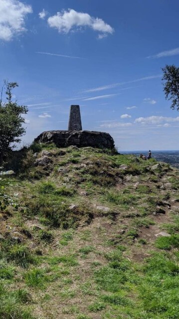
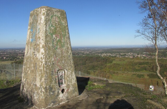
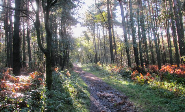
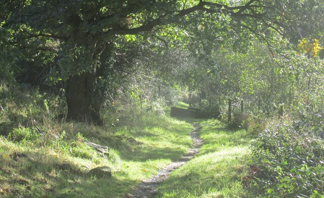
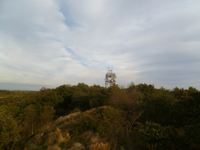
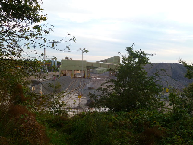
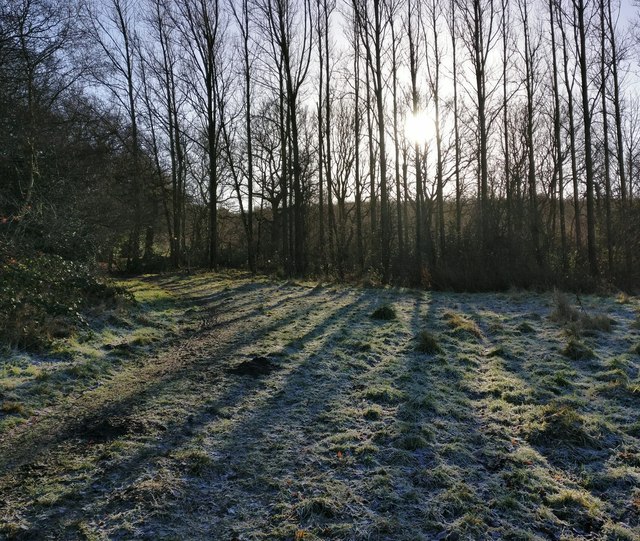
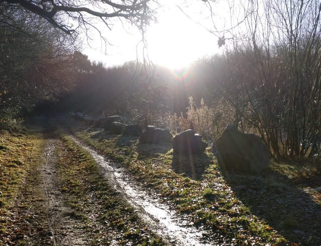
Bardon Hill, the highest point in Leicestershire, is a prominent feature of the area. It is an ancient volcanic plug that stands at a height of 912 feet. The hill offers breathtaking views of the surrounding countryside and is a popular destination for hikers and nature enthusiasts. Bardon Quarry, located on the hill, is an active quarrying site that has been in operation for over a century, primarily extracting granite and limestone.

In addition to its natural beauty, Bardon is also home to a number of industrial and commercial developments. The area has a strong mining heritage, with several coal mines operating in the past. Today, Bardon Business Park, located adjacent to the M1 motorway, is a major employment hub, housing a range of businesses.

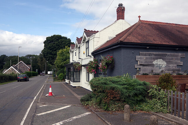
The civil parish has a small population, with approximately 1,000 residents. The area is primarily residential, with a mix of housing types, including detached houses, semi-detached houses, and bungalows. There are also a few local amenities, including a primary school, a village hall, and a church. Bardon provides a peaceful and picturesque setting, offering a blend of rural charm and convenient access to nearby towns and cities.

If you have any feedback on the listing, please let us know in the comments section below.

Bardon Images

Images are sourced within 2km of 52.712715/-1.314394 or Grid Reference SK4613. Thanks to Geograph Open Source API. All images are credited.

Light and Shade, Bardon Hill Near Coalville this path leads to/ from Bardon Hill. It was a lovely morning.
Light and Shade, Bardon Hill
Near Coalville this path leads to/ from Bardon Hill. It was a lovely morning.
Post Box on Greenhill Road, Coalville LE67 47. A fine Type M box listed by Royal Mail as Agar Nook.
Post Box on Greenhill Road, Coalville
LE67 47. A fine Type M box listed by Royal Mail as Agar Nook.
Puddle, Bardon Hill Despite the very hot and dry weather this puddle was encountered on one of the footpaths on Bardon Hill.
Puddle, Bardon Hill
Despite the very hot and dry weather this puddle was encountered on one of the footpaths on Bardon Hill.
The Copt Oak The Copt Oak pub is operated by Rotisserie Pub Restaurants, part of the Marston's estate. The emphasis is very much on dining. The building has evidently had a makeover since this view 15 years earlier: <a href="https://www.geograph.org.uk/photo/188366">SK4812 : Copt Oak</a>.
The Copt Oak
The Copt Oak pub is operated by Rotisserie Pub Restaurants, part of the Marston's estate. The emphasis is very much on dining. The building has evidently had a makeover since this view 15 years earlier: SK4812 : Copt Oak.
Copt Oak public house, Whitwick Road
Trig pillar
Trig pillar
Copt Oak youth hostel and church When Copt Oak's school closed it became a youth hostel, self-catering only at weekends and school holidays. Water was collected from the village stand-pipe by the volunteer wardens
Copt Oak youth hostel and church
When Copt Oak's school closed it became a youth hostel, self-catering only at weekends and school holidays. Water was collected from the village stand-pipe by the volunteer wardens
Triangulation pillar on Bardon Hill At 912ft Bardon Hill is Leicestershire's county top.
Triangulation pillar on Bardon Hill
At 912ft Bardon Hill is Leicestershire's county top.
Footpath to Bardon Hill Lovely track through the trees.
Footpath to Bardon Hill
Lovely track through the trees.
Footpath near Upper Greenhill Farm Bardon Hill walk.
Footpath near Upper Greenhill Farm
Bardon Hill walk.
St Peter's church
St Peter's church
Overbridge, M1
Overbridge, M1
A wet M1, southbound The M1 is a north–south motorway connecting London to Leeds, where it joins the A1(M) near Aberford. It was the first motorway to be completed in the United Kingdom.
The motorway is 193 miles long and was constructed in four phases. Most of the motorway was opened between 1959 and 1968 but the southern end was extended in 1977 and the northern end was extended in 1999.
A wet M1, southbound
The M1 is a north–south motorway connecting London to Leeds, where it joins the A1(M) near Aberford. It was the first motorway to be completed in the United Kingdom. The motorway is 193 miles long and was constructed in four phases. Most of the motorway was opened between 1959 and 1968 but the southern end was extended in 1977 and the northern end was extended in 1999.
Bridge north of J22, M1 The M1 is a north–south motorway connecting London to Leeds, where it joins the A1(M) near Aberford. It was the first motorway to be completed in the United Kingdom.
The motorway is 193 miles long and was constructed in four phases. Most of the motorway was opened between 1959 and 1968 but the southern end was extended in 1977 and the northern end was extended in 1999.
Bridge north of J22, M1
The M1 is a north–south motorway connecting London to Leeds, where it joins the A1(M) near Aberford. It was the first motorway to be completed in the United Kingdom. The motorway is 193 miles long and was constructed in four phases. Most of the motorway was opened between 1959 and 1968 but the southern end was extended in 1977 and the northern end was extended in 1999.
The antenna on Bardon Hill Taken near the marking column, at the top of Bardon Hill, in Coalville.
The antenna on Bardon Hill
Taken near the marking column, at the top of Bardon Hill, in Coalville.
Bardon Quarry A view of the loading conveyors and tracks of the quarry in Bardon, Coalville.
Bardon Quarry
A view of the loading conveyors and tracks of the quarry in Bardon, Coalville.
Low winter sunlight along the Ivanhoe Way The Ivanhoe Way has just left Vercor Close in Agar Nook, and is heading south towards Bardon Hill.
Low winter sunlight along the Ivanhoe Way
The Ivanhoe Way has just left Vercor Close in Agar Nook, and is heading south towards Bardon Hill.
The Ivanhoe Way towards Bardon Hill
Show me another place!

Bardon is located at Grid Ref: SK4613 (Lat: 52.712715, Lng: -1.314394)

Administrative County: Leicestershire

District: North West Leicestershire

Police Authority: Leicestershire

What 3 Words

///maddening.truckload.cool. Near Markfield, Leicestershire

Nearby Locations

Bardon Hill Wood Bardon

Related Wikis

Bardon Hill

Bardon Hill is the highest Hill in Leicestershire and on a clear day the Malvern and Shropshire Hills (approx. 50–60 miles), summits in Derbyshire (approx...
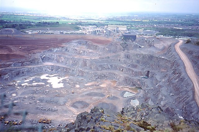
Bardon Hill Quarry

Bardon Hill Quarry is a 58.2-hectare (144-acre) geological Site of Special Scientific Interest east of Coalville in Leicestershire. It is a Geological...

Bardon Park Chapel

Bardon Park Chapel is a 300-year-old Christian meeting house at Bardon, Leicestershire, England. It stands back from the A511 road (Shaw Lane), between...

Abbots Oak

Abbots Oak is a hamlet near Coalville, Leicestershire, comprising a cluster of dwellings near Warren Hills, either side of the road between Whitwick and...

Holly Rock Fields

Holly Rock Fields is a 3.9 hectares (9.6 acres) biological Site of Special Scientific Interest east of Coalville in Leicestershire.This is a nationally...

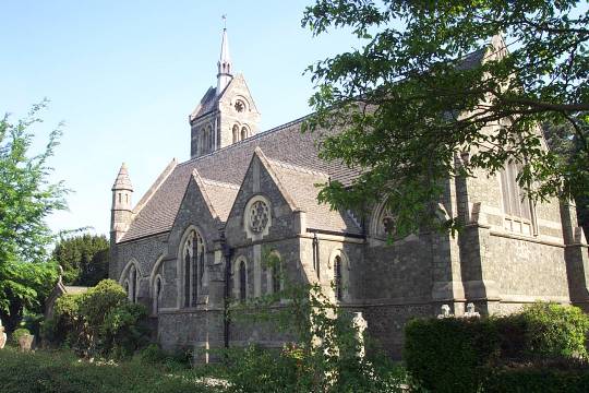
St Peter's Church, Bardon

St Peter's Church is a church in Bardon, Leicestershire. It is a Grade II listed building. == History == The church was designed by J.B. Everard (1844...

Billa Barra Hill

Billa Barra Hill is a 20.7 hectares (51 acres) Local Nature Reserve north of Stanton under Bardon in Leicestershire. It is owned and managed by Hinckley...

Bardon, Leicestershire

Bardon is a civil parish and former village in North West Leicestershire about 1.5 miles (2.4 km) southeast of the centre of Coalville. The parish includes...

Nearby Amenities

Located within 500m of 52.712715,-1.314394
Power: tower
Lat/Long: 52.7110016/-1.3080384
Power: tower
Lat/Long: 52.7094611/-1.3125976
Bardon Hill
Ele: 278
Natural: peak
Tourism: viewpoint
Wikipedia: en:Bardon Hill, Leicestershire
Lat/Long: 52.7144599/-1.3204762
Bardon Hill
Place: locality
Source: Bing
Wikidata: Q4860201
Wikipedia: en:Bardon Hill
Lat/Long: 52.7139197/-1.3196174
Man Made: survey_point
Lat/Long: 52.7144593/-1.3204566
Man Made: mast
Tower Type: communication
Lat/Long: 52.7142531/-1.3187907
The data included in this document is from www.openstreetmap.org. The data is made available under ODbL.

Have you been to Bardon?

Leave your review of Bardon below (or comments, questions and feedback).