Barden
Civil Parish in Yorkshire Craven
England
Barden

Barden is a civil parish located in the county of Yorkshire, in the northern region of England. It is situated within the Craven district, approximately 4 miles north of the market town of Skipton. Barden is a small, rural community with a population of around 100 people.
The parish is known for its picturesque beauty, as it is surrounded by the stunning landscapes of the Yorkshire Dales National Park. Barden lies in the valley of the River Wharfe and is bordered by rolling hills and lush green fields. The area is a popular destination for outdoor enthusiasts, offering numerous walking and cycling trails, as well as opportunities for fishing and birdwatching.
One of the notable landmarks in Barden is Barden Tower, a medieval fortified house that dates back to the 15th century. The tower is situated on the banks of the River Wharfe and is a popular attraction for history buffs and visitors interested in architectural heritage.
Despite its small size, Barden has a close-knit community and a strong sense of local pride. The parish has a village hall, which serves as a hub for community events and gatherings. Additionally, there is a small church, St. John the Baptist, which holds regular services and provides spiritual support to the local residents.
Overall, Barden offers a tranquil and idyllic setting for those seeking a peaceful retreat in the heart of the Yorkshire countryside.
If you have any feedback on the listing, please let us know in the comments section below.
Barden Images
Images are sourced within 2km of 54.018874/-1.922281 or Grid Reference SE0558. Thanks to Geograph Open Source API. All images are credited.


![A circular walk along the River Wharfe [12] A view of the top of The Strid as the river narrows. The Strid is a 15 foot (4.6 m) deep underwater channel caused by the narrowing of the river from 90 ft (27 m) wide, just to the north, to the width of a long stride less than 300 ft (91 m) later. It is especially dangerous as both banks are undercut. Its name comes from the Old English Stryth, meaning 'turmoil'. This was later corrupted to Strid, referring to 'the possibility of striding across'.
Starting from the Cavendish Pavilion, the walk follows the west bank of the River Wharfe upstream, passing The Strid, to the Barden Aqueduct Bridge. Crossing to the east bank, the walk continues downstream to return to the starting point. Just over 3½ miles.](https://s1.geograph.org.uk/geophotos/07/01/97/7019705_a9519a71.jpg)
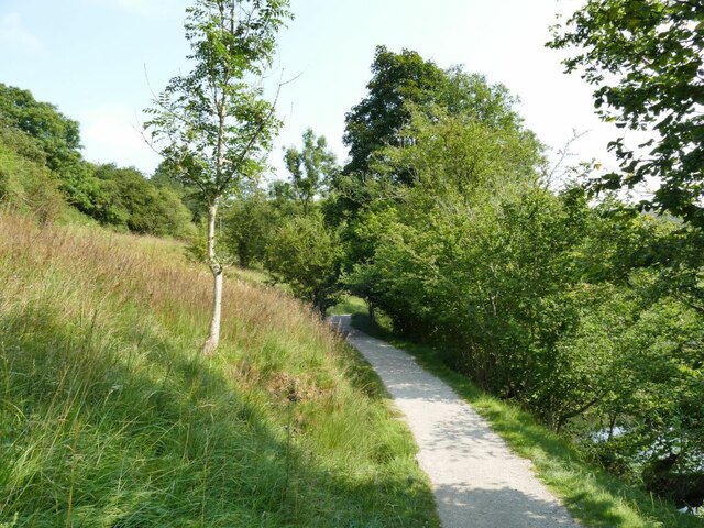
![A circular walk along the River Wharfe [13] The path continues through calm and peaceful Strid Wood in contrast to the tumult of the river below.
Starting from the Cavendish Pavilion, the walk follows the west bank of the River Wharfe upstream, passing The Strid, to the Barden Aqueduct Bridge. Crossing to the east bank, the walk continues downstream to return to the starting point. Just over 3½ miles.](https://s3.geograph.org.uk/geophotos/07/01/97/7019707_818019fe.jpg)
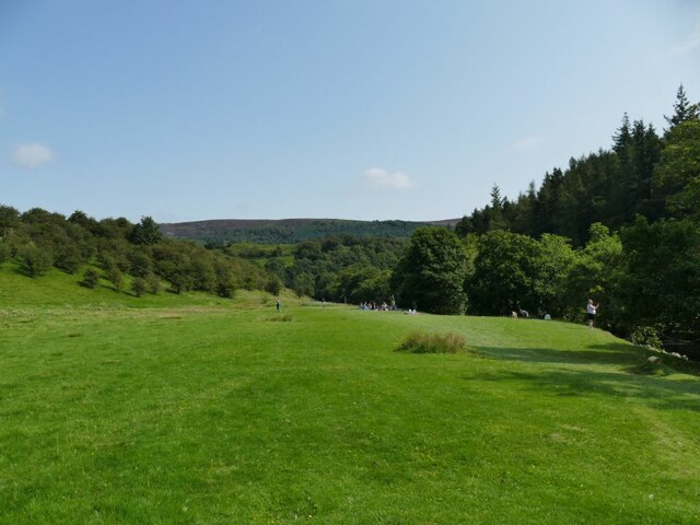
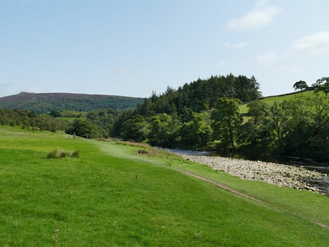
![A circular walk along the River Wharfe [14] The river is wider here before it begins to narrow to The Strid.
Starting from the Cavendish Pavilion, the walk follows the west bank of the River Wharfe upstream, passing The Strid, to the Barden Aqueduct Bridge. Crossing to the east bank, the walk continues downstream to return to the starting point. Just over 3½ miles.](https://s0.geograph.org.uk/geophotos/07/01/97/7019708_1f2b9a50.jpg)
![A circular walk along the River Wharfe [15] The path is carried over Bardon Beck on this footbridge.
Starting from the Cavendish Pavilion, the walk follows the west bank of the River Wharfe upstream, passing The Strid, to the Barden Aqueduct Bridge. Crossing to the east bank, the walk continues downstream to return to the starting point. Just over 3½ miles.](https://s1.geograph.org.uk/geophotos/07/01/97/7019709_498db184.jpg)
![A circular walk along the River Wharfe [16] The Barden Aqueduct Bridge carries the Nidd Aqueduct over the river. The aqueduct carries water from Angram and Scar House reservoirs in upper Nidderdale to Bradford in West Yorkshire.
Starting from the Cavendish Pavilion, the walk follows the west bank of the River Wharfe upstream, passing The Strid, to the Barden Aqueduct Bridge. Crossing to the east bank, the walk continues downstream to return to the starting point. Just over 3½ miles.](https://s2.geograph.org.uk/geophotos/07/01/97/7019710_6a8907e2.jpg)
![A circular walk along the River Wharfe [17] The path across the Barden Aqueduct Bridge which carries the Nidd Aqueduct over the river.
Starting from the Cavendish Pavilion, the walk follows the west bank of the River Wharfe upstream, passing The Strid, to the Barden Aqueduct Bridge. Crossing to the east bank, the walk continues downstream to return to the starting point. Just over 3½ miles.](https://s3.geograph.org.uk/geophotos/07/01/97/7019711_117d0d9b.jpg)
![A circular walk along the River Wharfe [18] The view upstream from Barden Aqueduct Bridge which carries the Nidd Aqueduct over the river.
Starting from the Cavendish Pavilion, the walk follows the west bank of the River Wharfe upstream, passing The Strid, to the Barden Aqueduct Bridge. Crossing to the east bank, the walk continues downstream to return to the starting point. Just over 3½ miles.](https://s0.geograph.org.uk/geophotos/07/01/97/7019716_08bffd71.jpg)
Barden is located at Grid Ref: SE0558 (Lat: 54.018874, Lng: -1.922281)
Division: West Riding
Administrative County: North Yorkshire
District: Craven
Police Authority: North Yorkshire
What 3 Words
///watchdogs.priced.tablet. Near Embsay, North Yorkshire
Nearby Locations
Related Wikis


Nearby Amenities
Located within 500m of 54.018874,-1.922281Have you been to Barden?
Leave your review of Barden below (or comments, questions and feedback).