Barden

Civil Parish in Yorkshire Richmondshire

England

Barden

Junction, A6108 Near Halfpenny House.
Junction, A6108 Credit: wfmillar

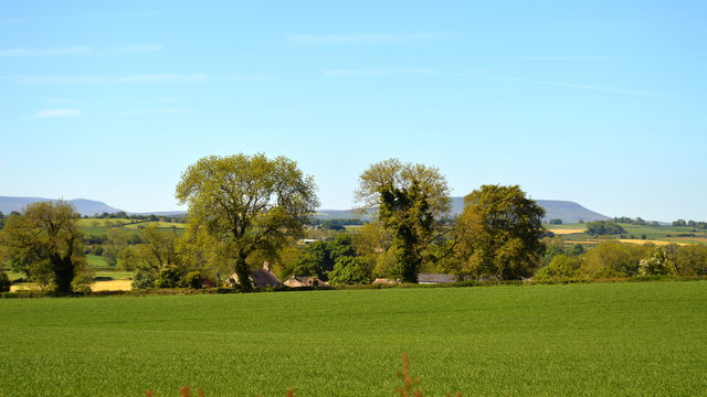
Barden is a small civil parish located in the Craven district of North Yorkshire, England. Situated within the Yorkshire Dales National Park, it is surrounded by stunning natural landscapes and picturesque countryside. The parish covers an area of approximately 10 square kilometers and is home to a population of around 50 residents.

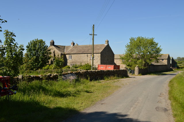
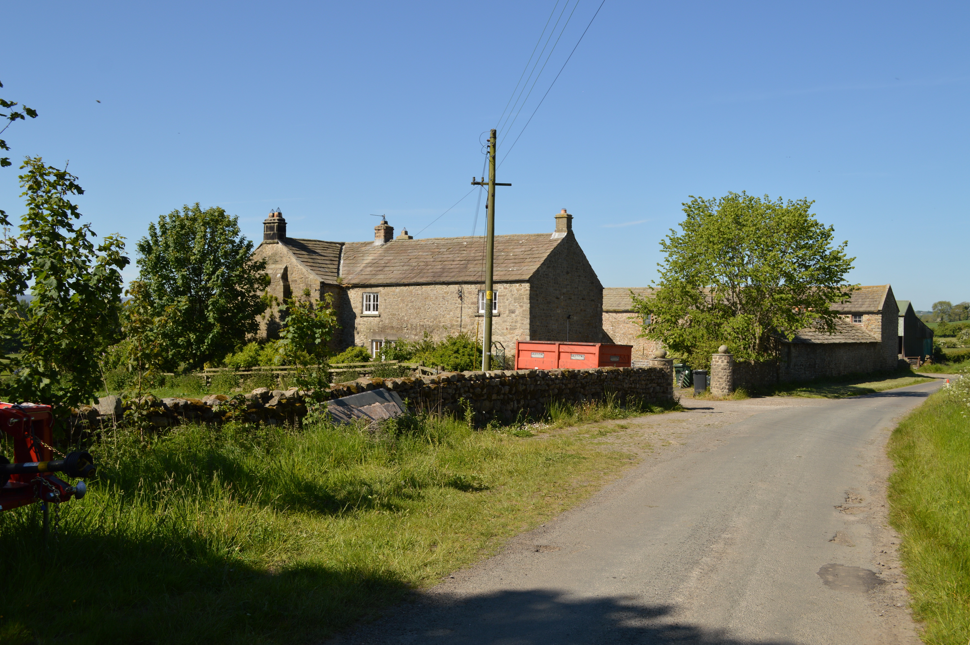
Barden is renowned for its historical significance, particularly due to the presence of Barden Tower, a fortified medieval house that dates back to the 15th century. Barden Tower was once the residence of the influential Clifford family and served as a hunting lodge for Henry Clifford, the Earl of Cumberland. Today, the tower serves as a popular tourist attraction, offering visitors a glimpse into its rich past.

The parish is also known for its connection to the nearby River Wharfe. Barden Bridge, a stone bridge built in the 16th century, spans the river and provides a picturesque crossing point for both pedestrians and vehicles. The river itself offers opportunities for fishing, as well as beautiful riverside walks.

Despite its small size, Barden has a close-knit community and a vibrant social life. The parish holds regular events and gatherings, including fairs and festivals, which bring residents and visitors together. The nearby villages of Burnsall and Grassington offer additional amenities such as shops, pubs, and restaurants, ensuring that residents have access to essential services.

In summary, Barden is a charming civil parish nestled in the heart of the Yorkshire Dales. With its historical landmarks, natural beauty, and strong community spirit, it offers a peaceful and idyllic lifestyle for its residents.

If you have any feedback on the listing, please let us know in the comments section below.

Barden Images

Images are sourced within 2km of 54.347487/-1.782992 or Grid Reference SE1494. Thanks to Geograph Open Source API. All images are credited.
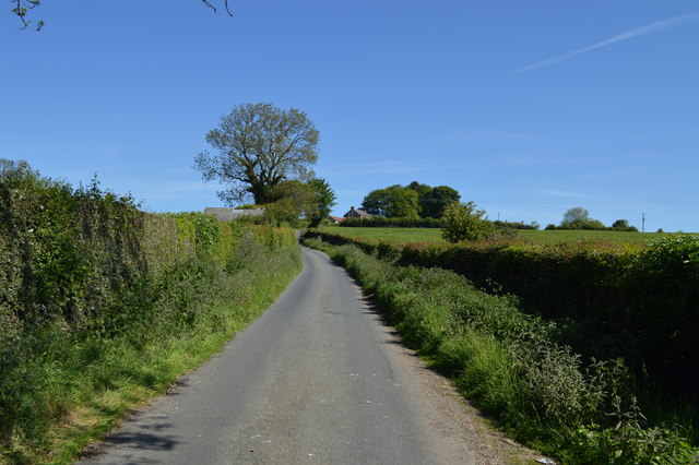
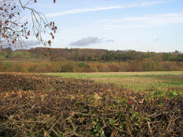
Junction, A6108 Near Halfpenny House.
Junction, A6108
Near Halfpenny House.
Road junction signs south of Boston Bridge A6108 southbound
Road junction signs south of Boston Bridge
A6108 southbound
Old Tank Hulk Rusty, decaying Chieftain tank hulk on Catterick training area.
Old Tank Hulk
Rusty, decaying Chieftain tank hulk on Catterick training area.
Tree at Track Junction A prominent tree at a track junction on Hauxwell Moor, Catterick Training Area. Pondhead Plantation in the background.
Tree at Track Junction
A prominent tree at a track junction on Hauxwell Moor, Catterick Training Area. Pondhead Plantation in the background.
Track Junction Track junction at Barden Moor, Catterick Training Area, there are safety posts along the side of the road due to the steep drop. An old tank hulk is a permanent feature here, used for training purposes.
Track Junction
Track junction at Barden Moor, Catterick Training Area, there are safety posts along the side of the road due to the steep drop. An old tank hulk is a permanent feature here, used for training purposes.
Pillbox above Halfpenny House Pillbox situated on the edge of MOD ranges facing southwest in the general direction of Leyburn
Pillbox above Halfpenny House
Pillbox situated on the edge of MOD ranges facing southwest in the general direction of Leyburn
Cross Lanes Farm, Barden
Tank Roads on Barden Fell Keep out! MOD property!
Tank Roads on Barden Fell
Keep out! MOD property!
Barden Moor MOD ranges just outside Catterick Garrison, with Hagworm Hill, the clump of trees to the right.
Barden Moor
MOD ranges just outside Catterick Garrison, with Hagworm Hill, the clump of trees to the right.
East Barden Dykes Smallholding in the lee of the hill.
East Barden Dykes
Smallholding in the lee of the hill.
Plantation on Barden Moor Effectively screening MOD land from the outside world. Just visible is a "no entry" warning sign which proliferate in this area.
Plantation on Barden Moor
Effectively screening MOD land from the outside world. Just visible is a "no entry" warning sign which proliferate in this area.
Crow Plump Delightful name for a nondescript stand of trees.
Crow Plump
Delightful name for a nondescript stand of trees.
Skelton Cote Farm While the Leyburn road runs closer to this farm, the back road to Barden gives a better view and has the badckdrop of Pen Hill to boot.
Skelton Cote Farm
While the Leyburn road runs closer to this farm, the back road to Barden gives a better view and has the badckdrop of Pen Hill to boot.
Barden Lane Approaching Barden from the south. The buildings of Barden Lane Farm can just be seen on the horizon.
Barden Lane
Approaching Barden from the south. The buildings of Barden Lane Farm can just be seen on the horizon.
Barden Old Hall A range of farm buildings largely unspoiled by modernisation.
Barden Old Hall
A range of farm buildings largely unspoiled by modernisation.
Friar Ings
Friar Ings
Sheep pasture, Willow Gill Rough pasture with sheep at Willow Gill at the edge of the Catterick ranges.
Sheep pasture, Willow Gill
Rough pasture with sheep at Willow Gill at the edge of the Catterick ranges.
Barden Lane Latest edition OS maps show this now as a 'Byway open to all traffic' [BOAT] which would suggest a change of grading from county road.
Barden Lane
Latest edition OS maps show this now as a 'Byway open to all traffic' [BOAT] which would suggest a change of grading from county road.
Show me another place!

Barden is located at Grid Ref: SE1494 (Lat: 54.347487, Lng: -1.782992)

Division: North Riding

Administrative County: North Yorkshire

District: Richmondshire

Police Authority: North Yorkshire

What 3 Words

///scrum.washable.confined. Near Catterick Garrison, North Yorkshire

Nearby Locations

Barden Tile Wood

Related Wikis

Barden, Richmondshire

Barden is a hamlet and civil parish in North Yorkshire, England. It is about 5 miles (8 km) south of Richmond. According to the 2001 census the parish...

Barden Old Hall

Barden Old Hall is a historic building in Barden, a hamlet near Richmond, North Yorkshire, in England. The building probably dates from the early 15th...

Hauxwell Hall

Hauxwell Hall or Hawkswell Hall is a grade II* listed 17th-century country house in West Hauxwell, North Yorkshire, England, some 5 miles (8 km) south...

Garriston

Garriston is a hamlet and civil parish north-east of Leyburn in North Yorkshire, England. In 2015, North Yorkshire County Council estimated the population...

Nearby Amenities

Located within 500m of 54.347487,-1.782992
East Barden Dykes
Place: farm
Lat/Long: 54.3465562/-1.7878946
Power: pole
Lat/Long: 54.3440624/-1.7851582
Power: pole
Lat/Long: 54.3444673/-1.7860043
Power: pole
Lat/Long: 54.3452912/-1.7876574
Power: pole
Lat/Long: 54.3456875/-1.7884644
Power: pole
Lat/Long: 54.3462833/-1.7896284
The data included in this document is from www.openstreetmap.org. The data is made available under ODbL.

Have you been to Barden?

Leave your review of Barden below (or comments, questions and feedback).