Ashwood Well
Lake, Pool, Pond, Freshwater Marsh in Yorkshire Craven
England
Ashwood Well

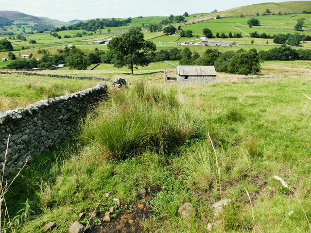
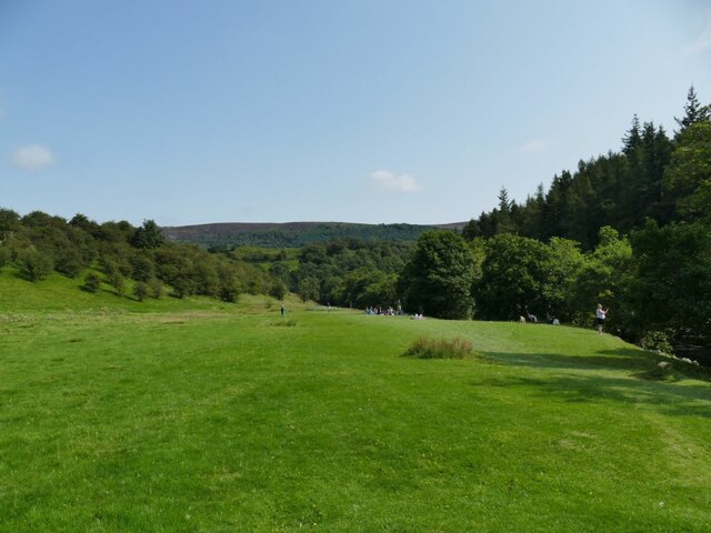
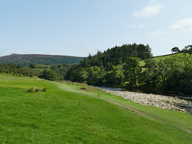
Ashwood Well is a picturesque freshwater marsh located in Yorkshire, England. Nestled amidst lush greenery and rolling hills, this natural wonder is a haven for both wildlife and nature enthusiasts alike. Covering an area of approximately 10 acres, Ashwood Well is a diverse ecosystem that comprises a lake, pool, pond, and freshwater marsh.
The centerpiece of Ashwood Well is its tranquil lake, which spans an impressive 5 acres and is surrounded by vibrant aquatic vegetation. The crystal-clear waters of the lake are home to a myriad of fish species, including perch, pike, and roach, making it a popular spot for anglers seeking to test their fishing skills. The lake also provides a picturesque backdrop for visitors looking to relax or indulge in leisurely activities such as boating or picnicking.
Adjacent to the lake lies a smaller pool, characterized by its shallow waters and abundance of water lilies. This serene pool attracts a variety of waterfowl, including ducks and swans, offering birdwatchers a chance to observe and appreciate their graceful movements.
A short distance away, a peaceful pond can be found, teeming with aquatic plants and small invertebrates. This microhabitat provides a suitable environment for amphibians such as frogs and newts, adding to the biodiversity of the area.
Lastly, Ashwood Well boasts an expansive freshwater marsh, which acts as a natural filter for the water sources in the vicinity. This marshland is characterized by its swaying reeds, grasses, and sedges, creating a habitat for a wide range of wetland species. Frogs, dragonflies, and water voles are just a few examples of the diverse wildlife that call this marsh their home.
In summary, Ashwood Well in Yorkshire offers visitors a unique opportunity to appreciate the beauty and diversity of a freshwater ecosystem. With its lake, pool, pond, and freshwater marsh, this natural gem provides a sanctuary for wildlife and a tranquil retreat for those seeking a connection with nature
If you have any feedback on the listing, please let us know in the comments section below.
Ashwood Well Images
Images are sourced within 2km of 54.02549/-1.914254 or Grid Reference SE0558. Thanks to Geograph Open Source API. All images are credited.


Ashwood Well is located at Grid Ref: SE0558 (Lat: 54.02549, Lng: -1.914254)
Division: West Riding
Administrative County: North Yorkshire
District: Craven
Police Authority: North Yorkshire
What 3 Words
///flattered.awoken.received. Near Embsay, North Yorkshire
Nearby Locations
Related Wikis

Appletreewick
Appletreewick is a village and civil parish in the Craven district of North Yorkshire, England, 6.5 miles (10.5 km) north-east of Skipton, 7 miles (11...

Barden Tower
Barden Tower is a ruined building in the Parish of Barden, in Wharfedale, North Yorkshire, England. The tower was used as a hunting lodge in the 15th and...

Barden, Craven
Barden is a civil parish in the Craven district of North Yorkshire, England. It consists of the hamlet of Drebley and a few scattered houses in Wharfedale...

Skyreholme
Skyreholme is a hamlet in Wharfedale in the Yorkshire Dales, North Yorkshire, England. It lies 1-mile (1.6 km) east of Appletreewick, in the small side...

Simon's Seat
Simon's Seat is a peak in the Yorkshire Dales in northern England. It is a prominent outcrop of millstone grit on the eastern side of Wharfedale. Although...

River Dibb
The River Dibb, also known as Barben Beck, is a small river located in North Yorkshire, England. It is a tributary of the River Wharfe. Grimwith Reservoir...

Parcevall Hall
Parcevall Hall -- also known as Parceval Hall -- and its gardens are located at Skyreholme near Appletreewick village, Wharfedale, North Yorkshire, England...

Hartlington
Hartlington is a small village and civil parish in the Craven district of North Yorkshire, England. At the 2011 Census, the population of the parish was...
Nearby Amenities
Located within 500m of 54.02549,-1.914254Have you been to Ashwood Well?
Leave your review of Ashwood Well below (or comments, questions and feedback).