Ballingham
Civil Parish in Herefordshire
England
Ballingham

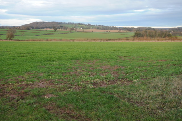
Ballingham is a civil parish located in the county of Herefordshire, England. Situated approximately 5 miles southeast of the city of Hereford, the parish covers an area of around 4 square miles. It is primarily a rural area characterized by rolling hills and picturesque countryside.
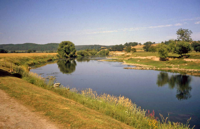
The village of Ballingham itself is small, with a population of around 200 residents. It is surrounded by farmland and offers a peaceful and tranquil setting for its inhabitants. The parish is known for its scenic beauty, with stunning views of the nearby river Wye and the surrounding Herefordshire countryside.
The village is served by a local church, St. Dubricius, which dates back to the 13th century and is a significant historical landmark in the area. The church provides a place of worship for the community and also attracts visitors interested in its architectural and historical significance.
Ballingham is well-connected to nearby towns and cities by road, with the A49 running through the parish. This allows for easy access to Hereford and other surrounding areas. Despite its small size, the village offers a sense of community and hosts regular events and activities for its residents.
Overall, Ballingham, Herefordshire, is a charming and idyllic civil parish characterized by its rural beauty, historical landmarks, and close-knit community.
If you have any feedback on the listing, please let us know in the comments section below.
Ballingham Images
Images are sourced within 2km of 51.981525/-2.620812 or Grid Reference SO5731. Thanks to Geograph Open Source API. All images are credited.


Ballingham is located at Grid Ref: SO5731 (Lat: 51.981525, Lng: -2.620812)
Unitary Authority: County of Herefordshire
Police Authority: West Mercia
What 3 Words
///germinate.sides.merit. Near Brockhampton, Herefordshire
Nearby Locations
Related Wikis

Ballingham
Ballingham is a small village of about 140 people, increasing to 181 at the 2011 Census in Herefordshire, England, situated in a loop of the River Wye...

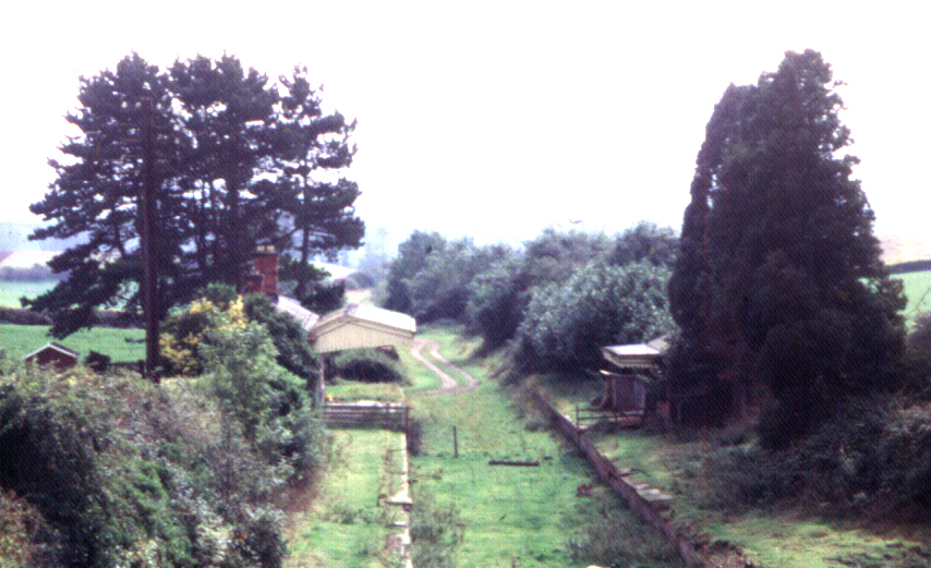
Ballingham railway station
Ballingham railway station is a disused stone built railway station that served the villages of Ballingham and Carey in Herefordshire on the Hereford,...

Ballingham Railway Bridge
Ballingham Railway Bridge (also known as Fawley Viaduct) was a railway bridge over the River Wye, built by the Hereford, Ross and Gloucester Railway. It...
Fawley railway station (Hereford, Ross and Gloucester Railway)
Fawley railway station is a disused stone built railway station that served the village of King's Caple in Herefordshire on Hereford, Ross and Gloucester...
Nearby Amenities
Located within 500m of 51.981525,-2.620812Have you been to Ballingham?
Leave your review of Ballingham below (or comments, questions and feedback).