Baldersby

Civil Parish in Yorkshire Harrogate

England

Baldersby

Skipton on Swale church This benchmark is cut into the stonework to the left of the main church access door. The wall is south facing and the mark is cut into the 3rd stone course.
Skipton on Swale church Credit: Mel Towler

Baldersby is a civil parish located in the county of North Yorkshire, England. Situated approximately 6 miles north of the market town of Thirsk, it is nestled in the beautiful countryside of the Vale of York. The parish covers an area of around 3 square miles and has a population of approximately 250 people.

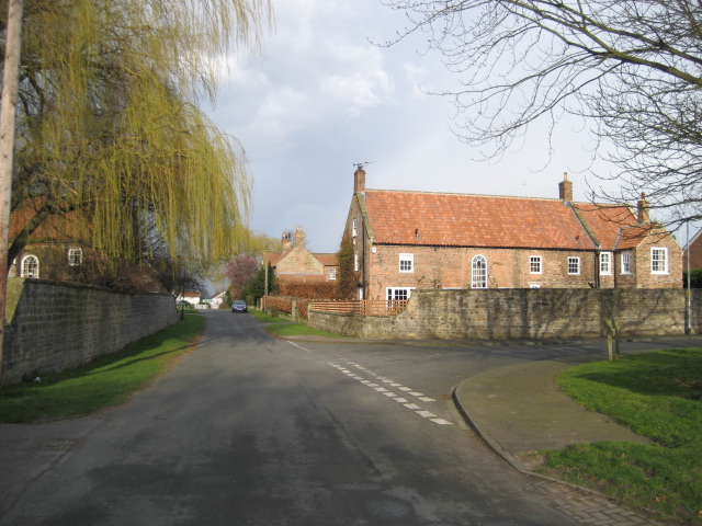
The village of Baldersby is a small, picturesque settlement with a charming rural character. It is known for its peaceful and idyllic atmosphere, making it an ideal place for those seeking a tranquil countryside lifestyle. The village is predominantly made up of traditional stone-built cottages, adding to its charm and character.

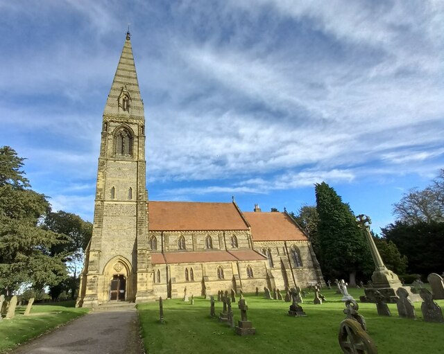
A notable feature of Baldersby is its historic church, St. James' Church. Dating back to the 12th century, this Grade II listed building boasts a stunning Norman architecture with intricate details and stained glass windows. The church serves as a community hub, hosting regular services as well as various events and activities throughout the year.

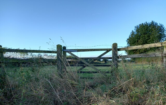
Surrounding the village are vast open fields and farmland, which contribute to the agricultural heritage of the area. The rolling countryside provides ample opportunities for outdoor activities such as walking, cycling, and horse riding. The landscape also offers breathtaking views of the Vale of York and the nearby Hambleton Hills.

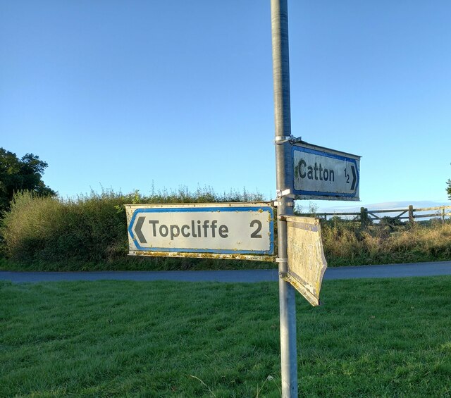
Baldersby is well-connected to neighboring towns and villages via a network of roads, making it easily accessible for both residents and visitors. While it may be a small parish, Baldersby's natural beauty, historic charm, and tight-knit community make it a truly special place to live or visit.

If you have any feedback on the listing, please let us know in the comments section below.

Baldersby Images

Images are sourced within 2km of 54.196225/-1.451156 or Grid Reference SE3577. Thanks to Geograph Open Source API. All images are credited.

Skipton on Swale church This benchmark is cut into the stonework to the left of the main church access door. The wall is south facing and the mark is cut into the 3rd stone course.
Skipton on Swale church
This benchmark is cut into the stonework to the left of the main church access door. The wall is south facing and the mark is cut into the 3rd stone course.
Skipton on Swale church A wider angle taken almost from the church gate looking north. There is a benchmark cut into the stonework to the left of the main church access door. The mark is cut into the 3rd stone course and is south facing.
Skipton on Swale church
A wider angle taken almost from the church gate looking north. There is a benchmark cut into the stonework to the left of the main church access door. The mark is cut into the 3rd stone course and is south facing.
Catton, Catton Lane According to the OS database the gatepost at this field entrance had a benchmark cut into one of the posts. Today wooden gateposts are in place.
Catton, Catton Lane
According to the OS database the gatepost at this field entrance had a benchmark cut into one of the posts. Today wooden gateposts are in place.
Baldersby St James church The benchmark is cut into a south facing wall of the church.
Baldersby St James church
The benchmark is cut into a south facing wall of the church.
Baldersby St James church There is a benchmark cut into the south facing wall of the church. It is located on the first buttress to the right of the church tower, immediately right of the drainpipe.
Baldersby St James church
There is a benchmark cut into the south facing wall of the church. It is located on the first buttress to the right of the church tower, immediately right of the drainpipe.
Traffic lights at Skipton Bridge on the River Swale Controlling traffic across the narrow bridge.
Traffic lights at Skipton Bridge on the River Swale
Controlling traffic across the narrow bridge.
The Swale in flood at Skipton Bridge A view from the south side of the bridge looking across the swollen river and the flooded fields that were either side of the A61. The road wasn't affected, but the next bridge upstream at Myton on Swale [A684] was impassable due to flooding.
The Swale in flood at Skipton Bridge
A view from the south side of the bridge looking across the swollen river and the flooded fields that were either side of the A61. The road wasn't affected, but the next bridge upstream at Myton on Swale [A684] was impassable due to flooding.
Building on the north side of Wide Howe Lane
Wide Howe Lane towards Baldersby St James
The lights on Skipton Bridge Waiting to pass over the River Swale in single file.
The lights on Skipton Bridge
Waiting to pass over the River Swale in single file.
Grazing by the Swale Close to Skipton Bridge.
Grazing by the Swale
Close to Skipton Bridge.
Line of Ragwort The line of trees are on the banks of the River Swale. The poisonous weed is on the far side of the grazing land.
Line of Ragwort
The line of trees are on the banks of the River Swale. The poisonous weed is on the far side of the grazing land.
A61 crosses the new A1(M)
Underlands Lane Country lane running eastwards from Melmerby. A helpful sign at the village end of this road says 'No access to A1', which is still correct as the road now links to the A6055, which runs along the line of the old A1 northbound carriageway.
Underlands Lane
Country lane running eastwards from Melmerby. A helpful sign at the village end of this road says 'No access to A1', which is still correct as the road now links to the A6055, which runs along the line of the old A1 northbound carriageway.
A6055 near Melmerby The newly [2012] designated A6055 runs parallel to the new A1[M] motorway from the A61 to the A684 at Leeming, and uses the line of the old northbound carriageway of A1.
A6055 near Melmerby
The newly [2012] designated A6055 runs parallel to the new A1[M] motorway from the A61 to the A684 at Leeming, and uses the line of the old northbound carriageway of A1.
Farmland by the new A1(M)
A1(M) approaching Underlands Lane Bridge The A1 is the longest numbered road in the UK at 410 miles long. It connects London with Edinburgh, via the east of England. 
For much of its path it follows the Great North Road the old coaching route between London and Edinburgh. Several sections of the route are classified as motorway A1(M). The modern A1 bypasses the towns the Great North Road passed through and is dual carriageway for most of its route through England.
A1(M) approaching Underlands Lane Bridge
The A1 is the longest numbered road in the UK at 410 miles long. It connects London with Edinburgh, via the east of England. For much of its path it follows the Great North Road the old coaching route between London and Edinburgh. Several sections of the route are classified as motorway A1(M). The modern A1 bypasses the towns the Great North Road passed through and is dual carriageway for most of its route through England.
Show me another place!

Baldersby is located at Grid Ref: SE3577 (Lat: 54.196225, Lng: -1.451156)

Division: North Riding

Administrative County: North Yorkshire

District: Harrogate

Police Authority: North Yorkshire

What 3 Words

///formal.wiggling.spreads. Near Thirsk, North Yorkshire

Related Wikis

Baldersby railway station

Baldersby railway station was a railway station serving the village of Baldersby in North Yorkshire, England. It was located on a line from Melmerby, north...

Baldersby

Baldersby is a village and civil parish in North Yorkshire, England, about 6 miles (10 km) west of Thirsk and 5 miles (8 km) north-east of Ripon on the...

Catton, North Yorkshire

Catton is a village and civil parish in the Hambleton District of North Yorkshire, England. It is situated between Thirsk and Ripon, on the River Swale...

Baldersby St James

Baldersby St James is a village in the Harrogate district of North Yorkshire, England. Several notable buildings in the village were commissioned by Viscount...

Nearby Amenities

Located within 500m of 54.196225,-1.451156
Leisure: playground
Lat/Long: 54.1996525/-1.4550464
The data included in this document is from www.openstreetmap.org. The data is made available under ODbL.

Have you been to Baldersby?

Leave your review of Baldersby below (or comments, questions and feedback).