Bainton
Civil Parish in Northamptonshire
England
Bainton

Bainton is a small civil parish located in Northamptonshire, England. Situated in the East Northamptonshire district, it covers an area of approximately 6.3 square kilometers. The village is nestled in the picturesque countryside, surrounded by rolling hills and farmland.
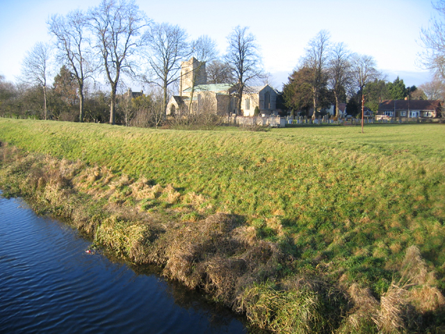
With a population of around 300 residents, Bainton exudes a quintessential English village charm. It is characterized by its traditional stone cottages, well-maintained gardens, and a sense of community spirit. The centerpiece of the village is the beautiful St. Mary's Church, a historic building dating back to the 12th century. The church is known for its stunning stained glass windows and medieval architecture, attracting visitors from near and far.
Despite its small size, Bainton offers a range of amenities for its residents. These include a village hall, a primary school, and a local pub, which serves as a hub for social gatherings and events. The village also benefits from its proximity to nearby towns, with easy access to essential services and amenities.
The surrounding area provides ample opportunities for outdoor activities, such as hiking and cycling, as there are numerous footpaths and bridleways to explore. Bainton is also within reach of several nature reserves and country parks, allowing residents to enjoy the natural beauty of Northamptonshire.
Overall, Bainton offers a serene and idyllic setting for those seeking a peaceful village lifestyle while still being connected to nearby towns and amenities.
If you have any feedback on the listing, please let us know in the comments section below.
Bainton Images
Images are sourced within 2km of 52.645141/-0.376497 or Grid Reference TF0906. Thanks to Geograph Open Source API. All images are credited.


Bainton is located at Grid Ref: TF0906 (Lat: 52.645141, Lng: -0.376497)
Division: Soke of Peterborough
Unitary Authority: Peterborough
Police Authority: Cambridgeshire
What 3 Words
///daffodils.reflected.broads. Near Helpston, Cambridgeshire
Related Wikis

Bainton, Cambridgeshire
Bainton is a village and civil parish in the Peterborough unitary authority area of Cambridgeshire, England. Bainton is on the southern edge of the Welland...

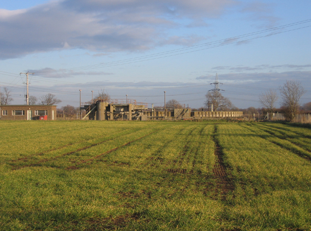
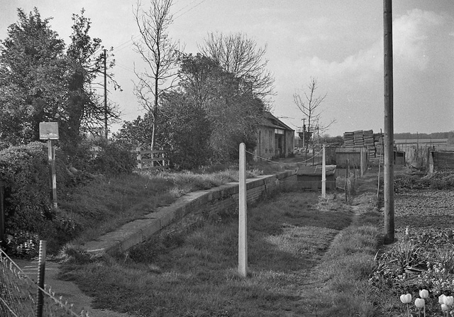
Bainton Gate railway station
Bainton Gate railway station was a short lived railway "station" in the Soke of Peterborough (now in Cambridgeshire) on the Syston and Peterborough Railway...

Ashton, Cambridgeshire
Ashton is a hamlet and former civil parish, now in the parish of Bainton, in the Peterborough district, in the ceremonial county of Cambridgeshire, England...

Tallington
Tallington is a village and civil parish in the South Kesteven district of Lincolnshire, England. The population of the civil parish at the 2011 census...

Lolham
Lolham is a hamlet in the City of Peterborough in England, located between Peterborough and Stamford on the border of Cambridgeshire and Lincolnshire....
Barnack railway station
Barnack railway station was a station in the Soke of Peterborough (now Cambridgeshire) serving the village of Barnack. Despite being located adjacent to...
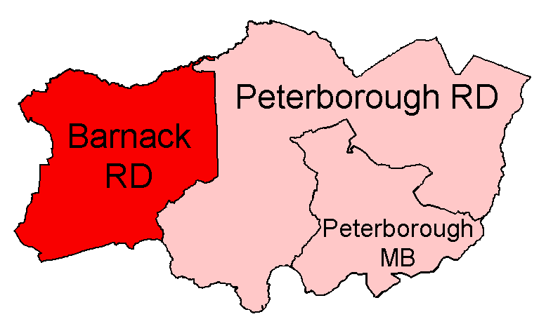
Barnack Rural District
Barnack was a rural district in the Soke of Peterborough and later Huntingdon and Peterborough from 1894 to 1974. It was created in 1894 under the Local...

Tallington railway station
Tallington railway station was a station in Tallington, Lincolnshire on the Great Northern Railway between Grantham and Peterborough. It was closed in...
Nearby Amenities
Located within 500m of 52.645141,-0.376497Have you been to Bainton?
Leave your review of Bainton below (or comments, questions and feedback).