Bakewell

Civil Parish in Derbyshire Derbyshire Dales

England

Bakewell

Rutland Square, Bakewell The war memorial and Rutland Arms Hotel is seen in Rutland Square. A very successful 19th century coaching inn, the hotel building was constructed in 1804. The Grade I listed All Saints’ Church is seen in the background, parts of which date from the 12th century, although most of the structure was completely rebuilt in the mid-19th century.
Rutland Square, Bakewell Credit: Daniel Parks

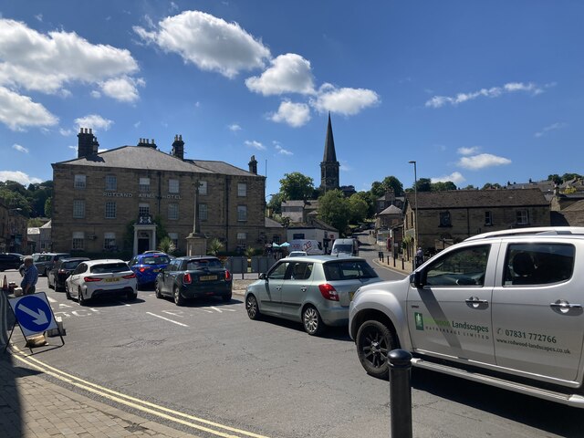
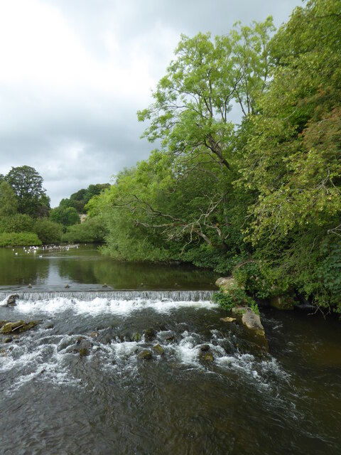
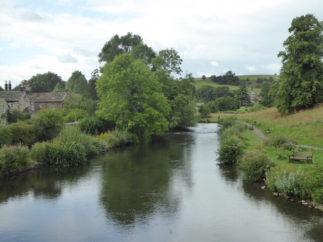
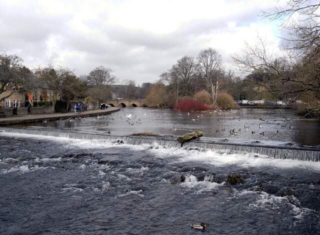
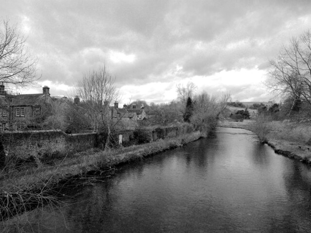
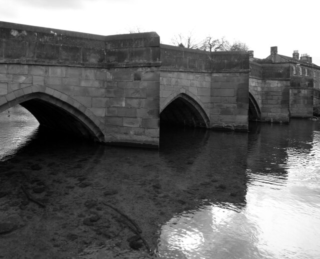
Bakewell is a civil parish located in the Derbyshire Dales district of Derbyshire, England. Situated on the River Wye, it is a picturesque town known for its historic charm and natural beauty. Bakewell is located in the Peak District National Park, making it a popular destination for outdoor enthusiasts and nature lovers.

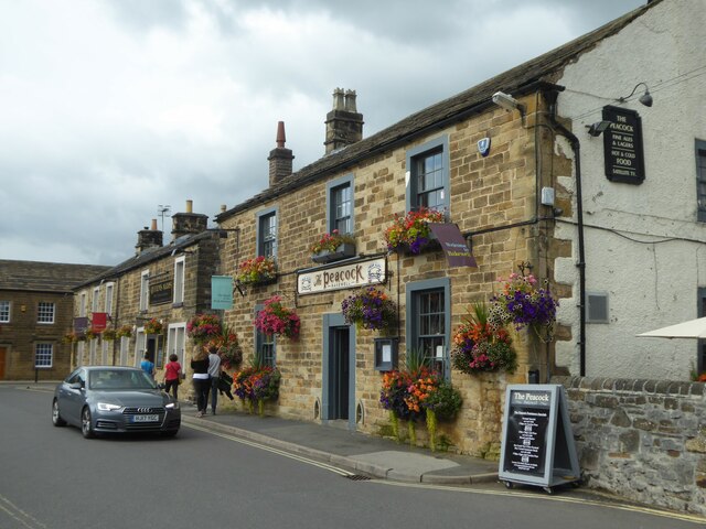
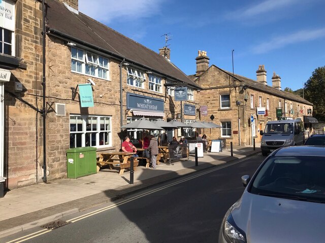
The town is famous for its delicious Bakewell pudding, a local dessert made with a flaky pastry base, layers of jam, and an almond filling. Visitors can indulge in this traditional treat at the numerous bakeries and cafes scattered throughout the town. Bakewell also hosts an annual Bakewell Show, an agricultural event that attracts thousands of visitors each year.

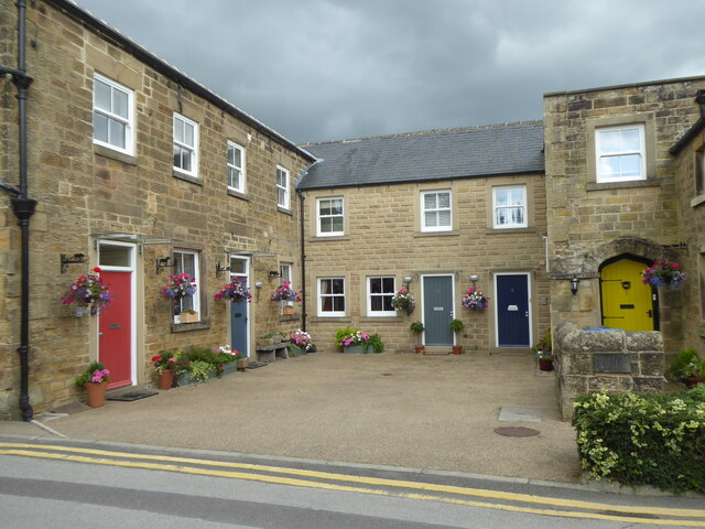
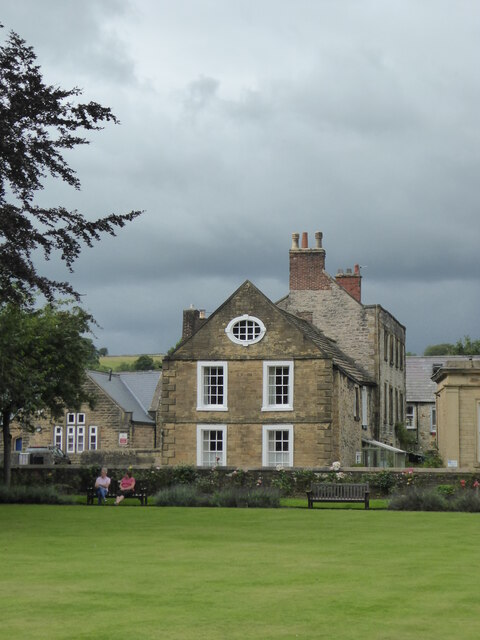
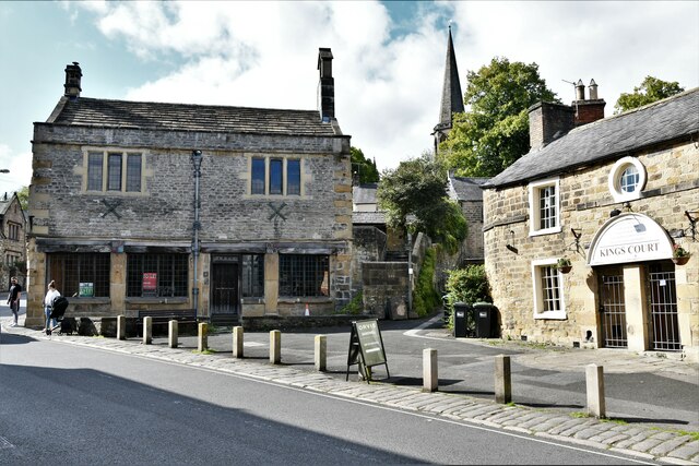
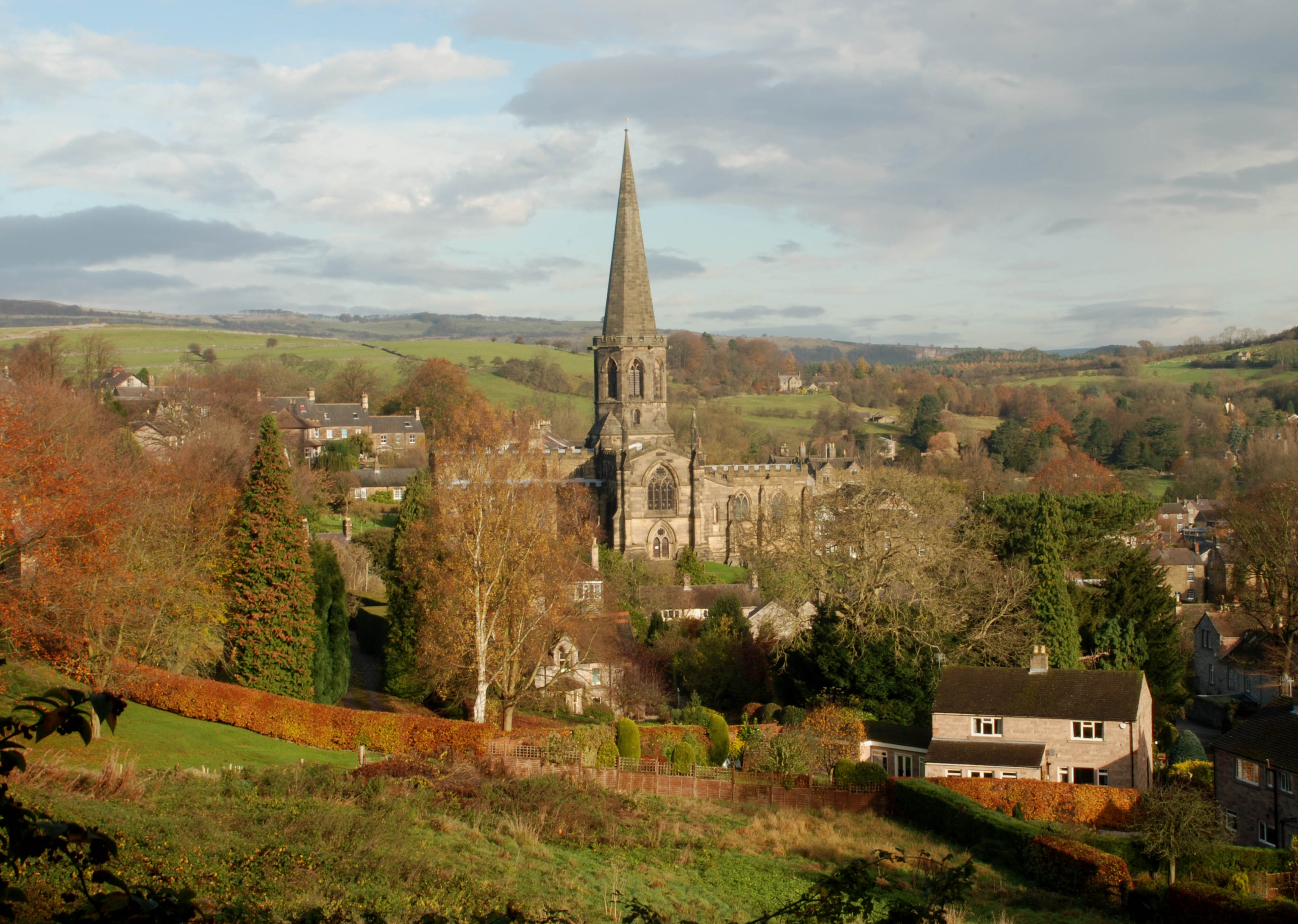
In addition to its culinary delights, Bakewell boasts a number of historic landmarks. The town's most iconic building is the 12th-century All Saints' Church, known for its unique spire and beautiful stained glass windows. The Old House Museum is another popular attraction, offering visitors a glimpse into the town's rich history and heritage.

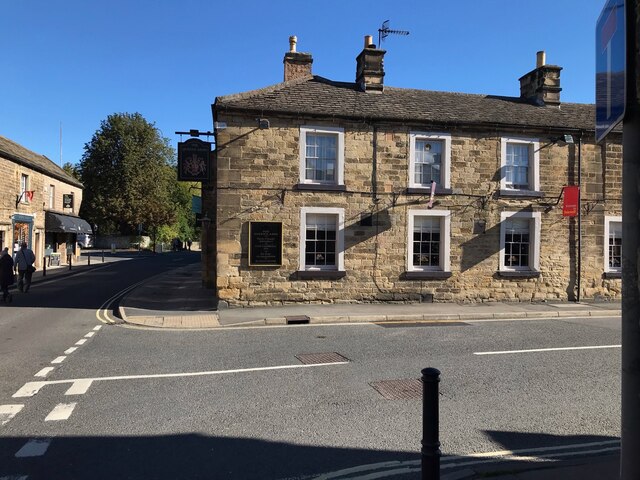
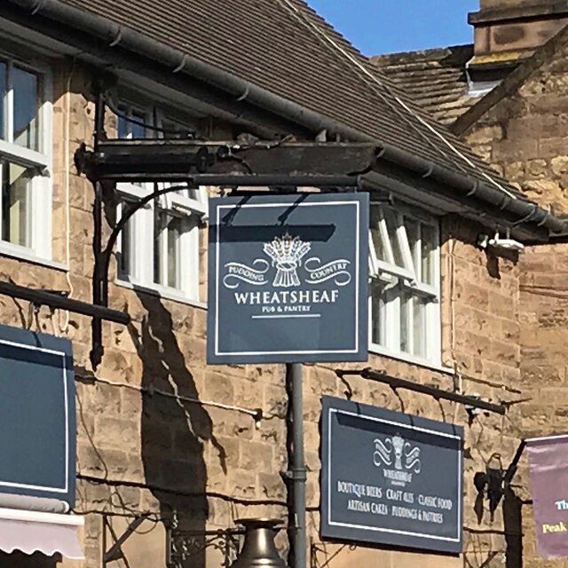
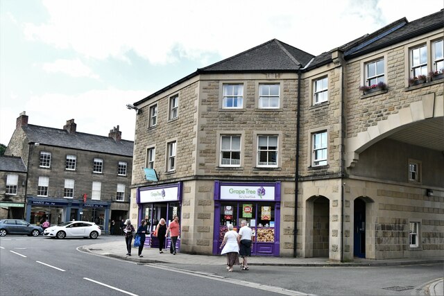
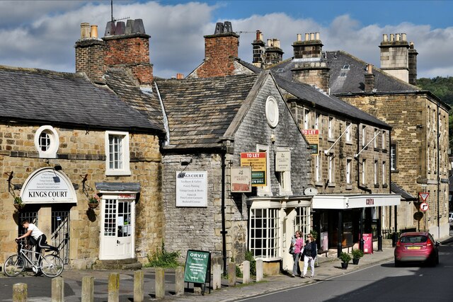
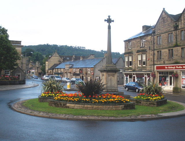
Bakewell is a bustling market town, with a variety of shops, boutiques, and galleries lining its streets. The weekly market, held in the town center, is a great place to find fresh produce, local crafts, and antiques.

Surrounded by rolling hills and stunning countryside, Bakewell is an ideal base for exploring the Peak District. Hiking, cycling, and horseback riding are popular activities in the area, with numerous trails and paths to suit all abilities.

Overall, Bakewell is a charming and vibrant town that offers a perfect blend of history, culture, and natural beauty. Whether you're a food lover, history enthusiast, or outdoor adventurer, there is something for everyone to enjoy in Bakewell.

If you have any feedback on the listing, please let us know in the comments section below.
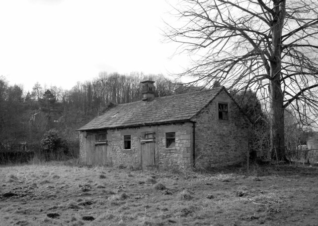
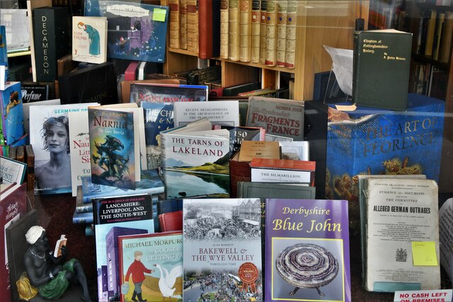
Bakewell Images

Images are sourced within 2km of 53.209593/-1.683536 or Grid Reference SK2168. Thanks to Geograph Open Source API. All images are credited.

Rutland Square, Bakewell The war memorial and Rutland Arms Hotel is seen in Rutland Square. A very successful 19th century coaching inn, the hotel building was constructed in 1804. The Grade I listed All Saints’ Church is seen in the background, parts of which date from the 12th century, although most of the structure was completely rebuilt in the mid-19th century.
Rutland Square, Bakewell
The war memorial and Rutland Arms Hotel is seen in Rutland Square. A very successful 19th century coaching inn, the hotel building was constructed in 1804. The Grade I listed All Saints’ Church is seen in the background, parts of which date from the 12th century, although most of the structure was completely rebuilt in the mid-19th century.
Houses in Rutland Mews Bakewell An attractive blend of old houses and a new building linking them together.
Houses in Rutland Mews Bakewell
An attractive blend of old houses and a new building linking them together.
Weir on the River Wye at Bakewell
The Peacock public house in Bakewell
House overlooking the bowling green in Bakewell
The River Wye upstream from the A619 in Bakewell
The sign of The Queens Arms See <a href="https://www.geograph.org.uk/photo/6984627">SK2168 : The Queens Arms</a>
The sign of The Queens Arms
The Queens Arms
The Queens Arms
The Wheatsheaf On Bridge Street, Bakewell.
The Wheatsheaf
On Bridge Street, Bakewell.
The sign of The Wheatsheaf See: <a href="https://www.geograph.org.uk/photo/6984633">SK2168 : The Wheatsheaf</a>.
The sign of The Wheatsheaf
The River Wye, Bakewell A weir seen from a footbridge with Bakewell Bridge in the background.
The River Wye, Bakewell
A weir seen from a footbridge with Bakewell Bridge in the background.
The River Wye seen from Bakewell Bridge The River Wye is a limestone river in the Peak District of Derbyshire. It is 15 miles in length, and is one of the major tributaries of the River Derwent, which flows into the River Trent.
The river rises on Axe Edge and flows east then south east to meet the Derwent near Rowsley. It has an impressive valley through Chee Dale and Monsal Dale.
The River Wye seen from Bakewell Bridge
The River Wye is a limestone river in the Peak District of Derbyshire. It is 15 miles in length, and is one of the major tributaries of the River Derwent, which flows into the River Trent. The river rises on Axe Edge and flows east then south east to meet the Derwent near Rowsley. It has an impressive valley through Chee Dale and Monsal Dale.
Bakewell Bridge Bakewell Bridge carries the A619 over the River Wye. It was originally constructed in the fourteenth century and was widemed in the nineteenth. It is a grade I listed structure.
Bakewell Bridge
Bakewell Bridge carries the A619 over the River Wye. It was originally constructed in the fourteenth century and was widemed in the nineteenth. It is a grade I listed structure.
Derelict barn, Scot's Garden, Bakewell
Bakewell: Grape Tree
Bakewell: Hawkridge Books window display
Bakewell, King Street
Show me another place!

Bakewell is located at Grid Ref: SK2168 (Lat: 53.209593, Lng: -1.683536)

Administrative County: Derbyshire

District: Derbyshire Dales

Police Authority: Derbyshire

What 3 Words

///iterative.jump.agency. Near Bakewell, Derbyshire

Related Wikis

Lady Manners School

Lady Manners School is an English secondary school located in Bakewell, a market town in the Peak District National Park, Derbyshire. It was founded on...

All Saints' Church, Bakewell

All Saints' Church, Bakewell, is the parish church of Bakewell, Derbyshire, England. It is a Grade I listed building. == The first church == The church...

Old House Museum, Bakewell

The Old House Museum in the town of Bakewell in Derbyshire is a typical 16th century yeoman's house that now houses a small museum with an exhibition of...

Bakewell Urban District

Bakewell was an Urban District in Derbyshire, England from 1894 to 1974. It was created under the Local Government Act 1894. The district was abolished...

Bagshaw Hall

Bagshaw Hall is a 17th-century grade II* listed country hall on Bagshaw Hill in Bakewell, Derbyshire. == History == The hall was constructed by Thomas...

Bakewell War Memorial

Bakewell War Memorial is a 20th-century grade II listed war memorial in Bakewell, Derbyshire. == History == The sandstone memorial is dedicated to the...

St Anselm's School, Bakewell

S. Anselm's Preparatory School is a private school located in Bakewell, Derbyshire, in the heart of the Peak District. Founded in 1888. Winner of the Tatler...

Bakewell

Bakewell is a market town and civil parish in the Derbyshire Dales district of Derbyshire, England, known for Bakewell pudding. It lies on the River Wye...

Nearby Amenities

Located within 500m of 53.209593,-1.683536
Post Box
Operator: Royal Mail
Ref: DE45 1293
Lat/Long: 53.2082009/-1.6796242
Post Box
Operator: Royal Mail
Post Box Type: lamp
Ref: DE45 1285D
Royal Cypher: EIIR
Royal Cypher Wikidata: Q33102113
Lat/Long: 53.2086846/-1.6777786
Post Box
Brand: Royal Mail
Brand Wikidata: Q638098
Mapillary: 912147042758435
Operator: Royal Mail
Operator Wikidata: Q638098
Post Box Mounting: stone_wall
Post Box Type: wall
Ref: DE45 1270
Survey Date: 2021-07-17
Lat/Long: 53.2120069/-1.6804224
Note: National speed limit sign westbound
Traffic Sign Forward: GB:671
Lat/Long: 53.2104016/-1.6846181
Old House Museum
Fee: yes
Source: OS_OpenData_StreetView
Tourism: museum
Website: https://www.oldhousemuseum.org.uk/
Wikidata: Q17545803
Wikipedia: en:Old House Museum, Bakewell
Lat/Long: 53.213487/-1.6798272
Barrier: stile
Material: stone
Source: survey;bing
Stile: squeezer
Lat/Long: 53.212929/-1.6812813
Barrier: stile
Source: survey;bing;gps
Stile: squeezer
Lat/Long: 53.2134759/-1.6827361
Barrier: kissing_gate
Lat/Long: 53.2103861/-1.6778346
Barrier: kissing_gate
Source: survey;gps
Lat/Long: 53.2064084/-1.6875233
Barrier: entrance
Source: survey;gps
Lat/Long: 53.2088782/-1.6830525
Crossing
Crossing: zebra
Lat/Long: 53.2074125/-1.6854809
Crossing
Crossing: zebra
Lat/Long: 53.2070729/-1.6844228
Crossing
Crossing: zebra
Lat/Long: 53.2069729/-1.6844214
Bus Stop
Bakewell (Lady Manners School)
Bus: yes
Naptan AtcoCode: 1000DBSL3882
Naptan NaptanCode: dbsgjmwd
Public Transport: platform
Lat/Long: 53.2073453/-1.684398
Bakewell (Lady Manners School)
Bus: yes
Public Transport: stop_position
Lat/Long: 53.2073922/-1.6843088
Generator Method: photovoltaic
Generator Output Electricity: yes
Generator Source: solar
Generator Type: solar_photovoltaic_panel
Location: roof
Power: generator
Lat/Long: 53.2092394/-1.6763074
Generator Method: photovoltaic
Generator Output Electricity: yes
Generator Source: solar
Generator Type: solar_photovoltaic_panel
Location: roof
Power: generator
Lat/Long: 53.2061008/-1.6793016
Entrance: yes
Lat/Long: 53.2128596/-1.6788639
Bench
Backrest: yes
Lat/Long: 53.2110468/-1.676539
Bench
Backrest: yes
Lat/Long: 53.212661/-1.6786495
Bench
Backrest: no
Lat/Long: 53.2127677/-1.6784708
Bus Stop
Bakewell, Monyash Road / Pickford Villas (Hail & Ride)
Bus: yes
Naptan AtcoCode: 1000DBMR3883
Naptan Bearing: SW
Naptan BusStopType: HAR
Naptan CommonName: Pickford Villas
Naptan Indicator: W-bound
Naptan Landmark: Pickford Villas
Naptan LocalityName: Bakewell
Naptan NaptanCode: dbsgjwpg
Naptan PlusbusZoneRef: BUXTON
Naptan Street: Monyash Road
Public Transport: platform
Source: naptan_import
Lat/Long: 53.2107576/-1.6836711
Bus Stop
Bakewell, Monyash Road / Pickford Villas (Hail & Ride)
Bus: yes
Naptan AtcoCode: 100000011766
Naptan Bearing: NE
Naptan BusStopType: HAR
Naptan CommonName: Pickford Villas
Naptan Indicator: E-bound
Naptan Landmark: Pickford Villas
Naptan LocalityName: Bakewell
Naptan NaptanCode: dbsgdmdg
Naptan PlusbusZoneRef: BUXTON
Naptan Street: Monyash Road
Public Transport: platform
Source: naptan_import
Lat/Long: 53.2107766/-1.6838201
Give Way
Direction: backward
Lat/Long: 53.212357/-1.6797676
Give Way
Direction: forward
Lat/Long: 53.2120015/-1.6806048
The data included in this document is from www.openstreetmap.org. The data is made available under ODbL.

Have you been to Bakewell?

Leave your review of Bakewell below (or comments, questions and feedback).