Baildon

Civil Parish in Yorkshire Bradford

England

Baildon

Potter Brow Road, Baildon Moor
Potter Brow Road, Baildon Moor Credit: habiloid

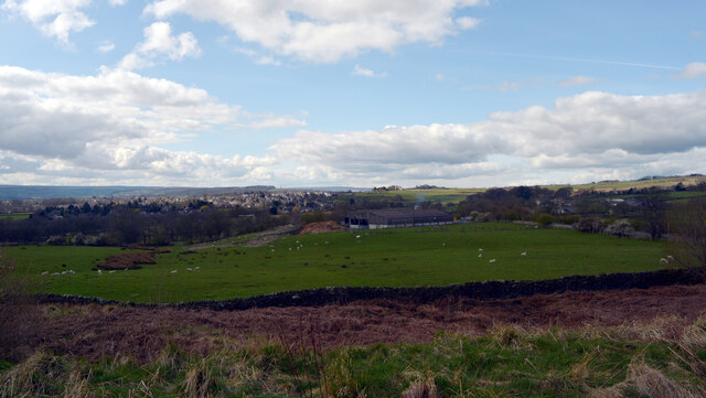
Baildon is a civil parish located in the metropolitan borough of Bradford, West Yorkshire, England. Situated on the southern slopes of the Aire Valley, it lies approximately 8 miles northwest of Bradford city center. The town is bordered by Shipley to the east, Bingley to the north, and the open countryside of Bracken Hall to the west.

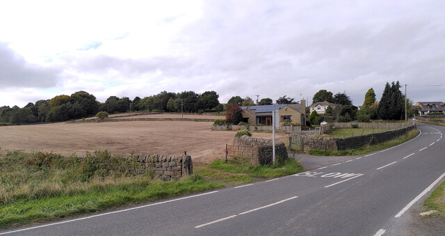
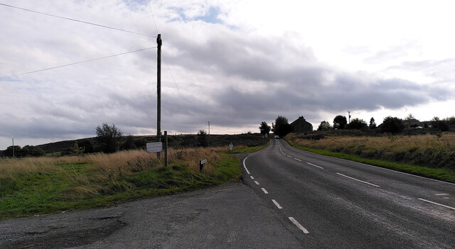
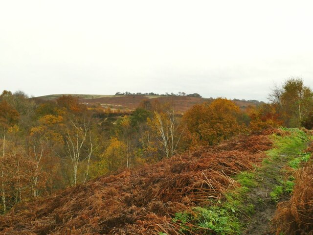
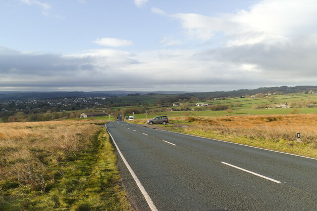
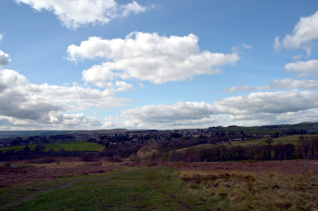
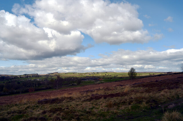
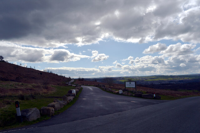
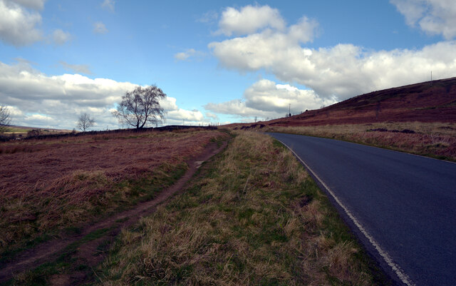
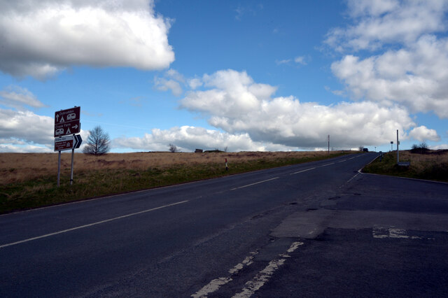
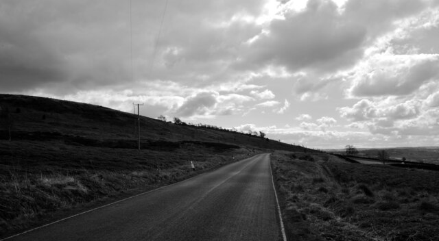
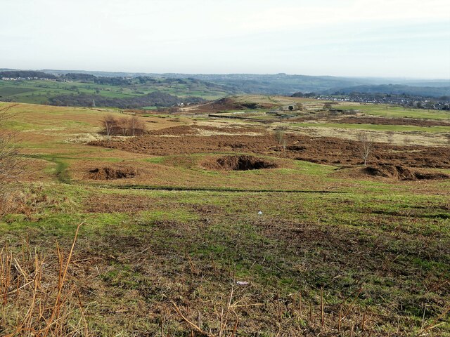
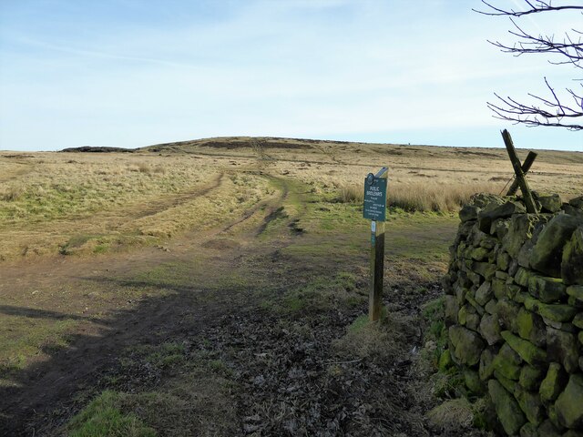
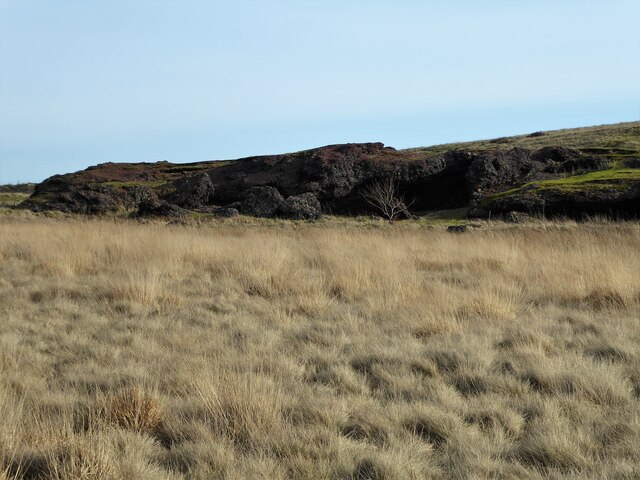
Baildon is known for its picturesque landscapes, with the Baildon Moor and Rombalds Moor providing scenic views and opportunities for outdoor activities such as hiking and bird-watching. The moors are also home to several Bronze Age and Iron Age remains, including cup and ring marked rocks and stone circles, attracting history enthusiasts.

The town center of Baildon offers a range of amenities, including shops, pubs, restaurants, and a library. The Baildon Village Museum provides an insight into the local history and heritage of the area, showcasing artifacts and exhibits related to Baildon's past.

The community in Baildon is active and vibrant, with various local groups and organizations catering to the interests and needs of its residents. The town hosts regular events and festivals, including the Baildon Carnival, which attracts visitors from across the region.

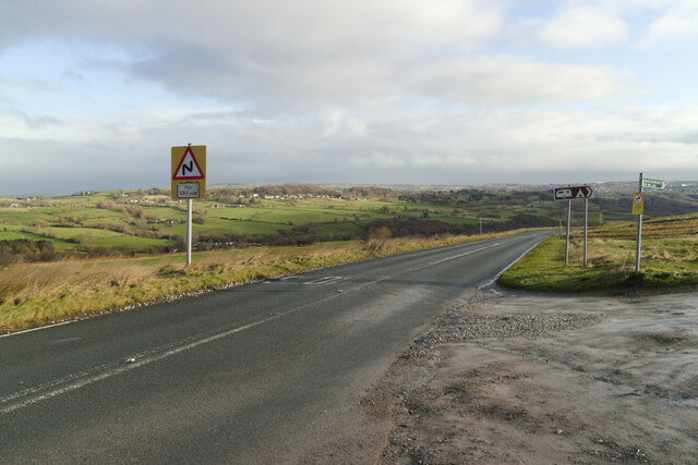
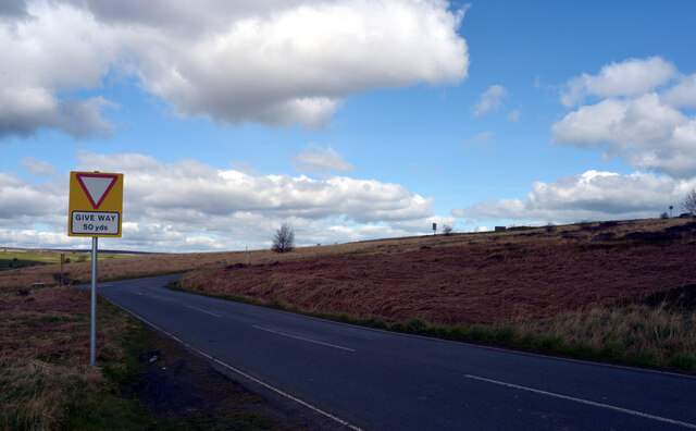
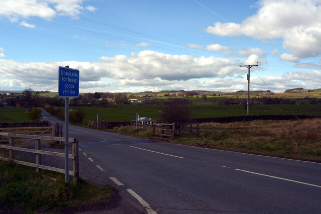
Transport links in Baildon are well-developed, with regular bus services connecting the town to nearby areas. The town is also conveniently located near major road networks, including the A6038 and A657, providing easy access to Bradford and Leeds.

Overall, Baildon offers a combination of natural beauty, historical significance, and a close-knit community, making it an attractive place to live and visit in Yorkshire.

If you have any feedback on the listing, please let us know in the comments section below.

Baildon Images

Images are sourced within 2km of 53.85272/-1.776423 or Grid Reference SE1439. Thanks to Geograph Open Source API. All images are credited.

Potter Brow Road, Baildon Moor
Hawksworth Road, Baildon Moor
The top of Shipley Glen A view from Lode Pit Lane at the point whence a bridleway descends into the glen.
The top of Shipley Glen
A view from Lode Pit Lane at the point whence a bridleway descends into the glen.
Bingley Road, Baildon Moor Approaching the bends near Baildon Golf Club.
Bingley Road, Baildon Moor
Approaching the bends near Baildon Golf Club.
Bingley Road approaching Glovershaw Farm
A view towards Eldwick from Glen Road, Baildon
A view from Glen Road, Baildon
Rood to Crook Farm seen from Glen Road, Baildon
Glen Road, Baildon
Glen Road, Baildon
Looking towards Glovershaw Farm from Glen Road, Baildon
Glen Road, Baildon
Glen Road, Baildon
Glovershaw Lane, Baildon
Junction of Bingley Road and Glen Road, Baildon
Glen Road, Baildon
Glen Road, Baildon
Decorative Bridge on Loadpit Beck The track across the bridge links Glen Road and Saltaire Road (or maybe it is an extension of the latter). Was the bridge ornamental because it was perhaps on a carriage drive of the Salts of Saltaire?
Decorative Bridge on Loadpit Beck
The track across the bridge links Glen Road and Saltaire Road (or maybe it is an extension of the latter). Was the bridge ornamental because it was perhaps on a carriage drive of the Salts of Saltaire?
Old Bell Pit remains View from the bridleway to Dobrudden with the disused Baildon reservoir embankments beyond the pit hollows
Old Bell Pit remains
View from the bridleway to Dobrudden with the disused Baildon reservoir embankments beyond the pit hollows
Bridleway to Baildon Hill At the corner of Dobrudden Caravan Park where bridleways cross one another, with Baildon Hill ahead.
Bridleway to Baildon Hill
At the corner of Dobrudden Caravan Park where bridleways cross one another, with Baildon Hill ahead.
The Cinder Caves An old tip of furnace type waste on Baildon Moor that appears like a lava flow  with hollows and 'caves'.
The Cinder Caves
An old tip of furnace type waste on Baildon Moor that appears like a lava flow with hollows and 'caves'.
Show me another place!

Baildon is located at Grid Ref: SE1439 (Lat: 53.85272, Lng: -1.776423)

Division: West Riding

Administrative County: West Yorkshire

District: Bradford

Police Authority: West Yorkshire

What 3 Words

///curiosity.saves.blur. Near Baildon, West Yorkshire

Related Wikis

Baildon Urban District

Baildon was an urban district in the West Riding of Yorkshire, England between 1894 and 1974. It was enlarged on 1 April 1937 by gaining part of Wharfedale...

Colne Valley Urban District

Colne Valley was an urban district in the West Riding of Yorkshire, England between 1937 and 1974. It takes its name from the River Colne which rises above...

Baildon

Baildon is a town and civil parish in the Bradford Metropolitan Borough in West Yorkshire, England and within the historic boundaries of the West Riding...

Shipley Glen Tramway

The Shipley Glen Tramway is a historic funicular tramway located in the wooded Shipley Glen near the village of Saltaire in the English county of West...

Baildon railway station

Baildon railway station serves the town of Baildon near Shipley in West Yorkshire, England. The station reopened under British Rail on 5 January 1973,...

Shipley (UK Parliament constituency)

Shipley is a constituency represented in the House of Commons of the UK Parliament since 2005 by Philip Davies, a Conservative. == Boundaries == 1885...

Roberts Park, Saltaire

Roberts Park is a 14 acres (5.7 ha) public urban park in Saltaire, West Yorkshire, England. Higher Coach Road, Baildon, is to the north and the park is...

Titus Salt School

Titus Salt School formerly called Salt Grammar School located in Baildon, West Yorkshire, England is a former grammar school, now a mixed comprehensive...

Nearby Amenities

Located within 500m of 53.85272,-1.776423
Source: landsat
Lat/Long: 53.8497593/-1.7812037
Source: landsat
Lat/Long: 53.8501049/-1.7814109
Source: landsat
Lat/Long: 53.8508041/-1.7810138
Source: landsat
Lat/Long: 53.8509276/-1.7805317
Source: landsat
Lat/Long: 53.8520491/-1.7781565
Source: landsat
Lat/Long: 53.8521784/-1.7782194
Source: landsat
Lat/Long: 53.8537237/-1.7787019
Source: landsat
Lat/Long: 53.8537325/-1.7786432
Source: landsat
Lat/Long: 53.8538175/-1.7786622
Source: landsat
Lat/Long: 53.8542474/-1.7790892
Source: landsat
Lat/Long: 53.8565627/-1.7783744
Source: landsat
Lat/Long: 53.8564715/-1.7771722
Source: landsat
Lat/Long: 53.8561904/-1.7746606
Source: landsat
Lat/Long: 53.8507291/-1.769736
Source: landsat
Lat/Long: 53.8502168/-1.7702992
Source: landsat
Lat/Long: 53.8495304/-1.7756493
Source: landsat
Lat/Long: 53.8488742/-1.7770573
Bus Stop
West Lane Greencliffe Avenue
Bus: yes
Naptan AtcoCode: 450015850
Naptan Bearing: SW
Naptan CommonName: West Lane Greencliffe Avenue
Naptan Crossing: Greencliffe Avenue
Naptan Landmark: Unknown
Naptan ShortCommonName: West ln Greencliffe
Naptan Street: West Lane
Naptan Verified: no
Public Transport: platform
Source: naptan_import
Lat/Long: 53.8501503/-1.7741119
Bus Stop
Westgate Newton Way
Bus: yes
Local Ref: 45020511
Naptan AtcoCode: 450020511
Naptan Bearing: W
Naptan CommonName: Westgate Newton Way
Naptan Crossing: Newton Way
Naptan Indicator: Stop 45020511
Naptan PlusbusZoneRef: LEEDS
Naptan ShortCommonName: Newton Way
Naptan Street: Westgate
Naptan Verified: no
Public Transport: platform
Source: naptan_import
Lat/Long: 53.8525402/-1.7688391
Bus Stop
Newton Way Springfield Road
Bus: yes
Local Ref: 45020512
Naptan AtcoCode: 450020512
Naptan Bearing: NE
Naptan CommonName: Newton Way Springfield Road
Naptan Crossing: Springfield Road
Naptan Indicator: Stop 45020512
Naptan Landmark: The Surgery
Naptan PlusbusZoneRef: LEEDS
Naptan ShortCommonName: West Court
Naptan Street: Newton Way
Naptan Verified: no
Public Transport: platform
Source: naptan_import
Lat/Long: 53.8528912/-1.76905
Bus Stop
The Grove Providence Avenue
Bus: yes
Local Ref: 45020513
Naptan AtcoCode: 450020513
Naptan Bearing: SE
Naptan CommonName: The Grove Providence Avenue
Naptan Crossing: Providence Avenue
Naptan Indicator: Stop 45020513
Naptan PlusbusZoneRef: LEEDS
Naptan ShortCommonName: Providence Avenue
Naptan Street: The Grove
Naptan Verified: no
Public Transport: platform
Source: naptan_import
Lat/Long: 53.8540801/-1.7703356
Bus Stop
Acre Rise Brantcliffe Drive
Bus: yes
Local Ref: 45020514
Naptan AtcoCode: 450020514
Naptan Bearing: SE
Naptan CommonName: Acre Rise Brantcliffe Drive
Naptan Crossing: Brantcliffe Drive
Naptan Indicator: Stop 45020514
Naptan Notes: OSR taken place 230805
Naptan PlusbusZoneRef: LEEDS
Naptan ShortCommonName: Brantcliffe Drive
Naptan Street: Acre Rise
Naptan Verified: no
Public Transport: platform
Source: naptan_import
Lat/Long: 53.8549932/-1.7731584
Bus Stop
Collier Lane Bentley Close
Bus: yes
Local Ref: 45020515
Naptan AtcoCode: 450020515
Naptan Bearing: NE
Naptan CommonName: Collier Lane Bentley Close
Naptan Crossing: Bentley Close
Naptan Indicator: Stop 45020515
Naptan PlusbusZoneRef: LEEDS
Naptan ShortCommonName: Bentley Close
Naptan Street: Collier Lane
Naptan Verified: no
Public Transport: platform
Source: naptan_import
Lat/Long: 53.8539628/-1.7748818
Bus Stop
Collier Lane Strathmore Drive
Bus: yes
Local Ref: 45020516
Naptan AtcoCode: 450020516
Naptan Bearing: NW
Naptan CommonName: Collier Lane Strathmore Drive
Naptan Crossing: Strathmore Drive
Naptan Indicator: Stop 45020516
Naptan PlusbusZoneRef: LEEDS
Naptan ShortCommonName: Strathmore Drive
Naptan Street: Collier Lane
Naptan Verified: no
Public Transport: platform
Source: naptan_import
Lat/Long: 53.8529699/-1.7726524
Bus Stop
West Lane Bank Crest
Bus: yes
Local Ref: 45020517
Naptan AtcoCode: 450020517
Naptan Bearing: SW
Naptan CommonName: West Lane Bank Crest
Naptan Crossing: Bank Crest
Naptan Indicator: Stop 45020517
Naptan PlusbusZoneRef: LEEDS
Naptan ShortCommonName: Bank Crest
Naptan Street: West Lane
Naptan Verified: no
Public Transport: platform
Source: naptan_import
Lat/Long: 53.8514674/-1.7718701
Bus Stop
West Lane Belmont Avenue
Bus: yes
Local Ref: 45020518
Naptan AtcoCode: 450020518
Naptan Bearing: NE
Naptan CommonName: West Lane Belmont Avenue
Naptan Crossing: Belmont Avenue
Naptan Indicator: Stop 45020518
Naptan PlusbusZoneRef: LEEDS
Naptan ShortCommonName: Belmont Avenue
Naptan Street: West Lane
Naptan Verified: no
Public Transport: platform
Source: naptan_import
Lat/Long: 53.8501329/-1.7743551
Bus Stop
West Lane Belmont Avenue
Local Ref: 45020519
Naptan AtcoCode: 450020519
Naptan Bearing: NE
Naptan CommonName: West Lane Belmont Avenue
Naptan Crossing: Belmont Avenue
Naptan Indicator: Stop 45020519
Naptan Landmark: Sandal Primary School
Naptan PlusbusZoneRef: LEEDS
Naptan ShortCommonName: Belmont Avenue
Naptan Street: West Lane
Naptan Verified: no
Source: naptan_import
Lat/Long: 53.8486379/-1.7775857
The Grove Providence Avenue
Local Ref: 45050960
Naptan AtcoCode: 450050960
Naptan Bearing: NW
Naptan BusStopType: CUS
Naptan CommonName: The Grove Providence Avenue
Naptan Indicator: Stop 45050960
Naptan PlusbusZoneRef: LEEDS
Naptan ShortCommonName: Providence Avenue
Naptan Street: The Grove
Naptan Verified: no
Source: naptan_import
Lat/Long: 53.8539992/-1.7703513
Acre Rise Brantcliffe Drive
Local Ref: 45050961
Naptan AtcoCode: 450050961
Naptan Bearing: NW
Naptan BusStopType: CUS
Naptan CommonName: Acre Rise Brantcliffe Drive
Naptan Crossing: Brantcliffe Drive
Naptan Indicator: Stop 45050961
Naptan PlusbusZoneRef: LEEDS
Naptan ShortCommonName: Brantcliffe Drive
Naptan Street: Acre Rise
Naptan Verified: no
Source: naptan_import
Lat/Long: 53.8549035/-1.7732349
Collier Lane Bentley Close
Local Ref: 45050962
Naptan AtcoCode: 450050962
Naptan Bearing: SW
Naptan BusStopType: CUS
Naptan CommonName: Collier Lane Bentley Close
Naptan Indicator: Stop 45050962
Naptan PlusbusZoneRef: LEEDS
Naptan ShortCommonName: Bentley Close
Naptan Street: Collier Lane
Naptan Verified: no
Source: naptan_import
Lat/Long: 53.8539176/-1.7747148
Collier Lane Strathmore Drive
Local Ref: 45050963
Naptan AtcoCode: 450050963
Naptan Bearing: SE
Naptan BusStopType: CUS
Naptan CommonName: Collier Lane Strathmore Drive
Naptan Indicator: Stop 45050963
Naptan PlusbusZoneRef: LEEDS
Naptan ShortCommonName: Strathmore Drive
Naptan Street: Collier Lane
Naptan Verified: no
Source: naptan_import
Lat/Long: 53.8530597/-1.7725911
West Lane Belmont Avenue
Local Ref: 45050966
Naptan AtcoCode: 450050966
Naptan Bearing: SW
Naptan BusStopType: CUS
Naptan CommonName: West Lane Belmont Avenue
Naptan Indicator: Stop 45050966
Naptan PlusbusZoneRef: LEEDS
Naptan ShortCommonName: West Lane
Naptan Street: West Lane
Naptan Verified: no
Source: naptan_import
Lat/Long: 53.8485929/-1.7775403
Source: landsat
Lat/Long: 53.8515342/-1.778392
Turning Circle
Lat/Long: 53.851634/-1.7753386
Turning Circle
Lat/Long: 53.8564647/-1.7730804
Historic: mine_shaft
Source: OS 1:25k
Lat/Long: 53.8568504/-1.7761042
Historic: mine_shaft
Source: OS 1:25k
Lat/Long: 53.8568941/-1.7767224
Historic: mine_shaft
Note: tentative
Source: Bing
Lat/Long: 53.8559151/-1.7797533
Historic: mine_shaft
Note: tentative
Source: Bing
Lat/Long: 53.8563012/-1.7793188
Historic: mine_shaft
Note: tentative
Source: Bing
Lat/Long: 53.8554201/-1.78082
Historic: mine_shaft
Note: tentative
Source: Bing
Lat/Long: 53.8547971/-1.7805894
Historic: mine_shaft
Note: tentative
Source: Bing
Lat/Long: 53.8558315/-1.7806645
Historic: mine_shaft
Note: tentative
Source: Bing
Lat/Long: 53.8557715/-1.7811741
Historic: mine_shaft
Note: tentative
Source: Bing
Lat/Long: 53.8558266/-1.7791311
Historic: mine_shaft
Note: tentative
Source: Bing
Lat/Long: 53.8551768/-1.7804821
Turning Circle
Lat/Long: 53.8549788/-1.7721877
Turning Circle
Lat/Long: 53.8534278/-1.7762151
Turning Circle
Lat/Long: 53.8559286/-1.7739464
Turning Circle
Lat/Long: 53.8559216/-1.7750465
Post Box
Operator: Royal Mail
Operator Wikidata: Q638098
Post Box Type: lamp
Royal Cypher: EIIR
Royal Cypher Wikidata: Q33102113
Lat/Long: 53.8531369/-1.773258
Post Box
Operator: Royal Mail
Operator Wikidata: Q638098
Post Box Type: wall
Royal Cypher: GR
Royal Cypher Wikidata: Q33102273
Lat/Long: 53.8503321/-1.7739935
Turning Circle
Lat/Long: 53.8541236/-1.7715018
Barrier: cattle_grid
Lat/Long: 53.8518414/-1.7822347
Barrier: yes
Lat/Long: 53.8483231/-1.7778879
Crossing
Crossing: marked
Tactile Paving: yes
Lat/Long: 53.849667/-1.7752832
Traffic Calming: hump
Lat/Long: 53.8498747/-1.7748462
Traffic Calming: hump
Lat/Long: 53.8490988/-1.7764876
Generator Method: photovoltaic
Generator Output Electricity: yes
Generator Source: solar
Generator Type: solar_photovoltaic_panel
Power: generator
Lat/Long: 53.8544041/-1.7784863
Source: landsat
Lat/Long: 53.8515366/-1.7783334
The data included in this document is from www.openstreetmap.org. The data is made available under ODbL.

Have you been to Baildon?

Leave your review of Baildon below (or comments, questions and feedback).