Brandcliff Hill

Hill, Mountain in Yorkshire

England

Brandcliff Hill

Potter Brow Road, Baildon Moor
Potter Brow Road, Baildon Moor Credit: habiloid

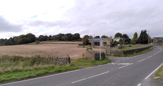
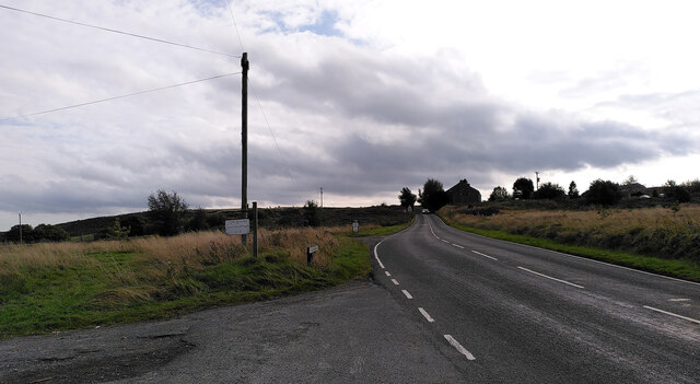
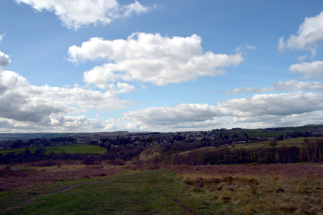
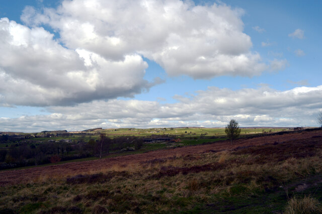
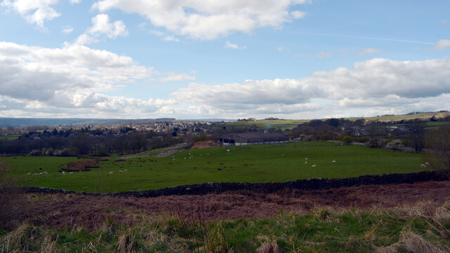
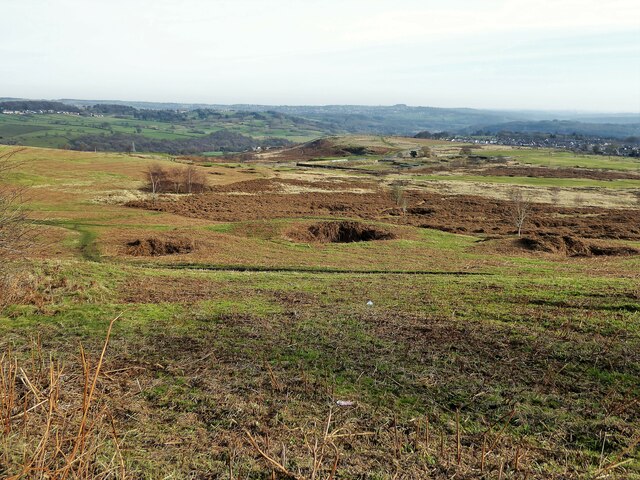
Brandcliff Hill is a prominent hill located in the county of Yorkshire, England. Standing at an elevation of approximately 400 meters (1,312 feet), it is considered to be one of the highest points in the region. The hill is situated in the northern part of Yorkshire, offering breathtaking panoramic views of the surrounding countryside.

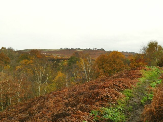
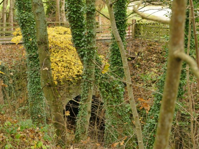
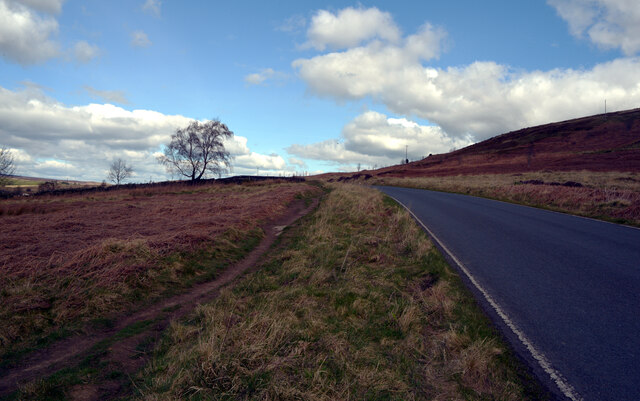
Covered in lush green vegetation, Brandcliff Hill is known for its picturesque beauty and tranquil atmosphere. It is a popular destination for outdoor enthusiasts, hikers, and nature lovers who are drawn to its stunning landscapes and diverse wildlife. The hill is home to a variety of plant species, including heather, grasses, and wildflowers, creating a vibrant and colorful environment.

The hill's unique geographical features make it an ideal location for a range of recreational activities. Visitors can enjoy hiking along the numerous trails that crisscross the hill, immersing themselves in the natural beauty of the area. Additionally, Brandcliff Hill offers excellent opportunities for birdwatching, as it is a habitat for various bird species, such as kestrels, buzzards, and peregrine falcons.

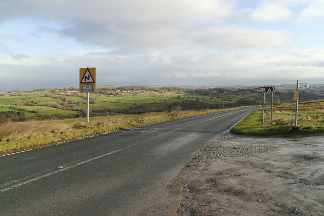
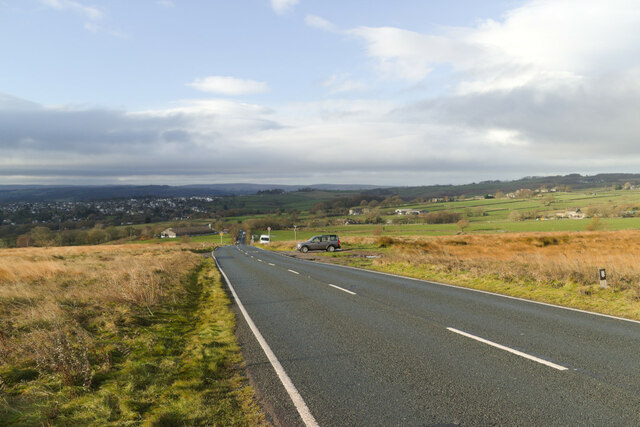
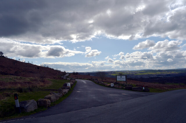
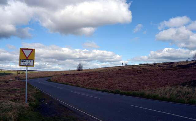
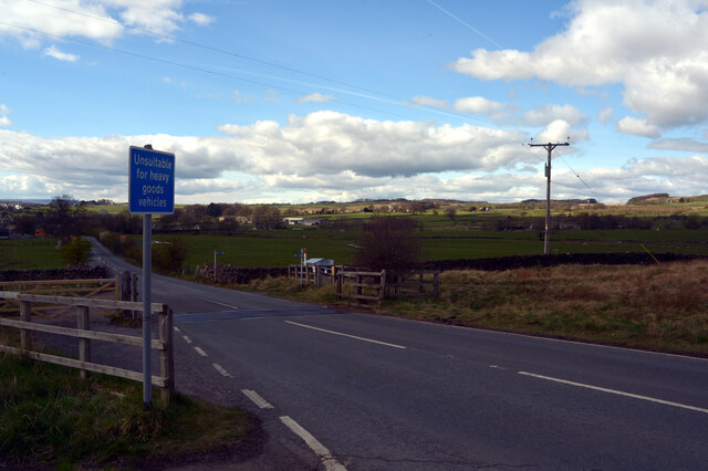
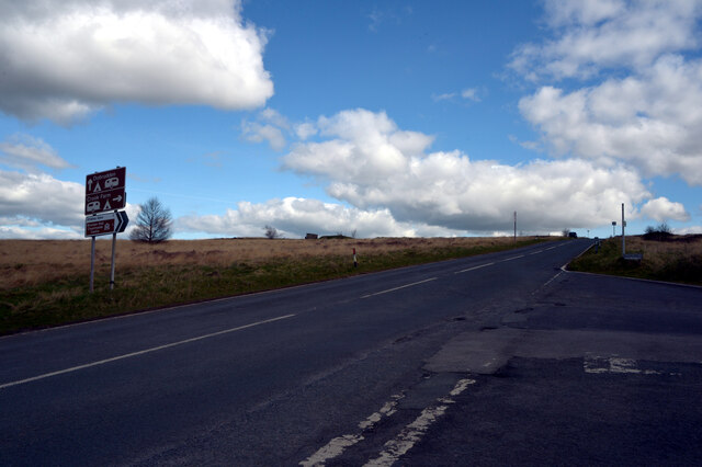
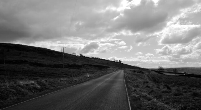
Brandcliff Hill is easily accessible, with a well-maintained road leading to the summit. At the top, there is a viewpoint that provides an expansive vista of the surrounding Yorkshire Dales National Park. The hill attracts visitors throughout the year, with each season offering its own unique charm, from vibrant spring blooms to the golden hues of autumn.

Overall, Brandcliff Hill is a captivating destination for those seeking a peaceful retreat in the heart of Yorkshire, offering stunning views, diverse flora and fauna, and a chance to reconnect with nature.

If you have any feedback on the listing, please let us know in the comments section below.

Brandcliff Hill Images

Images are sourced within 2km of 53.852748/-1.781486 or Grid Reference SE1439. Thanks to Geograph Open Source API. All images are credited.

Potter Brow Road, Baildon Moor
Hawksworth Road, Baildon Moor
The top of Shipley Glen A view from Lode Pit Lane at the point whence a bridleway descends into the glen.
The top of Shipley Glen
A view from Lode Pit Lane at the point whence a bridleway descends into the glen.
Willow Cottage, Saltaire Road, Eldwick Actually a large detached house rather than a cottage.  It appeared on a property website with an estimated value of £369,000. The name of the road is also misleading, because although you can get to Saltaire this way, it's only on foot. It is part of the Welcome Way.
Willow Cottage, Saltaire Road, Eldwick
Actually a large detached house rather than a cottage. It appeared on a property website with an estimated value of £369,000. The name of the road is also misleading, because although you can get to Saltaire this way, it's only on foot. It is part of the Welcome Way.
Culvert on the Loadpit Beck The culvert carries an access road leading to a former quarry that now contains a modern industrial building.
Culvert on the Loadpit Beck
The culvert carries an access road leading to a former quarry that now contains a modern industrial building.
Bingley Road, Baildon Moor Approaching the bends near Baildon Golf Club.
Bingley Road, Baildon Moor
Approaching the bends near Baildon Golf Club.
Bingley Road approaching Glovershaw Farm
A view towards Eldwick from Glen Road, Baildon
A view from Glen Road, Baildon
Rood to Crook Farm seen from Glen Road, Baildon
Glen Road, Baildon
Glen Road, Baildon
Looking towards Glovershaw Farm from Glen Road, Baildon
Glen Road, Baildon
Glen Road, Baildon
Glovershaw Lane, Baildon
Junction of Bingley Road and Glen Road, Baildon
Glen Road, Baildon
Glen Road, Baildon
Decorative Bridge on Loadpit Beck The track across the bridge links Glen Road and Saltaire Road (or maybe it is an extension of the latter). Was the bridge ornamental because it was perhaps on a carriage drive of the Salts of Saltaire?
Decorative Bridge on Loadpit Beck
The track across the bridge links Glen Road and Saltaire Road (or maybe it is an extension of the latter). Was the bridge ornamental because it was perhaps on a carriage drive of the Salts of Saltaire?
Old Bell Pit remains View from the bridleway to Dobrudden with the disused Baildon reservoir embankments beyond the pit hollows
Old Bell Pit remains
View from the bridleway to Dobrudden with the disused Baildon reservoir embankments beyond the pit hollows
Show me another place!

Brandcliff Hill is located at Grid Ref: SE1439 (Lat: 53.852748, Lng: -1.781486)

Division: West Riding

Unitary Authority: Bradford

Police Authority: West Yorkshire

What 3 Words

///hobby.frozen.pumps. Near Baildon, West Yorkshire

Related Wikis

Baildon Urban District

Baildon was an urban district in the West Riding of Yorkshire, England between 1894 and 1974. It was enlarged on 1 April 1937 by gaining part of Wharfedale...

Colne Valley Urban District

Colne Valley was an urban district in the West Riding of Yorkshire, England between 1937 and 1974. It takes its name from the River Colne which rises above...

Baildon

Baildon is a town and civil parish in the Bradford Metropolitan Borough in West Yorkshire, England and within the historic boundaries of the West Riding...

Shipley (UK Parliament constituency)

Shipley is a constituency represented in the House of Commons of the UK Parliament since 2005 by Philip Davies, a Conservative. == Boundaries == 1885...

Shipley Glen Tramway

The Shipley Glen Tramway is a historic funicular tramway located in the wooded Shipley Glen near the village of Saltaire in the English county of West...

Bracken Hall Countryside Centre and Museum

Bracken Hall Countryside Centre and Museum is a children's museum, natural history education centre and nature centre established in 1989 at Bracken Hall...

Titus Salt School

Titus Salt School formerly called Salt Grammar School located in Baildon, West Yorkshire, England is a former grammar school, now a mixed comprehensive...

Roberts Park, Saltaire

Roberts Park is a 14 acres (5.7 ha) public urban park in Saltaire, West Yorkshire, England. Higher Coach Road, Baildon, is to the north and the park is...

Nearby Amenities

Located within 500m of 53.852748,-1.781486
Source: landsat
Lat/Long: 53.8488795/-1.7834865
Source: landsat
Lat/Long: 53.8497593/-1.7812037
Source: landsat
Lat/Long: 53.8501049/-1.7814109
Source: landsat
Lat/Long: 53.8508041/-1.7810138
Source: landsat
Lat/Long: 53.8509276/-1.7805317
Source: landsat
Lat/Long: 53.8520491/-1.7781565
Source: landsat
Lat/Long: 53.8521784/-1.7782194
Source: landsat
Lat/Long: 53.8537237/-1.7787019
Source: landsat
Lat/Long: 53.8537325/-1.7786432
Source: landsat
Lat/Long: 53.8538175/-1.7786622
Source: landsat
Lat/Long: 53.8542474/-1.7790892
Source: landsat
Lat/Long: 53.8565627/-1.7783744
Bus Stop
Collier Lane Bentley Close
Bus: yes
Local Ref: 45020515
Naptan AtcoCode: 450020515
Naptan Bearing: NE
Naptan CommonName: Collier Lane Bentley Close
Naptan Crossing: Bentley Close
Naptan Indicator: Stop 45020515
Naptan PlusbusZoneRef: LEEDS
Naptan ShortCommonName: Bentley Close
Naptan Street: Collier Lane
Naptan Verified: no
Public Transport: platform
Source: naptan_import
Lat/Long: 53.8539628/-1.7748818
Collier Lane Bentley Close
Local Ref: 45050962
Naptan AtcoCode: 450050962
Naptan Bearing: SW
Naptan BusStopType: CUS
Naptan CommonName: Collier Lane Bentley Close
Naptan Indicator: Stop 45050962
Naptan PlusbusZoneRef: LEEDS
Naptan ShortCommonName: Bentley Close
Naptan Street: Collier Lane
Naptan Verified: no
Source: naptan_import
Lat/Long: 53.8539176/-1.7747148
Source: landsat
Lat/Long: 53.8515342/-1.778392
Turning Circle
Lat/Long: 53.851634/-1.7753386
Pottery Kiln
Historic: archaeological_site
Source: OS 1:25k
Lat/Long: 53.8530332/-1.7876401
Hope Hill Farm
Place: farm
Source: OS 1:25k
Lat/Long: 53.8519068/-1.7862453
Hope Hill
Natural: peak
Source: OS 1:25k
Lat/Long: 53.8542116/-1.7866552
Historic: mine_shaft
Note: tentative
Source: Bing
Lat/Long: 53.8558947/-1.7824669
Historic: mine_shaft
Note: tentative
Source: Bing
Lat/Long: 53.8559151/-1.7797533
Historic: mine_shaft
Note: tentative
Source: Bing
Lat/Long: 53.8563012/-1.7793188
Historic: mine_shaft
Note: tentative
Source: Bing
Lat/Long: 53.8554201/-1.78082
Historic: mine_shaft
Note: tentative
Source: Bing
Lat/Long: 53.8547971/-1.7805894
Historic: mine_shaft
Note: tentative
Source: Bing
Lat/Long: 53.8558315/-1.7806645
Historic: mine_shaft
Note: tentative
Source: Bing
Lat/Long: 53.8570717/-1.781453
Historic: mine_shaft
Note: tentative
Source: Bing
Lat/Long: 53.8568946/-1.7813887
Historic: mine_shaft
Note: tentative
Source: Bing
Lat/Long: 53.8557715/-1.7811741
Historic: mine_shaft
Note: tentative
Source: Bing
Lat/Long: 53.8558266/-1.7791311
Historic: mine_shaft
Note: tentative
Source: Bing
Lat/Long: 53.8551768/-1.7804821
Historic: mine_shaft
Note: tentative
Source: Bing
Lat/Long: 53.8571224/-1.7812492
Turning Circle
Lat/Long: 53.8534278/-1.7762151
Barrier: cattle_grid
Lat/Long: 53.8520121/-1.7846093
Barrier: cattle_grid
Lat/Long: 53.8518414/-1.7822347
Generator Method: photovoltaic
Generator Output Electricity: yes
Generator Source: solar
Generator Type: solar_photovoltaic_panel
Power: generator
Lat/Long: 53.8544041/-1.7784863
Source: landsat
Lat/Long: 53.8515366/-1.7783334
The data included in this document is from www.openstreetmap.org. The data is made available under ODbL.

Have you been to Brandcliff Hill?

Leave your review of Brandcliff Hill below (or comments, questions and feedback).