Badingham

Civil Parish in Suffolk East Suffolk

England

Badingham

Church of St. John the Baptist, Badingham <span class="nowrap"><a title="https://historicengland.org.uk/listing/the-list/list-entry/1030808?section=official-list-entry" rel="nofollow ugc noopener" href="https://historicengland.org.uk/listing/the-list/list-entry/1030808?section=official-list-entry">Link</a><img style="margin-left:2px;" alt="External link" title="External link - shift click to open in new window" src="https://s1.geograph.org.uk/img/external.png" width="10" height="10"/></span>
Church of St. John the Baptist, Badingham Credit: Sandy Gerrard

Badingham is a civil parish located in the county of Suffolk, England. Situated in the East Suffolk district, the village is nestled in the picturesque countryside, about 17 miles northeast of Ipswich and 8 miles south of Framlingham. Badingham has a small population, estimated to be around 400 people.

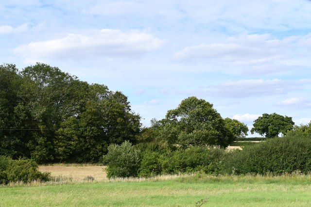
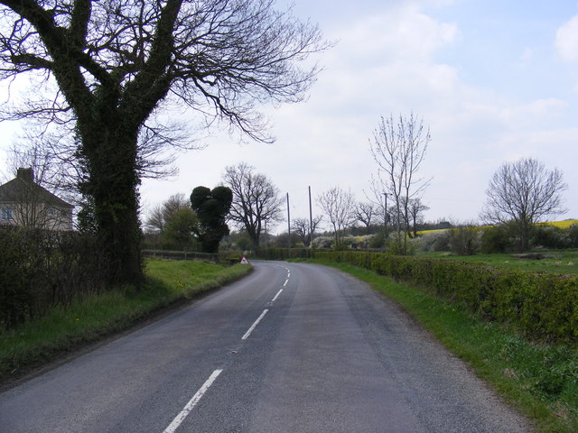
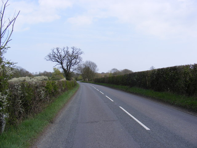
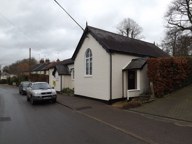
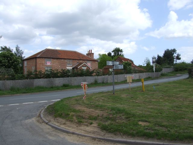
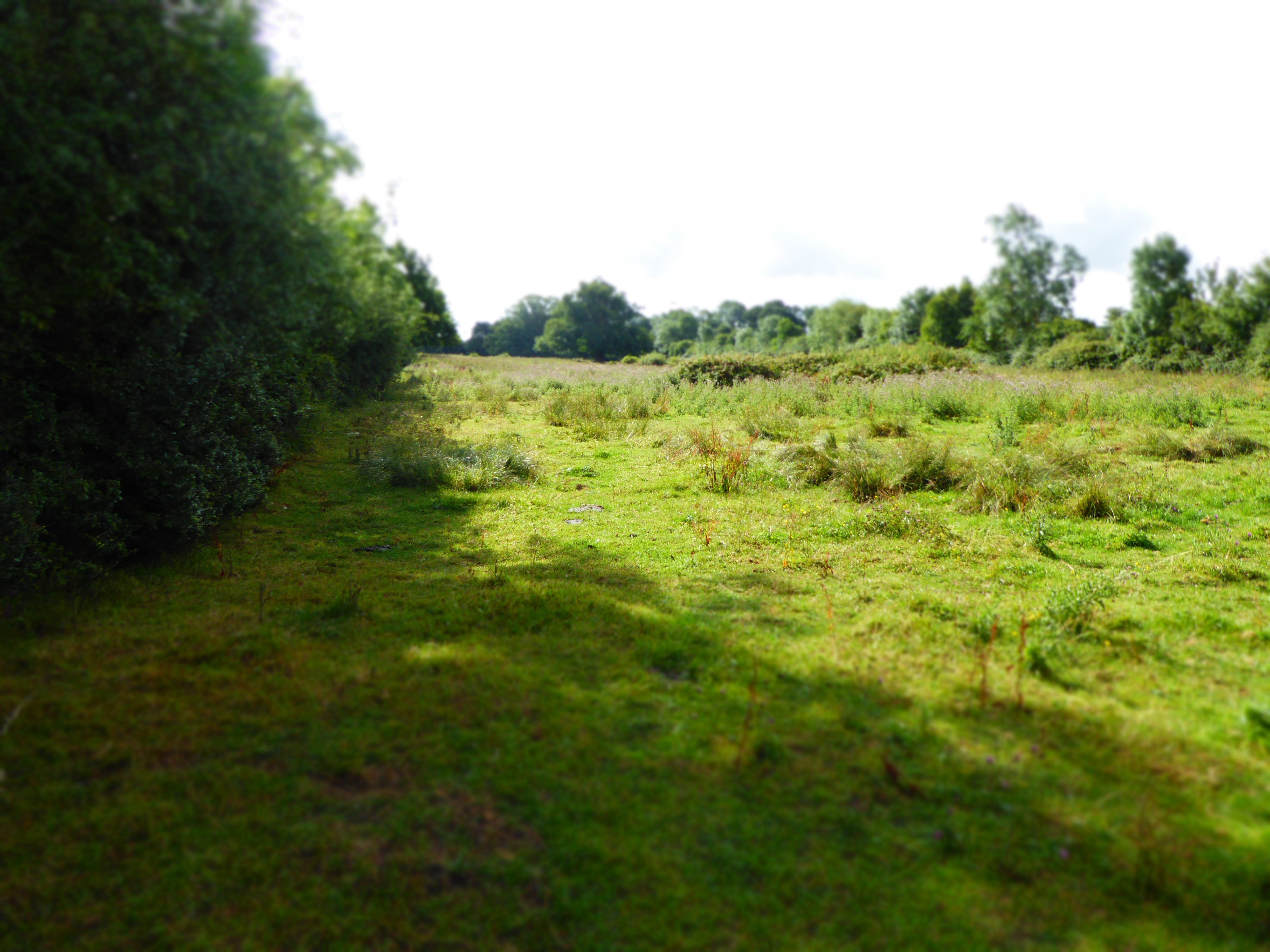
The village is characterized by its charming rural setting, with rolling hills, farmlands, and meandering country lanes. Badingham is known for its traditional flint and thatched cottages, which add to its quintessential English village ambiance.

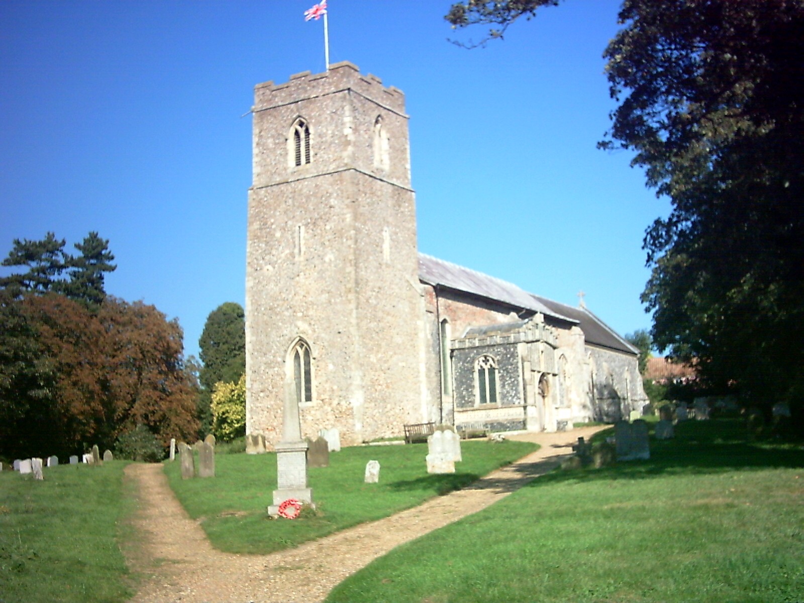
The heart of Badingham is centered around the village green, where the Grade II listed church of St. John the Baptist stands. This medieval church is a prominent feature of the parish, with its striking tower and historic architecture. The village also boasts a local pub, The White Horse, which is a popular gathering place for residents and visitors.

Badingham is surrounded by beautiful countryside, making it an ideal location for outdoor activities such as walking, cycling, and wildlife observation. The village is close to several nature reserves and the Suffolk Coast and Heaths Area of Outstanding Natural Beauty, providing ample opportunities for nature enthusiasts.

While Badingham is a small village, its proximity to larger towns and cities ensures that residents have access to essential amenities. The nearby towns of Framlingham and Saxmundham offer a wider range of services, including schools, shops, and healthcare facilities.

Overall, Badingham, Suffolk, presents a peaceful and idyllic rural retreat, offering a close-knit community and a tranquil lifestyle amidst the stunning Suffolk landscape.

If you have any feedback on the listing, please let us know in the comments section below.

Badingham Images

Images are sourced within 2km of 52.26076/1.389359 or Grid Reference TM3167. Thanks to Geograph Open Source API. All images are credited.

Church of St. John the Baptist, Badingham <span class="nowrap"><a title="https://historicengland.org.uk/listing/the-list/list-entry/1030808?section=official-list-entry" rel="nofollow ugc noopener" href="https://historicengland.org.uk/listing/the-list/list-entry/1030808?section=official-list-entry">Link</a><img style="margin-left:2px;" alt="External link" title="External link - shift click to open in new window" src="https://s1.geograph.org.uk/img/external.png" width="10" height="10"/></span>
Church of St. John the Baptist, Badingham
Church of St. Peter, Bruisyard <span class="nowrap"><a title="https://historicengland.org.uk/listing/the-list/list-entry/1377166?section=official-list-entry" rel="nofollow ugc noopener" href="https://historicengland.org.uk/listing/the-list/list-entry/1377166?section=official-list-entry">Link</a><img style="margin-left:2px;" alt="External link" title="External link - shift click to open in new window" src="https://s1.geograph.org.uk/img/external.png" width="10" height="10"/></span>
Church of St. Peter, Bruisyard
Badingham: Dennington Wood
Houses Houses at the side of the busy A1120 east of Dennington, Suffolk.
Houses
Houses at the side of the busy A1120 east of Dennington, Suffolk.
Cowslips north of Dennington Wood I was wondering yesterday - where are all the cowslips this year? Here are some of them, just opening up to a cold April day in East Suffolk.
Cowslips north of Dennington Wood
I was wondering yesterday - where are all the cowslips this year? Here are some of them, just opening up to a cold April day in East Suffolk.
Cold wet field and hedge This is spring 2008 and to the untrained eye the image is winter. But at the base of the hedge is a patch of opening cowslips - Primula veris - and the eye and heart is gladdened. See <a href="https://www.geograph.org.uk/photo/766079">TM2968 : Cowslips north of Dennington Wood</a> for detail.
Cold wet field and hedge
This is spring 2008 and to the untrained eye the image is winter. But at the base of the hedge is a patch of opening cowslips - Primula veris - and the eye and heart is gladdened. See TM2968 : Cowslips north of Dennington Wood for detail.
Small pond and Dennington Wood The public footpath proceeds across the scene and around the ivy-clad tree to the right.
Small pond and Dennington Wood
The public footpath proceeds across the scene and around the ivy-clad tree to the right.
Dennington Wood Taken from the A1120 Dennington Road
Dennington Wood
Taken from the A1120 Dennington Road
A1120 Badingham Road, Capon's Green Looking towards Wood Farm Cottages and Dennington
A1120 Badingham Road, Capon's Green
Looking towards Wood Farm Cottages and Dennington
A1120 Badingham Road, Capon's Green Looking towards Rook's Bridge and Badingham near Wash Farm
A1120 Badingham Road, Capon's Green
Looking towards Rook's Bridge and Badingham near Wash Farm
Roadsign on the A1120 Dennington Road
A1120 Dennington Road, Badingham Approaching the junction with the B1120 Framlingham Road
A1120 Dennington Road, Badingham
Approaching the junction with the B1120 Framlingham Road
Roadsigns on the B1120 At the junction with the A1120 Dennington Road
Roadsigns on the B1120
At the junction with the A1120 Dennington Road
Entering Badingham on the A1120 Dennington Road <span class="nowrap"><a title="https://en.wikipedia.org/wiki/Badingham" rel="nofollow ugc noopener" href="https://en.wikipedia.org/wiki/Badingham">Link</a><img style="margin-left:2px;" alt="External link" title="External link - shift click to open in new window" src="https://s1.geograph.org.uk/img/external.png" width="10" height="10"/></span>
Entering Badingham on the A1120 Dennington Road
Badingham Village Name sign on the A1120 <span class="nowrap"><a title="https://en.wikipedia.org/wiki/Badingham" rel="nofollow ugc noopener" href="https://en.wikipedia.org/wiki/Badingham">Link</a><img style="margin-left:2px;" alt="External link" title="External link - shift click to open in new window" src="https://s1.geograph.org.uk/img/external.png" width="10" height="10"/></span>
Badingham Village Name sign on the A1120
Badingham Village Hall Off Low Street
Badingham Village Hall
Off Low Street
Defibrillator & Badingham Village Hall sign Off Low Street
Defibrillator & Badingham Village Hall sign
Off Low Street
Low Street, Badingham Near Badingham Village Hall
Road No.C215
Low Street, Badingham
Near Badingham Village Hall Road No.C215
Show me another place!

Badingham is located at Grid Ref: TM3167 (Lat: 52.26076, Lng: 1.389359)

Administrative County: Suffolk

District: East Suffolk

Police Authority: Suffolk

What 3 Words

///ruby.protester.decorator. Near Framlingham, Suffolk

Related Wikis

Badingham

Badingham is a civil parish in the East Suffolk district of eastern England, in the county of Suffolk. It is situated 21.8 miles (35.1 kilometres) north...

Hulver Street

Hulver Street, also known simply as Hulver, is a hamlet near the market town of Beccles, in the civil parish of Henstead with Hulver Street, in the East...

Bruisyard

Bruisyard is a village in the valley of the River Alde in the county of Suffolk, England. The village had a population of around 175 at the 2011 census...

Bruisyard Abbey

The Abbey of Bruisyard was a house of Minoresses (Poor Clares) at Bruisyard in Suffolk. It was founded from Campsey Priory in Suffolk on the initiative...

Dennington

Dennington is a village and civil parish in the English county of Suffolk. It is 2 miles (3.2 km) north of Framlingham and 15 miles (24 km) north-east...

Cransford

Cransford is a village and a civil parish in the East Suffolk district, in the English county of Suffolk. The civil parish had a population at the 2011...

Cransford Meadow

Cransford Meadow is a 4.6-hectare (11-acre) biological Site of Special Scientific Interest south of Cransford in Suffolk.This unimproved grassland site...

Peasenhall

Peasenhall is a village and civil parish in the East Suffolk district, in the English county of Suffolk. The population of the civil parish at the 2021...

Nearby Amenities

Located within 500m of 52.26076,1.389359
Power: pole
Lat/Long: 52.2576244/1.3888588
Power: pole
Lat/Long: 52.2581142/1.3897973
Power: pole
Lat/Long: 52.2566643/1.3870188
Power: pole
Lat/Long: 52.2585561/1.3906899
Power: pole
Lat/Long: 52.2592761/1.3931303
Power: pole
Lat/Long: 52.2589252/1.3918787
Power: pole
Lat/Long: 52.2599657/1.3955901
Power: pole
Lat/Long: 52.2596307/1.3943953
Power: pole
Lat/Long: 52.2571343/1.3879194
Fixme: incomplete
Lat/Long: 52.2603008/1.383368
The data included in this document is from www.openstreetmap.org. The data is made available under ODbL.

Have you been to Badingham?

Leave your review of Badingham below (or comments, questions and feedback).