Aston upon Trent

Civil Parish in Derbyshire South Derbyshire

England

Aston upon Trent

Bridge 7B, Trent & Mersey canal A railway bridge, east of Weston-on-Trent.
Bridge 7B, Trent & Mersey canal Credit: Christine Johnstone

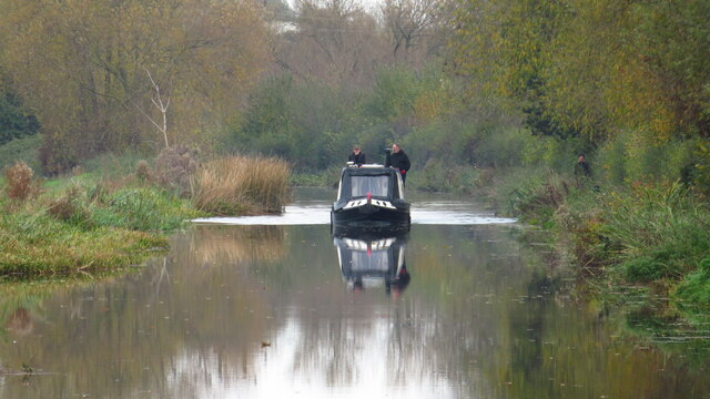
Aston upon Trent is a civil parish located in the South Derbyshire district of Derbyshire, England. It is situated approximately 8 miles south of Derby, the county town. The village is nestled along the banks of the River Trent, which forms the western boundary of the parish.

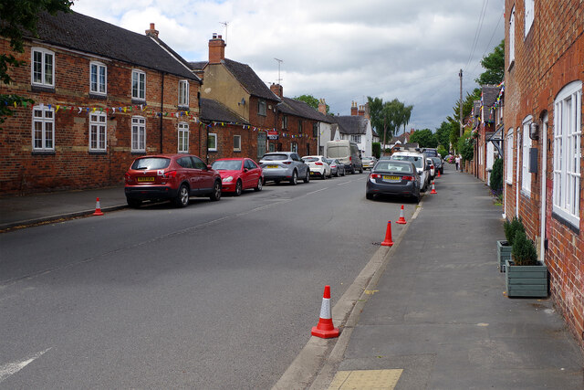
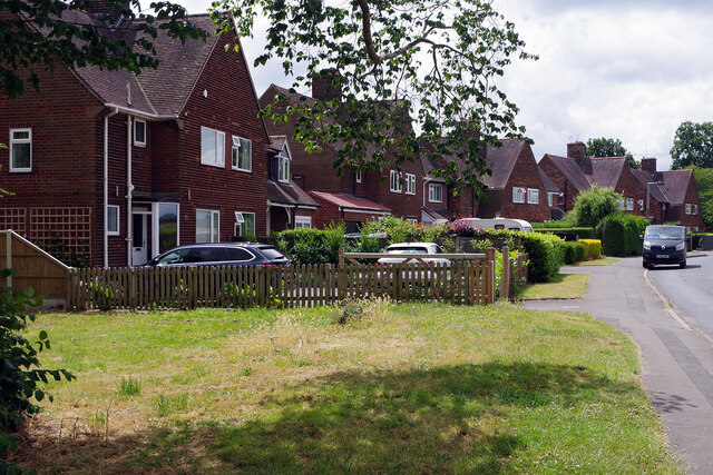
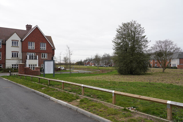
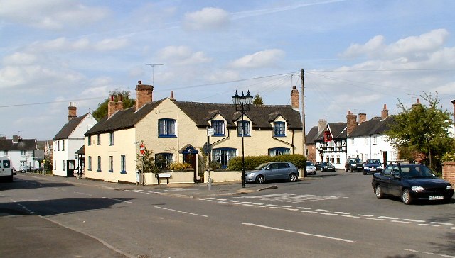
Aston upon Trent is known for its picturesque countryside and tranquil atmosphere. The village is characterized by its charming traditional cottages, many of which date back to the 18th and 19th centuries. The parish also includes the hamlets of Shardlow and Weston-on-Trent.

The village has a close-knit community, with several local amenities to cater to its residents. These include a primary school, a village hall, a parish church, and a pub. The primary school, Aston-on-Trent CofE Primary School, provides education for children aged 4-11.

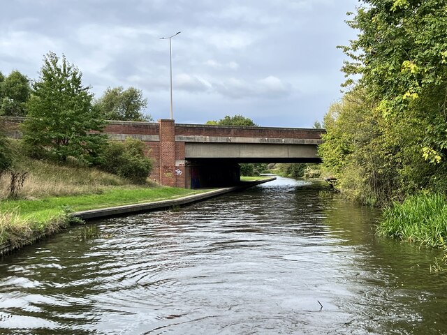
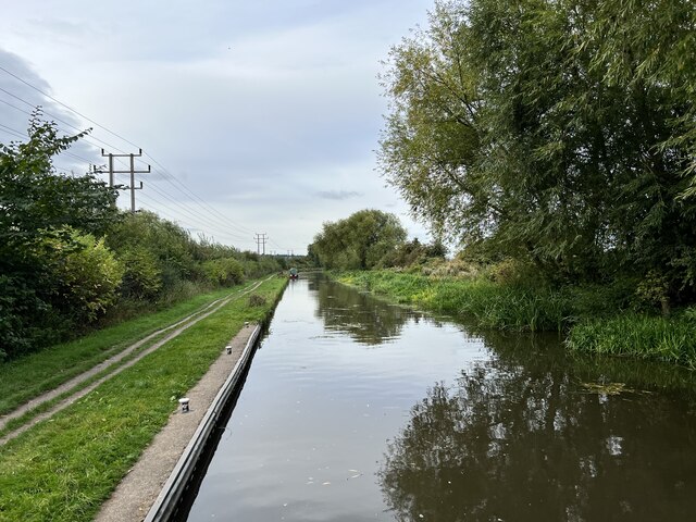
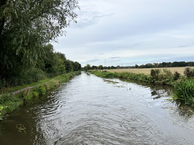
The surrounding countryside offers plenty of opportunities for outdoor activities, such as walking, cycling, and fishing. The River Trent is particularly popular for fishing enthusiasts, with its diverse range of fish species.

Aston upon Trent is well-connected to nearby towns and cities. The A50 road runs through the parish, providing convenient access to Derby, Stoke-on-Trent, and the wider Midlands area. The village also benefits from good public transport links, with regular bus services connecting it to nearby towns.

Overall, Aston upon Trent is a peaceful and picturesque village, offering a high quality of life for its residents and attracting visitors with its idyllic countryside setting.

If you have any feedback on the listing, please let us know in the comments section below.

Aston upon Trent Images

Images are sourced within 2km of 52.866159/-1.387857 or Grid Reference SK4130. Thanks to Geograph Open Source API. All images are credited.
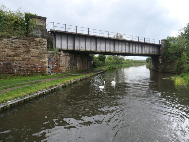
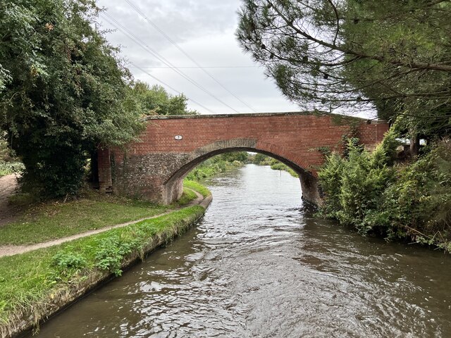
Bridge 7B, Trent & Mersey canal A railway bridge, east of Weston-on-Trent.
Bridge 7B, Trent & Mersey canal
A railway bridge, east of Weston-on-Trent.
Cow Pasture Bridge [no 7], from the east Carrying a bridleway over the Trent & Mersey canal.
Cow Pasture Bridge [no 7], from the east
Carrying a bridleway over the Trent & Mersey canal.
Weston Grange On the canal bank, east of Weston-on-Trent.  This may be the site of a medieval grange of Chester Abbey. The house is at the south corner of a farmyard, which it was separated from in 1980.
Weston Grange
On the canal bank, east of Weston-on-Trent. This may be the site of a medieval grange of Chester Abbey. The house is at the south corner of a farmyard, which it was separated from in 1980.
Birdcage Wood, from the south A small triangular wood on the boundary between Weston-on-Trent and Aston-on-Trent civil parishes.
Birdcage Wood, from the south
A small triangular wood on the boundary between Weston-on-Trent and Aston-on-Trent civil parishes.
Dark clouds over Moorland House Not generating much energy on the panels at the moment.
Dark clouds over Moorland House
Not generating much energy on the panels at the moment.
Hicken's Bridge The A50 bridge over the Trent and Mersey Canal.
Hicken's Bridge
The A50 bridge over the Trent and Mersey Canal.
The Trent and Mersey Canal Near Shardlow
The Trent and Mersey Canal
Near Shardlow
The Trent and Mersey Canal Looking towards Aston-on-Trent.
The Trent and Mersey Canal
Looking towards Aston-on-Trent.
The Trent and Mersey Canal Looking towards Aston-on-Trent.
The Trent and Mersey Canal
Looking towards Aston-on-Trent.
Bridge 7 on the Trent and Mersey Canal Near Weston Grange.
Bridge 7 on the Trent and Mersey Canal
Near Weston Grange.
Weston Grange From the Trent and Mersey Canal.
Weston Grange
From the Trent and Mersey Canal.
Weston Road, Aston-on-Trent Aston-on-Trent has a population of about 1,700 (2011 census) making it slightly larger than its neighbour Weston-on-Trent. It is not particularly close to the River Trent, having been established away from the flood plain. In this Sunday lunchtime view traffic cones were in place in connection with the village well-dressing festival which was taking place over the weekend. Wandering around, several of the locals could be heard complaining of a sore head, so it sounds as though a good time was had by all the previous evening.
Weston Road, Aston-on-Trent
Aston-on-Trent has a population of about 1,700 (2011 census) making it slightly larger than its neighbour Weston-on-Trent. It is not particularly close to the River Trent, having been established away from the flood plain. In this Sunday lunchtime view traffic cones were in place in connection with the village well-dressing festival which was taking place over the weekend. Wandering around, several of the locals could be heard complaining of a sore head, so it sounds as though a good time was had by all the previous evening.
Weston Road, Aston-on-Trent These are recognisably local authority built houses but they look substantial and have a pleasant location on the edge of the village.
Weston Road, Aston-on-Trent
These are recognisably local authority built houses but they look substantial and have a pleasant location on the edge of the village.
On the Trent & Mersey Canal by Aston upon Trent
The end of Richmond Drive This is the very edge of Aston on Trent with the view being a little west of south.
The end of Richmond Drive
This is the very edge of Aston on Trent with the view being a little west of south.
Daffodils beside Weston Road On the outskirts of Aston-upon-Trent.
Daffodils beside Weston Road
On the outskirts of Aston-upon-Trent.
Weston Hall The entrance ground floor gable on the left is the entrance to The Coopers Arms.

The hall was built in the early 17th century for the Roper family.

It has a Grade II* listing List Entry Number:1088352 <span class="nowrap"><a title="https://historicengland.org.uk/listing/the-list/list-entry/1088352?section=official-list-entry" rel="nofollow ugc noopener" href="https://historicengland.org.uk/listing/the-list/list-entry/1088352?section=official-list-entry">Link</a><img style="margin-left:2px;" alt="External link" title="External link - shift click to open in new window" src="https://s1.geograph.org.uk/img/external.png" width="10" height="10"/></span>
Weston Hall
The entrance ground floor gable on the left is the entrance to The Coopers Arms. The hall was built in the early 17th century for the Roper family. It has a Grade II* listing List Entry Number:1088352 LinkExternal link
The sign of the Coopers Arms The pub is housed in a 17th century grade II* listed hall : <a href="https://www.geograph.org.uk/photo/7434655">SK4028 : Weston Hall</a>
The sign of the Coopers Arms
The pub is housed in a 17th century grade II* listed hall : SK4028 : Weston Hall
Show me another place!

Aston upon Trent is located at Grid Ref: SK4130 (Lat: 52.866159, Lng: -1.387857)

Administrative County: Derbyshire

District: South Derbyshire

Police Authority: Derbyshire

What 3 Words

///rejoiced.eager.harshest. Near Aston-on-Trent, Derbyshire

Related Wikis

All Saints' Church, Aston-upon-Trent

All Saints’ Church, Aston upon Trent is a Grade I listed parish church in the Church of England in Aston-on-Trent, Derbyshire. == History == The church...

Aston-on-Trent

Aston-on-Trent is a village and civil parish in the South Derbyshire district, in the county of Derbyshire, England. The parish had a population of 1,682...

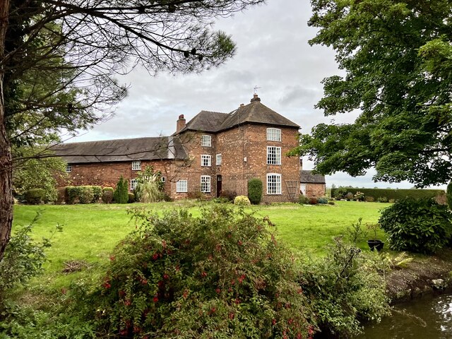
Aston Hall, Aston-on-Trent

Aston Hall is an 18th-century country house, now converted to residential apartments, at Aston-on-Trent, Derbyshire. It is a Grade II* listed building...

Derby South services

The Derby South services are two service stations run by Welcome Break on either side of the A50 road. The services are located in South Derbyshire, near...

Hanson Log Boat

The Hanson Log Boat was a Bronze Age dugout boat found in a gravel pit in Shardlow in Derbyshire. The log boat is now in Derby Museum and Art Gallery....

Shardlow

Shardlow is a village in Derbyshire, England about 6 miles (9.7 km) southeast of Derby and 11 miles (18 km) southwest of Nottingham. Part of the civil...

Weston-on-Trent

Weston-on-Trent is a village and civil parish in the South Derbyshire district of Derbyshire. The population of the civil parish at the 2011 census was...

Weston-on-Trent railway station

Weston on Trent railway station served the village of Weston-on-Trent, Derbyshire from 1869 to 1930. == History == The station was opened on 6 December...

Nearby Amenities

Located within 500m of 52.866159,-1.387857
Barrier: stile
Step Count: 1
Stile: stepover
Lat/Long: 52.8702847/-1.3857247
Addr City: Derby
Addr Housenumber: 92
Addr Postcode: DE72 2AF
Addr Street: Derby Road
Source Addr: survey
Source Addr Postcode: OS Opendata Codepoint
Lat/Long: 52.8658898/-1.384853
Addr City: Derby
Addr Housenumber: 90
Addr Postcode: DE72 2AF
Addr Street: Derby Road
Source Addr: interpolation
Source Addr Postcode: OS Opendata Codepoint
Lat/Long: 52.8658979/-1.3848986
Addr City: Derby
Addr Housenumber: 88
Addr Postcode: DE72 2AF
Addr Street: Derby Road
Source Addr: survey
Source Addr Postcode: OS Opendata Codepoint
Lat/Long: 52.8659044/-1.3849482
Addr City: Derby
Addr Housenumber: 86
Addr Postcode: DE72 2AF
Addr Street: Derby Road
Source Addr: survey
Source Addr Postcode: OS Opendata Codepoint
Lat/Long: 52.8659133/-1.3850072
Addr City: Derby
Addr Housenumber: 84
Addr Postcode: DE72 2AF
Addr Street: Derby Road
Source Addr: survey
Source Addr Postcode: OS Opendata Codepoint
Lat/Long: 52.865919/-1.3850649
Addr City: Derby
Addr Housenumber: 82
Addr Postcode: DE72 2AF
Addr Street: Derby Road
Source Addr: survey
Source Addr Postcode: OS Opendata Codepoint
Lat/Long: 52.865923/-1.3851199
Bus Stop
Alderslade Close
Bus: yes
Naptan AtcoCode: 1000DATD5082
Naptan NaptanCode: dbsagdpm
Public Transport: platform
Route Ref: 73
Shelter: no
Lat/Long: 52.8663047/-1.3851876
Addr City: Derby
Addr Housename: The Manor
Addr Postcode: DE72 2DB
Addr Street: Manor Farm Mews
Source Addr: survey
Source Addr Postcode: OS Opendata Codepoint
Lat/Long: 52.8623212/-1.3839813
Addr City: Derby
Addr Housenumber: 5
Addr Postcode: DE72 2DB
Addr Street: Manor Farm Mews
Fixme: Confirm location
Source Addr: survey
Source Addr Postcode: OS Opendata Codepoint
Lat/Long: 52.8624305/-1.3837654
Addr City: Derby
Addr Housenumber: 26
Addr Postcode: DE72 2AF
Addr Street: Derby Road
Source Addr: survey
Source Addr Postcode: OS Opendata Codepoint
Lat/Long: 52.8621658/-1.3850274
Addr City: Derby
Addr Housenumber: 24
Addr Postcode: DE72 2AF
Addr Street: Derby Road
Source Addr: survey
Source Addr Postcode: OS Opendata Codepoint
Lat/Long: 52.8621002/-1.385018
Addr City: Derby
Addr Housenumber: 22
Addr Postcode: DE72 2AF
Addr Street: Derby Road
Source Addr: survey
Source Addr Postcode: OS Opendata Codepoint
Lat/Long: 52.8620198/-1.3850076
Bus Stop
Moor Lane
Bench: no
Bus: yes
Public Transport: platform
Route Ref: 73
Shelter: no
Source: survey
Lat/Long: 52.8629457/-1.3849139
Bus Stop
Moor Lane
Bus: yes
Naptan AtcoCode: 1000DATD5086
Naptan NaptanCode: dbsagdta
Public Transport: platform
Route Ref: 73
Shelter: yes
Source: survey
Lat/Long: 52.8636662/-1.385088
Bench
Lat/Long: 52.8706251/-1.3870914
Notice Board
Lat/Long: 52.8705106/-1.3864637
Fixme: continues
Lat/Long: 52.8688134/-1.3874796
Power: pole
Lat/Long: 52.8639289/-1.3831985
Power: pole
Lat/Long: 52.8657506/-1.3835987
Power: pole
Lat/Long: 52.8647503/-1.3826502
Power: pole
Lat/Long: 52.8655593/-1.3820944
Bench
Lat/Long: 52.8666784/-1.3815703
Power: pole
Lat/Long: 52.8676822/-1.381276
Power: pole
Lat/Long: 52.8665869/-1.3816085
Power: pole
Lat/Long: 52.8699032/-1.3837744
Power: pole
Lat/Long: 52.8702481/-1.3857123
Generator Method: photovoltaic
Generator Output Electricity: yes
Generator Source: solar
Generator Type: solar_photovoltaic_panel
Location: roof
Power: generator
Lat/Long: 52.8673869/-1.3840708
Generator Method: photovoltaic
Generator Output Electricity: yes
Generator Source: solar
Generator Type: solar_photovoltaic_panel
Location: roof
Power: generator
Lat/Long: 52.8672703/-1.3841432
Generator Method: photovoltaic
Generator Output Electricity: yes
Generator Source: solar
Generator Type: solar_photovoltaic_panel
Location: roof
Power: generator
Lat/Long: 52.8645496/-1.383989
Generator Method: photovoltaic
Generator Output Electricity: yes
Generator Source: solar
Generator Type: solar_photovoltaic_panel
Location: roof
Power: generator
Lat/Long: 52.8645334/-1.383883
Generator Method: photovoltaic
Generator Output Electricity: yes
Generator Source: solar
Generator Type: solar_photovoltaic_panel
Location: roof
Power: generator
Lat/Long: 52.8645148/-1.3838307
Generator Method: photovoltaic
Generator Output Electricity: yes
Generator Source: solar
Generator Type: solar_photovoltaic_panel
Location: roof
Power: generator
Lat/Long: 52.8633929/-1.3838005
Generator Method: solar_thermal
Generator Output Hot Water: yes
Generator Source: solar
Generator Type: solar_thermal_collector
Location: roof
Power: generator
Lat/Long: 52.8633096/-1.3843748
Generator Method: solar_thermal
Generator Output Hot Water: yes
Generator Source: solar
Generator Type: solar_thermal_collector
Location: roof
Power: generator
Lat/Long: 52.8633011/-1.3845562
Generator Method: photovoltaic
Generator Output Electricity: yes
Generator Source: solar
Generator Type: solar_photovoltaic_panel
Location: roof
Power: generator
Lat/Long: 52.8617868/-1.3872174
Generator Method: photovoltaic
Generator Output Electricity: yes
Generator Source: solar
Generator Type: solar_photovoltaic_panel
Location: roof
Power: generator
Lat/Long: 52.8625673/-1.3869546
Generator Method: photovoltaic
Generator Output Electricity: yes
Generator Source: solar
Generator Type: solar_photovoltaic_panel
Location: roof
Power: generator
Lat/Long: 52.8632053/-1.3860212
Generator Method: photovoltaic
Generator Output Electricity: yes
Generator Source: solar
Generator Type: solar_photovoltaic_panel
Location: roof
Power: generator
Lat/Long: 52.8630677/-1.3860051
Generator Method: photovoltaic
Generator Output Electricity: yes
Generator Source: solar
Generator Type: solar_photovoltaic_panel
Location: roof
Power: generator
Lat/Long: 52.8624122/-1.3858629
Generator Method: photovoltaic
Generator Output Electricity: yes
Generator Source: solar
Generator Type: solar_photovoltaic_panel
Location: roof
Power: generator
Lat/Long: 52.8623879/-1.390707
Generator Method: photovoltaic
Generator Output Electricity: yes
Generator Source: solar
Generator Type: solar_photovoltaic_panel
Location: roof
Power: generator
Lat/Long: 52.8623765/-1.390656
Generator Method: photovoltaic
Generator Output Electricity: yes
Generator Source: solar
Generator Type: solar_photovoltaic_panel
Location: roof
Power: generator
Lat/Long: 52.8624049/-1.3906319
Waste Basket
Colour: black
Material: plastic
Operator: South Derbyshire District Council
Waste: trash
Lat/Long: 52.8627896/-1.388247
Waste Basket
Colour: green
Material: metal
Operator: South Derbyshire District Council
Waste: trash
Lat/Long: 52.8636569/-1.3850982
Waste Basket
Colour: green
Material: metal
Operator: South Derbyshire District Council
Waste: trash
Lat/Long: 52.8658957/-1.3852968
Waste Basket
Operator: South Derbyshire District Council
Waste: dog_excrement
Lat/Long: 52.8649911/-1.3825737
Waste Basket
Colour: green
Operator: South Derbyshire District Council
Waste: dog_excrement
Lat/Long: 52.8690121/-1.385997
Bus Stop
Alderslade Close
Public Transport: platform
Lat/Long: 52.8658955/-1.3852724
The data included in this document is from www.openstreetmap.org. The data is made available under ODbL.

Have you been to Aston upon Trent?

Leave your review of Aston upon Trent below (or comments, questions and feedback).