Brickyard Plantation

Wood, Forest in Derbyshire South Derbyshire

England

Brickyard Plantation

Birdcage Wood, from the south A small triangular wood on the boundary between Weston-on-Trent and Aston-on-Trent civil parishes.
Birdcage Wood, from the south Credit: Christine Johnstone

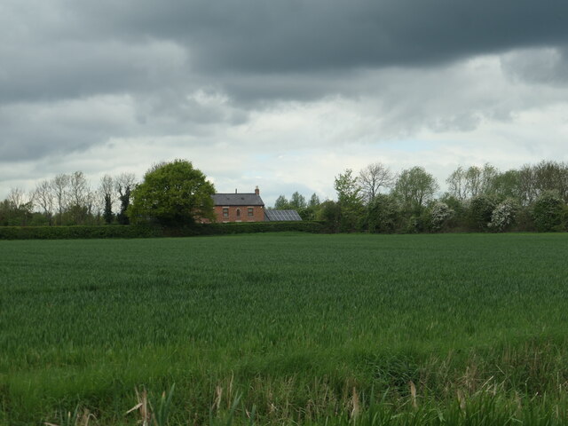
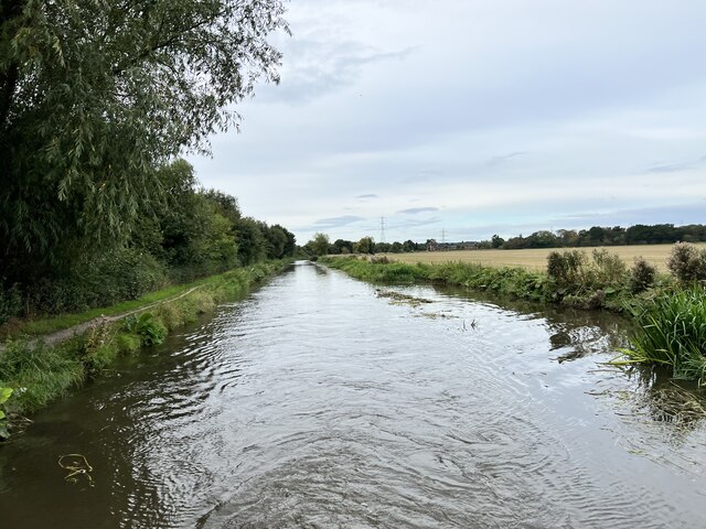
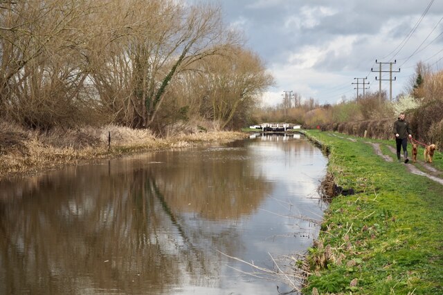
Brickyard Plantation, located in Derbyshire, England, is a remarkable woodland area known for its diverse flora and fauna. Spanning across several acres, this picturesque forest is a haven for nature enthusiasts and is a popular destination for hikers, birdwatchers, and wildlife photographers.

The woodland is dominated by an assortment of native tree species, including oak, beech, and birch, which provide a beautiful canopy over the forest floor. Bluebells, wild garlic, and foxgloves are just a few examples of the vibrant wildflowers that thrive in this enchanting woodland.

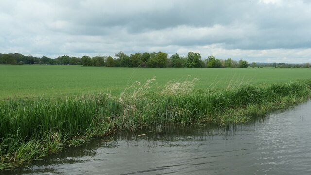
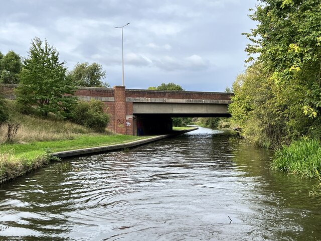
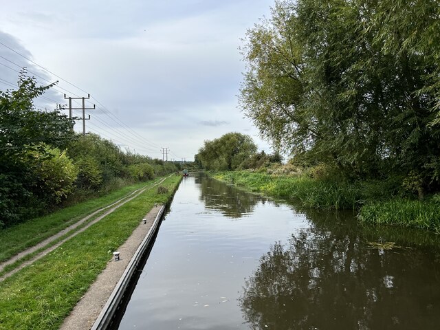
Numerous walking trails wind their way through Brickyard Plantation, offering visitors the opportunity to explore its natural beauty. These paths are well-maintained and provide easy access to the different sections of the woodland, including a tranquil lake that serves as a habitat for various waterfowl species.

The forest is also home to a rich array of wildlife. Deer, foxes, and badgers can often be spotted here, while birdwatchers can delight in the sight of woodpeckers, owls, and various migratory birds that visit the area. With its diverse ecosystem, Brickyard Plantation provides a valuable habitat for many species, contributing to the overall biodiversity of Derbyshire.

Additionally, the forest has a long and storied history, with remnants of an old brickyard that once operated within the plantation. This historical element adds an intriguing layer to the woodland, showcasing the area's past industrial activities.

Overall, Brickyard Plantation is a natural gem within Derbyshire, offering visitors an opportunity to connect with nature, explore its trails, and discover the abundant wildlife that thrives within its boundaries.

If you have any feedback on the listing, please let us know in the comments section below.

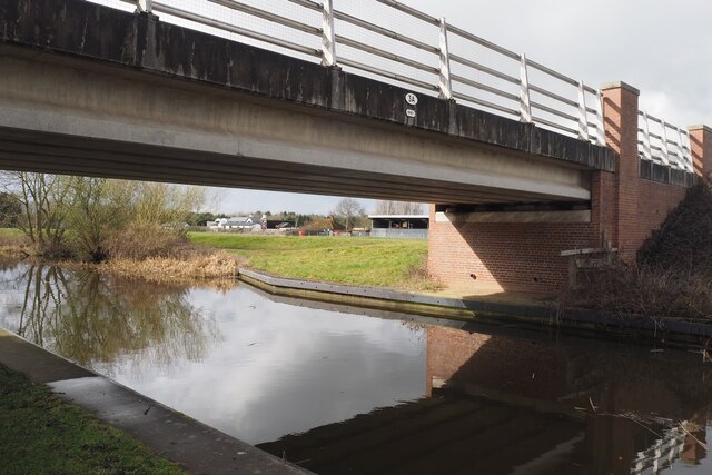
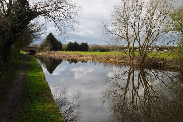
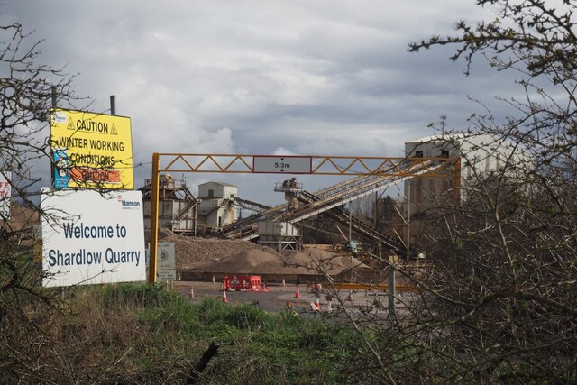
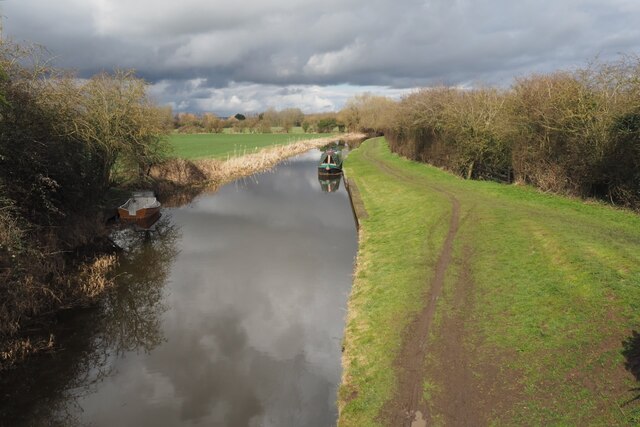
Brickyard Plantation Images

Images are sourced within 2km of 52.869706/-1.3879001 or Grid Reference SK4130. Thanks to Geograph Open Source API. All images are credited.

Birdcage Wood, from the south A small triangular wood on the boundary between Weston-on-Trent and Aston-on-Trent civil parishes.
Birdcage Wood, from the south
A small triangular wood on the boundary between Weston-on-Trent and Aston-on-Trent civil parishes.
Dark clouds over Moorland House Not generating much energy on the panels at the moment.
Dark clouds over Moorland House
Not generating much energy on the panels at the moment.
Hicken's Bridge The A50 bridge over the Trent and Mersey Canal.
Hicken's Bridge
The A50 bridge over the Trent and Mersey Canal.
The Trent and Mersey Canal Near Shardlow
The Trent and Mersey Canal
Near Shardlow
The Trent and Mersey Canal Looking towards Aston-on-Trent.
The Trent and Mersey Canal
Looking towards Aston-on-Trent.
The Trent and Mersey Canal Looking towards Aston-on-Trent.
The Trent and Mersey Canal
Looking towards Aston-on-Trent.
Weston Road, Aston-on-Trent Aston-on-Trent has a population of about 1,700 (2011 census) making it slightly larger than its neighbour Weston-on-Trent. It is not particularly close to the River Trent, having been established away from the flood plain. In this Sunday lunchtime view traffic cones were in place in connection with the village well-dressing festival which was taking place over the weekend. Wandering around, several of the locals could be heard complaining of a sore head, so it sounds as though a good time was had by all the previous evening.
Weston Road, Aston-on-Trent
Aston-on-Trent has a population of about 1,700 (2011 census) making it slightly larger than its neighbour Weston-on-Trent. It is not particularly close to the River Trent, having been established away from the flood plain. In this Sunday lunchtime view traffic cones were in place in connection with the village well-dressing festival which was taking place over the weekend. Wandering around, several of the locals could be heard complaining of a sore head, so it sounds as though a good time was had by all the previous evening.
Weston Road, Aston-on-Trent These are recognisably local authority built houses but they look substantial and have a pleasant location on the edge of the village.
Weston Road, Aston-on-Trent
These are recognisably local authority built houses but they look substantial and have a pleasant location on the edge of the village.
The end of Richmond Drive This is the very edge of Aston on Trent with the view being a little west of south.
The end of Richmond Drive
This is the very edge of Aston on Trent with the view being a little west of south.
Daffodils beside Weston Road On the outskirts of Aston-upon-Trent.
Daffodils beside Weston Road
On the outskirts of Aston-upon-Trent.
Bridge 3A Trent & Mersey Canal (1997) This seems to be an expensive looking bridge for what appears to be just a farm track running across it.

The date is probably the big clue as this is the time that the nearby A50 was finished.  Presumably therefore this was needed to restore access to the farm visible behind destroyed by the new road.
Bridge 3A Trent & Mersey Canal (1997)
This seems to be an expensive looking bridge for what appears to be just a farm track running across it. The date is probably the big clue as this is the time that the nearby A50 was finished. Presumably therefore this was needed to restore access to the farm visible behind destroyed by the new road.
The Trent & Mersey Canal Hicken's Bridge carrying the A50 visible in the distance.
The Trent & Mersey Canal
Hicken's Bridge carrying the A50 visible in the distance.
Canal Milepost Shardlow 1 Mile Preston Brook 91 Miles.

Grade II listed List Entry Number:1088357 <span class="nowrap"><a title="https://historicengland.org.uk/listing/the-list/list-entry/1088357?section=official-list-entry" rel="nofollow ugc noopener" href="https://historicengland.org.uk/listing/the-list/list-entry/1088357?section=official-list-entry">Link</a><img style="margin-left:2px;" alt="External link" title="External link - shift click to open in new window" src="https://s1.geograph.org.uk/img/external.png" width="10" height="10"/></span>

Originally at SK429 298.

See also <a href="https://www.geograph.org.uk/photo/6897993">SK4329 : A canal milepost</a> <a href="https://www.geograph.org.uk/photo/5700633">SK4329 : Shardlow 1 mile</a>.
Canal Milepost
Shardlow 1 Mile Preston Brook 91 Miles. Grade II listed List Entry Number:1088357 LinkExternal link Originally at SK429 298. See also SK4329 : A canal milepost SK4329 : Shardlow 1 mile.
Shardlow Quarry Sand and gravel extraction from the Trent flood plain.
Shardlow Quarry
Sand and gravel extraction from the Trent flood plain.
The Trent and Mesey Canal from Acrelane Bridge The Trent and Mersey Canal is 93·5 miles in length from Derwent Mouth to Preston Brook. The first cut was made by Josiah Wedgwood in July 1766 at Middleport (Stoke-on-Trent). The eastern section between Derwent Mouth and Shugborough (the junction with the Staffordshire and Worcestershire Canal) was already operational by 1770 and the whole canal through to Preston Brook, where it linked with the Bridgewater Canal was open for business by 1777. James Brindley was the engineer until his death in 1772. There are seventy-six locks en route to raise and lower the water level where hills impede the course. There are four tunnels, including the famous Harecastle Tunnel near Stoke-on-Trent.
The Trent and Mesey Canal from Acrelane Bridge
The Trent and Mersey Canal is 93·5 miles in length from Derwent Mouth to Preston Brook. The first cut was made by Josiah Wedgwood in July 1766 at Middleport (Stoke-on-Trent). The eastern section between Derwent Mouth and Shugborough (the junction with the Staffordshire and Worcestershire Canal) was already operational by 1770 and the whole canal through to Preston Brook, where it linked with the Bridgewater Canal was open for business by 1777. James Brindley was the engineer until his death in 1772. There are seventy-six locks en route to raise and lower the water level where hills impede the course. There are four tunnels, including the famous Harecastle Tunnel near Stoke-on-Trent.
Common butterbur (Petasites hybridus) Growing beside the Trent & Mersey Canal.
Common butterbur (Petasites hybridus)
Growing beside the Trent & Mersey Canal.
Distant view of Aston Lock On the Trent & Mersey Canal east of Aston-on-Trent.
Distant view of Aston Lock
On the Trent & Mersey Canal east of Aston-on-Trent.
Roundabout on the Derby Spur near Thulston
Show me another place!

Brickyard Plantation is located at Grid Ref: SK4130 (Lat: 52.869706, Lng: -1.3879001)

Administrative County: Derbyshire

District: South Derbyshire

Police Authority: Derbyshire

What 3 Words

///modifies.growl.podcast. Near Aston-on-Trent, Derbyshire

Related Wikis

All Saints' Church, Aston-upon-Trent

All Saints’ Church, Aston upon Trent is a Grade I listed parish church in the Church of England in Aston-on-Trent, Derbyshire. == History == The church...

Aston-on-Trent

Aston-on-Trent is a village and civil parish in the South Derbyshire district, in the county of Derbyshire, England. The parish had a population of 1,682...

Aston Hall, Aston-on-Trent

Aston Hall is an 18th-century country house, now converted to residential apartments, at Aston-on-Trent, Derbyshire. It is a Grade II* listed building...

Derby South services

The Derby South services are two service stations run by Welcome Break on either side of the A50 road. The services are located in South Derbyshire, near...

Hanson Log Boat

The Hanson Log Boat was a Bronze Age dugout boat found in a gravel pit in Shardlow in Derbyshire. The log boat is now in Derby Museum and Art Gallery....

Shardlow

Shardlow is a village in Derbyshire, England about 6 miles (9.7 km) southeast of Derby and 11 miles (18 km) southwest of Nottingham. Part of the civil...

Elvaston, Derbyshire

Elvaston is a small village and civil parish in Derbyshire, England. The parish also includes two hamlets, Ambaston and Thulston, and a modern housing...

South East Derbyshire Rural District

South East Derbyshire was a rural district in Derbyshire, England from 1894 to 1974. It covered an area to the south-east of Derby. It was formed as Shardlow...

Nearby Amenities

Located within 500m of 52.869706,-1.3879001
Motorway Junction
Aston Interchange
Exit To: Derby A6;Alvaston
Ref: 2
Lat/Long: 52.8715098/-1.3863769
Note: Curve hazard sign which gives an advisory speed of 40mph
Lat/Long: 52.8701774/-1.3914375
Barrier: stile
Step Count: 1
Stile: stepover
Lat/Long: 52.8702847/-1.3857247
Emergency Bay
Lat/Long: 52.8709929/-1.3945629
Phone
Check Date: 2023-03-02
Emergency: phone
Lat/Long: 52.8710433/-1.3944433
Phone
Emergency: phone
Lat/Long: 52.8711016/-1.392005
Emergency Bay
Lat/Long: 52.8711459/-1.3917216
Addr City: Derby
Addr Housenumber: 92
Addr Postcode: DE72 2AF
Addr Street: Derby Road
Source Addr: survey
Source Addr Postcode: OS Opendata Codepoint
Lat/Long: 52.8658898/-1.384853
Addr City: Derby
Addr Housenumber: 90
Addr Postcode: DE72 2AF
Addr Street: Derby Road
Source Addr: interpolation
Source Addr Postcode: OS Opendata Codepoint
Lat/Long: 52.8658979/-1.3848986
Addr City: Derby
Addr Housenumber: 88
Addr Postcode: DE72 2AF
Addr Street: Derby Road
Source Addr: survey
Source Addr Postcode: OS Opendata Codepoint
Lat/Long: 52.8659044/-1.3849482
Addr City: Derby
Addr Housenumber: 86
Addr Postcode: DE72 2AF
Addr Street: Derby Road
Source Addr: survey
Source Addr Postcode: OS Opendata Codepoint
Lat/Long: 52.8659133/-1.3850072
Addr City: Derby
Addr Housenumber: 84
Addr Postcode: DE72 2AF
Addr Street: Derby Road
Source Addr: survey
Source Addr Postcode: OS Opendata Codepoint
Lat/Long: 52.865919/-1.3850649
Addr City: Derby
Addr Housenumber: 82
Addr Postcode: DE72 2AF
Addr Street: Derby Road
Source Addr: survey
Source Addr Postcode: OS Opendata Codepoint
Lat/Long: 52.865923/-1.3851199
Bus Stop
Alderslade Close
Bus: yes
Naptan AtcoCode: 1000DATD5082
Naptan NaptanCode: dbsagdpm
Public Transport: platform
Route Ref: 73
Shelter: no
Lat/Long: 52.8663047/-1.3851876
Bench
Lat/Long: 52.8706251/-1.3870914
Bench
Lat/Long: 52.8707425/-1.3874159
Man Made: mast
Source: survey
Lat/Long: 52.8707064/-1.3891146
Notice Board
Lat/Long: 52.8705106/-1.3864637
Fixme: continues
Lat/Long: 52.8688134/-1.3874796
Power: pole
Lat/Long: 52.8711697/-1.386812
Note: Line above ground terminates here
Power: pole
Lat/Long: 52.8706006/-1.3865183
Power: pole
Lat/Long: 52.8718319/-1.3871366
Power: pole
Lat/Long: 52.8729587/-1.3876757
Power: pole
Lat/Long: 52.8741615/-1.3882819
Power: pole
Lat/Long: 52.8676822/-1.381276
Power: pole
Lat/Long: 52.8687565/-1.3809501
Power: pole
Lat/Long: 52.8692123/-1.3808502
Power: pole
Lat/Long: 52.8696106/-1.3807677
Power: pole
Lat/Long: 52.8697919/-1.3824373
Power: pole
Lat/Long: 52.8699032/-1.3837744
Power: pole
Lat/Long: 52.8702481/-1.3857123
Generator Method: photovoltaic
Generator Output Electricity: yes
Generator Source: solar
Generator Type: solar_photovoltaic_panel
Location: roof
Power: generator
Lat/Long: 52.8673869/-1.3840708
Generator Method: photovoltaic
Generator Output Electricity: yes
Generator Source: solar
Generator Type: solar_photovoltaic_panel
Location: roof
Power: generator
Lat/Long: 52.8672703/-1.3841432
Direction: 265
Man Made: surveillance
Surveillance: public
Surveillance Type: ALPR
Surveillance Zone: traffic
Lat/Long: 52.8717208/-1.3863806
Direction: 265
Man Made: surveillance
Surveillance: public
Surveillance Type: ALPR
Surveillance Zone: traffic
Lat/Long: 52.8716852/-1.3863674
Direction: 265
Man Made: surveillance
Surveillance: public
Surveillance Type: ALPR
Surveillance Zone: traffic
Lat/Long: 52.8716471/-1.3863525
Direction: 90
Man Made: surveillance
Surveillance: public
Surveillance Type: ALPR
Surveillance Zone: traffic
Lat/Long: 52.8715522/-1.3861271
Direction: 90
Man Made: surveillance
Surveillance: public
Surveillance Type: ALPR
Surveillance Zone: traffic
Lat/Long: 52.8715183/-1.3861137
Direction: 90
Man Made: surveillance
Surveillance: public
Surveillance Type: ALPR
Surveillance Zone: traffic
Lat/Long: 52.8714839/-1.3861076
Direction: 90
Man Made: surveillance
Surveillance: public
Surveillance Type: ALPR
Surveillance Zone: traffic
Lat/Long: 52.8714483/-1.3860929
Waste Basket
Colour: green
Material: metal
Operator: South Derbyshire District Council
Waste: trash
Lat/Long: 52.8658957/-1.3852968
Waste Basket
Colour: green
Operator: South Derbyshire District Council
Waste: dog_excrement
Lat/Long: 52.8690121/-1.385997
Bus Stop
Alderslade Close
Public Transport: platform
Lat/Long: 52.8658955/-1.3852724
The data included in this document is from www.openstreetmap.org. The data is made available under ODbL.

Have you been to Brickyard Plantation?

Leave your review of Brickyard Plantation below (or comments, questions and feedback).