Aston Somerville

Civil Parish in Gloucestershire Wychavon

England

Aston Somerville

A sea of wheat A view, looking south, from the bridleway across this very large (285 acre) field.  The woodland in the distance is Oldfield Brake.
A sea of wheat Credit: Michael Dibb

Aston Somerville is a civil parish located in the county of Gloucestershire, England. It is situated approximately 10 miles south of the town of Evesham and 15 miles northeast of Cheltenham. The parish covers an area of approximately 4.5 square miles and is surrounded by picturesque countryside.

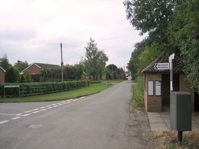
The village of Aston Somerville itself is a small and charming settlement, with a population of around 200 residents. It is characterized by its traditional Cotswold stone houses and beautiful rural landscapes. The parish is predominantly agricultural, with farming being the main industry in the area.

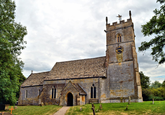
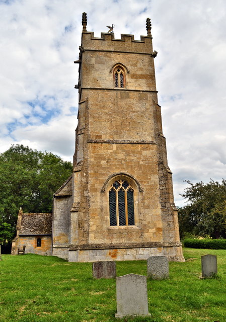
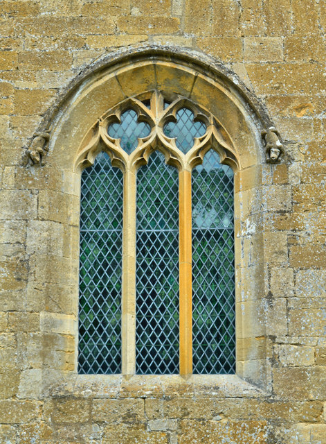
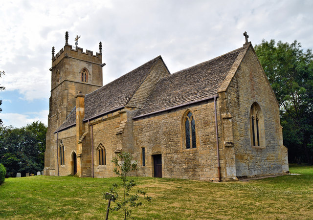
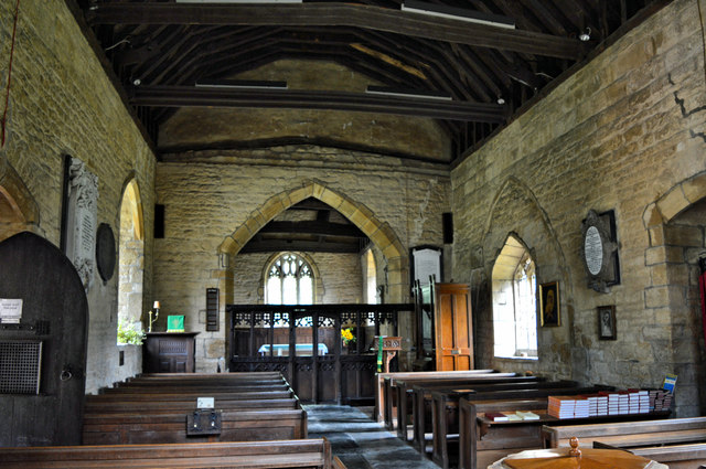
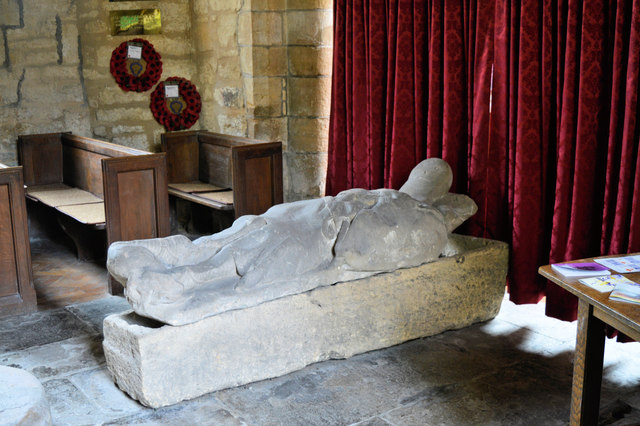
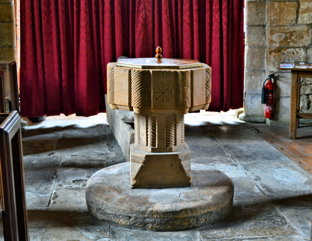
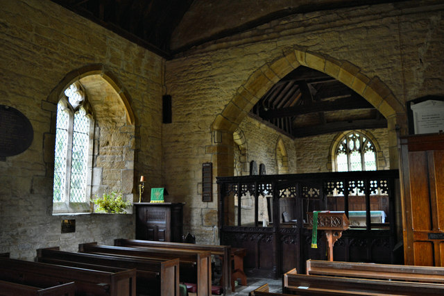
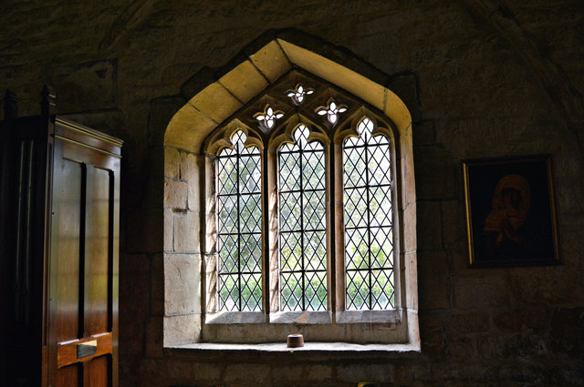
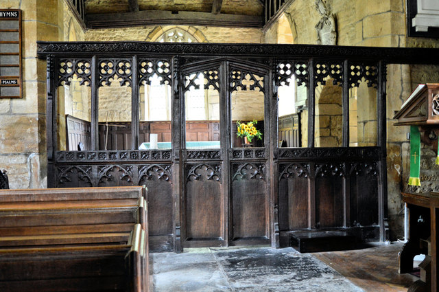
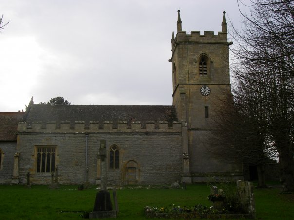
The parish is home to the Church of St Mary, a Grade II listed building that dates back to the 12th century. The church is known for its stunning medieval architecture, including a Norman doorway and a 13th-century font. It is a popular destination for visitors interested in history and architecture.

Despite its small size, Aston Somerville has a strong sense of community. The village has a village hall which serves as a hub for various social activities and events. Additionally, there are several footpaths and bridleways in the area, making it a popular destination for walkers and nature lovers.

Overall, Aston Somerville is a peaceful and picturesque civil parish in Gloucestershire, offering a tranquil rural lifestyle and a strong sense of community.

If you have any feedback on the listing, please let us know in the comments section below.

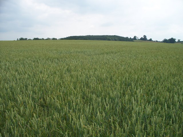
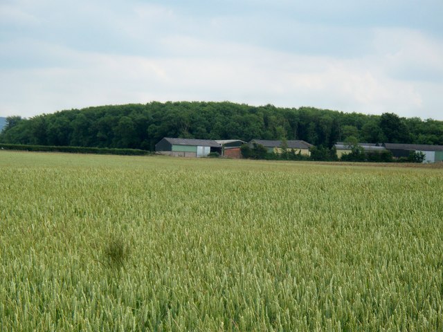
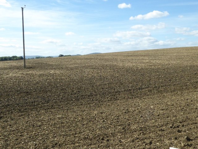
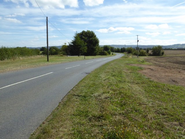
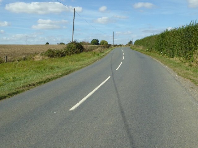
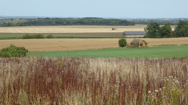
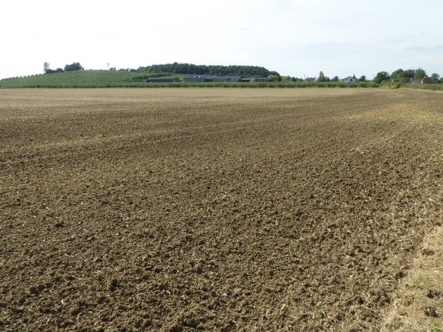
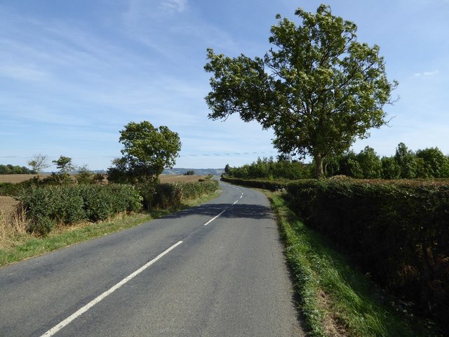
Aston Somerville Images

Images are sourced within 2km of 52.041414/-1.935365 or Grid Reference SP0438. Thanks to Geograph Open Source API. All images are credited.

A sea of wheat A view, looking south, from the bridleway across this very large (285 acre) field.  The woodland in the distance is Oldfield Brake.
A sea of wheat
A view, looking south, from the bridleway across this very large (285 acre) field. The woodland in the distance is Oldfield Brake.
Mount Farm Seen, across the field, from the bridleway.  Smith Hill Plantation behind the farm.
Mount Farm
Seen, across the field, from the bridleway. Smith Hill Plantation behind the farm.
Arable field near Mount Pleasant Farm A recently tilled arable field beside Mount Pleasant Farm.
Arable field near Mount Pleasant Farm
A recently tilled arable field beside Mount Pleasant Farm.
Hinton Road Hinton Road between the A46 near Hinton-on-the-Green to Childswickham.
Hinton Road
Hinton Road between the A46 near Hinton-on-the-Green to Childswickham.
Hinton Road near Mount Pleasant Farm Hinton Road between the A46 and the village of Childswickham.
Hinton Road near Mount Pleasant Farm
Hinton Road between the A46 and the village of Childswickham.
View to the north-east from Blake's Hill View to the north-east from Blake's Hill across arable farmland.  This is the same view as this picture from March 2009 <a href="https://www.geograph.org.uk/photo/1198767">SP0339 : Uncultivated land near Aston Somerville</a>
View to the north-east from Blake's Hill
View to the north-east from Blake's Hill across arable farmland. This is the same view as this picture from March 2009 SP0339 : Uncultivated land near Aston Somerville
Arable land near Mount Pleasant Arable land near Mount Pleasant, with Aston Hill in the background.
Arable land near Mount Pleasant
Arable land near Mount Pleasant, with Aston Hill in the background.
Hinton Road near Mount Pleasant Farm
St Mary the Virgin, Aston Somerville In Gloucestershire until 1931, now in Worcestershire. Mainly 14th-15th century and sensitively restored in 1908 by C. Ford Whitcombe. Sadly, the retirement of a vicar means that from now a service will only be held here every other month, meaning that closure is a future possibility.
St Mary the Virgin, Aston Somerville
In Gloucestershire until 1931, now in Worcestershire. Mainly 14th-15th century and sensitively restored in 1908 by C. Ford Whitcombe. Sadly, the retirement of a vicar means that from now a service will only be held here every other month, meaning that closure is a future possibility.
St Mary the Virgin, Aston Somerville The fine West tower.
St Mary the Virgin, Aston Somerville
The fine West tower.
St Mary the Virgin, Aston Somerville The West window.
St Mary the Virgin, Aston Somerville
The West window.
St Mary the Virgin, Aston Somerville
St Mary the Virgin, Aston Somerville The interior, looking East
St Mary the Virgin, Aston Somerville
The interior, looking East
St Mary the Virgin, Aston Somerville  Two pieces of unassociated medieval stonework - a Somerville knight in armour who has spent too much time outdoors and now rests on a stone coffin.
St Mary the Virgin, Aston Somerville
Two pieces of unassociated medieval stonework - a Somerville knight in armour who has spent too much time outdoors and now rests on a stone coffin.
St Mary the Virgin, Aston Somerville The rather puzzling font. The plinth is ancient, but no one is sure about the font itself.
St Mary the Virgin, Aston Somerville
The rather puzzling font. The plinth is ancient, but no one is sure about the font itself.
St Mary the Virgin, Aston Somerville
St Mary the Virgin, Aston Somerville A window on the South side, reset in a blocked arch which led to former chapel. The timeless beauty of late English gothic.
St Mary the Virgin, Aston Somerville
A window on the South side, reset in a blocked arch which led to former chapel. The timeless beauty of late English gothic.
St Mary the Virgin, Aston Somerville The 15th century screen.
St Mary the Virgin, Aston Somerville
The 15th century screen.
Show me another place!

Aston Somerville is located at Grid Ref: SP0438 (Lat: 52.041414, Lng: -1.935365)

Administrative County: Worcestershire

District: Wychavon

Police Authority: West Mercia

What 3 Words

///maybe.motive.input. Near Broadway, Worcestershire

Related Wikis

Aston Somerville

Aston Somerville is a small village approximately 3 miles (4.8 km) south of Evesham, Worcestershire, England. == History == Historically, the Aston Somerville...

Wormington

Wormington is a village civil parish in the Tewkesbury district, in Gloucestershire, England. It lies on the River Isbourne, 5 miles (8 km) north of Winchcombe...

Sedgeberrow

Sedgeberrow is a village and civil parish in the Wychavon district of Worcestershire, England, about 3 miles (4.8 km) south of Evesham. It stands beside...

Murcot

Murcot is a hamlet in the English county of Worcestershire. Murcot is located in the west of the Vale of Evesham and is to the west and south of the village...

Hinton on the Green

Hinton on the Green is a village and civil parish in the Wychavon district of Worcestershire in England. It is situated at the foot of Bredon Hill, about...

Childswickham

Childswickham is a village in Worcestershire, England, situated within the flat open landscape of the Vale of Evesham, between the Bredon and Cotswold...

Laverton Halt railway station

Laverton Halt railway station was a halt on the Honeybourne Line from Honeybourne to Cheltenham which served the hamlet of Laverton in Gloucestershire...

Wormington Grange

Wormington Grange is a Grade II* listed country house in the civil parish of Stanton, Gloucestershire, England. It lies one mile (1.6 km) south of the...

Nearby Amenities

Located within 500m of 52.041414,-1.935365
Bus Stop
School Road
Bench: yes
Bus: yes
Naptan AtcoCode: 2000G085100
Naptan Bearing: NE
Naptan BusStopType: CUS
Naptan CommonName: School Road
Naptan Crossing: Broadway Road
Naptan Indicator: Opp
Naptan NaptanCode: wocdjptd
Naptan Street: School Road
Naptan Verified: no
Note: exists on ground
Public Transport: platform
Shelter: yes
Source: naptan_import
Lat/Long: 52.0430408/-1.9353729
Bus Stop
School Road
Bus: yes
Naptan AtcoCode: 2000G501854
Naptan Bearing: SW
Naptan CommonName: School Road
Naptan Crossing: Broadway Road
Naptan Indicator: Adj
Naptan NaptanCode: wocgdjat
Naptan Street: School Road
Naptan Verified: no
Note: Not present on ground
Public Transport: platform
Source: naptan_import
Lat/Long: 52.0430661/-1.935124
Public Bookcase
Booth: K6
Colour: red
Disused Amenity: telephone
Man Made: telephone_box
Public Bookcase Type: phone_box
Lat/Long: 52.0437238/-1.9342293
Post Box
Collection Times: Mo-Fr 15:45; Sa 10:45
Old Ref: B055
Post Box Type: lamp
Ref: WR12 55
Royal Cypher: EIIR
Royal Cypher Wikidata: Q33102113
Lat/Long: 52.0431058/-1.9352964
Barrier: stile
Lat/Long: 52.0435164/-1.929457
Barrier: stile
Lat/Long: 52.0427612/-1.9407458
Barrier: stile
Lat/Long: 52.0428206/-1.9406621
Barrier: stile
Lat/Long: 52.043326/-1.9360425
Barrier: stile
Lat/Long: 52.0379135/-1.9376725
Barrier: stile
Lat/Long: 52.039/-1.9348596
Barrier: stile
Lat/Long: 52.039291/-1.9307581
Power: pole
Lat/Long: 52.0408164/-1.9419069
Power: pole
Lat/Long: 52.0420782/-1.9407444
Power: pole
Lat/Long: 52.0426345/-1.9417665
Power: pole
Lat/Long: 52.0431187/-1.939561
Location Transition: yes
Power: pole
Lat/Long: 52.0427529/-1.9404258
Location Transition: yes
Power: pole
Lat/Long: 52.0428928/-1.9384868
Power: pole
Lat/Long: 52.0435136/-1.9376132
Power: pole
Lat/Long: 52.0436594/-1.9369623
Barrier: stile
Lat/Long: 52.0438422/-1.9373294
Ashton Somerville North
Power: pole
Transformer: distribution
Voltage Primary: 11000
Lat/Long: 52.0438917/-1.9358975
Power: pole
Lat/Long: 52.0441293/-1.9384455
Power: pole
Lat/Long: 52.0441502/-1.934703
Power: pole
Lat/Long: 52.045133/-1.9373522
Power: pole
Lat/Long: 52.0379739/-1.9392759
Power: pole
Lat/Long: 52.0382432/-1.9376101
Power: pole
Lat/Long: 52.0384533/-1.9362721
Power: pole
Lat/Long: 52.0386832/-1.9349098
Power: pole
Lat/Long: 52.0392348/-1.933874
Power: pole
Lat/Long: 52.039867/-1.9352688
Ashton Somerville Sewage Works
Power: pole
Transformer: distribution
Voltage Primary: 11000
Lat/Long: 52.0404052/-1.9356118
Power: pole
Lat/Long: 52.0418413/-1.9285201
Power: pole
Lat/Long: 52.0421112/-1.9298135
Power: pole
Lat/Long: 52.0422931/-1.9300487
Power: pole
Lat/Long: 52.0429908/-1.9308766
Material: wood
Power: pole
Lat/Long: 52.0436762/-1.9316767
Power: pole
Lat/Long: 52.0443341/-1.9324361
Power: pole
Lat/Long: 52.0448276/-1.9340748
Power: pole
Lat/Long: 52.044921/-1.9331459
Power: pole
Lat/Long: 52.0455767/-1.9338846
Chest Tomb
HE Ref: 39908
Historic: monument
Listed Status: Grade II
Source Listed Status: English Heritage
Lat/Long: 52.0393517/-1.9322445
Ashton Somerville South
Material: wood
Power: pole
Transformer: distribution
Voltage Primary: 11000
Lat/Long: 52.0420069/-1.9326764
Power: pole
Lat/Long: 52.0421385/-1.931686
Power: pole
Lat/Long: 52.0422544/-1.9312824
Power: pole
Lat/Long: 52.0422684/-1.9307151
Ashton Somerville Church
Power: pole
Transformer: distribution
Voltage Primary: 11000
Lat/Long: 52.0400849/-1.932718
Power: pole
Lat/Long: 52.0399628/-1.9331445
Power: pole
Lat/Long: 52.0394384/-1.9349978
Ashton Somerville STW
Power: pole
Transformer: distribution
Voltage Primary: 11000
Lat/Long: 52.0403682/-1.9379899
Power: pole
Lat/Long: 52.0396572/-1.9378571
Power: pole
Lat/Long: 52.0389386/-1.9377324
The data included in this document is from www.openstreetmap.org. The data is made available under ODbL.

Have you been to Aston Somerville?

Leave your review of Aston Somerville below (or comments, questions and feedback).