Ash Plantation

Wood, Forest in Gloucestershire Wychavon

England

Ash Plantation

The Glebe Houses, Hinton Cross.
The Glebe Credit: JThomas

Ash Plantation is a picturesque woodland located in Gloucestershire, England. Covering an area of approximately 100 acres, it is situated in the heart of the county, near the village of Ashleworth. The plantation is part of a larger forested area known as the Forest of Dean.

The woodland is predominantly composed of ash trees, which give it its name. These tall and elegant trees create a dense canopy, providing shade and shelter for a diverse range of flora and fauna. The forest floor is covered in a rich carpet of mosses, ferns, and wildflowers, adding to the enchanting atmosphere of the plantation.

Ash Plantation has become a popular destination for nature enthusiasts, hikers, and birdwatchers, thanks to its abundant wildlife. The woodland is home to a variety of bird species, including woodpeckers, owls, and warblers. Visitors may also spot mammals such as deer, foxes, and badgers roaming the forest.

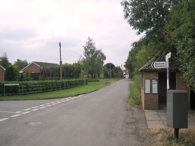
The plantation is crisscrossed by a network of well-maintained footpaths, allowing visitors to explore the woodland at their own pace. These paths lead to scenic viewpoints, where one can enjoy panoramic views of the surrounding countryside.

Ash Plantation is managed by the Forestry Commission, which ensures the conservation of the woodland while promoting sustainable forestry practices. The commission periodically carries out tree maintenance and woodland management activities to preserve the health and biodiversity of the area.

In summary, Ash Plantation is a captivating woodland in Gloucestershire, offering a tranquil retreat for nature lovers and a haven for a wide array of wildlife.

If you have any feedback on the listing, please let us know in the comments section below.

Ash Plantation Images

Images are sourced within 2km of 52.047953/-1.9368591 or Grid Reference SP0438. Thanks to Geograph Open Source API. All images are credited.

The Glebe Houses, Hinton Cross.
The Glebe
Houses, Hinton Cross.
A46 approaching Hinton Cross Looking north.
A46 approaching Hinton Cross
Looking north.
Minor road, Hinton Cross Towards Childswickham.
Minor road, Hinton Cross
Towards Childswickham.
Bridleway to Hinton on the Green Bridleway crossing this arable field to Hinton on the Green.  Bredon Hill is on the horizon.
Bridleway to Hinton on the Green
Bridleway crossing this arable field to Hinton on the Green. Bredon Hill is on the horizon.
Fields at Hinton Cross Looking east from Hinton Cross with the Childswickam Road on the right
Fields at Hinton Cross
Looking east from Hinton Cross with the Childswickam Road on the right
View towards Porter's Plantation As can be seen from the OS Map, about 75% of this square is occupied by one large field. This picture is taken from the footpath to Wickhamford, with Porter's Plantation in the NE corner of the square visible over the sea of wheat.
View towards Porter's Plantation
As can be seen from the OS Map, about 75% of this square is occupied by one large field. This picture is taken from the footpath to Wickhamford, with Porter's Plantation in the NE corner of the square visible over the sea of wheat.
Houses at Murcot Farm Seen approaching Murcot farm on the footpath from the west.  The eastern boundary of the square is just beyond the first house.
Houses at Murcot Farm
Seen approaching Murcot farm on the footpath from the west. The eastern boundary of the square is just beyond the first house.
Footpath to nowhere According to the OS Map this path runs along the edge of this field on the eastern boundary of the square, then crosses into the next square near Lower Farm and the just ends for no apparent reason!
Footpath to nowhere
According to the OS Map this path runs along the edge of this field on the eastern boundary of the square, then crosses into the next square near Lower Farm and the just ends for no apparent reason!
Bridleway Heading towards the footbridge in the corner of the field.
Bridleway
Heading towards the footbridge in the corner of the field.
Hinton Cross Hinton Cross is a difficult road junction on the busy A46 to the south of Evesham.
Hinton Cross
Hinton Cross is a difficult road junction on the busy A46 to the south of Evesham.
Grassland near Hinton Cross 1 Looking north over recently harvested haylage north of the Childswickham road.
Grassland near Hinton Cross 1
Looking north over recently harvested haylage north of the Childswickham road.
Grassland near Hinton Cross 2 Looking north-east over recently harvested haylage north of the Childswickham road.
Grassland near Hinton Cross 2
Looking north-east over recently harvested haylage north of the Childswickham road.
Grassland near Hinton Cross 3 Looking east over recently harvested haylage north of the Childswickham road.
Grassland near Hinton Cross 3
Looking east over recently harvested haylage north of the Childswickham road.
Footpath to nowhere The footpath leads nowhere - it runs along the edge of two fields, crosses another field then into a short section of enclosed track where it ends.
Footpath to nowhere
The footpath leads nowhere - it runs along the edge of two fields, crosses another field then into a short section of enclosed track where it ends.
Worcestershire farmland Seen from the footpath.  The flank of Bredon Hill is seen to the left.
Worcestershire farmland
Seen from the footpath. The flank of Bredon Hill is seen to the left.
Cottages near Murcot Seen from the footpath.  They are named Windhaven and Hunt Leys.
Cottages near Murcot
Seen from the footpath. They are named Windhaven and Hunt Leys.
Sleeping sleepers One of this pile of railway sleepers still has the rail chairs attached - seemingly narrow gauge.
Sleeping sleepers
One of this pile of railway sleepers still has the rail chairs attached - seemingly narrow gauge.
Start of footpath This short footpath leaves the minor road and runs to Hinton-on-the-Green,
Start of footpath
This short footpath leaves the minor road and runs to Hinton-on-the-Green,
Show me another place!

Ash Plantation is located at Grid Ref: SP0438 (Lat: 52.047953, Lng: -1.9368591)

Administrative County: Worcestershire

District: Wychavon

Police Authority: West Mercia

What 3 Words

///resting.seeing.written. Near Evesham, Worcestershire

Related Wikis

Aston Somerville

Aston Somerville is a small village approximately 3 miles (4.8 km) south of Evesham, Worcestershire, England. == History == Historically, the Aston Somerville...

Sedgeberrow

Sedgeberrow is a village and civil parish in the Wychavon district of Worcestershire, England, about 3 miles (4.8 km) south of Evesham. It stands beside...

Hinton on the Green

Hinton on the Green is a village and civil parish in the Wychavon district of Worcestershire in England. It is situated at the foot of Bredon Hill, about...

Murcot

Murcot is a hamlet in the English county of Worcestershire. Murcot is located in the west of the Vale of Evesham and is to the west and south of the village...

Wormington

Wormington is a village civil parish in the Tewkesbury district, in Gloucestershire, England. It lies on the River Isbourne, 5 miles (8 km) north of Winchcombe...

Hinton railway station (England)

Hinton railway station was a station on the Midland Railway between Tewkesbury and Evesham, England. It opened 1 October 1864 by the Midland Railway. The...

Evesham United F.C.

Evesham United Football Club are an English football club based in Evesham, Worcestershire. They reached the first round proper of the FA Cup for the first...

Childswickham

Childswickham is a village in Worcestershire, England, situated within the flat open landscape of the Vale of Evesham, between the Bredon and Cotswold...

Nearby Amenities

Located within 500m of 52.047953,-1.9368591
Tourism: viewpoint
Lat/Long: 52.0518937/-1.9402608
Power: pole
Lat/Long: 52.0435136/-1.9376132
Power: pole
Lat/Long: 52.0436594/-1.9369623
Barrier: stile
Lat/Long: 52.0438422/-1.9373294
Ashton Somerville North
Power: pole
Transformer: distribution
Voltage Primary: 11000
Lat/Long: 52.0438917/-1.9358975
Power: pole
Lat/Long: 52.0441293/-1.9384455
Power: pole
Lat/Long: 52.0441502/-1.934703
Power: pole
Lat/Long: 52.045133/-1.9373522
Power: pole
Lat/Long: 52.0462772/-1.9359902
Power: pole
Lat/Long: 52.0448276/-1.9340748
Power: pole
Lat/Long: 52.044921/-1.9331459
Power: pole
Lat/Long: 52.0455767/-1.9338846
Power: pole
Lat/Long: 52.0463466/-1.9336374
Power: pole
Lat/Long: 52.0474339/-1.934637
Power: pole
Lat/Long: 52.0471931/-1.9329964
Power: pole
Lat/Long: 52.0479789/-1.932385
Power: pole
Lat/Long: 52.0486277/-1.9332675
Power: pole
Lat/Long: 52.0487513/-1.9317854
Power: pole
Lat/Long: 52.0494765/-1.9312117
Power: pole
Lat/Long: 52.049716/-1.9319961
Power: pole
Lat/Long: 52.0502769/-1.9306004
Power: pole
Lat/Long: 52.0508212/-1.9313076
Telecom Aston Hill
Power: pole
Transformer: distribution
Voltage Primary: 11000
Lat/Long: 52.0519124/-1.9403315
The data included in this document is from www.openstreetmap.org. The data is made available under ODbL.

Have you been to Ash Plantation?

Leave your review of Ash Plantation below (or comments, questions and feedback).