Aston Sandford

Civil Parish in Buckinghamshire

England

Aston Sandford

The road through Ford
The road through Ford Credit: David Howard

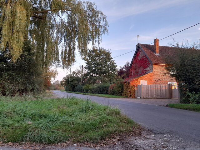
Aston Sandford is a civil parish located in the county of Buckinghamshire, England. Situated about 3 miles east of Aylesbury, the village is nestled in the beautiful countryside of the Aylesbury Vale district. With a population of around 200 residents, Aston Sandford retains its small and close-knit community atmosphere.

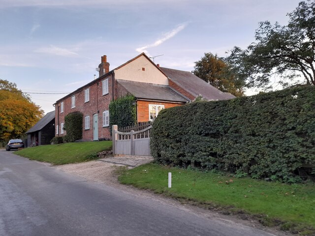
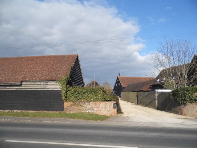
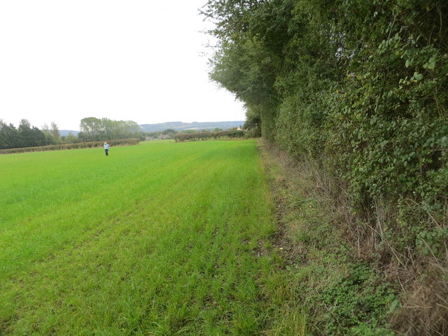
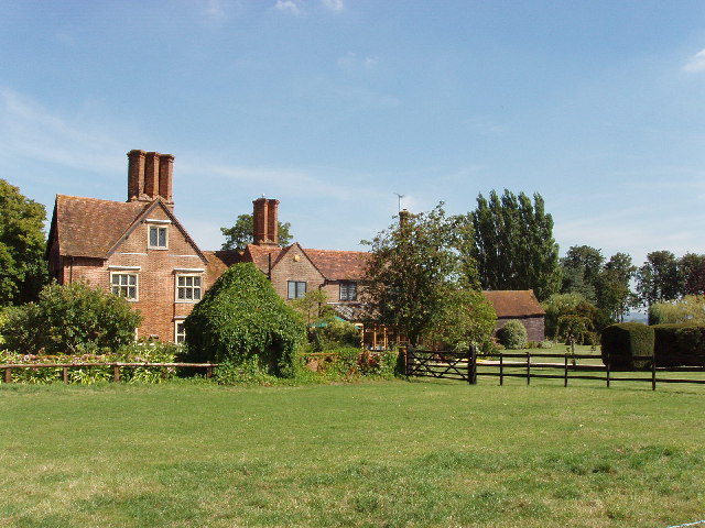
The village is surrounded by picturesque farmland and boasts stunning views of the Chiltern Hills, making it an idyllic location for nature lovers and those seeking a peaceful rural setting. The parish is known for its charming thatched cottages and historic buildings, including the 12th-century St. Michael's Church, which stands as a testament to the village's rich history.

Despite its small size, Aston Sandford offers a range of amenities to its residents. The village has a community hall, which serves as a hub for various social events and gatherings. Additionally, there is a playground for children and a cricket pitch for sports enthusiasts. The village also benefits from a local pub, providing a gathering place for locals and visitors alike.

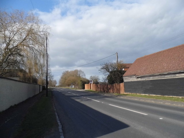
Aston Sandford is well-connected to nearby towns and cities, with good transportation links. The village is easily accessible by road, with the A418 passing through, connecting it to Aylesbury and Thame. Nearby rail stations in Aylesbury and Princes Risborough provide convenient connections to London and other major cities.

Overall, Aston Sandford offers a tranquil and picturesque setting, with a strong sense of community and a range of amenities for its residents to enjoy.

If you have any feedback on the listing, please let us know in the comments section below.

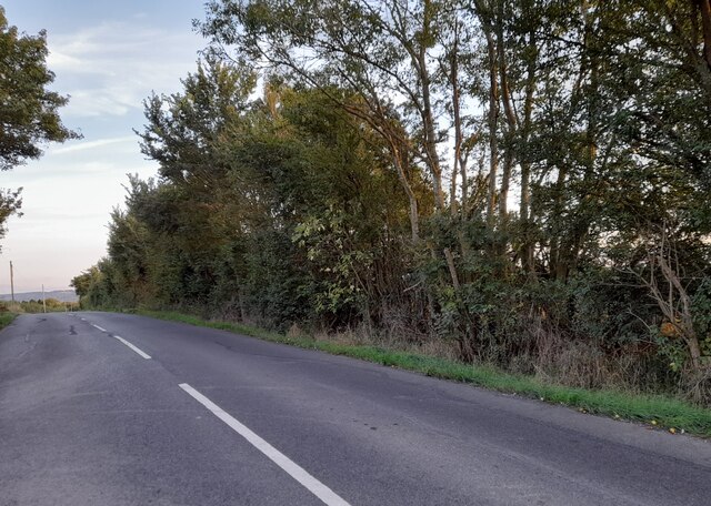
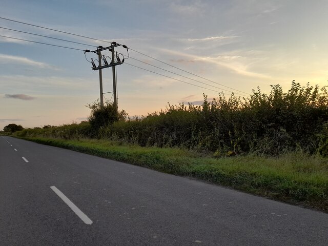
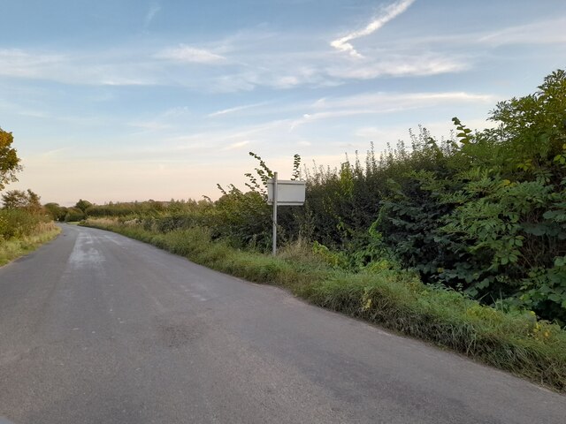
Aston Sandford Images

Images are sourced within 2km of 51.754523/-0.878983 or Grid Reference SP7706. Thanks to Geograph Open Source API. All images are credited.

The road through Ford
Electricity cables in Ford
Stockwell Lane, Owlswick
Stockwell Lane, Little Meadle
Train heading towards London DMU No. 165018 heads south towards Princes Risborough with the 1147 departure from Banbury to London Marylebone.  This train does not call at the nearby Haddenham & Thame Parkway Station.
Train heading towards London
DMU No. 165018 heads south towards Princes Risborough with the 1147 departure from Banbury to London Marylebone. This train does not call at the nearby Haddenham & Thame Parkway Station.
Bridge 103 at Ilmer GWR & GCR Joint Line bridge No. 103 was built in the early 1900's across the road to Ilmer from what is now the A4129 from Princes Risborough to Thame.
Bridge 103 at Ilmer
GWR & GCR Joint Line bridge No. 103 was built in the early 1900's across the road to Ilmer from what is now the A4129 from Princes Risborough to Thame.
No longer Anderson's Farm, Longwick By the Velux windows you can tell barns have become residential
No longer Anderson's Farm, Longwick
By the Velux windows you can tell barns have become residential
Thame Road, Longwick
Interior of St Peter's, Ilmer
Interior of St Peter's, Ilmer Looking east from behind the font to the chancel with both screen and arch of timber and a wagon roof.
Interior of St Peter's, Ilmer
Looking east from behind the font to the chancel with both screen and arch of timber and a wagon roof.
Old Milestone by the A4129 by Whirlbush Farm Carved stone post by the A4129, in parish of Kingsey (Aylesbury Vale District), Whirlbush Farm entrance (Aston Sandford), by hedge on wide verge, on South side of road. Thame stone, erected by the Princes Risborough & Thame turnpike trust in the 19th century. 

Inscription reads:-
: Oxford / 16 / THAME / 3(½) : : (Princes Risborough / 3½) : 

Buckinghamshire HER.
HER Number: 1420000000 <span class="nowrap"><a title="https://www.heritagegateway.org.uk/Gateway/Results_Single.aspx?uid=MBC32739&resourceID=1024" rel="nofollow ugc noopener" href="https://www.heritagegateway.org.uk/Gateway/Results_Single.aspx?uid=MBC32739&resourceID=1024">Link</a><img style="margin-left:2px;" alt="External link" title="External link - shift click to open in new window" src="https://s1.geograph.org.uk/img/external.png" width="10" height="10"/></span>

Milestone Society National ID: BU_THRI03
Old Milestone by the A4129 by Whirlbush Farm
Carved stone post by the A4129, in parish of Kingsey (Aylesbury Vale District), Whirlbush Farm entrance (Aston Sandford), by hedge on wide verge, on South side of road. Thame stone, erected by the Princes Risborough & Thame turnpike trust in the 19th century. Inscription reads:- : Oxford / 16 / THAME / 3(½) : : (Princes Risborough / 3½) : Buckinghamshire HER. HER Number: 1420000000 LinkExternal link Milestone Society National ID: BU_THRI03
Old Milestone by the A4129, north of Longwick by Ray Farm Carved stone post by the A4129, in parish of Longwick cum Ilmer (Wycombe District), Ray Farm, on wide verge between path and fence, on South side of road. Thame stone, erected by the Princes Risborough & Thame turnpike trust in the 19th century. 

Inscription reads:-
: Thame / 4 / Oxford / 18 : : Risboro / 2½ / Wycombe / 11 : 

Buckinghamshire HER.
HER Number: 1422100000 <span class="nowrap"><a title="https://www.heritagegateway.org.uk/Gateway/Results_Single.aspx?uid=MBC32790&resourceID=1024" rel="nofollow ugc noopener" href="https://www.heritagegateway.org.uk/Gateway/Results_Single.aspx?uid=MBC32790&resourceID=1024">Link</a><img style="margin-left:2px;" alt="External link" title="External link - shift click to open in new window" src="https://s1.geograph.org.uk/img/external.png" width="10" height="10"/></span>

Milestone Society National ID: BU_THRI04
Old Milestone by the A4129, north of Longwick by Ray Farm
Carved stone post by the A4129, in parish of Longwick cum Ilmer (Wycombe District), Ray Farm, on wide verge between path and fence, on South side of road. Thame stone, erected by the Princes Risborough & Thame turnpike trust in the 19th century. Inscription reads:- : Thame / 4 / Oxford / 18 : : Risboro / 2½ / Wycombe / 11 : Buckinghamshire HER. HER Number: 1422100000 LinkExternal link Milestone Society National ID: BU_THRI04
Field edge beside railway Looking south-eastward from the Triangulation Pillar.
Field edge beside railway
Looking south-eastward from the Triangulation Pillar.
Manor Farm, Owlswick
Old Berkeley House, Owlswick
Junction north of Owlswick The lane through Owlswick joins the Dinton - Meadle road.
Junction north of Owlswick
The lane through Owlswick joins the Dinton - Meadle road.
Road towards Ford
Road towards Ford
Show me another place!

Aston Sandford is located at Grid Ref: SP7706 (Lat: 51.754523, Lng: -0.878983)

Unitary Authority: Buckinghamshire

Police Authority: Thames Valley

What 3 Words

///slick.fires.intricate. Near Longwick, Buckinghamshire

Nearby Locations

Aston Sandford

Related Wikis

Waldridge, Buckinghamshire

Waldridge is an ancient village in the civil parish of Dinton-with-Ford and Upton in Buckinghamshire, England. Although little of the village survives...

Ilmer

Ilmer is a village and former civil parish, now in the parish of Longwick-cum-Ilmer, in Buckinghamshire, England. It is at the foot of the Chiltern Hills...

Ilmer Halt railway station

Ilmer Halt railway station was a former halt on the Great Western and Great Central Joint Railway serving the village of Ilmer in Buckinghamshire. ��2...

Owlswick

Owlswick is a hamlet in Buckinghamshire, England, about 3 miles E of Thame and 4 miles SSE of Aylesbury. It is part of the civil parish of Longwick-cum...

Nearby Amenities

Located within 500m of 51.754523,-0.878983
Power: tower
Lat/Long: 51.7516316/-0.8815164
Power: pole
Source: Bing
Lat/Long: 51.7520511/-0.8842789
Material: wood
Power: pole
Source: Bing
Lat/Long: 51.7512325/-0.883831
Power: pole
Source: Bin
Lat/Long: 51.752286/-0.8818349
Power: pole
Source: Bing
Lat/Long: 51.7529402/-0.8809713
Power: pole
Source: Bing
Lat/Long: 51.7535944/-0.8800593
Power: pole
Source: Bing
Lat/Long: 51.7542519/-0.879142
Power: pole
Source: Bing
Lat/Long: 51.7554939/-0.8774307
Power: pole
Source: Bing
Lat/Long: 51.755982/-0.8767548
Power: pole
Source: Bing
Lat/Long: 51.7570844/-0.8751348
Power: pole
Source: Bing
Lat/Long: 51.7526465/-0.8767286
Power: pole
Source: Bing
Lat/Long: 51.7566732/-0.872604
Power: pole
Source: Bing
Lat/Long: 51.7518585/-0.8778006
Power: pole
Source: Bing
Lat/Long: 51.7540072/-0.874864
Power: pole
Source: Bing
Lat/Long: 51.7517553/-0.8796236
Power: pole
Source: Bing
Lat/Long: 51.7547157/-0.8743297
Power: pole
Source: Bing
Lat/Long: 51.7552563/-0.8736297
Power: pole
Source: Bing
Lat/Long: 51.7534554/-0.8756148
Power: pole
Source: Bing
Lat/Long: 51.7559987/-0.8730904
Location Transition: yes
Material: wood
Power: pole
Source: Bing
Lat/Long: 51.7513984/-0.8832534
Power: pole
Source: Bing
Lat/Long: 51.7507921/-0.8766107
Power: pole
Source: Bing
Lat/Long: 51.7513102/-0.877917
Material: wood
Power: pole
Source: Bing
Lat/Long: 51.7513584/-0.8794351
Material: wood
Power: pole
Source: Bing
Lat/Long: 51.7514181/-0.8809506
Power: pole
Source: Bing
Lat/Long: 51.7546322/-0.8797101
Power: pole
Source: Bing
Lat/Long: 51.7538718/-0.8807427
Power: pole
Source: Bing
Lat/Long: 51.7553752/-0.8786748
Power: pole
Source: Bing
Lat/Long: 51.7563266/-0.8780686
Power: pole
Source: Bing
Lat/Long: 51.7573012/-0.877449
Power: pole
Source: Bing
Lat/Long: 51.7583472/-0.8767704
Power: pole
Source: Bing
Lat/Long: 51.7531287/-0.8817834
Power: pole
Source: Bing
Lat/Long: 51.7523745/-0.8828188
Pasture Farm
Lat/Long: 51.7547169/-0.8738241
Pasture Farm Cottages
Lat/Long: 51.7508095/-0.8796924
Barrier: stile
Lat/Long: 51.7504715/-0.8787971
Power: transformer
Voltage-high: 132000
Voltage-low: 33000
Lat/Long: 51.7519316/-0.8821173
Power: transformer
Voltage-high: 132000
Voltage-low: 33000
Lat/Long: 51.7515975/-0.8822916
Barrier: stile
Stile: stepover
Lat/Long: 51.7540541/-0.882194
Barrier: kissing_gate
Lat/Long: 51.7520205/-0.8781807
Barrier: kissing_gate
Lat/Long: 51.7519784/-0.8780719
Barrier: kissing_gate
Lat/Long: 51.7518069/-0.8772274
Barrier: kissing_gate
Lat/Long: 51.7517992/-0.877136
Power: pole
Lat/Long: 51.751654/-0.8830838
Barrier: kissing_gate
Lat/Long: 51.7554361/-0.8833524
Power: transformer
Lat/Long: 51.7514921/-0.8828303
Power: transformer
Lat/Long: 51.7515203/-0.8830006
Power: pole
Lat/Long: 51.7516423/-0.8812532
The data included in this document is from www.openstreetmap.org. The data is made available under ODbL.

Have you been to Aston Sandford?

Leave your review of Aston Sandford below (or comments, questions and feedback).