Aston Flamville
Civil Parish in Leicestershire Blaby
England
Aston Flamville

Aston Flamville is a civil parish located in the county of Leicestershire, England. Situated approximately 10 miles southwest of Leicester, it is a small village with a population of around 200 residents.
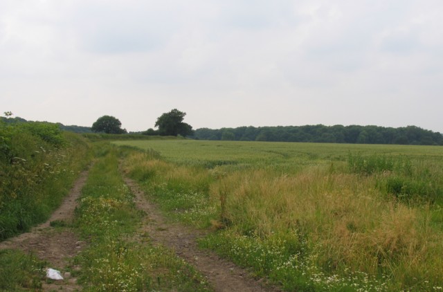
The village is known for its picturesque countryside and charming rural setting. It is surrounded by rolling hills and farmland, offering a tranquil and idyllic environment for its residents. The parish is part of the Hinckley and Bosworth district.
Aston Flamville is rich in history, with evidence of settlements dating back to the prehistoric period. The village itself has a long history, with records tracing its existence back to the Domesday Book in 1086. Throughout the centuries, it has been home to various notable figures and witnessed significant events.
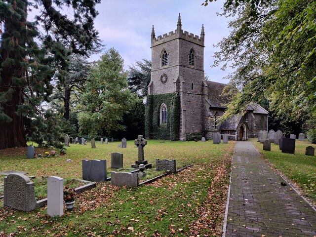
Despite its small size, Aston Flamville has a close-knit community and a strong sense of community spirit. The village features a historic church, St. Peter's Church, which is a focal point for religious services and community events. There are also several public footpaths and bridleways in the area, providing opportunities for residents and visitors to explore the surrounding natural beauty.
Aston Flamville's location offers convenient access to nearby towns and amenities. The larger town of Hinckley is within easy reach, providing a range of shops, supermarkets, and leisure facilities. The village also benefits from good transportation links, with major roads and motorways connecting it to other parts of Leicestershire and beyond.
If you have any feedback on the listing, please let us know in the comments section below.
Aston Flamville Images
Images are sourced within 2km of 52.530022/-1.319705 or Grid Reference SP4692. Thanks to Geograph Open Source API. All images are credited.


Aston Flamville is located at Grid Ref: SP4692 (Lat: 52.530022, Lng: -1.319705)
Administrative County: Leicestershire
District: Blaby
Police Authority: Leicestershire
What 3 Words
///parsnips.timidly.leans. Near Sapcote, Leicestershire
Nearby Locations
Related Wikis

Aston Flamville Manor
Aston Flamville Manor is a house in the village of Aston Flamville, Leicestershire. The front of the house was rebuilt in the 18th century, with five bays...

St Peter's Church, Aston Flamville
St Peter's Church is a church in Aston Flamville, Leicestershire. It is a Grade II listed building. == History == The church was built in the 11th century...
Aston Flamville
Aston Flamville is a village and civil parish in the Blaby district in Leicestershire, England. It is situated near Hinckley, but on the other (eastern...
Burbage Wood and Aston Firs
Burbage Wood and Aston Firs is a 51.1-hectare (126-acre) biological Site of Special Scientific Interest Leicestershire. == Overview == These semi-natural...
Burbage, Leicestershire
Burbage is a large village in the Borough of Hinckley and Bosworth in Leicestershire, England. According to the United Kingdom Census 2001 the parish...

Sharnford
Sharnford is a village and civil parish in Blaby of Leicestershire. The parish has a population of about 1,000, measured at the 2011 census as 985. The...
Britannia Fields
The Britannia Fields are a public open space at grid reference SP440919 in Britannia Road, Burbage, Leicestershire. The Fields land was once part of the...
Hinckley Rural District
The rural district of Hinckley was set up in 1894, covering the rural area around Hinckley, Leicestershire, England. It was named for Hinckley, but did...
Nearby Amenities
Located within 500m of 52.530022,-1.319705Have you been to Aston Flamville?
Leave your review of Aston Flamville below (or comments, questions and feedback).