Aston Flamville
Settlement in Leicestershire Blaby
England
Aston Flamville

Aston Flamville is a small village located in Leicestershire, England. Situated approximately 11 miles west of the city of Leicester, it falls within the district of Hinckley and Bosworth. Aston Flamville is surrounded by picturesque countryside, offering a peaceful and idyllic setting for its residents.
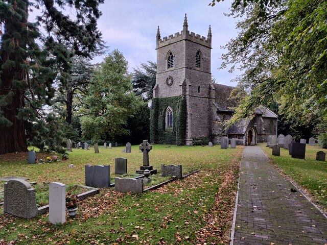
The village is characterized by its charming mix of traditional and modern architecture. It retains its historical charm with several well-preserved thatched cottages, alongside more contemporary housing developments. Aston Flamville also boasts a beautiful Grade II listed church, St. Peter's Church, which dates back to the 12th century and is known for its impressive Norman architecture.
Despite its relatively small size, Aston Flamville benefits from a thriving community spirit. The village has a close-knit population that actively organizes various events and social gatherings throughout the year. The local community center serves as a hub for these activities and provides a space for residents to come together.
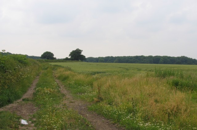
For those seeking outdoor activities, Aston Flamville offers easy access to the nearby countryside, providing opportunities for scenic walks and cycling routes. The village is also conveniently located near major road networks, making it easily accessible for commuters and visitors.
Although Aston Flamville may be small, its charm, historical significance, and strong community spirit make it a desirable place to live for those seeking a peaceful, rural lifestyle within easy reach of urban amenities.
If you have any feedback on the listing, please let us know in the comments section below.
Aston Flamville Images
Images are sourced within 2km of 52.529697/-1.319459 or Grid Reference SP4692. Thanks to Geograph Open Source API. All images are credited.


Aston Flamville is located at Grid Ref: SP4692 (Lat: 52.529697, Lng: -1.319459)
Administrative County: Leicestershire
District: Blaby
Police Authority: Leicestershire
What 3 Words
///handover.wrong.afflicted. Near Sapcote, Leicestershire
Nearby Locations
Related Wikis

Aston Flamville Manor
Aston Flamville Manor is a house in the village of Aston Flamville, Leicestershire. The front of the house was rebuilt in the 18th century, with five bays...

St Peter's Church, Aston Flamville
St Peter's Church is a church in Aston Flamville, Leicestershire. It is a Grade II listed building. == History == The church was built in the 11th century...
Aston Flamville
Aston Flamville is a village and civil parish in the Blaby district in Leicestershire, England. It is situated near Hinckley, but on the other (eastern...
Burbage Wood and Aston Firs
Burbage Wood and Aston Firs is a 51.1-hectare (126-acre) biological Site of Special Scientific Interest Leicestershire. == Overview == These semi-natural...

Sharnford
Sharnford is a village and civil parish in Blaby of Leicestershire. The parish has a population of about 1,000, measured at the 2011 census as 985. The...
Burbage, Leicestershire
Burbage is a large village in the Borough of Hinckley and Bosworth in Leicestershire, England. According to the United Kingdom Census 2001 the parish...
Britannia Fields
The Britannia Fields are a public open space at grid reference SP440919 in Britannia Road, Burbage, Leicestershire. The Fields land was once part of the...
Hinckley Rural District
The rural district of Hinckley was set up in 1894, covering the rural area around Hinckley, Leicestershire, England. It was named for Hinckley, but did...
Nearby Amenities
Located within 500m of 52.529697,-1.319459Have you been to Aston Flamville?
Leave your review of Aston Flamville below (or comments, questions and feedback).