Asselby

Civil Parish in Yorkshire

England

Asselby

Crossing Boothferry Bridge near Goole
Crossing Boothferry Bridge near Goole Credit: Colin Park

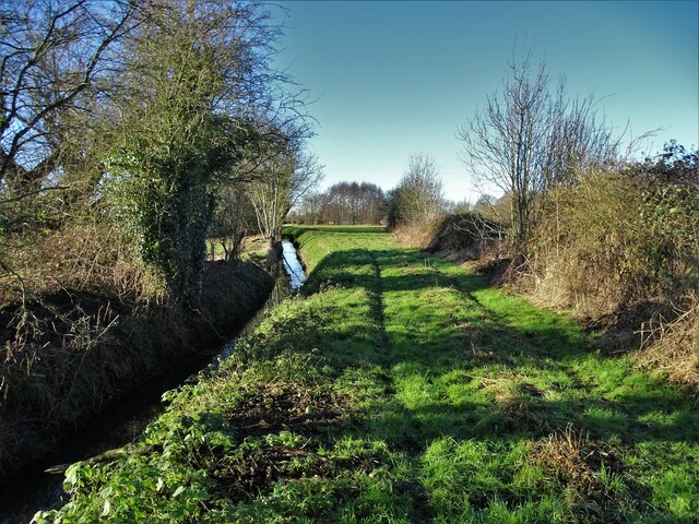
Asselby is a small civil parish located in the East Riding of Yorkshire, England. Situated approximately 5 miles southwest of the town of Howden, Asselby covers an area of around 3.5 square miles. The parish is predominantly rural, characterized by open farmland and scattered residential properties.

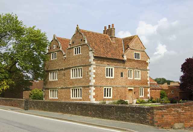
The village of Asselby itself is home to a population of around 200 people. It has a quaint and traditional feel, with its historic buildings and charming village green. The centerpiece of the village is the Grade II listed Asselby Hall, a country house dating back to the 18th century. The hall is surrounded by well-manicured gardens, adding to the picturesque setting.

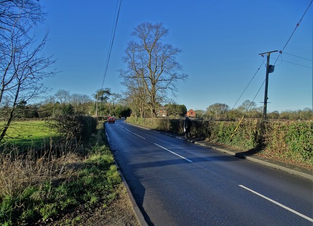
The parish is well-connected, with easy access to major transportation routes. The A614 road passes through the village, providing links to nearby towns and cities. The closest railway station is in Howden, offering regular services to destinations such as Hull, Leeds, and Doncaster.

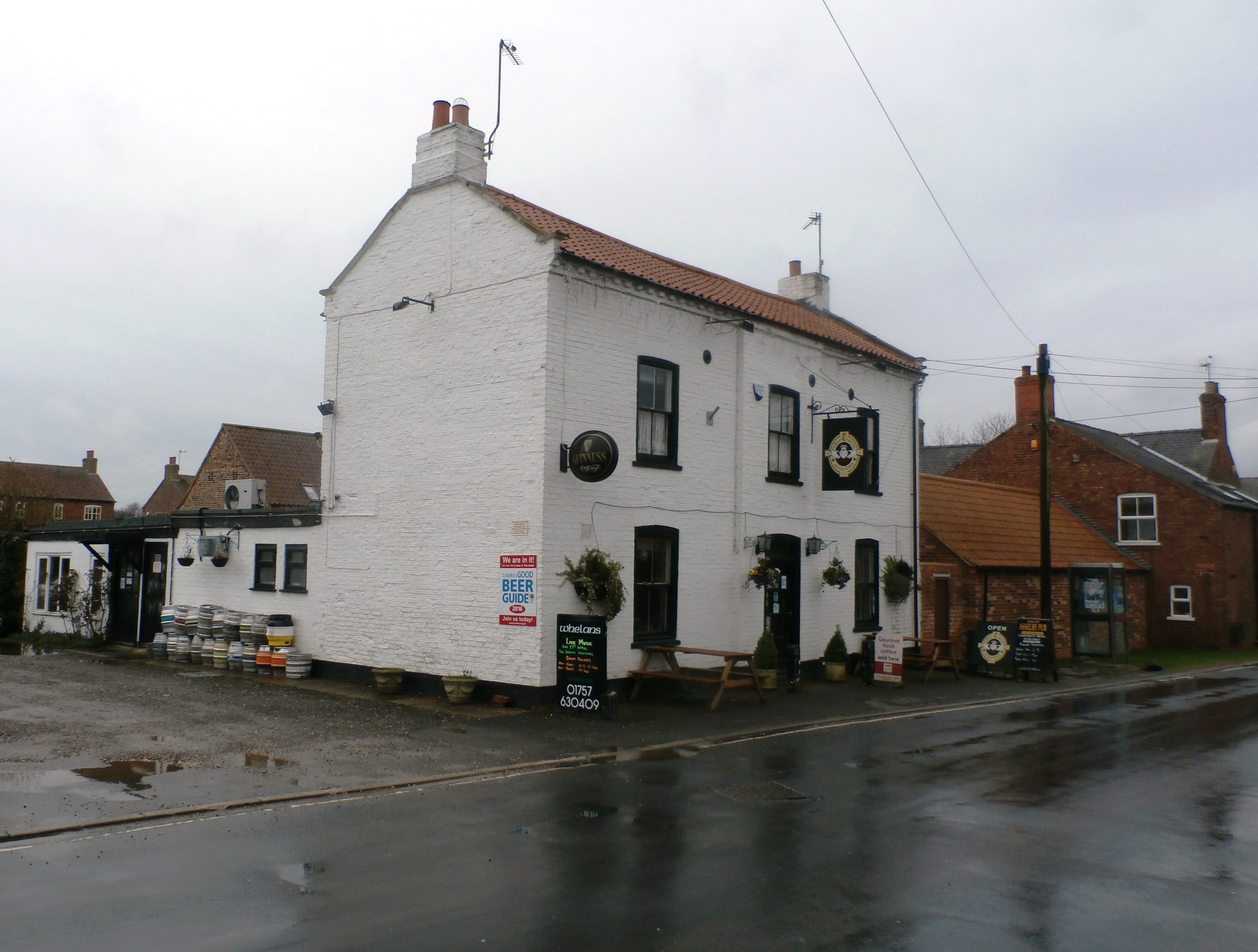
Despite its small size, Asselby offers a range of amenities to its residents. These include a village hall, a primary school, and a local pub. The surrounding countryside also provides ample opportunities for outdoor activities, such as walking, cycling, and birdwatching.

Overall, Asselby is a tranquil and close-knit community, perfect for those seeking a peaceful rural lifestyle within easy reach of larger urban areas.

If you have any feedback on the listing, please let us know in the comments section below.

Asselby Images

Images are sourced within 2km of 53.74041/-0.908998 or Grid Reference SE7227. Thanks to Geograph Open Source API. All images are credited.

Crossing Boothferry Bridge near Goole
On the Trans Pennine Trail heading west towards Asselby Island
Rubble pile on the dismantled railway
Track on Oxen Stang Field
On Knedlington Road, west of Howden
North of Yarmshaw Drain Walking along the course of a former railway track. Little evidence remains that trains once rumbled along this route.
North of Yarmshaw Drain
Walking along the course of a former railway track. Little evidence remains that trains once rumbled along this route.
By Yarmshaw Drain
By Yarmshaw Drain
On Landing Lane looking back to Asselby
North Bank of The River Ouse At Asselby Landing
North Bank of The River Ouse
At Asselby Landing
Farmland north of The River Ouse You can just make out the curve of The Ouse Bridge in the distance. It carries the M62 motorway. Seen from the riverbank path.
Farmland north of The River Ouse
You can just make out the curve of The Ouse Bridge in the distance. It carries the M62 motorway. Seen from the riverbank path.
Boothferry Bridge The bridge opened in 1929 and until 1972 was the only road bridge over The River Ouse in this vicinity - providing a vital traffic artery to and from East Yorkshire.
Boothferry Bridge
The bridge opened in 1929 and until 1972 was the only road bridge over The River Ouse in this vicinity - providing a vital traffic artery to and from East Yorkshire.
The River Ouse and Boothferry Bridge With Drax Power Station in the distance
The River Ouse and Boothferry Bridge
With Drax Power Station in the distance
Brick barn at Knedlington
"The Black Swan" in Asselby
By the river in Booth
The A63 at Newsholme
Oxen Stang Field With a crop of wheat and Drax Power Station on the skyline
Oxen Stang Field
With a crop of wheat and Drax Power Station on the skyline
Tractor lines in a field of barley Drax Power Station on the skyline
Tractor lines in a field of barley
Drax Power Station on the skyline
Show me another place!

Asselby is located at Grid Ref: SE7227 (Lat: 53.74041, Lng: -0.908998)

Division: East Riding

Unitary Authority: East Riding of Yorkshire

Police Authority: Humberside

What 3 Words

///artichoke.array.vipers. Near Airmyn, East Yorkshire

Nearby Locations

Asselby

Related Wikis

Asselby

Asselby is a village and civil parish in the East Riding of Yorkshire, England. It is located in the south-west of the county, north of the River Ouse...

Barn Hill Meadows

Barn Hill Meadows is a Site of Special Scientific Interest (SSSI) in the East Riding of Yorkshire, England. It is located close to the town of Howden....

Knedlington

Knedlington is a small hamlet and former civil parish, now in the parish of Asselby, in the East Riding of Yorkshire, England. It is situated approximately...

River Aire

The River Aire is a major river in Yorkshire, England, 92 miles (148 km) in length. Part of the river below Leeds is canalised, and is known as the Aire...

Nearby Amenities

Located within 500m of 53.74041,-0.908998
Pub
Black Swan
Addr City: Goole
Addr Postcode: DN14 7HE
Addr Street: Main Street
Addr Suburb: Asselby
Lat/Long: 53.7436823/-0.9124068
Bus Stop
Asselby Main Street
Naptan AtcoCode: 2200YEA01161
Naptan Bearing: E
Naptan CommonName: Asselby Main Street
Naptan Street: Main Street
Naptan Verified: no
Source: naptan_import
Lat/Long: 53.7439137/-0.9121773
Source: GPS
Lat/Long: 53.7403892/-0.9036952
Barrier: yes
Lat/Long: 53.7443246/-0.9104014
The data included in this document is from www.openstreetmap.org. The data is made available under ODbL.

Have you been to Asselby?

Leave your review of Asselby below (or comments, questions and feedback).